Byron Gap - Olympus - Cuvier
Forum rules
Tasmania specific bushwalking discussion. Please avoid publishing details of access to sensitive areas with no tracks.
Tasmania specific bushwalking discussion. Please avoid publishing details of access to sensitive areas with no tracks.
14 posts
• Page 1 of 1
Byron Gap - Olympus - Cuvier
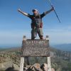
![]() by Lophophaps » Fri 06 Dec, 2013 1:10 pm
by Lophophaps » Fri 06 Dec, 2013 1:10 pm
Advice is sought about Mt Olympus. It appears that PWS have discontinued or discouraged the use of the Cuvier Valley track? Does anyone know if this so and what condition is the track is in? A tentative plan is to go from Narcissus to Byron Gap, then SE to the summit ridge. Petrarch-Olympus was walked many years ago and I have no recollection at all of the summit area apart from rocks. Descent is intended more or less SW from the summit, hitting the valley about a kilometre below Petrarch. Is this viable? Will there be many injuries? Ta muchly.
-

Lophophaps - Auctorita modica

- Posts: 3475
- Joined: Wed 09 Nov, 2011 9:45 am
- Region: Victoria
- Gender: Male
Re: Byron Gap - Olympus - Cuvier
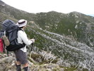
![]() by stepbystep » Fri 06 Dec, 2013 1:18 pm
by stepbystep » Fri 06 Dec, 2013 1:18 pm
I went up Olympus a year or so ago from beyond Echo Point via Lake Oenone and descended to Byron Gap via Lamonts Lookout.
The pad from Byron Gap is relatively easy to find and very easy to follow, then it's lots of boulders to the summit plateau. Cuvier Valley track is ok but annoying to follow as the buttongrass is taking over.
I'd reckon you could descend from the summit to Cuvier as you propose with no dramas, I have heard of an old route down that way.
Injuries? Depends how careful you are!
The idea of wilderness needs no defense, it only needs defenders ~ Edward Abbey
-

stepbystep - Lagarostrobos franklinii

- Posts: 7625
- Joined: Tue 19 May, 2009 10:19 am
- Location: Street urchin
- Region: Tasmania
- Gender: Male
Re: Byron Gap - Olympus - Cuvier
![]() by Son of a Beach » Fri 06 Dec, 2013 2:00 pm
by Son of a Beach » Fri 06 Dec, 2013 2:00 pm
Descending to Cuvier from the summit would be no problem if OK with boulder hopping. I went almost half way down and then back up and down the other side to Oenone.
(I'd gone up from Byron Gap just finding my own way).
The Cuvier valley track is almost non existent until you get closer to the Overland Track. Navigation is not hard but button grass walking is frustrating.
(I'd gone up from Byron Gap just finding my own way).
The Cuvier valley track is almost non existent until you get closer to the Overland Track. Navigation is not hard but button grass walking is frustrating.
- Son of a Beach
- Lagarostrobos franklinii
- Posts: 6929
- Joined: Thu 01 Mar, 2007 7:55 am
- ASSOCIATED ORGANISATIONS: Bit Map (NIXANZ)
- Region: Tasmania
- Gender: Male
Re: Byron Gap - Olympus - Cuvier
![]() by Lophophaps » Fri 06 Dec, 2013 3:27 pm
by Lophophaps » Fri 06 Dec, 2013 3:27 pm
Thanks. I forgot to ask: is the track from the OLT south of Narcissus to Byron Gap still navigable? A pad from Byron Gap is mentioned. Would this be SE up to about 1300 metre, where the rocks appear to start? Rock hopping is fine, with care needed, and stopping in rain. It's hoped to camp on the summit plateau, 360 degrees view. Button Grass does not amuse, and navigation should not be too hard - SE to finish between the Cuvier River and Olympus. I recall fairly open country; may have changed. Thirty years ago this track was a mud hole. I may even wash. If the track has not been found by the Lyell Highway the compass must be wrong.
-
Lophophaps - Auctorita modica
- Posts: 3475
- Joined: Wed 09 Nov, 2011 9:45 am
- Region: Victoria
- Gender: Male
Re: Byron Gap - Olympus - Cuvier
![]() by baeurabasher » Fri 06 Dec, 2013 4:32 pm
by baeurabasher » Fri 06 Dec, 2013 4:32 pm
I managed to do a walk to Othrys recently and managed to stay on a pad the whole way.. but it is vague in places.
Elitism attitude that some individuals, with a certain ancestry, higher intellect, wealth, specialized training or experience
- baeurabasher
- Atherosperma moschatum

- Posts: 90
- Joined: Tue 26 Jul, 2011 8:09 am
- Region: Tasmania
- Gender: Male
Re: Byron Gap - Olympus - Cuvier
![]() by north-north-west » Fri 06 Dec, 2013 7:02 pm
by north-north-west » Fri 06 Dec, 2013 7:02 pm
Cuvier's not that bad. The buttongrass section is vague in places and can be a bit damp, but there are still a few markers and it's mostly just a matter of following the easiest line through the buttongrass. Where the old track crosses the treed hills it's fairly obvious. And once you're at Petrarch the route is clear enough except for one damp patch amongst the tea-tree. And the climbg up to the Gap is a good rtack - even has some duckboarding.
With Olympus, don't try to climb directly up to Lamont's and follow the ridge back to the summit - I did and it took forever. There are some fairly big and awkward boulders up there.
It's a bit exposed up top, but still a wonderful place to camp, and the southern summit is worth a visit, too.
With Olympus, don't try to climb directly up to Lamont's and follow the ridge back to the summit - I did and it took forever. There are some fairly big and awkward boulders up there.
It's a bit exposed up top, but still a wonderful place to camp, and the southern summit is worth a visit, too.
"Mit der Dummheit kämpfen Götter selbst vergebens."
-

north-north-west - Lagarostrobos franklinii
- Posts: 15493
- Joined: Thu 14 May, 2009 7:36 pm
- Location: The Asylum
- ASSOCIATED ORGANISATIONS: Social Misfits Anonymous
- Region: Tasmania
Re: Byron Gap - Olympus - Cuvier
![]() by Son of a Beach » Fri 06 Dec, 2013 8:08 pm
by Son of a Beach » Fri 06 Dec, 2013 8:08 pm
From the OT to Byron Gap through the forest there are markers on the trees you can follow but sometimes they can be hard to find and there's not much of a pad on the ground. It can be a bit tricky to follow the route at times. But if you're careful and prepared to keep looking out for markers (and maybe back track occasionally) you should be OK.
- Son of a Beach
- Lagarostrobos franklinii
- Posts: 6929
- Joined: Thu 01 Mar, 2007 7:55 am
- ASSOCIATED ORGANISATIONS: Bit Map (NIXANZ)
- Region: Tasmania
- Gender: Male
Re: Byron Gap - Olympus - Cuvier
![]() by norts » Fri 06 Dec, 2013 8:18 pm
by norts » Fri 06 Dec, 2013 8:18 pm
I have done Echo PT, Lake Oenone, Petrarch, was not too difficult. The track from OLT up to Byron Gap is fairly well marked and a very nice walk.
Has anyone been up the Cuvier since PAWS did the burn off earlier this year, things might have changed up that way a bit. I think most of the burning was closer to Petrarch. Even if you cant find the track you only have to keep the river on one side and Olympus on the other. Best to find the track once you are getting closer to Cynthia Bay ie when the button grass finishes and the valley closes in, as the scrub could be a bit difficult.
Roger
Roger
-
norts - Lagarostrobos franklinii
- Posts: 2008
- Joined: Wed 01 Aug, 2007 10:45 am
- Location: Germantown Tas.
- Region: Tasmania
Re: Byron Gap - Olympus - Cuvier
![]() by clarence » Fri 06 Dec, 2013 10:36 pm
by clarence » Fri 06 Dec, 2013 10:36 pm
I did track from Narcissus to Byron Gap 4 yrs ago. Quite easy to follow and pleasant walking. The route up to Lamonts Lookout from Byron Gap is fairly straightforward but there is a very steep and long boulderfield from here to the Olympus north plateau- making for very slow and arduous walking with a full pack. The views are sensational and make it worthwhile.
When I did Cuvier Valley around the same time the track through the buttongrass areas (2/3 of the distance from Watersmeet to Lake Petrach) was non-existent.
Clarence
When I did Cuvier Valley around the same time the track through the buttongrass areas (2/3 of the distance from Watersmeet to Lake Petrach) was non-existent.
Clarence
- clarence
- Athrotaxis cupressoides

- Posts: 323
- Joined: Sun 12 Feb, 2012 7:52 pm
- Region: Tasmania
- Gender: Male
Re: Byron Gap - Olympus - Cuvier
![]() by baeurabasher » Sat 07 Dec, 2013 4:53 am
by baeurabasher » Sat 07 Dec, 2013 4:53 am
clarence wrote:I did track from Narcissus to Byron Gap 4 yrs ago.
When I did Cuvier Valley around the same time the track through the buttongrass areas (2/3 of the distance from Watersmeet to Lake Petrach) was non-existent.
Clarence
Hmmm perhaps what i grade as a pad, others would not... or perhaps i got lucky.
The track IS still there folks!!
Elitism attitude that some individuals, with a certain ancestry, higher intellect, wealth, specialized training or experience
- baeurabasher
- Atherosperma moschatum
- Posts: 90
- Joined: Tue 26 Jul, 2011 8:09 am
- Region: Tasmania
- Gender: Male
-
dplanet - Phyllocladus aspleniifolius

- Posts: 569
- Joined: Thu 04 Oct, 2007 8:21 pm
- Location: Ormond-Caulfield, Melbourne
- Region: Victoria
- Gender: Female
Re: Byron Gap - Olympus - Cuvier
![]() by Lophophaps » Sun 08 Dec, 2013 5:32 am
by Lophophaps » Sun 08 Dec, 2013 5:32 am
The above is most useful. Thanks. Let's see if I have this clear.
OLT to Byron Gap is fair to good, but take care. There's a pad from Byron Gap to the scree. It's possible to stay on the Lamonts-Olympus ridge, but it's bouldery and slow. Good views. An alternative is to turn the scree on the Cuvier side, traversing at about 1200 metre until level with Oenone/summit and ascend via a boulder field. There's water near the summit.
Descent to Cuvier Valley is possible. The old track may be hard to follow but exists in places. Try and find the old track at the end of the button grass, approaching Cynthia Bay.
My last 1:25 map is Olympus, which stops maybe three kilometre from the OLT near Watersmeet. I don't really want to buy the next 1:25, Rufus, for maybe an hour of walking, but the detail would be an advantage for the last section. Any ideas?
-
Lophophaps - Auctorita modica
- Posts: 3475
- Joined: Wed 09 Nov, 2011 9:45 am
- Region: Victoria
- Gender: Male
Re: Byron Gap - Olympus - Cuvier
![]() by norts » Sun 08 Dec, 2013 6:02 am
by norts » Sun 08 Dec, 2013 6:02 am
Go to the LIST it actually shows the the cuvier valley track
http://maps.thelist.tas.gov.au/listmap/app/list/map
Then search for Lake Petrarch, once you have found it, go to Base Maps( top right of screen) drop down box, choose scanned maps. That should give you all the detail you need.
Roger
http://maps.thelist.tas.gov.au/listmap/app/list/map
Then search for Lake Petrarch, once you have found it, go to Base Maps( top right of screen) drop down box, choose scanned maps. That should give you all the detail you need.
Roger
-
norts - Lagarostrobos franklinii
- Posts: 2008
- Joined: Wed 01 Aug, 2007 10:45 am
- Location: Germantown Tas.
- Region: Tasmania
Re: Byron Gap - Olympus - Cuvier
![]() by Lophophaps » Sun 08 Dec, 2013 9:59 am
by Lophophaps » Sun 08 Dec, 2013 9:59 am
Brilliant! I was unaware of this web site. My monochrome printer is not as good as colour, but I'll manage. My PB is no map, no notes in an unfamiliar area - at night. It was a bit fiddly getting the scale and coverage more or less as required.
-
Lophophaps - Auctorita modica
- Posts: 3475
- Joined: Wed 09 Nov, 2011 9:45 am
- Region: Victoria
- Gender: Male
14 posts
• Page 1 of 1
Who is online
Users browsing this forum: No registered users and 34 guests