Hi,
Has anyone been up on Mother Cummings Peak. Do you know which track is best and what road it starts from.
BWG
MotherCummingsPeak
Forum rules
Tasmania specific bushwalking discussion. Please avoid publishing details of access to sensitive areas with no tracks.
Tasmania specific bushwalking discussion. Please avoid publishing details of access to sensitive areas with no tracks.
14 posts
• Page 1 of 1
MotherCummingsPeak
![]() by bushwalkinGeeks » Thu 07 Jun, 2007 1:46 pm
by bushwalkinGeeks » Thu 07 Jun, 2007 1:46 pm
Last edited by bushwalkinGeeks on Mon 11 Jun, 2007 1:31 pm, edited 1 time in total.
-

bushwalkinGeeks - Nothofagus cunninghamii

- Posts: 9
- Joined: Sun 13 May, 2007 9:18 pm
- Location: Devonport
Mother Cummings
![]() by Pompom » Thu 07 Jun, 2007 5:14 pm
by Pompom » Thu 07 Jun, 2007 5:14 pm
Hi Geeks, I've not been up the above but I've been up what must be the easiest track up to the plateau, Syds Track. To get to it take the Westrope rd from Dale brook passing the start of the Higgs Track, then the start of the Westons Track, keep going for about1/2 a K ? A blocked off track is found on the right hand side. It might be clear now, we would 2 wheel drive up this track to the start of Syds. The way up from here is a breeze,I reckon a sensible human being must have cut this one. At the top[ which is very open] the main part of the track heads to Mt Ironstone but it shouldn't be too difficult to find a way up Mother Cummings and Bastion Bluff by experienced walkers.
- Pompom
![]() by tasadam » Thu 07 Jun, 2007 5:25 pm
by tasadam » Thu 07 Jun, 2007 5:25 pm
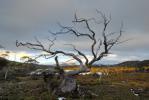
You may have seen that photo I took from the other post.
That was taken from the track that goes up toward Mother Cummings Peak.
The start is pretty easy to find, you go through the town of Meander and past the dam site. When I was there a couple of weeks ago the straight through road was still open and it probably will be until the dam is flooded, but they have (by the look of it) finished a bypass road that is above the high water mark.
Anyway you go straight on, only a couple of km from memory and keep an eye on the roads (vehicular tracks more like it) on the right side, look for one called Smoko Road. Well marked as I recall.
Follow it to the end. Park here. From here you cross the creek where the vehicle bridge used to be. You can rock-hop, or there is a log slightly downstream that you can straddle. You get on to the track on the other side (that used to be a road) and follow a steady climb for more than a kilometre but I didn't measure it. It sure was pretty with lots of funghi everywhere. As you wander up hill, you will come to a left turn which opens to what appears to be an old quarry, all flat but clear. Go along a bit and you will see a couple of delapidated signs on the ground. Effectively, rather than continue around to the left and downhill, you go slightly uphill and across thos clearing to pick up a well defined track. Eventually this track comes to the flowing river / creek / whatever, which you follow up for a while then cross. Once you cross, I am afraid you are on your own because all we did was wander upstream to take photos - it is a marked track but from memory there is another marked track at the creek crossing that goes off in another direction - possibly to the peak, I don't know.
I have heard that if you do go up, when you get there take a note or a GPS bearing so you can find the exit to the plateau, it can get disorientating particularly if cloudy or if cloud comes in.
The Chapman book Day Walks of Tasmania has some excellent notes and a map if you need more, or someone else might reply.
Have fun and take care crossing the creek the 2nd time - pretty slippery!
-
tasadam - Magnus administratio

- Posts: 5940
- Joined: Tue 10 Apr, 2007 6:58 pm
- Location: Near Devonport, Tasmania
- ASSOCIATED ORGANISATIONS: TasmaniART, Smitten Merino, Macpac
- Region: Tasmania
- Gender: Male
![]() by Birddog » Thu 07 Jun, 2007 6:26 pm
by Birddog » Thu 07 Jun, 2007 6:26 pm
I've tried the Chapman route, which begins from Smoko Road. A 4WD is required for this road. The Chapman walk includes a walk to Chasm Falls. I'm not sure that the falls were worth it. As I recall it made for a very long day. Friends who went with me that day also went via Westrope Road. Apparently it was much more satisfying.
- Birddog
- Nothofagus cunninghamii
- Posts: 6
- Joined: Wed 06 Jun, 2007 1:15 pm
- Location: Launceston
![]() by Birddog » Thu 07 Jun, 2007 6:29 pm
by Birddog » Thu 07 Jun, 2007 6:29 pm
Also to add to Tasadam you ned to follow the river all the way up to Smoko falls. The track to the peak goes up (and up and up) from the falls. Smoko falls, although small, are quite interesting.
- Birddog
- Nothofagus cunninghamii
- Posts: 6
- Joined: Wed 06 Jun, 2007 1:15 pm
- Location: Launceston
![]() by tasadam » Thu 07 Jun, 2007 6:30 pm
by tasadam » Thu 07 Jun, 2007 6:30 pm
Not so, I went up there in a front wheel drive Toyota Corolla hatch. There had been a LOT of rain previous to our trip hence the trouble crossing the creek, but we made it to the car park easily. The road in was a tad boggy not far from the turnoff onto Smoko Road, but nothing threatening.Birddog wrote:A 4WD is required for this road.
So we were on the track to the top... Didn't make it as far as the falls when we went, the photography was far too interesting on the way.Birddog wrote:you ned to follow the river all the way up to Smoko falls.
Must get around to putting a few in the gallery.
-
tasadam - Magnus administratio
- Posts: 5940
- Joined: Tue 10 Apr, 2007 6:58 pm
- Location: Near Devonport, Tasmania
- ASSOCIATED ORGANISATIONS: TasmaniART, Smitten Merino, Macpac
- Region: Tasmania
- Gender: Male
![]() by bushwalkinGeeks » Thu 07 Jun, 2007 7:21 pm
by bushwalkinGeeks » Thu 07 Jun, 2007 7:21 pm
tasadam wrote:Didn't make it as far as the falls when we went, the photography was far too interesting on the way.
Sounds perfect - thats the main reason for going. How long would it take to walk smoko road and the track to the summit? Walking time only.
Thanks for all the help.
Looks like this is the stepper of the two tracks!
-
bushwalkinGeeks - Nothofagus cunninghamii
- Posts: 9
- Joined: Sun 13 May, 2007 9:18 pm
- Location: Devonport
Re: Mother Cummings
![]() by bushwalkinGeeks » Thu 07 Jun, 2007 7:24 pm
by bushwalkinGeeks » Thu 07 Jun, 2007 7:24 pm
Pompom wrote:At the top[ which is very open] the main part of the track heads to Mt Ironstone but it shouldn't be too difficult to find a way up Mother Cummings and Bastion Bluff by experienced walkers.
Thanks for this help Pompom. You have answered another question of mine which was "how to get to Ironstone Mountain?". Great advice.
-
bushwalkinGeeks - Nothofagus cunninghamii
- Posts: 9
- Joined: Sun 13 May, 2007 9:18 pm
- Location: Devonport
Mother Cummings
![]() by Pompom » Mon 11 Jun, 2007 5:38 pm
by Pompom » Mon 11 Jun, 2007 5:38 pm
Hi Geeks, A bit more about Syds Track up to the plateau. If you have Google Earth and go to the following co-ordinates. 41 40 10 s 146 31 9 e
You will see the track up from Smoko Creek on the right and it seems to be a real stinker, whereas the Syds Track, not marked takes off the Westrope Rd to the right of the Last track marked,[Westons]. If the track is found it's so easy it's not funny.
I've tried to mark[roughly] the start of Syds on the selection from Google Earth, if it works. Click on the URL below.
Cheers
pompom
[/img]http://i45.photobucket.com/albums/f62/tassiepompom/MotherCummings.jpg
- Pompom
![]() by bushwalkinGeeks » Mon 11 Jun, 2007 11:24 pm
by bushwalkinGeeks » Mon 11 Jun, 2007 11:24 pm
Pompom,
Thanks for that. Can you save it as a kml file.
This link is the Mount Ironstone Track you mentioned that starts at Smoko Road. Does Syds Track end up in the same place as this track?
btw if you haven't install GE 1.4 then you might - it shows your marked tracks a bit better.
BWG.
Thanks for that. Can you save it as a kml file.
This link is the Mount Ironstone Track you mentioned that starts at Smoko Road. Does Syds Track end up in the same place as this track?
btw if you haven't install GE 1.4 then you might - it shows your marked tracks a bit better.
BWG.
-
bushwalkinGeeks - Nothofagus cunninghamii
- Posts: 9
- Joined: Sun 13 May, 2007 9:18 pm
- Location: Devonport
![]() by Joe » Fri 15 Jun, 2007 10:14 pm
by Joe » Fri 15 Jun, 2007 10:14 pm
I have many Tassie walks books. This mountain is in Chapmans as previously mentioned and also Hardy and Elsons. Of all the tassie walks books I rekon Hardy and Elsons are the pick for my style of walking. Family Walks around Launceston and N.E. Tasmania is the one that this track is in. They recommend the front track. Its accessed of the same road (westropes) that Lady Lake track starts on...just further on rather than turning off for the Higgs track.
If you are around this side of the mountain then there is also a sign off the road for a big tree. Being an avid big tree lover i followed it when there last and could find nothing..so if anyone finds it and can give me directions I would be very greatful
Cheers
Joe
If you are around this side of the mountain then there is also a sign off the road for a big tree. Being an avid big tree lover i followed it when there last and could find nothing..so if anyone finds it and can give me directions I would be very greatful
Cheers
Joe
-

Joe - in vino veritas

- Posts: 675
- Joined: Mon 26 Mar, 2007 10:35 pm
- Location: Devonport Tas
- ASSOCIATED ORGANISATIONS: Stoney Creek Outdoor Equipment.
- Region: Tasmania
![]() by Son of a Beach » Sat 16 Jun, 2007 9:21 am
by Son of a Beach » Sat 16 Jun, 2007 9:21 am
Was it you who scrawled "Stump!" in chalk at the end of the "Big Tree" sign?

We went to have a look for the big tree too, but were disappointed. We did find two possibilities near the 1.2km mark indicated by the sign:
1. An old stump in amongst the young plantation trees.
2. A large fallen tree.
I suspect that it is supposed to be one of these two, but in either case, the signs ought to be removed, because there is no big tree there now (or otherwise, a further sign should be erected to point out what you and I were both unable to find!).
All in all, the "Big Tree" was a "Big Waste of Time" and a "Big Disappointment" for us.
- Son of a Beach
- Lagarostrobos franklinii

- Posts: 7024
- Joined: Thu 01 Mar, 2007 7:55 am
- ASSOCIATED ORGANISATIONS: Bit Map (NIXANZ)
- Region: Tasmania
- Gender: Male
![]() by Joe » Sat 16 Jun, 2007 4:20 pm
by Joe » Sat 16 Jun, 2007 4:20 pm
Son of a Beach wrote:Was it you who scrawled "Stump!" in chalk at the end of the "Big Tree" sign?
We went to have a look for the big tree too, but were disappointed. We did find two possibilities near the 1.2km mark indicated by the sign:
1. An old stump in amongst the young plantation trees.
2. A large fallen tree.
I suspect that it is supposed to be one of these two, but in either case, the signs ought to be removed, because there is no big tree there now (or otherwise, a further sign should be erected to point out what you and I were both unable to find!).
All in all, the "Big Tree" was a "Big Waste of Time" and a "Big Disappointment" for us.
no wasnt me...but did notice that. I drove right up into the hills on that road the day i was thre...some interesting views further along...and if it hadnt been for fallen tree on road i rekon you can drive pretty high up the side of the central plateau...even in a 2wd.
-
Joe - in vino veritas
- Posts: 675
- Joined: Mon 26 Mar, 2007 10:35 pm
- Location: Devonport Tas
- ASSOCIATED ORGANISATIONS: Stoney Creek Outdoor Equipment.
- Region: Tasmania
14 posts
• Page 1 of 1
Who is online
Users browsing this forum: No registered users and 27 guests