Hi,
I am planning to hike and camp somewhere near Wilkinson creek and Mt Townsend with my child this coming week.
I am coming from Summit walk, would anyone who has experienced this route give me a help in directing to Wilkinson creek, starting from the intersection between track to Kosi summit toward Main range track? How many KM should i expect before making a left turn toward wilkinson creek? is there any sign or track available on GPS?
If i would like to continue the next day to hike to Mt Townsend, should i go back again to Main range track? or i could continue the hike from Wilkinson creek? concern with the wind, If the wind direction is coming from North West or West North West, would it be safe to camp in wilkinson creek? As i understood from the forum that this area is quite expose to westerly.
I am also thinking to stay one night near Mt Townsend, but a bit concern where to pitch the tent at? would love to pitch somewhere with a nice view, is there any campsite not that far from the Summit? would it be in northern/western/eastern or southern facing?
Many thanks in advance for any advises given, really much appreciated.
Regards,
Rudy
Need help to go and camp in Wilkinson creek
Forum rules
NSW & ACT specific bushwalking discussion. Please avoid publishing details of access to sensitive areas with no tracks.
NSW & ACT specific bushwalking discussion. Please avoid publishing details of access to sensitive areas with no tracks.
13 posts
• Page 1 of 1
Need help to go and camp in Wilkinson creek
![]() by rM788 » Wed 17 Dec, 2014 10:20 pm
by rM788 » Wed 17 Dec, 2014 10:20 pm
"A man hikes to discover himself"
-
rM788 - Nothofagus gunnii

- Posts: 21
- Joined: Sun 28 Sep, 2014 10:48 pm
- Location: Wollongong
- Region: New South Wales
- Gender: Male
Re: Need help to go and camp in Wilkinson creek
![]() by Lophophaps » Thu 18 Dec, 2014 1:42 pm
by Lophophaps » Thu 18 Dec, 2014 1:42 pm
Rudy, I don’t have a map with me, so from memory. From the Kosciuszko summit road turn or veer right towards Albina, Blue Lake and Charlottes Pass. This is a major track, many steps. You go downhill for about 40 minutes to a broad saddle south of Muellers Peak. From here a series of pads leads to Townsend. The scrub is not too friendly if you lose the track. Try to pick up the pad near the saddle. The pad improves as you approach Townsend.
There are heaps of campsites in Wilkinsons Valley, but I prefer Alice Rawson as the views are better. Note that camping on the Townsend plateau is not permitted. PWS has a poor set of notes describing this, and a map, which I cannot locate. There’s nice rocks to hide behind, with creeks quite high on the summits.
There are heaps of campsites in Wilkinsons Valley, but I prefer Alice Rawson as the views are better. Note that camping on the Townsend plateau is not permitted. PWS has a poor set of notes describing this, and a map, which I cannot locate. There’s nice rocks to hide behind, with creeks quite high on the summits.
-

Lophophaps - Auctorita modica

- Posts: 3382
- Joined: Wed 09 Nov, 2011 9:45 am
- Region: Victoria
- Gender: Male
Re: Need help to go and camp in Wilkinson creek
![]() by DarrenM » Thu 18 Dec, 2014 3:22 pm
by DarrenM » Thu 18 Dec, 2014 3:22 pm
Do you have any more info on the no camping thing on Townsend plateau Lophophaps? I couldn't find anything on the Parks website.....were there any reasons given?
- DarrenM
- Athrotaxis cupressoides

- Posts: 465
- Joined: Tue 19 Oct, 2010 7:10 pm
- Location: Sydney
- Region: New South Wales
- Gender: Male
Re: Need help to go and camp in Wilkinson creek
![]() by Lizzy » Thu 18 Dec, 2014 7:10 pm
by Lizzy » Thu 18 Dec, 2014 7:10 pm
Here's a map off OSM... As you can see not too far from Kosci
- Attachments
-
-
Lizzy - Athrotaxis selaginoides

- Posts: 1074
- Joined: Mon 16 Nov, 2009 1:13 pm
- Region: New South Wales
- Gender: Female
Re: Need help to go and camp in Wilkinson creek
![]() by rM788 » Thu 18 Dec, 2014 9:09 pm
by rM788 » Thu 18 Dec, 2014 9:09 pm
Hi Lizzy, DarrenM and Lophophaps,
Many thanks for your replies and map enclosed, sorry i was late to reply to all of you.
Btw, how long and how many KM roughly from the intersection to Kosi summit to the left turn toward Wilkinson creek would it be?
I was planning to start walking from Charlotte pass around 11am and would love to stop over in Kosi summit to show my 8 years old son before heading to Wilkinson or, do u think if i am heading directly to Alice rawson or townsend from Kosi summit at around 2.30pm i should have enough time to be there? considered i am not really 100% sure the track to go there, would only depend on reading my GPS.
My last concern, is there any water source/creek that i can get near townsend or alice rawson? or i should fill up at wilkinson creek?
Thanks again for your advice and time given to me. Much appreciated.
regards,
Rudy
"A man hikes to discover himself"
-
rM788 - Nothofagus gunnii
- Posts: 21
- Joined: Sun 28 Sep, 2014 10:48 pm
- Location: Wollongong
- Region: New South Wales
- Gender: Male
Re: Need help to go and camp in Wilkinson creek
![]() by Lophophaps » Fri 19 Dec, 2014 8:22 am
by Lophophaps » Fri 19 Dec, 2014 8:22 am
Rudy, a better starting point for the distance is the turnoff from the summit road, 133650. From there it’s about 1.5 kilometres to Muellers Pass, the big broad one. The distance is not the issue. The main factors are party fitness and weather. If these are okay, leaving the summit at about 2.30 pm should get you to Muellers Pass at about 4 pm at the latest. With a child this is getting late, so every effort should be made to clear the summit earlier, say 1.30 pm at the latest. Hence, an earlier start at Charlottes is indicated.
The navigation is not hard from Muellers Pass. Keep Muellers Peak on the right and follow the pad. If this is lost just contour round to the saddle north of Muellers Peak. From there the track is much more obvious. In fine weather the way is easily seen.
There are a number of good creeks from here. Camping is allowed north from about the word “Rawson” on the map, and generally prohibited on the terraces under the summit on the approach from Muellers Pass. I cannot locate the PWS advice about camping, it's buried on another computer.
You must repeat must have a map and compass. A GPS is all well and good, but if the thing dies a backup is needed. Also, let someone know in writing of your intentions, with a cutoff time. If you are not back by then you are overdue. One option is to continue on the circuit to Blue Lake and Charlottes. You should be able to reach this by mid-arvo, with a river crossing at the end. I’ve never got wet on this crossing. The track on this walk is easy to follow.
-
Lophophaps - Auctorita modica
- Posts: 3382
- Joined: Wed 09 Nov, 2011 9:45 am
- Region: Victoria
- Gender: Male
Re: Need help to go and camp in Wilkinson creek
![]() by north-north-west » Fri 19 Dec, 2014 8:46 am
by north-north-west » Fri 19 Dec, 2014 8:46 am
Re the camping restrictions on the Main Range: there are signs erected at various points that show the no-camp zones. They look like this
Lake Albina is the relevant catchment and, technically, the no-camping zone extends around the summit of Mt Townsend and includes the entire ridgeline north of the pad that leads to the summit tower. That said, many people ignore this (including myself on occasion). The most important thing is to chose your toilet site carefully and bury everything properly or even take a poo tube.
Lake Albina is the relevant catchment and, technically, the no-camping zone extends around the summit of Mt Townsend and includes the entire ridgeline north of the pad that leads to the summit tower. That said, many people ignore this (including myself on occasion). The most important thing is to chose your toilet site carefully and bury everything properly or even take a poo tube.
"Mit der Dummheit kämpfen Götter selbst vergebens."
-

north-north-west - Lagarostrobos franklinii

- Posts: 15144
- Joined: Thu 14 May, 2009 7:36 pm
- Location: The Asylum
- ASSOCIATED ORGANISATIONS: Social Misfits Anonymous
- Region: Tasmania
Re: Need help to go and camp in Wilkinson creek
![]() by Lophophaps » Fri 19 Dec, 2014 8:52 am
by Lophophaps » Fri 19 Dec, 2014 8:52 am
NNW, thanks for the map. This is the same as the PDF I can't find. PWS make it hard to comply: obscure PDFs, no grid lines, faded contours with no altitude marked. Plead ignorance, insanity or both. Your description is accurate, as is your advice.
-
Lophophaps - Auctorita modica
- Posts: 3382
- Joined: Wed 09 Nov, 2011 9:45 am
- Region: Victoria
- Gender: Male
Re: Need help to go and camp in Wilkinson creek
![]() by rM788 » Fri 19 Dec, 2014 3:56 pm
by rM788 » Fri 19 Dec, 2014 3:56 pm
Many thanks again Lophophaps, i really appreciate your advice and direction. Yes i would bring a map and compass as a back up for sure. Hope my son would be fit enough to walk up to Alice rawson otherwise we may end up in wilkinsons creek and follow your option to go to blue lake and charlotte pass on the next day.
Well noted North-North-West, thank you.
Cheers Mates, hope you guys have a Merry Christmas and Happy New Year 2015.
Rudy
Well noted North-North-West, thank you.
Cheers Mates, hope you guys have a Merry Christmas and Happy New Year 2015.
Rudy
"A man hikes to discover himself"
-
rM788 - Nothofagus gunnii
- Posts: 21
- Joined: Sun 28 Sep, 2014 10:48 pm
- Location: Wollongong
- Region: New South Wales
- Gender: Male
Re: Need help to go and camp in Wilkinson creek
![]() by DarrenM » Fri 19 Dec, 2014 5:42 pm
by DarrenM » Fri 19 Dec, 2014 5:42 pm
Ah!
Thanks North North West. Just catchment. I thought there was some other obscure thing going on up there. Cheers.
Have a good trip Rudy and don't forget the camera.
Thanks North North West. Just catchment. I thought there was some other obscure thing going on up there. Cheers.
Have a good trip Rudy and don't forget the camera.
- DarrenM
- Athrotaxis cupressoides
- Posts: 465
- Joined: Tue 19 Oct, 2010 7:10 pm
- Location: Sydney
- Region: New South Wales
- Gender: Male
Re: Need help to go and camp in Wilkinson creek
![]() by rM788 » Fri 19 Dec, 2014 7:24 pm
by rM788 » Fri 19 Dec, 2014 7:24 pm
For sure mate..... Never hike without it 
Thanks again.
Rudy
Thanks again.
Rudy
"A man hikes to discover himself"
-
rM788 - Nothofagus gunnii
- Posts: 21
- Joined: Sun 28 Sep, 2014 10:48 pm
- Location: Wollongong
- Region: New South Wales
- Gender: Male
Re: Need help to go and camp in Wilkinson creek
![]() by Lophophaps » Sat 20 Dec, 2014 9:22 am
by Lophophaps » Sat 20 Dec, 2014 9:22 am
This is MS Word file from PWS. Page two is the map but it will not load. DOC files cannot be attached to a PM. Challenges are everywhere!
Main Range Dispersed Camping
Kosciuszko National Park
Please see map over page for some suggested areas with space for two or more tents:
A few things to remember when camping:
• If your group size is over 20 you need to apply to NPWS for consent.
• Dispersed overnight camping is permitted except:
o within the catchments of:
Lake Albina
Blue Lake
Club Lake
Lake Cootapatamba; and
Hedley Tarn
o within 200 metres of:
Charlotte Pass, Crackenback Chairlift, Guthega Village and Guthega Power Station trackheads
Crackenback Chairlift to Mount Kosciuszko walkway
summit of Mount Kosciuszko and Rawson Pass.
where the Main Range Walk crosses the Snowy River at Foremans Crossing (immediately below Charlotte Pass).
any road open to public vehicular access except at designated walk-in campsites.
o within the drinking water catchments for ski resorts adjacent to the Main range this includes:
Rock Creek (Perisher/Porcupine Area),
Pipers Creek catchment (Prussian Flat)
Stilwell Creek (Stilwell/Charlotte Pass)
Blue Cow Creek (New and Old Farm Creeks).
o • Within 30 m of rivers, streams and lakes;
• Huts are only to be used for day and emergency use (General overnight camping not permitted)
• Always use a fuel stove and carry plenty of warm clothes (NB: No open/ wood fires are permitted in the alpine area outside hut fireplaces)
• Camp only on thick snow grass and avoid eroded, burnt and wet boggy sites
• Please be considerate of other park users when camping within the area immediately surrounding Seamans Hut (preferably camp beyond ~ 200m or sight of the hut).
• Please assess areas for camp sites and avoid using areas recently impacted by other users. Please attempt to avoid camping adjacent to other groups (i.e. allow distance and be out of sight of other groups).
• Leave campsites in the condition you found them and if possible better
• Please attempt to camp at least 50m from tracks
• Treat all water before drinking (Boil, Treatment tablet, Filter or UV treat)
• Wash at least 100m metres away from watercourses and scatter wash water.
• When moving over untracked ground spread your impact by dispersing your group and using a different track each time
• Avoid walking on sparse rocky ground, sensitive vegetation and wet sphagnum areas.
• Where operational toilets are not available, we encourage removal of all human waste for disposal at an appropriate location. Only faecal waste or faecal waste bagged in plain paper bags is acceptable to be deposited in toilets within Kosciuszko National Park. Otherwise please bury all faecal waste at least 100m from water sources.
• Please carry out all other waste and deposit in acceptable rubbish bins within the resort areas or out of the Park.
• Please also refer to:
o Care for the Alps (Australian Alps National Park)
o Huts Code for Visitors (Australian Alps National Park)
Your cooperation is appreciated in caring for this environment and ensuring it is protected for all to use.
-
Lophophaps - Auctorita modica
- Posts: 3382
- Joined: Wed 09 Nov, 2011 9:45 am
- Region: Victoria
- Gender: Male
Re: Need help to go and camp in Wilkinson creek
![]() by rM788 » Fri 26 Dec, 2014 5:57 pm
by rM788 » Fri 26 Dec, 2014 5:57 pm
Thanks again Lophophaps, DarrenM & North-north west,
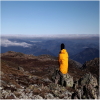
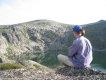
Sorry I just able to reply to u... Me n my boy just back on Monday, we made it camped 1 night at wilkinsons creek on northern side and 1 night at mt townsend on western side. It was a pleasant trip n pleasant weather.... Really windless during our stays... Except those flies during the day.
Thanks again for all the help n info you share with me. that was very helpful.
Thinking to go solo this coming autumn to Alice rawson, look the view should even better on western facing.
Best regards,
Rudy
"A man hikes to discover himself"
-
rM788 - Nothofagus gunnii
- Posts: 21
- Joined: Sun 28 Sep, 2014 10:48 pm
- Location: Wollongong
- Region: New South Wales
- Gender: Male
13 posts
• Page 1 of 1
Return to New South Wales & ACT
Who is online
Users browsing this forum: No registered users and 50 guests