Mittagong Food Resupply?
NSW & ACT specific bushwalking discussion. Please avoid publishing details of access to sensitive areas with no tracks.
Mittagong Food Resupply?
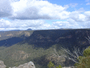
![]() by A Jay » Mon 25 Sep, 2017 12:22 am
by A Jay » Mon 25 Sep, 2017 12:22 am
- A Jay
- Atherosperma moschatum

- Posts: 57
- Joined: Fri 22 Sep, 2017 6:17 am
- Region: New South Wales
- Gender: Male
Re: Mittagong Food Resupply?
![]() by wildwanderer » Mon 25 Sep, 2017 8:00 am
by wildwanderer » Mon 25 Sep, 2017 8:00 am
The Kattomba to Mittagoing trip also involves walking through very remote country, some areas with no visible track. With flooding and fires especially around the nattai river, parts of the journey can bear little resemblance to online track notes. An experienced navigator and bushwalker in your party would be essential. There is a train station at either end for the return trip. A excellent trip report (albeit travelling in the opposite direction) can be found here - http://www.mitupela.net/gnw/mittagongtokatoomba.html
From reading your earlier posts, you were talking about doing your first multi-day walk. (along the six foot track).
I would suggest setting your sights on a shorter duration walk first. If your looking for more of wilderness experience (as opposed to the six foot track which is more of a historical/fire trail walk.) I would suggest a walk though the grose valley from Mt Victoria to Blackheath. Its 30km all up and you can do it over 2 or 3 days and is accessible from public transport at either end. There are other options. This is a great thread with many mulitday walks listed in the Sydney area. http://www.bushwalk.com/forum/viewtopic.php?f=36&t=26299
-

wildwanderer - Athrotaxis selaginoides

- Posts: 1640
- Joined: Tue 02 May, 2017 8:42 am
- Location: Out of lockdown \o/
- Region: New South Wales
- Gender: Male
Re: Mittagong Food Resupply?
![]() by michael_p » Mon 25 Sep, 2017 12:01 pm
by michael_p » Mon 25 Sep, 2017 12:01 pm
In Mittagong there is a Woolies and an Aldi. They are both on the Old Hume Highway towards Welby, probably a km or so from Lake Alexandra. Both should have a supply of fruits and nuts.
I have read and been told by fellow walkers that the section of the walk from Emmetts Flat (bottom of Starlights Track) to Mittagong has become very overgrown and is hard work getting through. Many people exit up Starlights to the Wattle Ridge entry point. The nearest shop to Wattle Rodge is in Hill Top but it is just a general store not a supermarket. If you can get phone reception you can get a taxi to Mittagong or have someone meet you at Wattle Ridge.
Michael.
-
michael_p - Athrotaxis selaginoides
- Posts: 1378
- Joined: Sun 15 Nov, 2009 6:58 pm
- Location: Macarthur Region of Sydney.
- Region: New South Wales
- Gender: Male
Re: Mittagong Food Resupply?
![]() by Neo » Mon 25 Sep, 2017 5:29 pm
by Neo » Mon 25 Sep, 2017 5:29 pm
Right next to Mittagong is Bowral, I know there is a bulk foods store there. It's in an arcade between the main street and the big Coles carpark.
Also there is a DIY laundromat somewhere in Mitta, not so in Bowral or Moss Vale, except for asking to use one at a caravan park.
- Neo
- Athrotaxis selaginoides
- Posts: 1888
- Joined: Wed 31 Aug, 2016 4:53 pm
- Location: Port Macquarie NSW
- Region: New South Wales
- Gender: Male
Re: Mittagong Food Resupply?
![]() by ribuck » Mon 25 Sep, 2017 6:07 pm
by ribuck » Mon 25 Sep, 2017 6:07 pm
Katoomba to Kanangra then back again? Sure. But Katoomba to Mittagong is a complete adventure in itself.
-

ribuck - Athrotaxis selaginoides
- Posts: 1887
- Joined: Wed 15 May, 2013 3:47 am
- Region: Other Country
- Gender: Male
Re: Mittagong Food Resupply?
![]() by rcaffin » Mon 25 Sep, 2017 8:52 pm
by rcaffin » Mon 25 Sep, 2017 8:52 pm
Yes, of course you can resupply in Mittagong: large town, lots of residents, they need food. Could have a night there in a motel and a dinner out - think of the luxury!
Be VERY careful of the Nattai water though, all the way down its length. It used to be toxic before the new Mittagong STP, and I still would not trust it. Mittagong councillors were smart. Toxic effluent from Mitta STP, straight into Nattai, into Sydney water supply. Bad PR. They (Mitta) could not afford an upgrade (they said), so Sydney Water Board or the State govt had to pay for it!
There used to be a bus back to Parramatta as well - still there? We had to wait a few hours for it as it had had a puncture en route ... a saga for the passengers. The driver had a radio so he was able to update the Parra base.
Cheers
Roger
-

rcaffin - Athrotaxis selaginoides
- Posts: 1226
- Joined: Thu 17 Jul, 2008 3:46 pm
Re: Mittagong Food Resupply?
![]() by Hughmac » Mon 25 Sep, 2017 9:17 pm
by Hughmac » Mon 25 Sep, 2017 9:17 pm
- Hughmac
- Athrotaxis cupressoides

- Posts: 154
- Joined: Sat 14 Apr, 2012 9:20 pm
- Region: New South Wales
Re: Mittagong Food Resupply?
![]() by DaveNoble » Mon 25 Sep, 2017 10:13 pm
by DaveNoble » Mon 25 Sep, 2017 10:13 pm
For your other thread -
At present, it has been fairly dry recently in the greater Sydney district - so a lot of usual sources of water may have dried up. Best water sources are side creeks of the Nattai, or the main river (but filter or treat), the Wollondilly (OK to drink), Yerranderie (tank water at the back of the court house - available to the public), Tonalli River (probably OK to drink), Butchers Ck - may be dry at the ford, need to look for pools, then Kowmung River (good reliable water) or Catholic Bushwalkers Huts just off Scotts Main (tank available to other bushwalkers), some small dams on Scotts Main - usually pretty poor looking water - filter, boil etc), Medlow Gap - the dam is a bit suspect and often dry, nearby Lake Birrell is often full - but definitely treat), Often good soaks on the side of the road along Narrow Neck.
- DaveNoble
- Athrotaxis selaginoides
- Posts: 1031
- Joined: Sun 03 Feb, 2008 3:56 pm
Re: Mittagong Food Resupply?
![]() by puredingo » Wed 27 Sep, 2017 8:01 am
by puredingo » Wed 27 Sep, 2017 8:01 am
You could look at exiting via the Boxvale (is that right?) track, then walking to that new, big super centre thingy with a million food shops, the complex before Wombyen caves road begins. Walk down to the Wangenderry walls entry and kick off again from there. Heaps of different options for a way back after that.
- puredingo
- Athrotaxis selaginoides
- Posts: 1270
- Joined: Mon 13 Feb, 2012 6:54 am
- Region: New South Wales
Re: Mittagong Food Resupply?
![]() by jackhinde » Wed 27 Sep, 2017 7:41 pm
by jackhinde » Wed 27 Sep, 2017 7:41 pm
I doubt very much you'll be stocking up there and wandering back though.
- jackhinde
- Athrotaxis cupressoides
- Posts: 324
- Joined: Wed 23 Nov, 2011 5:01 pm
- Location: Kangaroo Valley
- Region: New South Wales
- Gender: Male
Re: Mittagong Food Resupply?
![]() by Tortoise » Wed 27 Sep, 2017 8:02 pm
by Tortoise » Wed 27 Sep, 2017 8:02 pm
wildwanderer wrote:Katoomba to Mittagong is a big undertaking in itself. (7-10 days). Not many people then turn around and walk back.
The Kattomba to Mittagoing trip also involves walking through very remote country, some areas with no visible track. With flooding and fires especially around the nattai river, parts of the journey can bear little resemblance to online track notes. An experienced navigator and bushwalker in your party would be essential. There is a train station at either end for the return trip. A excellent trip report (albeit travelling in the opposite direction) can be found here - http://www.mitupela.net/gnw/mittagongtokatoomba.html
From reading your earlier posts, you were talking about doing your first multi-day walk. (along the six foot track).
I would suggest setting your sights on a shorter duration walk first. If your looking for more of wilderness experience (as opposed to the six foot track which is more of a historical/fire trail walk.) I would suggest a walk though the grose valley from Mt Victoria to Blackheath. Its 30km all up and you can do it over 2 or 3 days and is accessible from public transport at either end. There are other options. This is a great thread with many mulitday walks listed in the Sydney area. http://www.bushwalk.com/forum/viewtopic.php?f=36&t=26299
A Jay, I agree 100% with wildwanderer. As you said, you're new to multi-day walks. A 260-odd km walk through some remote country, without tracks in places, with significant alterations to the route from fire and flood is just not a good idea for a beginner. Or even 130 km, if you don't do the return trip. Work up to it, and get the experience you need before you take on something like that. I love your enthusiasm! You do need to be realistic, though. There are good reasons to do so, both for you and potential Searchers and Rescuers. I hope you have a ball starting with easier, shorter on-track walks.
-

Tortoise - Lagarostrobos franklinii

- Posts: 5158
- Joined: Sat 28 Jan, 2012 9:31 pm
- Location: NW Tasmania
- Region: Tasmania
- Gender: Female
Re: Mittagong Food Resupply?
![]() by A Jay » Sun 01 Oct, 2017 3:56 pm
by A Jay » Sun 01 Oct, 2017 3:56 pm
wildwanderer wrote:Katoomba to Mittagong is a big undertaking in itself. (7-10 days). Not many people then turn around and walk back.
The Kattomba to Mittagoing trip also involves walking through very remote country, some areas with no visible track. With flooding and fires especially around the nattai river, parts of the journey can bear little resemblance to online track notes. An experienced navigator and bushwalker in your party would be essential. There is a train station at either end for the return trip. A excellent trip report (albeit travelling in the opposite direction) can be found here - http://www.mitupela.net/gnw/mittagongtokatoomba.html
From reading your earlier posts, you were talking about doing your first multi-day walk. (along the six foot track).
I would suggest setting your sights on a shorter duration walk first. If your looking for more of wilderness experience (as opposed to the six foot track which is more of a historical/fire trail walk.) I would suggest a walk though the grose valley from Mt Victoria to Blackheath. Its 30km all up and you can do it over 2 or 3 days and is accessible from public transport at either end. There are other options. This is a great thread with many mulitday walks listed in the Sydney area. http://www.bushwalk.com/forum/viewtopic.php?f=36&t=26299
Hi, sorry everyone, I didn't realize I had responses to this question as I got no notification of replies, otherwise I'd have responded earlier.
Anyway, I ended up reading about the Katoomba to Mittagong trail and you're right, it's not something I'm ready for.
I was indeed scoping out Six Foot Track, but also want the wilderness experience for sure. I like forests, especially rainforests.
I really like the sound of the 30km Mt Victoria to Blackheath. Is that well signposted? Would I need a map in my hand, or can I just hit that trail?
Perhaps I failed to select to receive notifications, I just saw a box to tick for that, I might have failed to do so.
- A Jay
- Atherosperma moschatum
- Posts: 57
- Joined: Fri 22 Sep, 2017 6:17 am
- Region: New South Wales
- Gender: Male
Re: Mittagong Food Resupply?
![]() by A Jay » Sun 01 Oct, 2017 4:08 pm
by A Jay » Sun 01 Oct, 2017 4:08 pm
It's cool that there's train station at Mittagong.
- A Jay
- Atherosperma moschatum
- Posts: 57
- Joined: Fri 22 Sep, 2017 6:17 am
- Region: New South Wales
- Gender: Male
Re: Mittagong Food Resupply?
![]() by A Jay » Sun 01 Oct, 2017 4:18 pm
by A Jay » Sun 01 Oct, 2017 4:18 pm
Tortoise wrote:wildwanderer wrote:Katoomba to Mittagong is a big undertaking in itself. (7-10 days). Not many people then turn around and walk back.
The Kattomba to Mittagoing trip also involves walking through very remote country, some areas with no visible track. With flooding and fires especially around the nattai river, parts of the journey can bear little resemblance to online track notes. An experienced navigator and bushwalker in your party would be essential. There is a train station at either end for the return trip. A excellent trip report (albeit travelling in the opposite direction) can be found here - http://www.mitupela.net/gnw/mittagongtokatoomba.html
From reading your earlier posts, you were talking about doing your first multi-day walk. (along the six foot track).
I would suggest setting your sights on a shorter duration walk first. If your looking for more of wilderness experience (as opposed to the six foot track which is more of a historical/fire trail walk.) I would suggest a walk though the grose valley from Mt Victoria to Blackheath. Its 30km all up and you can do it over 2 or 3 days and is accessible from public transport at either end. There are other options. This is a great thread with many mulitday walks listed in the Sydney area. http://www.bushwalk.com/forum/viewtopic.php?f=36&t=26299
A Jay, I agree 100% with wildwanderer. As you said, you're new to multi-day walks. A 260-odd km walk through some remote country, without tracks in places, with significant alterations to the route from fire and flood is just not a good idea for a beginner. Or even 130 km, if you don't do the return trip. Work up to it, and get the experience you need before you take on something like that. I love your enthusiasm! You do need to be realistic, though. There are good reasons to do so, both for you and potential Searchers and Rescuers. I hope you have a ball starting with easier, shorter on-track walks.
Yeah, I'm nothing if not enthusiastic. More enthusiasm than experience or sense haha
- A Jay
- Atherosperma moschatum
- Posts: 57
- Joined: Fri 22 Sep, 2017 6:17 am
- Region: New South Wales
- Gender: Male
Re: Mittagong Food Resupply?
![]() by A Jay » Sun 01 Oct, 2017 4:29 pm
by A Jay » Sun 01 Oct, 2017 4:29 pm
EDIT: I asked johnw this question about the Grose Valley nagivation on another thread, and this was his encouraging response:
"A Jay, you should be fine without a GPS. I agree with wildwanderer's comment about the state of the Grose Valley track and I made similar observations earlier in this thread. I just had a look at the "off track" comment etc on WildWalks and it has left me scratching my head. Matt's track notes on that site are usually pretty accurate so I'm not sure what it's referring to in this instance. Based on my own experience I can't agree. Yes, it is narrow and slightly overgrown at times, with some risk of following a false lead e.g. on a bend. But unlikely you would get very far before realising the error. It's a regularly walked track and not hard to follow. I was there a couple of weeks ago downstream of Pierces Pass and nothing had changed navigation-wise since my previous visit in April. Probably 12-18 months since I've been anywhere upstream of Pierces but I can't imagine much has changed. Maybe the odd recent tree fall to negotiate. All that said I always take a topo map on every trip so I know where I am, plus a compass; and it makes it more enjoyable if you can identify the features encountered using the map. If you have the opportunity maybe take a short day trip into the valley to get an idea of the track. Then you can be more confident of what to expect before your multi-day trip."
- A Jay
- Atherosperma moschatum
- Posts: 57
- Joined: Fri 22 Sep, 2017 6:17 am
- Region: New South Wales
- Gender: Male
Re: Mittagong Food Resupply?
![]() by rcaffin » Mon 02 Oct, 2017 6:39 pm
by rcaffin » Mon 02 Oct, 2017 6:39 pm
You must remember that WildWalks is written for the novice fresh off the street.
Mind you, I disagree about the 'no visible tracks' bit: I can't recall ANY sections that did not have a very visible track.
As for the GPS bit ... some people don't seem to be able to do anything at all without a video screen in front of their nose.
Cheers
Roger
-
rcaffin - Athrotaxis selaginoides
- Posts: 1226
- Joined: Thu 17 Jul, 2008 3:46 pm
Re: Mittagong Food Resupply?
![]() by A Jay » Mon 02 Oct, 2017 7:12 pm
by A Jay » Mon 02 Oct, 2017 7:12 pm
rcaffin wrote:I just had a look at the Mt Victoria to Blackheath walk on WildWalks. It says some sections have no visible tracks and that someone in the group needs to have off-track navigation experience and GPS.
You must remember that WildWalks is written for the novice fresh off the street.
Mind you, I disagree about the 'no visible tracks' bit: I can't recall ANY sections that did not have a very visible track.
As for the GPS bit ... some people don't seem to be able to do anything at all without a video screen in front of their nose.
Cheers
Roger
Haha too true, my friend.
So, if one had a map and compass, could they navigate the Katoomba to Mittagong without any prior knowledge of the trail and no other navigational equipment?
Are all walking trails included on standard topographical maps? How does that work? How powerful IS a map and compass?
- A Jay
- Atherosperma moschatum
- Posts: 57
- Joined: Fri 22 Sep, 2017 6:17 am
- Region: New South Wales
- Gender: Male
Re: Mittagong Food Resupply?
![]() by wildwanderer » Tue 03 Oct, 2017 8:58 am
by wildwanderer » Tue 03 Oct, 2017 8:58 am
A Jay wrote:rcaffin wrote:I just had a look at the Mt Victoria to Blackheath walk on WildWalks. It says some sections have no visible tracks and that someone in the group needs to have off-track navigation experience and GPS.
You must remember that WildWalks is written for the novice fresh off the street.
Mind you, I disagree about the 'no visible tracks' bit: I can't recall ANY sections that did not have a very visible track.
As for the GPS bit ... some people don't seem to be able to do anything at all without a video screen in front of their nose.
Cheers
Roger
Haha too true, my friend.
So, if one had a map and compass, could they navigate the Katoomba to Mittagong without any prior knowledge of the trail and no other navigational equipment?
Are all walking trails included on standard topographical maps? How does that work? How powerful IS a map and compass?
If you have solid navigation skills and a map/compass then you can navigate yourself from A to B in most places on the planet. Having visible features like hills/ridges/rivers etc make it easier.
Not all walking tracks are included on the standard topos (and the inclusion can vary from edition to edition). Generally speaking most of the popular tracks are included.
-
wildwanderer - Athrotaxis selaginoides
- Posts: 1640
- Joined: Tue 02 May, 2017 8:42 am
- Location: Out of lockdown \o/
- Region: New South Wales
- Gender: Male
Re: Mittagong Food Resupply?
![]() by A Jay » Tue 03 Oct, 2017 9:46 am
by A Jay » Tue 03 Oct, 2017 9:46 am
wildwanderer wrote:A Jay wrote:rcaffin wrote:I just had a look at the Mt Victoria to Blackheath walk on WildWalks. It says some sections have no visible tracks and that someone in the group needs to have off-track navigation experience and GPS.
You must remember that WildWalks is written for the novice fresh off the street.
Mind you, I disagree about the 'no visible tracks' bit: I can't recall ANY sections that did not have a very visible track.
As for the GPS bit ... some people don't seem to be able to do anything at all without a video screen in front of their nose.
Cheers
Roger
Haha too true, my friend.
So, if one had a map and compass, could they navigate the Katoomba to Mittagong without any prior knowledge of the trail and no other navigational equipment?
Are all walking trails included on standard topographical maps? How does that work? How powerful IS a map and compass?
If you have solid navigation skills and a map/compass then you can navigate yourself from A to B in most places on the planet. Having visible features like hills/ridges/rivers etc make it easier.
Not all walking tracks are included on the standard topos (and the inclusion can vary from edition to edition). Generally speaking most of the popular tracks are included.
I'm going to have to get onto YouTube and watch some how-to-navigate using map and compass. I think I would be able to do so right now, I know what contours are and what a compass is, however I ought to make sure I know for sure what I'm doing. Well I don't even know what ratios to use, and you don't know what you don't know, so who knows what I don't know. Better do some study on it. I think I'll be forever studying how to trip instead of actually tripping haha. Been studying on gear and things for weeks and still not ready. At least the cold's going away while I wait. Thanks for your advice, much appreciated.
- A Jay
- Atherosperma moschatum
- Posts: 57
- Joined: Fri 22 Sep, 2017 6:17 am
- Region: New South Wales
- Gender: Male
Return to New South Wales & ACT
Who is online
Users browsing this forum: No registered users and 22 guests