I was wondering if any one has walk from say just south of Eden on the NSW/VIC border to Mt Kosciusko? A bit like Tim Macartney-Snape but on a much smaller scale.
It is 191Km's in a straight line. Of course the walk would be longer than that..
BTW what is the name of the point on the NSW/VIC border and is there a track to it, from either the NSW or VIC side?
Thanks!
Sea to Summit
Forum rules
NSW & ACT specific bushwalking discussion. Please avoid publishing details of access to sensitive areas with no tracks.
NSW & ACT specific bushwalking discussion. Please avoid publishing details of access to sensitive areas with no tracks.
14 posts
• Page 1 of 1
-
Greenie - Athrotaxis cupressoides

- Posts: 321
- Joined: Mon 07 Dec, 2009 3:26 pm
- Region: New South Wales
- Gender: Male
Re: Sea to Summit
![]() by Lizzy » Sun 04 Jul, 2010 3:27 pm
by Lizzy » Sun 04 Jul, 2010 3:27 pm
Hi Greenie,
Haven't done this walk, although have done parts....
Here is a link to Outward Bound who runs a course- not jusy bushwalking but sections of canoeing etc
http://www.outwardbound.org.au/index.ph ... &Itemid=14
Another state they finish in Marlo, VIc
http://www.boec.vic.edu.au/student/student-camps.htm
Might be able to get some more info there...
Goodluck
Lizzy
-
Lizzy - Athrotaxis selaginoides

- Posts: 1074
- Joined: Mon 16 Nov, 2009 1:13 pm
- Region: New South Wales
- Gender: Female
Re: Sea to Summit
![]() by WarrenH » Sun 04 Jul, 2010 6:23 pm
by WarrenH » Sun 04 Jul, 2010 6:23 pm
Lizzy do you mean the Aboriginal pathway called the Bundian Way?
http://www.netspeed.com.au/seforests/bundian_way.htm
I might be wrong but looking at the map on the site, the trail looks like it goes over Tingaringy, matching the fire trails through Byadbo.
There isn't a bridge at the end of the Sandy Creek Fire Trail crossing the Snowy, below Mount Trooper. It is a wet crossing. It was an old travelling stock crossing at times of low water levels which was seasonal because the Snowy was once, one of the World's great roaring alpine rivers. If the water is up you will not make it across the Snowy. Currently at Sandy Creek crossing it is over a metre deep. If the river is flowing at only 3 or 4 knots no one will get across. I've looked at the crossing on several occasions from the Barry Way side and the water has been to-up for me to even consider going. It is a fire trail, National Parks' 4x4 can make it across, when the water is low, like half way up the door. Brett McClellend is the Park Ranger in charge of the Southern Kosci' region, his number is (02) 64505600. He said that currently the water level is over the 4X4's bonnet. I talked to him only a few days ago.
There is another old stock crossing of the Snowy about 7 ks lower down. Ranger McClelland will know where it is, I just can't remember. The only dry crossing is McKillop's Bridge.
Warren.
- WarrenH
- Phyllocladus aspleniifolius

- Posts: 991
- Joined: Thu 07 Jan, 2010 6:54 pm
- Region: Australian Capital Territory
Re: Sea to Summit
![]() by Greenie » Sun 04 Jul, 2010 7:16 pm
by Greenie » Sun 04 Jul, 2010 7:16 pm
Thankyou both for ideas. Would there be many places to camp along the way?
It looks like there would be a few river crossings towards the east.
How much of a distance is McKillop's Bridge away from the Sandy Creek Crossing?
What time of year would the river be at it's lowest?
It looks like there would be a few river crossings towards the east.
How much of a distance is McKillop's Bridge away from the Sandy Creek Crossing?
What time of year would the river be at it's lowest?
-
Greenie - Athrotaxis cupressoides
- Posts: 321
- Joined: Mon 07 Dec, 2009 3:26 pm
- Region: New South Wales
- Gender: Male
Re: Sea to Summit
![]() by climberman » Sun 04 Jul, 2010 7:48 pm
by climberman » Sun 04 Jul, 2010 7:48 pm
If you did it in reverse you could walk from Kozzie down through to the Snowy, and packaft down to the coast !
- climberman
- Phyllocladus aspleniifolius
- Posts: 656
- Joined: Tue 09 Dec, 2008 7:32 pm
Re: Sea to Summit
![]() by WarrenH » Sun 04 Jul, 2010 8:37 pm
by WarrenH » Sun 04 Jul, 2010 8:37 pm
"Thankyou both for ideas. Would there be many places to camp along the way?"
Many places along the way. The Aboriginal people showed the drovers the best routes through the mountains for the travelling stock. The old/historic Travelling Stock Routes here follows the Bundian Way. The routes were designed so that stock being walked to market could reach a camp site with water each evening. Now that many of the old routes are decommissioned these camp sites still exist in what is known as the Travelling Stock Reserves and they are administered by the NSW Department of Primary Industry's 'Livestock Health and Pest Association'. The LHPA Rangers issue permits to allow free camping on the TSR. The LHPA regions that the Bundian Way passes through are LHPA Cooma, LHPA Bombala and LHPA South Coast and several National Parks of course.
There is a book called the 'The Long Paddock' which is a directory and 63 map altas of the extant NSW Travelling Stock Routes and the thousands of Travelling Stock Reserves that are basically invisible but still exist. The directory lists the water resources on each of the TSRs. The directory is available on the web from the NSW Department of Primary Industry bookshop for $35 plus $10 postage. 'The Long Paddock' is a very comprehensive body of work.
John Blay is a consultant on the Bundian Way project and possibly the best person to contact about the Bundian Way ... sefproject@netspeed.com.au
Once you know the exact route the LHPA Regional Rangers can be contacted at ... http://www.lhpa.org.au/contact
I use the TSRs a lot as a touring cyclist. What I do is I ring the LHPA regional Rangers well ahead of time and then give them my approximate dates for when I'll enter their region and tell them what TSRs I'll most likely camp in. When I enter their region I'll call them to say that I've arrived so that they can tell me what reserves I might have to share with travelling stock. If you are with travelling stock where you are camping camp well away from the water supply because stock will rather die of thirst than drink near a camp that's near their only access to water (it sounds totally silly but it is true). LHPA Rangers can tell you if there are other restrictions to using a particular TSR. On some TSR we are able to light fires and on others the collecting of fire wood is prohibited.
This is how many of the great routes of Australia work utilising the TSRs. This is how the Bicentennial National Trail works making best use of the TSRs and following the historic routes.
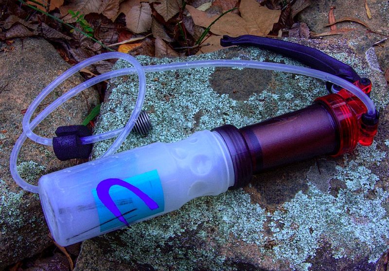
When I'm on a TSR I use a water filter because I don't know when stock last used a reserve, unless the stock is there of course. I have an MSR Miniworks water filter. The filter screws onto nalgene bottles.
Good luck, take lots of shots.
More information still to come.
Warren.
Many places along the way. The Aboriginal people showed the drovers the best routes through the mountains for the travelling stock. The old/historic Travelling Stock Routes here follows the Bundian Way. The routes were designed so that stock being walked to market could reach a camp site with water each evening. Now that many of the old routes are decommissioned these camp sites still exist in what is known as the Travelling Stock Reserves and they are administered by the NSW Department of Primary Industry's 'Livestock Health and Pest Association'. The LHPA Rangers issue permits to allow free camping on the TSR. The LHPA regions that the Bundian Way passes through are LHPA Cooma, LHPA Bombala and LHPA South Coast and several National Parks of course.
There is a book called the 'The Long Paddock' which is a directory and 63 map altas of the extant NSW Travelling Stock Routes and the thousands of Travelling Stock Reserves that are basically invisible but still exist. The directory lists the water resources on each of the TSRs. The directory is available on the web from the NSW Department of Primary Industry bookshop for $35 plus $10 postage. 'The Long Paddock' is a very comprehensive body of work.
John Blay is a consultant on the Bundian Way project and possibly the best person to contact about the Bundian Way ... sefproject@netspeed.com.au
Once you know the exact route the LHPA Regional Rangers can be contacted at ... http://www.lhpa.org.au/contact
I use the TSRs a lot as a touring cyclist. What I do is I ring the LHPA regional Rangers well ahead of time and then give them my approximate dates for when I'll enter their region and tell them what TSRs I'll most likely camp in. When I enter their region I'll call them to say that I've arrived so that they can tell me what reserves I might have to share with travelling stock. If you are with travelling stock where you are camping camp well away from the water supply because stock will rather die of thirst than drink near a camp that's near their only access to water (it sounds totally silly but it is true). LHPA Rangers can tell you if there are other restrictions to using a particular TSR. On some TSR we are able to light fires and on others the collecting of fire wood is prohibited.
This is how many of the great routes of Australia work utilising the TSRs. This is how the Bicentennial National Trail works making best use of the TSRs and following the historic routes.
When I'm on a TSR I use a water filter because I don't know when stock last used a reserve, unless the stock is there of course. I have an MSR Miniworks water filter. The filter screws onto nalgene bottles.
Good luck, take lots of shots.
More information still to come.
Warren.
Last edited by WarrenH on Mon 05 Jul, 2010 5:11 am, edited 1 time in total.
- WarrenH
- Phyllocladus aspleniifolius
- Posts: 991
- Joined: Thu 07 Jan, 2010 6:54 pm
- Region: Australian Capital Territory
Re: Sea to Summit
![]() by WarrenH » Sun 04 Jul, 2010 9:11 pm
by WarrenH » Sun 04 Jul, 2010 9:11 pm
"How much of a distance is McKillop's Bridge away from the Sandy Creek Crossing?"
McKillop's Bridge is 35-40 kilometres south of Sandy Creek Crossing following the Snowy. By road via Wulgulmerang and Little River it is 82 kilometres. In my first post I mentioned the other crossing, which could be worth exploring.
I've been talking to a guy from the Blue Mountains, Warwick, who is doing a similar trip next Easter, he is called Wokka. Wokka is doing several reccys before he does his trip. Are you from Wokka's group? I've seen from your site that your are an experienced walker.
"What time of year would the river be at it's lowest?"
At the worst time of year, during the height of summer when water elsewhere, can be hard to find. During the early thaw or even in late Spring the current can be too fast and now when it shouldn't be up, good rains have kept the Snowy full. I've seen the Snowy in summer when it has been unlinked pools. That is why I gave you Ranger McClelland's number, because he is the Ranger in charge of southern Kosci' NP and he has his finger on the pulse.
Don't be put off with what I've written. What I've written is to help overcome some of the hurdles. A major trek like this through at times very severe country, especially traversing the coastal ranges of the SE on a route that is in and out of national parks, on little travelled paths at times, travelling into the jurisdictions of others at times, contacting people that you have to rely on like the LHPA Rangers, can take as long to organise properly, than it can take to do the actual trek.
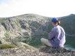
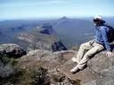
I don't know if you get down this way much, but the round hill on the horizon is Tingeringy. I took the shot from half way up Mount Hamilton. The valley immediately in front is Suggan Buggan and the other valley is the Snowy. Tingaringy is about 35 kilometres from the Snowy as the Ravens and Little Ravens fly.
Warren.
McKillop's Bridge is 35-40 kilometres south of Sandy Creek Crossing following the Snowy. By road via Wulgulmerang and Little River it is 82 kilometres. In my first post I mentioned the other crossing, which could be worth exploring.
I've been talking to a guy from the Blue Mountains, Warwick, who is doing a similar trip next Easter, he is called Wokka. Wokka is doing several reccys before he does his trip. Are you from Wokka's group? I've seen from your site that your are an experienced walker.
"What time of year would the river be at it's lowest?"
At the worst time of year, during the height of summer when water elsewhere, can be hard to find. During the early thaw or even in late Spring the current can be too fast and now when it shouldn't be up, good rains have kept the Snowy full. I've seen the Snowy in summer when it has been unlinked pools. That is why I gave you Ranger McClelland's number, because he is the Ranger in charge of southern Kosci' NP and he has his finger on the pulse.
Don't be put off with what I've written. What I've written is to help overcome some of the hurdles. A major trek like this through at times very severe country, especially traversing the coastal ranges of the SE on a route that is in and out of national parks, on little travelled paths at times, travelling into the jurisdictions of others at times, contacting people that you have to rely on like the LHPA Rangers, can take as long to organise properly, than it can take to do the actual trek.
I don't know if you get down this way much, but the round hill on the horizon is Tingeringy. I took the shot from half way up Mount Hamilton. The valley immediately in front is Suggan Buggan and the other valley is the Snowy. Tingaringy is about 35 kilometres from the Snowy as the Ravens and Little Ravens fly.
Warren.
Last edited by WarrenH on Mon 05 Jul, 2010 5:12 am, edited 5 times in total.
- WarrenH
- Phyllocladus aspleniifolius
- Posts: 991
- Joined: Thu 07 Jan, 2010 6:54 pm
- Region: Australian Capital Territory
Re: Sea to Summit
![]() by SteveJ » Sun 04 Jul, 2010 10:46 pm
by SteveJ » Sun 04 Jul, 2010 10:46 pm
The name of the point on the NSW/VIC border is Cape Howe and there is walking track to it from both sides (Nadgee or Mallacotta) it is a 2 day walk form either side. It is a lovely section of coast. I don't believe there is an easy way from the coast to the west from Cape Howe but it is doable, tough contry though, I guess that is why it is wilderness.
The Crossing (land education trust) run a youth walk every year from Bermagui up to the mountains (Sea ro Snow Crossing), different route (similar to the Outward bound one). They are very good people, that do an amazing thing.
http://www.thebegavalley.org.au/index.php?id=seatosnow
Mmm OK I will if you will?
Steve
The Crossing (land education trust) run a youth walk every year from Bermagui up to the mountains (Sea ro Snow Crossing), different route (similar to the Outward bound one). They are very good people, that do an amazing thing.
http://www.thebegavalley.org.au/index.php?id=seatosnow
climberman wrote:If you did it in reverse you could walk from Kozzie down through to the Snowy, and packaft down to the coast !
Mmm OK I will if you will?
Steve
- SteveJ
- Athrotaxis cupressoides
- Posts: 341
- Joined: Mon 10 Nov, 2008 1:09 pm
Re: Sea to Summit
![]() by Tony » Mon 05 Jul, 2010 6:45 am
by Tony » Mon 05 Jul, 2010 6:45 am
Hi Greenie.
I know some walkers who have walked from Dead Horse Gap at the base of Mt Kosciuszco to near Cape Howe via the Black Allan line.
http://www.dse.vic.gov.au/CA256F310024B ... n+Line.pdf
When they reached the start of the Murray River they tried follow the Black Allan Line and find as many of the cairns as they could. As far as they could find out this was only the second time the Black Allan Line was walked in recent times. While some of the walk can be done on roads, a lot is through very rugged trackless country, a lot of the time water was very hard to find, and large quantities of water had to be carried up and down some very steep hills. Closer to the coast the walking could be done on roads and through farm land, where some long boring +30k days where walked.
As with the previous group they abandoned the last few kilometers to Cape Howe as they found the scrub impenetrable.
If you decide that you would like to do this route I could put you in touch.
Tony
There is no such thing as bad weather.....only bad clothing. Norwegian Proverb
-
Tony - Athrotaxis selaginoides
- Posts: 1896
- Joined: Fri 16 May, 2008 1:40 pm
- Location: Canberra
- Region: Australian Capital Territory
Re: Sea to Summit
![]() by Greenie » Mon 05 Jul, 2010 9:14 pm
by Greenie » Mon 05 Jul, 2010 9:14 pm
Thanks all for the infomation.
I never knew about either the Black Allan Line or the Bundian Way. A good read there on the Black Allan line. It's ashame that there isn't an official Bundian Way track, yet.
I do have a Steripen, but the MSR Miniworks water filter looks good, as I would have to carry a fair few batteries for such a walk.
It was just an idea, but from all the above, I might just do this now. It will take a lot of planning I know. Thanks for all of the contact details.
I first need to put a few more K's on my boots and legs.
I will then take lots of shots and blog about it
-
Greenie - Athrotaxis cupressoides
- Posts: 321
- Joined: Mon 07 Dec, 2009 3:26 pm
- Region: New South Wales
- Gender: Male
Re: Sea to Summit
![]() by WarrenH » Tue 06 Jul, 2010 8:13 am
by WarrenH » Tue 06 Jul, 2010 8:13 am
"It's a shame that there isn't an official Bundian Way track, yet."
You can still walk all the way along the Bundian Pathway, through wild country, fire trails or on minor country roads. Many traces of the path still remain in the present day. If you Google Bundian Way you can find information on the route including historic maps.
John Blay the contact is one of Australia's greatest modern day explorers, what this man has done is extraordinary. There will be nothing that he can't tell you.
Cheers.
- WarrenH
- Phyllocladus aspleniifolius
- Posts: 991
- Joined: Thu 07 Jan, 2010 6:54 pm
- Region: Australian Capital Territory
Re: Sea to Summit
![]() by Greenie » Thu 08 Jul, 2010 9:02 pm
by Greenie » Thu 08 Jul, 2010 9:02 pm
Thanks. I hope that I can include a bit of the Black Allan Line, maybe start and finish? But do the Bundian the rest of the way.
I'll give John Blay a call.
Thanks
I'll give John Blay a call.
Thanks
-
Greenie - Athrotaxis cupressoides
- Posts: 321
- Joined: Mon 07 Dec, 2009 3:26 pm
- Region: New South Wales
- Gender: Male
Re: Sea to Summit
![]() by north-north-west » Fri 09 Jul, 2010 7:04 pm
by north-north-west » Fri 09 Jul, 2010 7:04 pm
climberman wrote:If you did it in reverse you could walk from Kozzie down through to the Snowy, and packaft down to the coast !
This is my dream walk. Following the Snowy all the way from the top of Kosciuszko to the coast. I'd then write a book about it, covering every aspect of the river: Aboriginal and colonial history, botany, zoology, geology, hydrology, etc, all leavened with the more amusing and exciting of the trip notes.
I'd call it Summit to Sea.
With a special edition for northern England called Summat to See.
"Mit der Dummheit kämpfen Götter selbst vergebens."
-

north-north-west - Lagarostrobos franklinii

- Posts: 15121
- Joined: Thu 14 May, 2009 7:36 pm
- Location: The Asylum
- ASSOCIATED ORGANISATIONS: Social Misfits Anonymous
- Region: Tasmania
Re: Sea to Summit
![]() by Mister G » Fri 23 Jul, 2010 2:49 pm
by Mister G » Fri 23 Jul, 2010 2:49 pm
Don't forget there is an official footrace from Boydtown Beach (south of Eden) to Kosci- website is at http://www.coast2kosci.com/index.html. Total distance 240km, course record is 26 hours.
- Mister G
- Nothofagus gunnii

- Posts: 26
- Joined: Fri 23 Jul, 2010 2:46 pm
- Location: Katoomba
- Region: New South Wales
- Gender: Male
14 posts
• Page 1 of 1
Return to New South Wales & ACT
Who is online
Users browsing this forum: ggorgeman and 17 guests