Hi
I am off to hike in the Alpine NP, up the Crinolene, camp on Long hill plateau starting from Mt Tamboritha sadddle this weekend.
We'll end up at Breakfast creek by the Wellington river road north of Licola.
It will be cold, strenuous but most of all , highly worthwhile.
I shall report on the trip soon.
Trip Report: mt Ligar,Crinolene & long hill plateau
Forum rules
Victoria specific bushwalking discussion. Please avoid publishing details of access to sensitive areas with no tracks.
Victoria specific bushwalking discussion. Please avoid publishing details of access to sensitive areas with no tracks.
8 posts
• Page 1 of 1
Trip Report: mt Ligar,Crinolene & long hill plateau
![]() by paidal_chalne_vala » Mon 07 May, 2012 5:18 pm
by paidal_chalne_vala » Mon 07 May, 2012 5:18 pm
Last edited by paidal_chalne_vala on Mon 14 May, 2012 9:17 pm, edited 1 time in total.
- paidal_chalne_vala
- Lagarostrobos franklinii

- Posts: 2458
- Joined: Sun 22 Jan, 2012 10:30 pm
- ASSOCIATED ORGANISATIONS: VNPA.BTAC.Friends of Baw Baw.Mt.Bogong Club.
- Region: Victoria
- Gender: Male
Re: The crinolene, and long hill plateau from tamboritha sad
![]() by north-north-west » Wed 09 May, 2012 7:10 pm
by north-north-west » Wed 09 May, 2012 7:10 pm
Well, goody for you, sonny Jim.
"Mit der Dummheit kämpfen Götter selbst vergebens."
-

north-north-west - Lagarostrobos franklinii
- Posts: 15145
- Joined: Thu 14 May, 2009 7:36 pm
- Location: The Asylum
- ASSOCIATED ORGANISATIONS: Social Misfits Anonymous
- Region: Tasmania
Re: The crinolene, and long hill plateau from tamboritha sad
![]() by andrewp » Wed 09 May, 2012 7:46 pm
by andrewp » Wed 09 May, 2012 7:46 pm
Hi,
We were there Feb 2011. The track from the saddle disappeared not far beyond the rock shelter. We didn't pick up a track until we were close to the falls at the end of Long Hill. Don't know if anything has changed since then.
We were there Feb 2011. The track from the saddle disappeared not far beyond the rock shelter. We didn't pick up a track until we were close to the falls at the end of Long Hill. Don't know if anything has changed since then.
-
andrewp - Athrotaxis cupressoides

- Posts: 274
- Joined: Mon 29 Aug, 2011 10:34 am
- Region: Victoria
- Gender: Male
Re: The crinolene, and long hill plateau from tamboritha sad
![]() by paidal_chalne_vala » Mon 14 May, 2012 9:13 pm
by paidal_chalne_vala » Mon 14 May, 2012 9:13 pm
Hi
The hike over the weekend of 12-13 Th of May was grueling and the weather was very cold. It snowed a number of times on both days.
We did a car shuffle/shuttle from Breakfast creek up to the Mt Tamboritha saddle car park (1280 M). There was snow on the logs at the cattle pens.
It began to snow more as we ascended the 4wd old Dingo track at around 1400 M at around 9 am
Then after 7 kms on the jeep track we walked onto the ridge to approach the Long hill plateau. There was no track. Our VNPA walk leader followed the edge of the cliff line and often we were just bush bashing through post bush fire regrowth of saplings. It was 1 km per hour hard slog bush walking with a map and compass.
A machete would have come in very handy. Only blue electrical tape every 200 M , tied to a bush indicated the 'path'.
Eventually we got to the rock shelter for lunch at around 1 pm and some grand views of the ranges. The weather remained cold and windy but the drizzle held off until dusk .
We couldn't find the best camp site, [grassy and flat and open] at the long hill because it was becoming dark and it was raining. It was discovered by accident by some of our mob who went to find the creek by bush bashing through the thick scrub towards the gully that heads off the plateau.
We were tired and just pitched our tents wherever we could manage it. I started a fire with paraffin cubes and there was plenty of firewood that was dry. This was most welcome. After eating a vast amount of pasta and chillie pesto & hot tea I pulled out the martin backpacker guitar that I had brought and entertained everybody ..
It took some knocks over the weekend since we all had to scramble around on all fours because the rocks and " path" were so slippery and scrubby .Some climbing up and down backwards./on one's backside was necessary .
I fell over at least five times, others maybe more.
It was cold , windy and rainy on the ridge(1200 M) and I did not sleep that much on Sat. night.
We all got up at day break .In order to make breakfast , I bashed my way through the scrub to get water from the creek. Yes having water on tap seemed like a world away.
When we were ready to move on just before 9 am on Sunday it began to snow , again. It was really cold , about 3 -4 degrees C.
Eventually we got to the edge of the Long hill and saw mt Ligar aka the Crinolene.
we ploughed on without rest until 11 am until we reached the summit. It was a real scramble over rocks , mud and scrub and bit risky , what with the steep drop on the sides and with the sleet and then snow & all to reach the summit.We could see snow on the summits of the higher peaks in the area.
After morning snack/s and rest we rugged up more and pressed on . The track was often just a line of diabolically slippery rocks.The wind and drizzle continued alternating with sleet and snow.......
By lunch time we had descended across the saddle and knob past Mt Ligar and then down on a woefully muddy and slippery zig zag trail to lunch time HQ on a grassy flat about 4 km from Break fast creek.
The sun came out and we rested in the sun . It was 8 C. at 900 M.
The descent on Macmillan's trail was punishing on the knees and I slipped a few times. We started to strip off our weather proof layers as we neared closer to the valley floor and the balmy double figures weather there.
We reached the school camp buildings at 14:50.
In drier weather without full packs this walk , a total of 26 km could be done in one day from dawn to dusk in daylight savings.
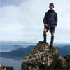
I found it to be one of the most difficult pack carry hikes I have ever done. The views of the great dividing range from along the Long hill plateau when you come out into a clearing are/were grand and there was nobody else walking up there while our party was doing this hike.
I am now as stiff , scratched up and sore in my muscles as can be.
If you like a good challenging hike away from the crowds then give it a go.The main issues are (1) whether there is any water in the creek on Long Hill plateau .(2) navigation with a map and compass since the track is n't there half the time and you have to scrabble up boulders and between saplings and watch out for being poked in the eyes by twigs and looking at every step you make since this is not a maintained track at all until you leave the Long Hill and Crinolene/Mt Ligar and head towards Breakfast creek. It is draining both mentally and physically if you are used to walking on established trails where you can get a rhythm and take in the views .
We went and got the other cars back at the Tamboritha saddle. It was snowing up there at around 15:30.
I was home by 20:00 and the hot shower, fresh clothes, hot meal and warm bed were quite a reward.
The hike over the weekend of 12-13 Th of May was grueling and the weather was very cold. It snowed a number of times on both days.
We did a car shuffle/shuttle from Breakfast creek up to the Mt Tamboritha saddle car park (1280 M). There was snow on the logs at the cattle pens.
It began to snow more as we ascended the 4wd old Dingo track at around 1400 M at around 9 am
Then after 7 kms on the jeep track we walked onto the ridge to approach the Long hill plateau. There was no track. Our VNPA walk leader followed the edge of the cliff line and often we were just bush bashing through post bush fire regrowth of saplings. It was 1 km per hour hard slog bush walking with a map and compass.
A machete would have come in very handy. Only blue electrical tape every 200 M , tied to a bush indicated the 'path'.
Eventually we got to the rock shelter for lunch at around 1 pm and some grand views of the ranges. The weather remained cold and windy but the drizzle held off until dusk .
We couldn't find the best camp site, [grassy and flat and open] at the long hill because it was becoming dark and it was raining. It was discovered by accident by some of our mob who went to find the creek by bush bashing through the thick scrub towards the gully that heads off the plateau.
We were tired and just pitched our tents wherever we could manage it. I started a fire with paraffin cubes and there was plenty of firewood that was dry. This was most welcome. After eating a vast amount of pasta and chillie pesto & hot tea I pulled out the martin backpacker guitar that I had brought and entertained everybody ..
It took some knocks over the weekend since we all had to scramble around on all fours because the rocks and " path" were so slippery and scrubby .Some climbing up and down backwards./on one's backside was necessary .
I fell over at least five times, others maybe more.
It was cold , windy and rainy on the ridge(1200 M) and I did not sleep that much on Sat. night.
We all got up at day break .In order to make breakfast , I bashed my way through the scrub to get water from the creek. Yes having water on tap seemed like a world away.
When we were ready to move on just before 9 am on Sunday it began to snow , again. It was really cold , about 3 -4 degrees C.
Eventually we got to the edge of the Long hill and saw mt Ligar aka the Crinolene.
we ploughed on without rest until 11 am until we reached the summit. It was a real scramble over rocks , mud and scrub and bit risky , what with the steep drop on the sides and with the sleet and then snow & all to reach the summit.We could see snow on the summits of the higher peaks in the area.
After morning snack/s and rest we rugged up more and pressed on . The track was often just a line of diabolically slippery rocks.The wind and drizzle continued alternating with sleet and snow.......
By lunch time we had descended across the saddle and knob past Mt Ligar and then down on a woefully muddy and slippery zig zag trail to lunch time HQ on a grassy flat about 4 km from Break fast creek.
The sun came out and we rested in the sun . It was 8 C. at 900 M.
The descent on Macmillan's trail was punishing on the knees and I slipped a few times. We started to strip off our weather proof layers as we neared closer to the valley floor and the balmy double figures weather there.
We reached the school camp buildings at 14:50.
In drier weather without full packs this walk , a total of 26 km could be done in one day from dawn to dusk in daylight savings.
I found it to be one of the most difficult pack carry hikes I have ever done. The views of the great dividing range from along the Long hill plateau when you come out into a clearing are/were grand and there was nobody else walking up there while our party was doing this hike.
I am now as stiff , scratched up and sore in my muscles as can be.
If you like a good challenging hike away from the crowds then give it a go.The main issues are (1) whether there is any water in the creek on Long Hill plateau .(2) navigation with a map and compass since the track is n't there half the time and you have to scrabble up boulders and between saplings and watch out for being poked in the eyes by twigs and looking at every step you make since this is not a maintained track at all until you leave the Long Hill and Crinolene/Mt Ligar and head towards Breakfast creek. It is draining both mentally and physically if you are used to walking on established trails where you can get a rhythm and take in the views .
We went and got the other cars back at the Tamboritha saddle. It was snowing up there at around 15:30.
I was home by 20:00 and the hot shower, fresh clothes, hot meal and warm bed were quite a reward.
Last edited by paidal_chalne_vala on Tue 15 May, 2012 12:00 am, edited 1 time in total.
- paidal_chalne_vala
- Lagarostrobos franklinii
- Posts: 2458
- Joined: Sun 22 Jan, 2012 10:30 pm
- ASSOCIATED ORGANISATIONS: VNPA.BTAC.Friends of Baw Baw.Mt.Bogong Club.
- Region: Victoria
- Gender: Male
Re: Trip Report: mt Ligar,Crinolene & long hill plateau
![]() by sim1oz » Mon 14 May, 2012 10:32 pm
by sim1oz » Mon 14 May, 2012 10:32 pm
Thanks for sharing your trip report. Sounds like a real adventure! I had wanted to go on this walk but my kids were not impressed with the idea of my being away for Mothers' Day. Did you manage to take any photos given the weather conditions? Post some if you did.
Carpe diem!
-

sim1oz - Athrotaxis cupressoides
- Posts: 479
- Joined: Mon 17 Jan, 2011 10:15 pm
- Region: Victoria
- Gender: Female
Re: Trip Report: mt Ligar,Crinolene & long hill plateau
![]() by paidal_chalne_vala » Tue 15 May, 2012 12:02 am
by paidal_chalne_vala » Tue 15 May, 2012 12:02 am
Hi
I shot a reel of 36 film. I will get it developed and see what the results are. My Nikon analogue camera fogged up !
I shot a reel of 36 film. I will get it developed and see what the results are. My Nikon analogue camera fogged up !
- paidal_chalne_vala
- Lagarostrobos franklinii
- Posts: 2458
- Joined: Sun 22 Jan, 2012 10:30 pm
- ASSOCIATED ORGANISATIONS: VNPA.BTAC.Friends of Baw Baw.Mt.Bogong Club.
- Region: Victoria
- Gender: Male
Re: Trip Report: mt Ligar,Crinolene & long hill plateau
![]() by north-north-west » Tue 15 May, 2012 4:33 pm
by north-north-west » Tue 15 May, 2012 4:33 pm
Yer, I always reckoned the full circuit from Breakfast Creek could be done as a two-dayer, although a suitable campsite might be difficult as there's not much water up on Tamboritha.
"Mit der Dummheit kämpfen Götter selbst vergebens."
-
north-north-west - Lagarostrobos franklinii
- Posts: 15145
- Joined: Thu 14 May, 2009 7:36 pm
- Location: The Asylum
- ASSOCIATED ORGANISATIONS: Social Misfits Anonymous
- Region: Tasmania
Re: Trip Report: mt Ligar,Crinolene & long hill plateau
![]() by paidal_chalne_vala » Mon 30 Jul, 2012 10:14 pm
by paidal_chalne_vala » Mon 30 Jul, 2012 10:14 pm
there was water running in the creek at the gully near Long hill plateau. Before the drought broke you'd have to carry water in which makes it a real nut cracker of a hike.
- paidal_chalne_vala
- Lagarostrobos franklinii
- Posts: 2458
- Joined: Sun 22 Jan, 2012 10:30 pm
- ASSOCIATED ORGANISATIONS: VNPA.BTAC.Friends of Baw Baw.Mt.Bogong Club.
- Region: Victoria
- Gender: Male
8 posts
• Page 1 of 1
Who is online
Users browsing this forum: No registered users and 52 guests