Hi everyone, I am planning a multi day hike around Girraween National Park but am having trouble getting my hands on a topographic map. Ideally I'd like the Hema Girraween, Bald Rock and Sundown map but it is no longer in print and I can't get my hands on a copy (paper or digital) If anyone knows where I can get one I'd really appreciate it.
Also to help my planning, does anyone have a list of the bush camps and there GPS locations to help me out.
Thanks in advance for anyone that can help
AC
Girraween National Park MAP required
Forum rules
Queensland specific bushwalking discussion. Please avoid publishing details of access to sensitive areas with no tracks.
Queensland specific bushwalking discussion. Please avoid publishing details of access to sensitive areas with no tracks.
12 posts
• Page 1 of 1
Girraween National Park MAP required
![]() by Adventure Calls » Wed 14 Sep, 2016 7:57 am
by Adventure Calls » Wed 14 Sep, 2016 7:57 am
- Adventure Calls
- Nothofagus cunninghamii

- Posts: 6
- Joined: Tue 13 Sep, 2016 2:18 pm
- Location: Chinchilla
- Region: Queensland
- Gender: Male
Re: Girraween National Park MAP required
![]() by ofuros » Wed 14 Sep, 2016 4:46 pm
by ofuros » Wed 14 Sep, 2016 4:46 pm
Download from here Jason.... if you have trouble, i'll send them to you through the email address you sent me.
http://qtopo.dnrm.qld.gov.au/desktop/
Pm sent.
http://qtopo.dnrm.qld.gov.au/desktop/
Pm sent.
Mountain views are good for my soul...& getting to them is good for my waistline !
https://ofuros.exposure.co/
https://ofuros.exposure.co/
-
ofuros - Athrotaxis selaginoides

- Posts: 1930
- Joined: Fri 05 Feb, 2010 4:42 pm
- Region: Queensland
- Gender: Male
Re: Girraween National Park MAP required
![]() by Adventure Calls » Thu 15 Sep, 2016 10:03 am
by Adventure Calls » Thu 15 Sep, 2016 10:03 am
Thanks ofuros.. I have accessed the Qtopo website and downloaded. I've had to split the area over 3 maps to cover where I want to walk but its usable.
Thanks again!
PS: from your experience with this park, do you think its worthwhile going next week after all the rain or would it be a slush pit?
Thanks again!
PS: from your experience with this park, do you think its worthwhile going next week after all the rain or would it be a slush pit?
- Adventure Calls
- Nothofagus cunninghamii
- Posts: 6
- Joined: Tue 13 Sep, 2016 2:18 pm
- Location: Chinchilla
- Region: Queensland
- Gender: Male
Re: Girraween National Park MAP required
![]() by ofuros » Thu 15 Sep, 2016 9:26 pm
by ofuros » Thu 15 Sep, 2016 9:26 pm
The park drains well so you should be fine...granite rocks can be slippery on damp days though.
When booking a camp/remote camp location, there will be Gps co-ords on the info/reserve page.
http://www.nprsr.qld.gov.au/parks/girra ... mping.html
https://qpws.usedirect.com/QPWS/Facilit ... hView.aspx
Enjoy your adventure, Adventure Calls.
When booking a camp/remote camp location, there will be Gps co-ords on the info/reserve page.
http://www.nprsr.qld.gov.au/parks/girra ... mping.html
https://qpws.usedirect.com/QPWS/Facilit ... hView.aspx
Enjoy your adventure, Adventure Calls.
Mountain views are good for my soul...& getting to them is good for my waistline !
https://ofuros.exposure.co/
https://ofuros.exposure.co/
-
ofuros - Athrotaxis selaginoides
- Posts: 1930
- Joined: Fri 05 Feb, 2010 4:42 pm
- Region: Queensland
- Gender: Male
Re: Girraween National Park MAP required
![]() by Adventure Calls » Fri 16 Sep, 2016 1:18 pm
by Adventure Calls » Fri 16 Sep, 2016 1:18 pm
Thanks for all your help, and maps ofuros:)
- Adventure Calls
- Nothofagus cunninghamii
- Posts: 6
- Joined: Tue 13 Sep, 2016 2:18 pm
- Location: Chinchilla
- Region: Queensland
- Gender: Male
Re: Girraween National Park MAP required
![]() by cams » Sun 18 Sep, 2016 4:31 pm
by cams » Sun 18 Sep, 2016 4:31 pm
It may be worth checking the information centre in Stanthorpe (the one on the left just as you pass south over the creek in town) for a Hema map. That's where we got ours. They might still have some in stock depending on how long ago they went out of print. This is a disappointment.
-

cams - Phyllocladus aspleniifolius

- Posts: 725
- Joined: Tue 24 Aug, 2010 1:54 pm
- Region: Tasmania
- Gender: Male
Re: Girraween National Park MAP required
![]() by rowdy79 » Mon 19 Sep, 2016 8:04 am
by rowdy79 » Mon 19 Sep, 2016 8:04 am
I've recently asked at the Stanthorpe information centre for a map - they have none.
- rowdy79
- Nothofagus cunninghamii
- Posts: 8
- Joined: Mon 19 Sep, 2016 7:55 am
- Region: Queensland
Re: Girraween National Park MAP required
![]() by tomh » Mon 19 Sep, 2016 6:52 pm
by tomh » Mon 19 Sep, 2016 6:52 pm
The HEMA map has useful bw information not in the topo.
Although I have not used this service, the map is apparently available from the copies direct service at the National Library
https://copiesdirect.nla.gov.au/items/import?source=cat&sourcevalue=4495095
Although I have not used this service, the map is apparently available from the copies direct service at the National Library
https://copiesdirect.nla.gov.au/items/import?source=cat&sourcevalue=4495095
- tomh
- Athrotaxis cupressoides

- Posts: 157
- Joined: Wed 02 Jun, 2010 3:44 pm
- Region: Queensland
- Gender: Male
Re: Girraween National Park MAP required
![]() by Adventure Calls » Wed 28 Sep, 2016 3:38 pm
by Adventure Calls » Wed 28 Sep, 2016 3:38 pm
Yeh I tried the Stanthorpe Info centre, they had none left. I did manage to get my hands on one privately from asking around. So glad I did.
By the way, I did the 2 night 3 day hike and it was great. Definitely recommend it. The ranger said I was lucky as all the previous rain had scared everyone off and I was on my own out there (except for one Swedish guy) which I didn't come across. I am one to take my shoes off on water crossing to keep my feet dry.. I had to do this A LOT... but it was worth it, the creeks were runny clean and fresh.
By the way, I did the 2 night 3 day hike and it was great. Definitely recommend it. The ranger said I was lucky as all the previous rain had scared everyone off and I was on my own out there (except for one Swedish guy) which I didn't come across. I am one to take my shoes off on water crossing to keep my feet dry.. I had to do this A LOT... but it was worth it, the creeks were runny clean and fresh.
- Adventure Calls
- Nothofagus cunninghamii
- Posts: 6
- Joined: Tue 13 Sep, 2016 2:18 pm
- Location: Chinchilla
- Region: Queensland
- Gender: Male
Re: Girraween National Park MAP required
![]() by Maculata » Sat 01 Oct, 2016 5:54 am
by Maculata » Sat 01 Oct, 2016 5:54 am
The petrol stations and Information Centre in Tenterfield NSW still stocked the Hema maps last I checked (admittedly 2-3 months ago). Might be worth a shot
- Maculata
- Nothofagus gunnii

- Posts: 15
- Joined: Fri 02 May, 2014 7:56 pm
- Region: New South Wales
- Gender: Male
Re: Girraween National Park MAP required
![]() by bordergate » Fri 07 Oct, 2016 8:15 pm
by bordergate » Fri 07 Oct, 2016 8:15 pm
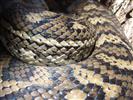
I checked at the Tenterfield info centre for you today and they have none, I drive between Warwick and T/field 3 times weekly so I will continue to look around. By the way if you were thinking of heading out this way to walk I can assure you there is water everywhere, also have seen 2 brown snakes,
P.S. I will check the Warwick servos this w/e
P.S. I will check the Warwick servos this w/e
- bordergate
- Nothofagus cunninghamii
- Posts: 3
- Joined: Mon 01 Jun, 2015 2:17 pm
- Region: Queensland
- Gender: Male
Re: Girraween National Park MAP required
![]() by nmarkroberts » Tue 01 Nov, 2016 10:23 am
by nmarkroberts » Tue 01 Nov, 2016 10:23 am
Here is my map http://www.organisedgrime.com.au/Girraween.pdf drawn for mountain bikers but probably all you need.
- nmarkroberts
- Nothofagus cunninghamii
- Posts: 2
- Joined: Tue 01 Nov, 2016 10:11 am
- ASSOCIATED ORGANISATIONS: Family Bushwalks in South East Queensland
- Region: Queensland
- Gender: Male
12 posts
• Page 1 of 1
Who is online
Users browsing this forum: No registered users and 15 guests