It was a party of 6 which ventured into the SW with an 8 day trip to the Eastern Arthurs.
It was another occasion when I took the van over on the ferry to give us wheels on the ground.
2 of us travelled over from SA - putting in a quick hike to Mt Stapylton in the Grampians along the way.
We also dropped in on Liffey Falls and Pine Lake when driving down to Hobart.
The locals in Hobart were still in a buzz due to several recent rescues out of the SW due to big rains and flooding.
Having picked up the other 4 walkers, we had hoped for an early start next day, but it started with some running around trying to borrow a Trangia burner for one of the team who had accidentally ommitted it from his kit.
So we ended up starting at 11 am from the headend of the Huon Track. The day was overcast with some rain.
I had read about maintenance work on the track so I was a little surprised to find some logs across it. Still, it was a pretty good track for walking.
We stopped at 1:45 pm for lunch at Blakes Opening before finishing the day at Harrisons Creek at 5 pm - 15km covered.
Saturday was the best weather of the trip. The morning clouds sooned burned off leaving clear blue skies. Pity this was a day for covering distance.
I love how the dark waters of Tas can produce great reflections, and the track skirting the Huon had a few spots to highlight this.
- Reflections in the Huon River
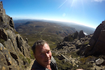
The views of the Western Arthurs from McKays Spur lifted our spirits, but Cracroft Crossing was a bit of an ordeal.
Firstly, it appears we missed the main track by following what appeared to be a clear track out along the bend in the river. At this point the track disappears in a vast area of cutting grass.
We eventually bashed our way around till we came to a log jumble with a very large log offering a good way to cross the river.
The 3 young ones tested their nerve by walking across this, while the 3 oldies [that includes me] went on a bit further and having picked up the main track again, waded across.
It was quite hot by this stage - so some of the guys went for a swim and it was our lunch break.
- Crossing the Cracroft - carefully..
Then came the second problem. The track through the riverside scrub to the campsite was difficult to pick up.
According to some who had been here before, it appears that it must have been burnt out at some stage and the regrowth has been prolific so that not much indication of the old track is left.
We did eventually get to the campsite - and again, the comment was that it was smaller than before due to the strong regrowth.
So it was a relief to find the track then breaks out onto the buttongrass plains.
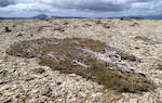
This section is duckboard - apparently due to a die back disease that infected the area.
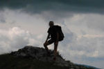
- Starting up the Razorback looking back to Cracroft Crossing
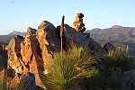
The day was still hot and the rest of the walk was without shade - over the plains and bare hillsides. But the view of the Eastern and Western Arthurs including Federation from the Razorback were great.
- Federation Peak beckons
- Luckmans Lead