Mt Anne Map

Trip reports, stories, track notes. Multiple/large photos are OK in this forum.
Forum rules
Posting large/multiple images in this forum is OK. Please start topic titles with the name of the location or track.

For topics focussed on photos rather than the trip, please consider posting in the 'Gallery' forum instead.

This forum is for posting information about trips you have done, not for requesting information about a track or area.

Mt Anne Map

Postby Rachanabanana » Fri 16 Dec, 2016 8:58 am

Hello :)

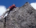
I am planning to do the Mt Anne Circuit.

I will be using a paper Topo map - could someone advise the best map?

Would it be 1: 25000 Bowes AND Anne.?

Also the final leg of the Circuit, following the Mount Anne Track south of Mount Sarah Jane, and around the southern end of Lake Judd - it appears the track heads SW towards the Scotts Peak Road...many kms south of the carpark and start of the track - is this correct? Is this why people stash bikes? Any way around this?

Any advice is greatly appreciated!

Rachel
Rachanabanana
Nothofagus cunninghamii
 
Posts: 2
Joined: Fri 16 Dec, 2016 8:51 am
Region: New South Wales
Gender: Female

Re: Mt Anne Map

Postby pazzar » Fri 16 Dec, 2016 9:14 am

You wont need the Bowes map, but the last section will be on the Scotts 1:25000. Alternatively there is one 1:50000 map available for the area (Lake Pedder I think is it's name).

There is about an 8km road bash back to the start of the track. People sometimes stash a bike there, or if you have access to a second vehicle, groups can do a car shuffle to save the walk. The walk adds about 1.5 hours to the end of the trip.
"It's not what you look at that matters, it's what you see."
User avatar
pazzar
Lagarostrobos franklinii
 
Posts: 2743
Joined: Thu 09 Jul, 2009 5:22 pm
Location: Hobart
Region: Tasmania
Gender: Male

Re: Mt Anne Map

Postby Rachanabanana » Fri 16 Dec, 2016 9:41 am

THANK YOU!!!
Rachanabanana
Nothofagus cunninghamii
 
Posts: 2
Joined: Fri 16 Dec, 2016 8:51 am
Region: New South Wales
Gender: Female

Re: Mt Anne Map

Postby tastrax » Fri 16 Dec, 2016 10:25 am

You can also check out which maps are required using the LIST map system and adding the map index layers

http://maps.thelist.tas.gov.au/listmap/ ... kId=170334
Cheers - Phil

OSM Mapper
User avatar
tastrax
Lagarostrobos franklinii
 
Posts: 2048
Joined: Fri 28 Mar, 2008 6:25 pm
Location: What3words - epic.constable.downplayed
ASSOCIATED ORGANISATIONS: RETIRED! - Parks and Wildlife Service
Region: Tasmania

Re: Mt Anne Map

Postby Scottyk » Fri 23 Dec, 2016 6:51 am

When I did it I survived without the Scotts map. It really isn't possible to get lost in the last few km's once past the Lake Judd turn off
User avatar
Scottyk
Phyllocladus aspleniifolius
 
Posts: 825
Joined: Tue 16 Apr, 2013 9:00 am
ASSOCIATED ORGANISATIONS: www.tasgear.com.au
Region: Tasmania
Gender: Male

Re: Mt Anne Map

Postby north-north-west » Fri 23 Dec, 2016 8:08 pm

Scottyk wrote:When I did it I survived without the Scotts map. It really isn't possible to get lost in the last few km's once past the Lake Judd turn off

Unless you sink too far into a bog . . .
"Mit der Dummheit kämpfen Götter selbst vergebens."
User avatar
north-north-west
Lagarostrobos franklinii
 
Posts: 15114
Joined: Thu 14 May, 2009 7:36 pm
Location: The Asylum
ASSOCIATED ORGANISATIONS: Social Misfits Anonymous
Region: Tasmania


Return to TAS Trip Reports & Track Notes

Who is online

Users browsing this forum: No registered users and 1 guest

cron