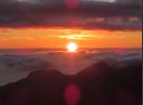
On Sunday October 8, 2017, a friend and I set off from Hobart to tackle Snowy North. Earlier in the year, we’d climbed Snowy South and Nevada Peak, both times in piercingly blue skies without a cloud to be seen. Now, we were expecting a damp walk, with light rain forecast for our attempt at the Snowy Range Abel Trifecta as I coined it. Fortunately for us, cloudy, but dry conditions awaited us. We drove through Maydena, marvelling at the surrounding peaks. Tyenna Peak, Mt Mueller, The Needles, and us we made our way up Styx Road, The Thumbs and Florentine Peak also made an appearance. Our destination meanwhile, was also visible through the trees. With the weather on our side, we now hoped the authorities were on our side too. Alas, at South Styx Road, we came across a locked gate. This was despite an email from Forestry Tas sorry, umm, Sustainable Timber Tasmania, saying they expected them to be clear. However, the area is apparently under Parks and Wildlife management.
Not to be deterred, we dug out the laminated 1:50000 Snowy Range topo map, and found a possible route in to Ted Ransleys Road. It was longer, but we were determined to climb this peak. We lucked out – the gate at the eastern end of Waterfall Creek Road was open, and looked like it had been open for a very long time. On we went, until we were once again stopped, this time by a fallen tree. No dramas there – out came the axe, and 5 minutes later, we were on our way again. One more fallen tree later, as well as an extremely low hanging one, we had made it to the end of Ted Ransleys Road, where a large “Road Ends” sign greeted us. With all the delays, it had taken over 2 hours to get there, and it was now 10am. According to forum posts online and the Abels book, we were supposed to have driven through a logging coupe. No sign of it; I guess it must have regenerated. It did mean though, that following those forum directions wouldn’t be possible.
No rain yet, as we set off. The 1:50000 map shows the track meeting Ted Ransleys Rd a couple of hundred metres past the “Road Ends” sign. So that’s where we went, and we stumbled across a small rock cairn with an orange marker on top of it. And into the bush we went, searching in vain for more arrows and tape. No luck though, so we just headed in a southerly direction up the hill, hoping to reunite with the track further up. It was at this point that I opened up an app on my phone: Australia Topo Maps. I decided to turn location on and get the app to track our route. A few minutes later, we reunited with the track, and were ecstatic! Now we could properly enjoy the walk up. The forest was wonderful. Small creeks trickled over green moss. Birds sung out. It really was a lush forest.
1 hour into the walk, we made a crucial error, not realising we’d done so. At this particular point, two sets of tape head off in differing directions. One up the hill, one back down. Naturally, we continued our upwards trajectory, forgetting to compare our elevation with where the track lies on the map. I would say that this was because we were totally unaware this was the place where we’d start contouring instead of continuing up. Anyway, we forged on, and the tapes became increasingly sparse. Nonetheless, I was enjoying myself. The pandani was abundant and tall, and it was a fun challenge trying to locate the next marker. Many of them lay on the forest floor, hidden underneath the forest litter.
I would say it was an hour later that the tape markers ended, and we became rather concerned. The GPS had us on a trajectory towards Pluto Bluff; nowhere near where the track was supposed to go. We couldn’t catch a glimpse of anything really, except for a cliff face above us. We had a crucial decision to make – and what we did baffles me. Instead of comparing our route on the phone app to the map, we chose to keep going up, in the hope we’d reach the cliffs that protect Pluto Bluff. Our belief was that we could then follow the ridge across to Snowy North from there, and with any luck locate the actual route for the descent. So we pushed on, into ever thickening scrub. Now, my level of bushwalking experience is nowhere near the likes of some on this forum. I’ve only climbed 24 Abels as of today (hoping to do a couple more over the next few days with this good weather forecast), have gained 60-70 peak bagging points I think, and have walked Tassie’s more popular multiday walks (Overland, SCT, Frenchmans, etc). So I’d never experienced real thick scrub before. And this just became overwhelming. We stuck at it for a while following the path of least resistance (that being waist deep scrub compared to head high) as the clouds burnt off, revealing a warm sun. The views were surprisingly good from our position: Mt Anne, Mueller, Wedge, Clear Hill, The Thumbs, Wright, Florentine, Tyenna, The Needles to name a few. But as we came across an impenetrable wall of scrub and pandani well over two metres high, we realised this plan of ours was not going to succeed. We’d travelled something like 100 metres in 30-40 minutes. That may be a slight exaggeration but regardless, it was a slow pace. After some lunch, and with extremely heavy hearts, we turned back.
It was at this point that I was thankful for my Australia Topo Maps app. The GPS navigational skills on it aren’t perfect, but it certainly helped on the descent through the scrub, which was far quicker than ascending (probably because all the scrub leaned northwards). Passing a few features we recognised amongst the scrub on the way up, we were eternally grateful to reach the forest. After adjusting our route, we finally, FINALLY, met up with the ‘track’. We descended with care, and then came to a junction. This junction just happened to be where we’d made our crucial mistake earlier. It was at this point we noticed two small arrows carved into a tree, pointing in the directions of the tape. How hadn’t we spotted this? After reminiscing on what could’ve been, we sadly pushed on, popping back out on Ted Ransleys after around 6 and a half hours.
What I learnt. It’s a common adage, but know when to turn back and when you’ve reached your limit. It’s a lesson that’s taking some time for me to learn, after a failed attempt at Mt Picton in winter; it really is a psychological battle. I’ve also acknowledged the fact that it’s probably time for me to invest in a proper GPS, if I’m to be doing more off-track walking in the future. With the knowledge of the actual route in my head, I can now feel confident on the inevitable return trip. Who knows when that will be, but I am determined to complete the ‘Snowy Range Abel Trifecta’.
For those that are interested, I made a YouTube video of our adventure. Here it is: https://www.youtube.com/watch?v=bIxsjePJw2E
Failure on Snowy North
Forum rules
Posting large/multiple images in this forum is OK. Please start topic titles with the name of the location or track.
For topics focussed on photos rather than the trip, please consider posting in the 'Gallery' forum instead.
This forum is for posting information about trips you have done, not for requesting information about a track or area.
9 posts
• Page 1 of 1
Failure on Snowy North
![]() by L_Cham_67 » Sat 14 Oct, 2017 2:14 pm
by L_Cham_67 » Sat 14 Oct, 2017 2:14 pm
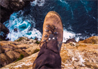
- Attachments
-
- An easier patch of scrub - fantastic views though!
-
L_Cham_67 - Athrotaxis selaginoides

- Posts: 1045
- Joined: Thu 17 Dec, 2015 6:43 pm
- Region: Tasmania
- Gender: Male
Re: Failure on Snowy North
![]() by north-north-west » Sat 14 Oct, 2017 5:00 pm
by north-north-west » Sat 14 Oct, 2017 5:00 pm
Sounds like fun. I've already knocked off the Snowy trifecta, but it would be interesting to redo Snowy North from that end.
"Mit der Dummheit kämpfen Götter selbst vergebens."
-

north-north-west - Lagarostrobos franklinii

- Posts: 15114
- Joined: Thu 14 May, 2009 7:36 pm
- Location: The Asylum
- ASSOCIATED ORGANISATIONS: Social Misfits Anonymous
- Region: Tasmania
Re: Failure on Snowy North
![]() by L_Cham_67 » Sat 14 Oct, 2017 5:56 pm
by L_Cham_67 » Sat 14 Oct, 2017 5:56 pm
Despite not making it, I did thoroughly enjoy the walk up - it's lovely forest.
-
L_Cham_67 - Athrotaxis selaginoides
- Posts: 1045
- Joined: Thu 17 Dec, 2015 6:43 pm
- Region: Tasmania
- Gender: Male
Re: Failure on Snowy North
![]() by GPSGuided » Sun 15 Oct, 2017 6:46 am
by GPSGuided » Sun 15 Oct, 2017 6:46 am
Lovely adventure! Question, what did you mean by ‘followed the wrong tape’ in the video? Was there another set of tapes?
Just move it!
-

GPSGuided - Lagarostrobos franklinii
- Posts: 6968
- Joined: Mon 13 May, 2013 2:37 pm
- Location: Sydney
- Region: New South Wales
Re: Failure on Snowy North
![]() by L_Cham_67 » Sun 15 Oct, 2017 7:14 am
by L_Cham_67 » Sun 15 Oct, 2017 7:14 am
When we were coming back down, we noticed there were two different choices of direction. One of them was the route we had followed on the way up, the other we missed.
In the video, that piece of text is referring to the place where we found an arrow on a tree. I can't remember the elevation unfortunately, but I can only assume that was the actual route up, because out of all the info I have read on Snowy North, I didn't see anything about ending up beneath Pluto Bluff. The closest info I read about this was on naturelover's blog, quote:
"...which we climbed, not abruptly, to a point where we actually descended for a tiny bit, in order to traverse for over a kilometre."
I assume this was where we went off the usual route, as we never made that traverse through the forest, let alone the small descent it was just a constant uphill climb from the outset.
Hopefully that answers the question!
In the video, that piece of text is referring to the place where we found an arrow on a tree. I can't remember the elevation unfortunately, but I can only assume that was the actual route up, because out of all the info I have read on Snowy North, I didn't see anything about ending up beneath Pluto Bluff. The closest info I read about this was on naturelover's blog, quote:
"...which we climbed, not abruptly, to a point where we actually descended for a tiny bit, in order to traverse for over a kilometre."
I assume this was where we went off the usual route, as we never made that traverse through the forest, let alone the small descent
Hopefully that answers the question!
-
L_Cham_67 - Athrotaxis selaginoides
- Posts: 1045
- Joined: Thu 17 Dec, 2015 6:43 pm
- Region: Tasmania
- Gender: Male
Re: Failure on Snowy North
![]() by stepbystep » Sun 15 Oct, 2017 11:16 am
by stepbystep » Sun 15 Oct, 2017 11:16 am
From memory there was an old track up towards Pluto Bluff. The actual track hits the ridge further along. gawd it's ages since I went up there....great views.
The idea of wilderness needs no defense, it only needs defenders ~ Edward Abbey
-
stepbystep - Lagarostrobos franklinii
- Posts: 7707
- Joined: Tue 19 May, 2009 10:19 am
- Location: Street urchin
- Region: Tasmania
- Gender: Male
Re: Failure on Snowy North
![]() by L_Cham_67 » Sat 11 Nov, 2017 9:04 pm
by L_Cham_67 » Sat 11 Nov, 2017 9:04 pm
Went back to Snowy North today, and I can report success! Summiting my 29th Abel took us a long time though - trying to navigate through the forest where tape is sparse, followed by the pandani and scrub where the track is extremely steep and overgrown. We spent 10 hours out on the trail (including stops).
-
L_Cham_67 - Athrotaxis selaginoides
- Posts: 1045
- Joined: Thu 17 Dec, 2015 6:43 pm
- Region: Tasmania
- Gender: Male
Re: Failure on Snowy North
![]() by Tortoise » Sat 11 Nov, 2017 9:25 pm
by Tortoise » Sat 11 Nov, 2017 9:25 pm
Yay! There always seems to be that extra bit of satisfaction when I finally get to a peak I had to have more than one shot at. (Pokana will be a great celebration if I get there one day!)
Looking forward to doing some more of those southern Abels myself soon.
Looking forward to doing some more of those southern Abels myself soon.
-

Tortoise - Lagarostrobos franklinii
- Posts: 5157
- Joined: Sat 28 Jan, 2012 9:31 pm
- Location: NW Tasmania
- Region: Tasmania
- Gender: Female
Re: Failure on Snowy North
![]() by L_Cham_67 » Sun 26 Nov, 2017 11:40 am
by L_Cham_67 » Sun 26 Nov, 2017 11:40 am
I made another video; this time of the successful trip for those that are interested: https://www.youtube.com/watch?v=ojp6gy32xV0
-
L_Cham_67 - Athrotaxis selaginoides
- Posts: 1045
- Joined: Thu 17 Dec, 2015 6:43 pm
- Region: Tasmania
- Gender: Male
9 posts
• Page 1 of 1
Return to TAS Trip Reports & Track Notes
Who is online
Users browsing this forum: No registered users and 1 guest