Wednesday November 1, 2017: 11:20AM
I was driving up Mountain Road, just outside of Lilydale. My plan was to head up to Mt Arthur, Tasmania’s most northerly Abel. I left Hobart just after 8am, with a plan to spend a couple of days in Northeast Tassie. The day before I had had an exam for uni, and with a two-week break between exams, I felt that I could afford a few days off from study. The higher up Mountain Road I went, the more concerned I became. The road wasn’t rough, rather I was concerned about A) whether I would easily locate the track, and B) whether it would actually be open or not as it apparently crosses private property. I needn’t have worried. The track and carpark were found with ease. For those who haven’t been, the track starts right up near the end of the road where there is a small turning circle. A painted sign saying “walking track” is propped up on the right-hand side of the road along with about 10 pieces of orange tape on surrounding trees. The carpark is a few minutes’ walk down the road.
- Parking Area
- Start of the track
11:45AM
I set off, with camera and mini-tripod in hand. I was immediately greeted to a much greener, lusher forest than anticipated. I was predicting a nice walk up through a dry eucalypt forest, but I was pleasantly surprised. Ferns, mossy logs and trees, and a dense forest created a wonderful walking experience. It wasn’t overly steep or difficult, and the track was in extremely good nick. No mud to speak of, and wide enough to not have to pay close attention to where you placed your feet. It was magnificent walking, and only emphasised the importance of the ‘journey’ of bushwalking, rather than just the destination.
12:30PM
One thing that had been missing from the walk so far was wildlife. So far, I’d only been kept company by the sounds of birdlife, and nothing changed as I skirted past a small boulder field. The forest was changing, but it was still beautiful. One of the beauties of solo walking is that feeling of being part of, and within nature at its best. Mt Arthur is hardly wilderness, but the scarcity of views on the climb up made it difficult to realise that.
12:40PM
Just under an hour after leaving, I arrived at a track junction. 20 metres down the right-hand track was a small, uninviting shelter which housed a variety of information about Mt Arthur. There was also a car right next by, so it looked like I wasn’t going to be alone on the summit. I pushed on, along a track that was becoming rockier the further I travelled. And the views began to open up. The view back down to Lilydale and the surrounding paddocks was particularly good. There was no sun, but it was still a warm day, and my walking pace (which ended up being much quicker than the Abels book estimated time) + the heat resulted myself becoming drenched in sweat (there are a couple of clips in the video where you can tell).
- Small shelter
1:00PM
Livingstone Cabin came into view around about this time, as did the first piece of infrastructure. This was where the people from the car had gone; I assume they were doing some maintenance or monitoring, or something along those lines. Livingstone Cabin looked ancient, it was covered in rust, yet still had a certain charm about it. The views across to the north, east, and west were outstanding though. From here, the track snakes its way through scrub, passing small outcrops and along a short stretch of boardwalk. As many of you undoubtedly know already, this is where you turn off the track to head over to the large beehive cairn which I had been able to see for a considerable period of time. It was a little wet underfoot here, and within minutes of leaving the boardwalk and after a short scramble up boulders, I was standing beside the large cairn.
- Infrastructure
- Livingstone Cabin
- Summit area
1:25PM
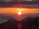
I had arrived at the summit of Mt Arthur, after 1hr, 40 minutes of walking. The Abels book allows 2hr 30 mins for the walk up, so I was pleasantly surprised at my pace, as I had hopes of climbing Mt Barrow later in the day. I was stupid enough to try and climb on top of the beehive cairn (which I noticed had a small plaque in it saying ‘1188m’). I inadvertently kicked out a couple of rocks on the cairn…Shhhh! (don’t worry, I put them back in). The views were first class: Mt Barrow loomed to the south, with the tops of Ben Lomond poking up behind. Launceston lay sprawled out beside the River Tamar, which you could see winding its way up to meet Bass Strait. Many of the peaks in the Great Western Tiers were also visible: Quamby Bluff, Drys Bluff, to name a couple. Mt Roland was also a distant sight. The views north-eastward were extensive: but scenic was probably not the most accurate term to use. Large swathes of forest in the Bessells Ridge area had been cut down, and left bare. There were plenty of Abels visible to the east and southeast however: Maurice, Saddleback, Victoria, Albert, Ben Nevis and I think Tower Hill were all visible. I somehow got down off that cairn, picked out a flat rock, and sat down to have some lunch. The sun decided to make an appearance, as did a wedge tailed eagle. It hung around for a few minutes, but never really came that close, so I wasn’t able to truly appreciate the marvellous winged creature.
2:05PM
It was time to head back down. It didn’t feel like I was walking all that quickly, but somehow I was back down at the car by 3:30pm, and driving back down to Lilydale Road ten minutes later.
Mt Arthur was a walk which far exceeded my expectations. The views from the summit were outstanding, but what I’ll remember most about this trip was the climb up. Sure, there are plenty of peaks with nicer forest than Mt Arthur, but when you allow for location, my low expectations of the climb to begin with (which I was very wrong about!), and quality of track, then you have yourself a great little walk within touching distance of Launceston.
Here’s a video I made of the Mt Arthur trip for those interested: https://www.youtube.com/watch?v=WXSi_E5pq0s