I finally got around to doing this circuit last weekend after having it on the radar for ages. It was a really nice walk, more scenic than I'd imagined, but quite tough over two days in warm weather.
We drove up on Friday night and started walking from Breakfast Creek about 8am on Saturday. It was a pretty big day. The climbing starts straight away and doesn't let up until the summit of The Crinoline, around 850m vertical gain over 6km. The track was excellent until the turn-off to The Crinoline, and still good up to the Crinoline itself. We continued up to Long Hill Creek (not much track to the creek from the campsites, follow the top of the cliffs), where we enjoyed lunch in the shade, practically sitting in the creek. The creek was flowing quite well but it doesn't look to have much of a catchment area so I don't think it would be reliable far into the summer. We filled up here with water for the rest of the walk, so our packs were suddenly a lot heavier for the hottest part of the day!
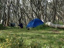
As we got up to the top of the Long Hill ridge the track became much less obvious and we found ourselves wandering along on the north side of the ridge when we probably should have stayed right on top. We got back on top soon enough (to where there were some cairns) but the track seemed non-existent and before long we were scrub bashing. We repeatedly criss-crossed right over where the track should have been (according to both the SV map and the open source GPS map) but there wasn't any sign of it. Navigation was fairly easy but it wasn't much fun negotiating scrub in the heat with 6 litres of water in my pack. Around the 1293 summit the track became more clear, and soon after that it became really really clear - someone has gone to a lot of effort to line the track with logs and branches, as well as plenty of cairns. Very nice walking for the next bit with great views to the north (looks like some good off-track walking could be done in that area). The rock shelter was lovely and we considered camping there but wanted to knock off a few more kms so continued further. My friend's back was giving her trouble so we ended up stopping at the end of the 4WD track. A pretty ordinary campsite but just enough room for our tent, and we were pretty knackered.
We were walking on the 4WD track by 7am Sunday. After half an hour or so of climbing we started passing lots of good campsites (although all 4WD accessible). We stopped for brekky after an hour, just a bit before the weather station. We left the road at the weather station and headed south to the summit of Tamboritha. Beautiful country, lots of lovely campsites if you have water. I knew from another trip report that we might find a waterhole around here, but we were surprised to find three healthy, full waterholes in the next section of the walk. One at the saddle between Tamboritha and Little Tamboritha, another at 718 512 and another at 710 585. They looked pretty good but I imagine you'd want to treat the water.
From Tamboritha down the track wasn't always present or obvious but the navigating was fairly easy. There were a few bits that got a bit scrubby but nothing too horrible. It was a pretty long, hot and steep descent though. For the very last section somebody has done a very enthusiastic (slightly over the top perhaps?) job with the pink tape - even tying it around rocks like they were Xmas presents!
We'd finished walking by just after 1pm. I accidentally stopped the GPS for the first hour on Sunday so my stats aren't quite accurate, but I'd say it was about 29km to 30km, with about 1800m elevation gain. There were heaps of wildflowers out in the lower to middle altitudes of the walks, and water available, so I reckon that early to mid-November is a great time to do this walk if you can avoid a hot weekend. A good workout over 2 days (glad I didn't take any newbies) and could be a lovely, fairly easy walk over 3 days (first night at Long Hill near the creek, second night by one of the waterholes, short last day).
Crinoline - Tamboritha circuit
Forum rules
Posting large/multiple images in this forum is OK. Please start topic titles with the name of the location or track.
For topics focussed on photos rather than the trip, please consider posting in the 'Gallery' forum instead.
This forum is for posting information about trips you have done, not for requesting information about a track or area.
2 posts
• Page 1 of 1
Crinoline - Tamboritha circuit
![]() by Drew » Tue 22 Nov, 2016 10:34 am
by Drew » Tue 22 Nov, 2016 10:34 am
- Drew
- Phyllocladus aspleniifolius

- Posts: 777
- Joined: Fri 13 Jan, 2012 11:16 am
- Region: Victoria
- Gender: Male
Re: Crinoline - Tamboritha circuit
![]() by GregR » Wed 23 Nov, 2016 12:07 pm
by GregR » Wed 23 Nov, 2016 12:07 pm
Thanks Drew.
Great report.
hope to do this area after the heat dies down next year.
Cheers,
Greg
Great report.
hope to do this area after the heat dies down next year.
Cheers,
Greg
-
GregR - Phyllocladus aspleniifolius
- Posts: 873
- Joined: Mon 07 Jan, 2013 11:24 am
- Region: Victoria
- Gender: Male
2 posts
• Page 1 of 1
Return to VIC Trip Reports & Track Notes
Who is online
Users browsing this forum: No registered users and 1 guest