Wet
Day 1
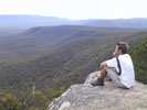
My walking partner and I were excited about this walk and for good reason, snow was in the forecast!
An early start out of Melbourne saw us parking the car in the Alpine National Park and waking by 12 noon in the rain and constant drizzle.

We followed the Nobs 4wd track which ascended very quickly up towards the marked junction with the Australian Alps walking track.

Then at about 1200ish meters the rain turned magically to snow! This was a personal highlight for me as it marks the first time I have seen snow falling on mainland Australia.

There was no clear junction for the AAWT so where it seemed like a good place we turned off the track for a walk in the fresh snow towards The Nobs. The weather was really moving in quickly and the ceiling of clouds seems to descend in minutes to limit visibility drastically. We descended from The Nobs and found a beautiful camp site in the saddle between The Nobs and High Cone.

As night began to fall Hughie decided to let loose and give us a great snow show. Somewhere in the excitement of it all I left my over pants where I had removed them. A quick jaunt found them almost as I left them.

Day 2
We awoke to most of the snow already melted as our camp was at 1300 meters. We were looking forward to seeing how much had stuck in the higher country.
We followed the AAWT that appeared and disappeared in various parts. It passed through some great saddles and gaps and before ascending to the next height.

With the temp hovering around 2*C it was wet and chilly to say the least and the wind was gusting upwards of 45kmph.
We passed up and over Square Top and then up to Mt Clear.
Unfortunately it didn’t live up to its name. But the snow was awesome! I didn’t think I would ever have to kick step here. I’m very pleased to say that I was incorrect.


We crossed Mt Clear in the gusty wind and sleet. We descended quickly to get out of the wind but the rain continued.
Meeting up with an old 4wd track we turned back on our direction to start the loop. After a little ways of walking we came onto another stunning campsite where we called it a day and hunkered down to a warm soup.

Day 3
It was a pretty easy day with the only distance on the 4wd track and Hughie as our obstacles. The snowy ascents and slippery descents were done.

The low ceiling of cloud provided some eerie walking through the remanets of the bushfires.
The overgrown track made sure to re-soak us with all the moisture caught on the leaves.


After a final creek crossing we met back with The Nobs Track and an easy jaunt back to the car.

It was great to see such another beautiful area of Australia and I look forward to getting back to the same area again in the future!