This was my first overnight walk, had done quite a few long day walks but nothing overnight carrying my own stuff. Started off from Pierce's Pass at around midday after getting some lunch in Blackheath on Saturday, my pack was heavy (16kg) as I'm doing a walk in May where I'll be carrying for two. (serious case of DOMS on Sunday while sitting in the car driving home). I used the wildwalks track notes which were great, I also tracked our progress with my GPS watch (Garmin forerunner 920XT), seemed to be quite a variance in the distance between my watch GPS and what Wildwalks had stated ~7.6km to Acacia Flat, my watch reckoned 9.4km. Saturday was a fantastic day for a walk, sunny and clear but not too hot. The knees whinged as we got towards the bottom of pierces pass, then it was shoes off for the wade across, dry feet and continue on.


Along the track to Acacia flat there were many small lizards like the one in the photo below (he or she was the biggest I came across), the track was pretty clear and easy to navigate. The Grose River had a nice low roar to it from the recent heavy rains I assume, was quite enjoyable walking along. Got to Blue Gum Forest which was rather spectacular and then the mozzies arrived, so many mozzies. We stopped once or twice for some photos but decided to keep walking as they seemed to have more trouble getting to you while walking, or at least, it felt that way. After Blue Gum it was a short walk to Acacia Flat where we pitched the tents at the first clear spot, which happened to be near Govetts Creek (10m behind the Orange tent in photo) and quite far from the loo and other campers. Acacia Flat was quite busy with multiple groups camping the night.


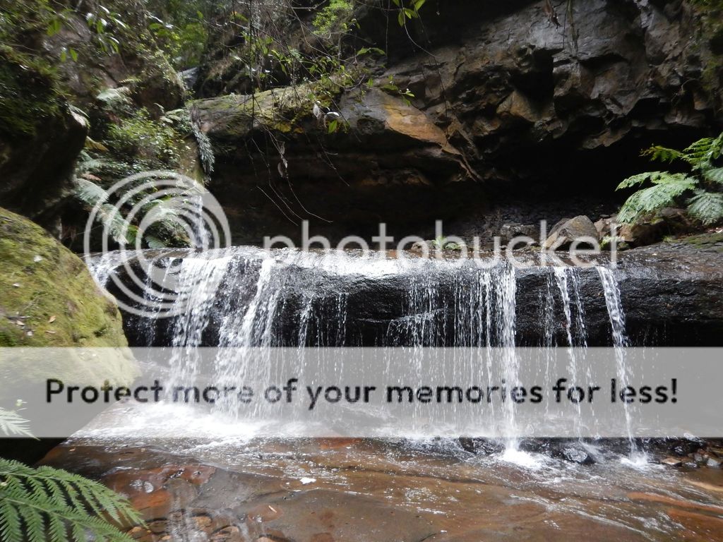
The next morning we were off after some brief rain through the night, just to ensure we were packing everything up while it was wet...at least it wasn't raining while we were packing I guess. From Acacia Flat to junction rock the track was pretty clear, made a wrong turn just past junction rock and ended up where people had been using the 'toilet', smelt it first...right near the creek too :/ ...turned back quickly and went the right way. Up up it went, the last section of walk was nice creeks, stunning waterfalls, and trees all over the track, some quite large as seen below in the photos. As we reached the falls, we briefly stopped for some photos and then kept on heading up, trying to avoid the daywalkers coming down the stairs from Govetts lookout. Up some steep and soggy stairs we were at the top (almost), more chocolate, then we followed the road back the Heritage Centre at Blackheath.


If you're into fungi, there were quite a few on display along Govetts Brook (I think - the trail following the creek up to the waterfall). Some bad photos are included below:


Other than the mozzies, there were some leeches, but we only managed to attract three, and none in our group got one that latched on. All up it was a great walk and a pretty good one to do for a first overnighter, if you can organise some people with a car for the shuffle required at the end.
In total, according to my watch, we took 3hrs and 40 minutes the first day to cover 9.4km with 587m descent, and 4 hrs the second day to cover 9.4km with a total ascent of 764m.


