AAWT 2015 - Baw Baw to Mt Howitt

A forum for discussing the Australian Alps Walking Track. This is a 655 km long track from Walhalla (Vic) to Tharwa (ACT)

AAWT 2015 - Baw Baw to Mt Howitt

Postby GBW » Thu 27 Aug, 2015 11:14 pm

Pardon my terrible writing skills but here goes:

My partner and I completed the Baw Baw to Howitt section in January 2015. Being relative newbies, it was a huge undertaking at the time considering our inexperience in multiday long distance walking and we knew we had a challenge ahead of us.

We had done a lot of bushwalking... several trips to the Grampians, Prom, etc but no real overnight stuff with packs so in 2014 we got our gear, packs tent etc and started getting some hours under our belt doing Feathertop circuit, Tali Karng via Wellington River twice, The Crinoline twice, a snow camp out the back of Donna Buang on the coldest Melbourne night of the year, Baw Baw Plateau and numerous other overnighters. It all helped sort out what we needed and what we didn't. Sure we made some mistakes along the way and probably still are, but our system works OK so I suppose that's what counts.

Then about November I had the idea to tackle a section of the track so we began our planning. I'd had a couple of Chapmans books for about a year and read them numerous times, got the relevent maps, sourced any resources I could off the internet including this site, looked at satellite images and studied the maps highlighting the route, water sources, camps etc so I thought we were pretty prepared, even though we had no idea what we were in for.

Because my partner was with me, most of the loose itinery was based around her capabilities. If I was doing it solo it would different. The plan was to cover the 160k over 16 days with 2 rest days along the way at our designated food/water drops. That's all the time we had off over the Christmas break and as much as seemed comfortably doable and I thought by then we might have had enough. I know that's a pretty slow pace but that allowed time to collect water, bad weather, catastrophe etc. and there was no rush, we could just enjoy it at our own pace and if we did it quicker it made no difference.

So 2 days before New Years we set off to place food/water drops...one at Fiddlers Green and one at Barkley Jeep Track/Jamieson-Licola rd. Only two days between the two but Walhalla rd to Jam/Licola rd via South rd was only 50 minutes so they were pretty easy to access and it reduced the carry weight for the last section..

IMG_7317.JPG
Preparing food drops


On New Years day my Dad drove us out to Baw Baw, we said our goodbyes, went through the routines of the Spot OK, not OK, Help messages once more and set off towards Howitt. This could be a long story if I keep this up. I'll write some more when I have time.

IMG_7591.JPG
Leaving Baw Baw


Day 1: Baw Baw Village to Whitelaw Hut Ruin(10k)

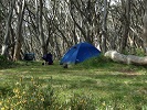
We got going about midday for the gentle stroll through the snowgums to Whitelaw Hut Site which we had walked to from Mt Erica prior to this trip, arriving mid afternoon, set up camp, collected some water from the nearby stream and got the maps out to go over the next day to Stronachs. This is as far as we'd been across the plateau so it was into the unknown from here on. All good so far...except for those damn march flies.

IMG_7657.JPG
Camp at Whitelaw Hut Ruin


https://www.facebook.com/media/set/?set ... 35bbb561de

Day 2: Whitelaw Hut Ruin to Stronachs Camp (12k)

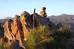
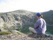
Another easy day...and mostly downhill to Stronachs camp. The forecast had warned of high temperatures today, I think it was 40C in Melbourne but nowhere near that on the plateau. For the first time I carried a small AM/FM radio which was very useful for weather/fire updates and the like. We got an early start to avoid the heat, passing the Upper Yarra Track turnoff and stopping at Rocky Knob for a short break to admire the views north.

IMG_7678.JPG
Rocky Knob


Most of the track was wide and easy to follow with only short sections overgrown, a few trees down here and there, but finding your way was never a problem...it was along this section we saw our first of many snakes. As we descended the snowgums disappeared and were replaced with the more familiar tall eucalypt forest and we arrived at camp about midday.

IMG_7714.JPG
Forest near Stronachs Camp


It had warmed up considerably so we were happy to sit out the heat, collecting water from stream 200m up Thomson Valley road. The signposted campsite for AAWT walkers is set back in the forest 200m or so from the road. It was here we met eljimberino on his solo AAWT trek to Canberra. His 100% cuban fibre setup made me think about how to lighten things up, not that we were overloaded, but there's always room from improvement. I'm pretty sure all campsites from Baw Baw along this section through to Blue Jacket are fuel stove only but there is plenty of evidence that not everyone is obeying the rules.

IMG_7748.JPG
Stronachs Camp


https://www.facebook.com/media/set/?set ... 160fefa3cd

Don't fall asleep yet...there's 14 more days to go.

Day 3: Stronachs Camp to Thomson River (14k)

Another warm humid day was on the cards so it was an early start again. eljimberino strolled into camp as we were having breakfast loaded up and ready to go. After a quick chat about our plans for the day he was off. The way out of Stronachs is different to what is marked on the map which indicates a route NE from the road then NW. I'd seen this on a GPS track sourced from the web (Karen Cody) so we headed north to a marker leading into the forest which cuts off a small section and eventually meets up with Upper Thomson Tk and the infamous Trig Point Tk. The route became a little less defined as we headed north which is more the way I expected most of the track to be until we reached Upper Thompson Tk. There are a couple of alternate routes through this section down to the river...Basalt Hill Tk being one, but I'm unsure there's much difference, they both look as bad as each other...so I chose to stick to the route in Chapmans book and follow Trig Pt Tk.

IMG_7770.JPG
Route to Upper Thomsom Tk


IMG_7805.JPG
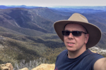
Me...as happy as a pig in mud!


After a bit of a road bash for several km, passing a trig marker and water tank we reached the steep downhill section to Thomson Jordan Divide Rd.

IMG_7818.JPG
Trig Pt Track...it's steep!

All was going well as we crept our way down; it was loose underfoot and I told Bridge to take her time and watch her footing then, just as I turned to check her progress...disaster struck...left foot slid forward, right leg buckled underneath her and down she went. "HOLY #@!$%&" was my my initial reaction...I was sure she'd done a knee by the way she fell. After several minutes I removed her pack, assessed her condition and after a bit of a stroll around she seemed OK, a bit sore but good to go on. I carried her pack and mine down the remainder of the steep section to the road...30kg down that track was sure a challenge but we eventually made it to the bottom.

Whew...that was a close call and could have ended this adventure on day 3! I strapped her knee up with a compression bandage for some support and off we went, passing Easton Dam to the turnoff over Thomson River to the camp.

The turnoff from the road into the forest is easily missed so keep an eye out for it on you left. The river was cold, perfect for that sore knee and after setting up I made sure she gave it a good soaking in the cool water to help reduce any swelling. What an eventful day and I knew this would make the next couple of days a bit more difficult for her (and me). Not the nicest camp in the world, but there was no complaining as we cooled off in the river.

IMG_7850.JPG
Thomson River crossing


A bit of cloud had moved in by late afternoon and the temperatures dropped much to our relief, so we ate, read the maps and got an early night in preparation for the first day of ups.

https://www.facebook.com/media/set/?set ... 8dc3b067b8
Last edited by GBW on Thu 03 Sep, 2015 10:33 am, edited 15 times in total.
"If you wish to make an apple pie from scratch, you must first invent the universe"
User avatar
GBW
Athrotaxis selaginoides
 
Posts: 1176
Joined: Fri 02 May, 2014 9:03 am
Location: Melbourne
Region: Victoria
Gender: Male

Re: Our experience on the AAWT 2015

Postby neilmny » Fri 28 Aug, 2015 9:04 am

Great stuff GBW, can't wait for the rest. Thanks for posting.
By the way there's nothing wrong with your writing skills either.
Very good to read.
User avatar
neilmny
Lagarostrobos franklinii
 
Posts: 2604
Joined: Fri 03 Aug, 2012 11:19 am
Region: Victoria
Gender: Male

Re: Our experience on the AAWT 2015

Postby GBW » Fri 28 Aug, 2015 12:20 pm

neilmny wrote:Great stuff GBW, can't wait for the rest. Thanks for posting.
By the way there's nothing wrong with your writing skills either.
Very good to read.


Thanks mate...
"If you wish to make an apple pie from scratch, you must first invent the universe"
User avatar
GBW
Athrotaxis selaginoides
 
Posts: 1176
Joined: Fri 02 May, 2014 9:03 am
Location: Melbourne
Region: Victoria
Gender: Male

Re: Our experience on the AAWT 2015

Postby GBW » Fri 28 Aug, 2015 2:53 pm

Day 4: Thomson River to Blue Jacket (13k)

IMG_7854.JPG
Thomson River Camp


A little bit of overnight rain didn't worry us. We'd tested the tent out in several downpours prior and were confident it would keep us dry. Bridgette was still very sore...I reached for the first aid kit and handed her a couple of supercharged prescription panadol...not quite enough to knock out a horse...but it sure would help. After a redistribution of gear to lighten her load I realized I must be up well above the 20kg mark...this was going to be a big day...over Mt Easton then down Casper Ck track to Blue Jacket. After strapping her knee and assuring me she was good to go, we set off in light drizzle up towards Easton.

Most of this section follows old forest tracks which is a bit of shame...I do like the off track sections more and some work on realignment in this area would be great to avoid the road bash.

IMG_8039.JPG
Somewhere along the way


IMG_7883.JPG
Little Easton


The track (if there was one) over Lt Easton was heavily overgrown as was the track up to Mt. Easton but nothing to get concerned about, with the occassional yellow ribbon indicating the way.

IMG_7897.JPG
"Track" up to Mt Easton


IMG_7905.JPG
Mt Easton


We were greeted by some nice views across to Mt Victor on the way.

IMG_7953.JPG
Views to the north from Casper Ck Tk


We just needed to get down Casper Creek tk and Blue Jacket was just around the corner. It was another steep one down so being the gentleman that I am, I again carried Bridges pack down the entire length of Casper Ck track.

IMG_7938.JPG
Casper Creek Track...another steep one.


I was relieved to reach the bottom near Violet Town Tk and get Bridge down in one piece. The fall had definitely affected her confidence on the steep descents. It's hard to believe this was once a old gold mining area 150 years ago...all that remains is some evidence of diggings. After a couple of k along Red Jacket Track we reached the Blue Jacket camp, set up, fetched some water from the Jordan River and relaxed. Lots of blackberry in this area but fortunately some sort of path to get the 200m down to the river.

IMG_7985.JPG
Jordan River


My collapsible S2S bucket came in very handy in these situations. Tomorrow we reach our first food drop so it will be like Christmas.

IMG_7990.JPG
Blue Jacket Camp


https://www.facebook.com/media/set/?set ... 2f03a869ee
Last edited by GBW on Tue 01 Sep, 2015 12:05 pm, edited 8 times in total.
"If you wish to make an apple pie from scratch, you must first invent the universe"
User avatar
GBW
Athrotaxis selaginoides
 
Posts: 1176
Joined: Fri 02 May, 2014 9:03 am
Location: Melbourne
Region: Victoria
Gender: Male

Re: Our experience on the AAWT 2015

Postby GregR » Fri 28 Aug, 2015 3:08 pm

Quite an adventure. Can't wait for the rest of it. I have been looking at doing a section of the AAWT and this is really interesting stuff.

Love the pics too.

GregR
User avatar
GregR
Phyllocladus aspleniifolius
 
Posts: 873
Joined: Mon 07 Jan, 2013 11:24 am
Region: Victoria
Gender: Male

Re: Our experience on the AAWT 2015

Postby GBW » Fri 28 Aug, 2015 4:55 pm

Day 5: Blue Jacket to Fiddlers Green (18km)

Temperatures were much nicer as we left Blue Jacket and headed up the road to Red Jacket, stopping at the old school site which has some remnants of days gone by, most notably an old boiler, then up to Red Jacket for a quick look around the old cemetery.

IMG_8006.JPG
Old boiler at Red Jacket (not the one in blue...that's my missus)


IMG_8026.JPG
Red Jacket Cemetery


The camp at Red Jacket is right on the river...nice spot but clearly marked as 'No Camping' area, probably due to it's close proximity to the river in the catchment area. Makes sense.

IMG_8030.JPG
Red Jacket


From here the route travels up the Victor Spur, eventually meeting up with Victor Spur Tk and onto Walhalla Rd.

IMG_8036.JPG
Start of Victor Spur Tk


This section was quite overgrown...just stick to the center of the spur and keep going up through the path of least resistance. Several false tracks lead to the left (as we discovered), ignore them and go straight up the middle. I really enjoyed this section after the road walking. Bridge kept asking me if we were on the track to which I explained there was no track and we just keep pushing up until we hit the road. I think that's when she realised what was going on and said with a smile..."Oh...I get it"...I think she's getting the hang of it.

IMG_8070.JPG
Is there a track? Um....no.


Two more snakes along this section...a large tiger and this bloke who wouldn't get out of the way.

IMG_8390.JPG
Copperhead


We finally reached the road, much to Bridges relief, and made our way along to Walhalla Rd. This section involves a road bash up to Mt Selma rd and on to Fiddlers Green, passing an old hut and a couple of historic survey markers.

IMG_8118.JPG
Old hut on Walhalla Road


No cars came by and we would have accepted a lift if offered. Damn. Upon arrival at Fiddlers I collected our food drop bucket which I'd stashed over the road about 100m in and we enjoyed some soft drink, twisties and other goodies.

IMG_8142.JPG
One happy camper


Stage one completed succesfully and we could just sit back and pig out for a day. There was phone reception there as well.

IMG_8135.JPG
Nice views from Fiddlers Green


https://www.facebook.com/media/set/?set ... 87d884d7ac
Last edited by GBW on Tue 01 Sep, 2015 12:33 pm, edited 9 times in total.
"If you wish to make an apple pie from scratch, you must first invent the universe"
User avatar
GBW
Athrotaxis selaginoides
 
Posts: 1176
Joined: Fri 02 May, 2014 9:03 am
Location: Melbourne
Region: Victoria
Gender: Male

Re: Our experience on the AAWT 2015

Postby GBW » Fri 28 Aug, 2015 5:45 pm

GregR wrote:Quite an adventure. Can't wait for the rest of it. I have been looking at doing a section of the AAWT and this is really interesting stuff.

Love the pics too.

GregR

Thanks Greg. I highly recommend it.
"If you wish to make an apple pie from scratch, you must first invent the universe"
User avatar
GBW
Athrotaxis selaginoides
 
Posts: 1176
Joined: Fri 02 May, 2014 9:03 am
Location: Melbourne
Region: Victoria
Gender: Male

Re: Our experience on the AAWT 2015

Postby GBW » Fri 28 Aug, 2015 9:23 pm

Day 6: Rest day at Fiddlers Green (4 km)

Well it was what it says...a rest day...we did take a stroll up to Sunflower Hill and down Fiddlers Green Track for a look and also gave me time to work on my hopelessly inadequate photography skills...I don't think there's much improvement...

IMG_8155.JPG
Sunrise at Fiddlers Green

IMG_8157.JPG
Tree stump

IMG_8172.JPG
Fiddlers Green Camp

IMG_8178.JPG
Trees and stuff

IMG_8187.JPG
Sunflower Hill

IMG_8189.JPG
A tree

IMG_8194.JPG
Clouds moving in at Fiddlers

IMG_8193.JPG
Me again


We're both refreshed and ready for the assault on the Black River track. Trust me...I'm trying to get this finished as quick as I can so I can stop annoying you chaps with my frivolous banter.
Last edited by GBW on Tue 01 Sep, 2015 11:55 am, edited 2 times in total.
"If you wish to make an apple pie from scratch, you must first invent the universe"
User avatar
GBW
Athrotaxis selaginoides
 
Posts: 1176
Joined: Fri 02 May, 2014 9:03 am
Location: Melbourne
Region: Victoria
Gender: Male

Re: Our experience on the AAWT 2015

Postby eggs » Fri 28 Aug, 2015 10:04 pm

Most enjoyable - keep it coming
User avatar
eggs
Lagarostrobos franklinii
 
Posts: 10463
Joined: Fri 23 May, 2008 2:58 pm
Location: Para Vista, South Australia
Region: South Australia

Re: Our experience on the AAWT 2015

Postby GBW » Fri 28 Aug, 2015 10:51 pm

Day 7: Fiddlers Green to Black River (16km)

A beautiful sunrise started what could turn out to be an eventful day.

IMG_8218.JPG
Sunrise


It was to be a day of decision making...do we take the Black River track, or do we chicken out and take the CS1. We'd chatted to two Parks blokes...up at Howitt and at Red Jacket asking their opinion on the condition of the track and both said it was overgrown and suggested the alternative route. Hmmmm...lets think about it while we walk...

IMG_8265.JPG
Vehicle track heading north from Mt Selma Rd


Several km of road bash later along Mt Selma rd, over Mt Singleton and up a track north we reached the turnoff point for Black River Tk, clearly marked with tape.

IMG_8267.JPG
Black River Tk turnoff


Decision time...after a quick glance at the maps, the flip of a coin and a 'How bad could it be?', we reached a decision ...let's do it. So off we went down into the valley.

IMG_8289.JPG
Track down to Black River


A nice big tiger snake on the track greeted us as we began what could turn into a 1/2 day bush bash along the river. The track down to the river was ok with some overgrown sections but generally easy to follow. It was the 2k along the river I was worried about. Upon reaching the river, it wasn't obvious where the track went from there, so while Bridge cooled off I crossed over and began looking for anything that resembled a track.

IMG_8294.JPG
Made it to the river


At one point I considered wading down the river but the amount of trees down and some rather deep pools soon put that idea to rest.

IMG_8301.JPG
Is it too deep to walk through?...Yep


All of a sudden, 50 meters down the river behind the grassy knoll...there it was...a track..I FOUND IT!

IMG_8298.JPG
We must be on the right track...


We were happy to say the least and while the track was overgrown in places and scrambled up and down the steep banks of the river, we'd seen worse in our travels and it took about an hour to make the 2k along the river to the camp.

IMG_8312.JPG
Track along the river


"See...that wasn't so bad" I boasted to Bridge. I think we were both happy to get out of that valley.

Black river conquered!

IMG_8320.JPG
We made it


The moral of the story...well there is no moral...it just sounds good when it ends like that.

IMG_8325.JPG
Camp at Black River


https://www.facebook.com/media/set/?set ... 29f59dd8f4
Last edited by GBW on Tue 01 Sep, 2015 12:08 pm, edited 2 times in total.
"If you wish to make an apple pie from scratch, you must first invent the universe"
User avatar
GBW
Athrotaxis selaginoides
 
Posts: 1176
Joined: Fri 02 May, 2014 9:03 am
Location: Melbourne
Region: Victoria
Gender: Male

Re: Our experience on the AAWT 2015

Postby Lizzy » Sat 29 Aug, 2015 6:52 am

Enjoying your adventures :D
User avatar
Lizzy
Athrotaxis selaginoides
 
Posts: 1074
Joined: Mon 16 Nov, 2009 1:13 pm
Region: New South Wales
Gender: Female

Re: Our experience on the AAWT 2015

Postby surly 17 » Sat 29 Aug, 2015 9:49 am

This is a great read GBW I love the camp pictures.
surly 17
Atherosperma moschatum
 
Posts: 66
Joined: Fri 20 Apr, 2012 8:31 pm
Region: Victoria
Gender: Male

Re: Our experience on the AAWT 2015

Postby idc1970 » Sat 29 Aug, 2015 10:02 pm

Very interesting, it's a great read!
idc1970
Nothofagus gunnii
Nothofagus gunnii
 
Posts: 32
Joined: Wed 12 Feb, 2014 6:13 pm
Region: New South Wales
Gender: Male

Re: Our experience on the AAWT 2015

Postby GBW » Mon 31 Aug, 2015 1:05 am

Day 8: Black River to Mt Skene (15km)

We woke to a dark sky and the forecast was for rain later in the day. Again, the small AM radio I had was very useful and had reception on several stations, but no phone reception in that valley. Our destination was the lookout near Jam-Licola rd hoping to see a nice sunset, but the way the skies were, it wasn't looking good...Black River certainly lives up to its name in these conditions.

IMG_8345.JPG
Black River log crossing (we chickened out)


IMG_8347.JPG
Someone got a new chainsaw for Christmas


The track out of BR heads west then loops around to the north, crossing the river and rising steeply towards Mt Shillinglaw. It was a good workout but I think we were both feeling stronger from the previous days of walking.

IMG_8362.JPG
The climb out of Black River


Once over Shillinglaw, the track descends gently north where it joins the McMillans Tk and continues on to meet Jam-Licola rd.

IMG_8393.JPG
Track heading north to Jam/Licola Rd


While I was happy to reach the road, I wasn't looking forward to walking the couple of km along it, and was glad to reach Middle Ridge rd and get off the gravel. I also left my walking sticks behind...Oh well, time to find a new set.

IMG_8431.JPG
Bridge looking chuffed


IMG_8444.JPG
Start of the off road section


The track leaves the road at this point passing through an awesome fern display along an overgrown track which at first was hard to locate in the scrub, eventually meeting up with a more defined vehicle track.

IMG_8458.JPG
Me looking doubly chuffed


This section was quite overgrown but again, nothing impenetrable. The sky was getting darker and we could hear thunder in the distance so we were keen to get to camp before the rain.

IMG_8473.JPG
"Track" up to Skene Lookout


It's an eerie place near Mt Skene against a dark sky, with the dead trees a reminder of devastating fires at some point.

IMG_8494.JPG
Final push to camp


One final push and we were at the camp, took our packs off and prepared to setup. An electrical storm was brewing, rain was falling and several nearby lightning flashes made me a little nervous…I didn’t want to be a guinea pig for testing the electrical conductivity of a 3m section of aircraft aluminium tubing. So after some discussion, we aborted on the location and backtracked down to a safer area.

IMG_8503.JPG
Lookout near Skene


By this time the rain was bucketing down (have I mentioned how much I hate setting up in the rain). Looks like we’re cooking in the vestibule tonight.
The electrical storm lasted about an hour and it rained on and off most of the night, not that we cared…we were sound asleep.

https://www.facebook.com/media/set/?set ... 63f3e2543c
Last edited by GBW on Sat 05 Sep, 2015 2:43 am, edited 7 times in total.
"If you wish to make an apple pie from scratch, you must first invent the universe"
User avatar
GBW
Athrotaxis selaginoides
 
Posts: 1176
Joined: Fri 02 May, 2014 9:03 am
Location: Melbourne
Region: Victoria
Gender: Male

Re: Our experience on the AAWT 2015

Postby wildlight » Mon 31 Aug, 2015 1:10 am

Roll on GBW, am really enjoying the commentary and photos. Thanks very much for posting pics and text. I was going to PM you and query- those white buckets you used for food stashing- where can I buy some?

Cheers

WildLight
wildlight
Athrotaxis cupressoides
 
Posts: 215
Joined: Tue 24 Mar, 2009 2:03 pm

Re: Our experience on the AAWT 2015

Postby GBW » Mon 31 Aug, 2015 1:18 am

wildlight wrote:Roll on GBW, am really enjoying the commentary and photos. Thanks very much for posting pics and text. I was going to PM you and query- those white buckets you used for food stashing- where can I buy some?

Cheers

WildLight


Cheers Wildlight...I'm actually enjoying this myself...probably the most I've written in this form since school. I'm pretty sure I got the buckets at Masters but cant remember what they cost...around the $15-20 mark I think. 20 Litre with a plastic clip strip around the lid that's a bugger to get open once sealed.
"If you wish to make an apple pie from scratch, you must first invent the universe"
User avatar
GBW
Athrotaxis selaginoides
 
Posts: 1176
Joined: Fri 02 May, 2014 9:03 am
Location: Melbourne
Region: Victoria
Gender: Male

Re: Our experience on the AAWT 2015

Postby GBW » Mon 31 Aug, 2015 5:48 pm

Day 9: Skene Lookout to Rumpff Saddle (5 km)

Yep…a whole five kilometers. Today was a short day to our second food drop at the camp above Rumpff Saddle. We probably could have pushed on through the rain yesterday but in the end it made little difference as I expected to cover the 5k to camp by early morning.

IMG_8514.JPG
Camp below lookout


Views from the lookout were nil, what a shame, so we powered past to rejoin Jam-Licola rd with the sounds of Willie Nelson in my head (you know the song…do…do…dododo) for the road bash up to Barkley Jeep Track.

IMG_8516.JPG
Heading towards Jam-Licola rd


IMG_8520.JPG
Rejoining Jam-Licola rd


As much as I hate gravel, it was still an interesting walk, reaching the camp at 10am.

IMG_8533.JPG
Gravel rd...


IMG_8525.JPG
On the road again...do do dododo


IMG_8538.JPG
Turn up here


It looked like the rain would continue on and off for the rest of the day so we set up camp, retrieved the food drop and settled in for the day.

IMG_8574.JPG
Camp above Rumpff Saddle


Occasional breaks in the cloud offered some nice views to the north as we enjoyed a hearty brunch of bacon, eggs and freshly baked herb damper to the soothing sounds of ABC Jazz radio.

IMG_8592.JPG
Occasional views to the north


This AAWT caper all seemed too damn easy, but we both knew the most challenging sections were still to come with several mountains to be conquered.

One positive with the weather was water along the route would be plentiful.

Unlike the first section where most of the camps were pretty well locked in rock solid, I only had a vague idea about where we would make camp at the end of each day so it was going to be a case of play it by ear from here on.

IMG_8589.JPG
Bridge...making sure we don't get lost


We restocked our packs and after a delicious dinner of Thai Curry Chicken and Mongolian Chicken Hotpot with Fluffy White Rice, followed by a Butterscotch Steamed Pudding with Crème Anglaise we were stuffed, so we retreated to our polyester palace to look over the maps and notes for the next section to Mt Sunday.

IMG_8594.JPG
Track down to Rumpff Saddle


Ah…the serenity.
Last edited by GBW on Wed 02 Sep, 2015 8:05 pm, edited 8 times in total.
"If you wish to make an apple pie from scratch, you must first invent the universe"
User avatar
GBW
Athrotaxis selaginoides
 
Posts: 1176
Joined: Fri 02 May, 2014 9:03 am
Location: Melbourne
Region: Victoria
Gender: Male

Re: Our experience on the AAWT 2015

Postby Travis22 » Mon 31 Aug, 2015 7:26 pm

GBW, really enjoying your report!

Your pics look so familiar, have you shared them here before?

Again thanks for sharing your experience on the AAWT and i look forward to the next update.

Travis.
User avatar
Travis22
Phyllocladus aspleniifolius
 
Posts: 704
Joined: Thu 15 Nov, 2012 7:11 pm
Region: Victoria
Gender: Male

Re: Our experience on the AAWT 2015

Postby scoha » Mon 31 Aug, 2015 7:49 pm

GBW wrote:
wildlight wrote:Roll on GBW, am really enjoying the commentary and photos. Thanks very much for posting pics and text. I was going to PM you and query- those white buckets you used for food stashing- where can I buy some?

Cheers

WildLight


If you prefer the metal variety - you can buy 20L brand new paint pails (obviously without any paint ever being in them!) from NCI Packaging - with the little lever operated seal you get on this size paint container. Ive just bought 4 for $50 so a bit pricier but I was worried about rodent attack on plastic - I might be over-worrying! We dont have capybaras in Australia.
scoha
Athrotaxis cupressoides
 
Posts: 111
Joined: Thu 30 Oct, 2014 5:59 pm
Region: Victoria
Gender: Male

Re: Our experience on the AAWT 2015

Postby GregR » Mon 31 Aug, 2015 8:07 pm

I don't want this to end, you are motivating me to get off the couch and just do it!
Wild light beat me to it on the sealable drums, another planning issue taken care of.

Keep up the good work.

Cheers
Greg
User avatar
GregR
Phyllocladus aspleniifolius
 
Posts: 873
Joined: Mon 07 Jan, 2013 11:24 am
Region: Victoria
Gender: Male

Re: Our experience on the AAWT 2015

Postby GBW » Tue 01 Sep, 2015 8:49 am

Thanks everyone who commented, I'm home today so will try and get some more done...it takes me a while to get it together. Travis I have posted links to the full set of pics somewhere and used numerous other pics here and there...nothing specific but if you hunt around I'm sure you'll find them.
"If you wish to make an apple pie from scratch, you must first invent the universe"
User avatar
GBW
Athrotaxis selaginoides
 
Posts: 1176
Joined: Fri 02 May, 2014 9:03 am
Location: Melbourne
Region: Victoria
Gender: Male

Re: Our experience on the AAWT 2015

Postby GBW » Tue 01 Sep, 2015 11:10 am

Day 10: Rumpff Saddle to Mt Sunday (17km)

It rained steadily throughout the night, and come morning we were both reluctant to get out of the comfort of the tent and into the rain.

IMG_8600.JPG
Barkly River Jeep Track


Donning our wet weather gear, we quickly packed up (have I mentioned how much I hate packing up in the rain) and proceeded down the relatively steep rocky track towards Rumpff Saddle.

IMG_8608.JPG
Rumpff Saddle

After a quick look around we continued up Middle Ridge Rd towards Mt McKinty.

IMG_8618.JPG
Middle Ridge Rd

Water was everywhere, and several large flooded sections on the track needed to be negotiated.

IMG_8689.JPG
Flooded track


IMG_8737.JPG
Steep rocky track


IMG_8731.JPG
Headless deer along the way


The fog gradually thickened as we passed Peters Gorge and The Gorge, both of which offered nothing to see; I’m sure the views would be stunning on a clear day.

IMG_8751.JPG
Near Peters Gorge


Walking along the ridgeline over Mt McKinty towards Mt Sunday in the fog was a great experience and added a new dimension to the place, but even though visibility was limited to about 50m, at no stage did we feel like we would lose our way.

IMG_8746.JPG
Foggy ridgeline


IMG_8735.JPG
Along the track to Mt Sunday


Upon reaching the large open clearing near Mt Sunday, I grabbed the compass to set a bearing NE off the summit. To my surprise I was spot on (thanks Mr Chapman), finding an AAWT marker leading to a path to the north.

IMG_8760.JPG
Clearing near Mt Sunday...head NE


The rain was getting heavier and while we were both still dry (apart from our feet), we decided to make camp in a clearing about 500m north of the summit. We had the setup drill down pat by now, so quickly had the tent up and were out of the rain. Eventually the rain eased, allowing us to cook some food, and settled into our normal routine of preparation for the next day. I used the tent footprint to collect 4 liters of water for the next days travels towards the peaks of Mt McDonald.

In the fog you sure get a sense of the areas remoteness; we hadn't seen another soul for 5 days since chatting to some PV blokes back at Red Jacket.
Last edited by GBW on Tue 01 Sep, 2015 5:08 pm, edited 6 times in total.
"If you wish to make an apple pie from scratch, you must first invent the universe"
User avatar
GBW
Athrotaxis selaginoides
 
Posts: 1176
Joined: Fri 02 May, 2014 9:03 am
Location: Melbourne
Region: Victoria
Gender: Male

Re: Our experience on the AAWT 2015

Postby Lophophaps » Tue 01 Sep, 2015 11:19 am

GBW, good story, good pics, thanks. The pic that made me smile was one of an AWT marker, surviving for maybe 30-40 years.Easton still has no view and a distinctive summit. You were very lucky with knees, snakes and weather, but not with getting lifts. I'm looking forward to the rest.
User avatar
Lophophaps
Auctorita modica
Auctorita modica
 
Posts: 3382
Joined: Wed 09 Nov, 2011 9:45 am
Region: Victoria
Gender: Male

Re: Our experience on the AAWT 2015

Postby GBW » Tue 01 Sep, 2015 5:00 pm

Day 11: Mt Sunday to Mt MacDonald (11km)

IMG_8770.JPG
Camp at Mt Sunday


It was still drizzling as we packed up and left Mt Sunday and by coincidence it just happened to be on a Sunday…how appropriate. The plan was to get over Mt MacDonald today but the weather would determine just how far we got.

IMG_8806.JPG
Track towards Mt Sunday rd


We were a little slow getting going and worked our way down to Mt Sunday rd, arriving at Low Saddle at about 11am. I had planned to camp here the day before but on seeing the site was glad we didn’t…the place was riddled with car parts and shot-up cans of Wild Turkey.

IMG_8815.JPG
Nearing Low Saddle


Water would be scarce on the ridge and over the summit and while we probably had enough to get by, we collected another 3 liters from the point marked in Chapmans book to the NW of Low Saddle just to be sure. It was a bit of a bush bash as the marked track from the road was nowhere to be found...but the water was there (I knew he wouldn't lie to us).


IMG_8845.JPG
Bridge looking very serious


After picking the leeches off Bridges forehead, we continued along Mt Sunday rd until we reached the marked turnoff to the track which runs north up the ridge towards the summit. This was an interesting section with an undefined track marked by numerous cairns leading up the rocky narrow ridge.

IMG_8883.JPG
One of many cairns on the way up


IMG_8893.JPG
Track towards the summit


IMG_8895.JPG
Rocky narrow ridge


As we got higher we had occasional glimpses of the surrounding area, but before long we found ourselves in heavy fog and the wind had picked up considerably. After reaching the first knoll it was time to reconsider things; not being familiar with the area we played it safe while we had some flat ground and called it quits for the day rather than getting caught half way up the summit with no place to go.

IMG_8907.JPG
Bit of a scramble


IMG_8926.JPG
Camp on the Ridge


Just after setting up the tent rain began to fall so I was happy we made the call. Not quite as far as I would have liked to get but still a great spot for the night, and it seemed a waste to go up when the chances of some nice views where practically zero.

IMG_8938.JPG
View from camp
Last edited by GBW on Sat 05 Sep, 2015 4:27 pm, edited 4 times in total.
"If you wish to make an apple pie from scratch, you must first invent the universe"
User avatar
GBW
Athrotaxis selaginoides
 
Posts: 1176
Joined: Fri 02 May, 2014 9:03 am
Location: Melbourne
Region: Victoria
Gender: Male

Re: Our experience on the AAWT 2015

Postby GBW » Wed 02 Sep, 2015 4:37 pm

Day 12: Mt MacDonald to Barkly River East Road (11km)

IMG_8945.JPG
Morning


For the 4th day running we awoke to foggy conditions and light drizzle. Things weren’t looking good for the panoramic views we had been hoping for from Mt MacDonald, however once we’d packed up there was some signs that the sun was trying to break through…at last! As we started our way toward the west peak things started to improve with flashes of blue sky raising our hopes for an end to this unbearable nightmare.

IMG_8976.JPG
Here comes the sun...do do dodo


In what seemed no time at all, the fog cleared, blue skies appeared and we had magnificent views to the NW...Now We’re Talkin’. After reaching a flat area we both stopped, removed our packs and just sat and enjoyed what we had come for, staring out across the valleys with grins ear to ear.

IMG_8998.JPG
Half way up


After 15 minutes or so we continued up towards the west peak…it was a fairly steep climb but the views to our left took away any pain. Once at the top we again stopped, removed our packs and basked in the sunshine looking out toward The Bluff, Mt Buller and Eagles Peaks.

IMG_9273.JPG
The Bluff


It was hard to leave but we knew we still had a mountain to climb so off we went, reaching the cairn marked treeless summit of Mt MacDonald 1/2 h later. By this stage the sun had some real warmth and we took the opportunity to empty our packs and dry everything.

IMG_9147.JPG
Looking back at the west peak of MacDonald


IMG_9153.JPG
Almost there Bridge.


We must have stayed up there for well over 2 hours pointing out the surrounding features…Mt Clear, Square Top, The Nobs, High Cone, The Crinoline, and looking back towards Mt Sunday and Mt Skene, with Baw Baw just a blurry lump on the horizon (did we really walk from there?) …it’s a fantastic 360 view and was easily the highlight of the trip to date.

IMG_9188.JPG
Looking south from the summit...you can just see Baw Baw


IMG_9304.JPG
Looking east toward Mt Clear, Square Top, High Cone and the Nobs


After an early lunch and repacking the gear, we decided to get to the vehicle track coming up from Barkly River about 4k away where there was water and a camp.

IMG_9236.JPG
Looking back from near the east peak


The ridge walk across to the east peak in the sunshine was again very rewarding, and after taking care not to follow the main ridge to the north, we descended the east peak and reached the camp about an hour later. We set up and went for a stroll down the vehicle track to get water, finding it in the location just as Chapman describes in his book… too easy...It’s a nice little camp and had phone reception as well.

Ah….what a great day. Tomorrow we tackle The Nobs, High Cone and Square Top which should be fun...hopefully the weather stays like this.

IMG_9350.JPG
Camp at Barkley River East road (Nobs Track)
Last edited by GBW on Sat 05 Sep, 2015 11:19 pm, edited 11 times in total.
"If you wish to make an apple pie from scratch, you must first invent the universe"
User avatar
GBW
Athrotaxis selaginoides
 
Posts: 1176
Joined: Fri 02 May, 2014 9:03 am
Location: Melbourne
Region: Victoria
Gender: Male

Re: Our experience on the AAWT 2015

Postby north-north-west » Wed 02 Sep, 2015 5:35 pm

Glad you had good weather for the Big Mac. One of my favourite Victorian peaks. There's just something about it.
"Mit der Dummheit kämpfen Götter selbst vergebens."
User avatar
north-north-west
Lagarostrobos franklinii
 
Posts: 15119
Joined: Thu 14 May, 2009 7:36 pm
Location: The Asylum
ASSOCIATED ORGANISATIONS: Social Misfits Anonymous
Region: Tasmania

Re: Our experience on the AAWT 2015

Postby GBW » Wed 02 Sep, 2015 6:11 pm

north-north-west wrote:Glad you had good weather for the Big Mac. One of my favourite Victorian peaks. There's just something about it.


That's for sure NNW.., Magdala is excellent too but there's something about that ridge walk, plus the views are excellent in every direction.
"If you wish to make an apple pie from scratch, you must first invent the universe"
User avatar
GBW
Athrotaxis selaginoides
 
Posts: 1176
Joined: Fri 02 May, 2014 9:03 am
Location: Melbourne
Region: Victoria
Gender: Male

Re: Our experience on the AAWT 2015

Postby Lophophaps » Wed 02 Sep, 2015 9:14 pm

Evocative pics and words. Having the poor weather low down was probably unhappy at the time but then the views from MacDonald made up for it. I can picture you drying in warm sunlight on a beautiful day on a beautiful mountain, views south and NE, journey done and journey pending. There's pic before the summit of a person sitting in shadow facing right, two peaks behind with a deepish saddle. Is that the Governors, Lickhole Gap and Eagles Peak, with Timbertop behind?
User avatar
Lophophaps
Auctorita modica
Auctorita modica
 
Posts: 3382
Joined: Wed 09 Nov, 2011 9:45 am
Region: Victoria
Gender: Male

Re: Our experience on the AAWT 2015

Postby GBW » Sat 05 Sep, 2015 9:38 am

I'd say that's about spot on from the alignment on the maps Lophophaps...could probably draw a line to within 100m of where we were sitting! First time I'd ever seen any of these mountains from this side.
"If you wish to make an apple pie from scratch, you must first invent the universe"
User avatar
GBW
Athrotaxis selaginoides
 
Posts: 1176
Joined: Fri 02 May, 2014 9:03 am
Location: Melbourne
Region: Victoria
Gender: Male

Re: Our experience on the AAWT 2015

Postby GBW » Sat 05 Sep, 2015 1:29 pm

Day 13: Barkly River East rd ( Nobs Tk) to Mt Clear (12km)

We were in good spirits after yesterdays walk over MacDonald as we worked our way along Nobs Track towards the Nobs, but again, things didn't look good on the weather front with a forecast of rain and storms for later in the day.

IMG_9381.JPG
Nobs Track (MacDonald in the background)


IMG_9406.JPG
Track toward The Nobs


The track left Nobs Tk and headed south along a well marked route towards the NE nob of The Nobs (I suppose that’s what you call it). After a short, sharp climb we reached the rocky top and had a clear view of the route toward Mt Clear, but could also see some rather nasty clouds gathering to the west toward Mt Eadley Stoney. The southern summit of the Nobs was only a short distance away, and as much as I would have loved to see the views, we chose to continue on, descending east towards High Cone through some beautiful open forest to a saddle with numerous possible campsites.

IMG_9476.JPG
Descending The Nobs


IMG_9554.JPG
Track to High Cone


For whatever reason we got a little disorientated west of High Cone, stopping to check the maps and pinpoint our position. I think we were gawking at the beauty of the place too much rather than keeping an eye on where we were headed. Pushing on we reached the open grassy area on the NW slopes of High Cone, and sidled our way across to rejoin the ridge at its northern end.

IMG_9573.JPG
The sidle across High Cone


Rain started to fall and the wind picked up as we reached the saddle approaching Square Top; we sheltered under some trees as we had a bite to eat. It was too early to stop yet and made plans to at least get over ST before the days end and see how things were looking then…the saddle between ST and Mt Clear seemed to offer a sheltered place to camp if the weather got any worse.

IMG_9611.JPG
En route to Square Top


Reaching the base of Square Top, we knew there were two options…over the top or around the west side. As we looked up, numerous rock sections near the top appeared to be a difficult option in the rain and wind so we chose to sidle across the rather steep grassy slope to the base of Mt Clear…BAD CALL...and was probably the biggest mistake we made the whole trip.

IMG_9630.JPG
Sidle across Square Top (Mt Clear in the distance)


I could see the saddle across to Mt Clear shrouded in cloud and knew we just had to get there and we were right. About 500m in, I realized the remaining 1k sidle across wasn’t going to be as easy as it looked, and combined with the wind and rain on the exposed slope it was obvious this was a mistake.

We stopped, had a chat and both decided it was time to get out of this situation and head for the top. It was steep and slippery, and I was using the grass and anything else I could grip onto to pull myself up the slope. Finally things started to level out and we reached the plateau…it was like stepping into The Garden Of Eden up there…a mini Baw Baw Plateau…flat as a tack…and offered some shelter from the elements, much to our relief.

IMG_9641.JPG
Square Top Plateau


I still don’t think Bridge has quite forgiven me for choosing that option. We worked our way through the beautiful alpine forest to the northern end of ST and descended to the saddle at the base of Mt Clear. By this stage the storm front had really hit and while we had some shelter, called it quits for the day in pouring rain and howling wind.

IMG_9667.JPG
Looking towards Mt "Clear"


The photos don't do justice to how windy it really was out there...but this quick video should give some indication...hope this works...(it's a bit on the noisy side so maybe turn your volume down a touch)...


I’m not totally unfamiliar with alpine weather, having been a downhill skier since the age of two (I’m 53 by the way), and while bushwalking can’t really be compared to being on the slopes in bad weather, you do get an understanding of how bad it can get up here... even in January.

IMG_9654.JPG
Camp in saddle between Square Top and Mt Clear


What a day…and so much for the good weather...lets see what tomorrow has in store as we cross Mt Clear and the King Billys.
Last edited by GBW on Mon 07 Sep, 2015 12:44 pm, edited 3 times in total.
"If you wish to make an apple pie from scratch, you must first invent the universe"
User avatar
GBW
Athrotaxis selaginoides
 
Posts: 1176
Joined: Fri 02 May, 2014 9:03 am
Location: Melbourne
Region: Victoria
Gender: Male

Next

Return to AAWT

Who is online

Users browsing this forum: No registered users and 4 guests