Well I arrived at Mt Hotham yesterday and all is going well. I seemed to cop my fair share of inclement weather with snow falling at Whitelaw Hut Site, Mt Clear, Macalister Springs, Mt Speculation, The Razor, The Viking and on my climb up the GAR to Mt Hotham, I did get a couple of days of blue sky to dry things out a bit - so all's good

This section was actually in pretty good nick (better than I'd feared), obviously there is a lot of climbing and descending but there is no surprise there. The regrowth situation is not too bad, the Barry Mountains were probably the worst as far as regrowth goes. The Razor Viking - to Barry Saddle took me about 10 hours (with an hour off in the middle of the day at Viking Saddle). The track marking has made this section a lot easier navigation wise than it used to be - it's still very rough going though.
The walk from Mt MacDonald to the Viking has to be the best sustained walking for great scenery in Victoria I would of thought, it's one stunning view after another. The weather actually enhanced things in a way, after all it is the
Alpine track!
So far I've only met one walker heading south, a young bloke (I think his name was Ben) who I met as I was heading into Barry Saddle after a long day, he looked like he was doing it a lot easier than me

I also bumped into an older guy descending off Mt MacDonald who was meant to be heading north but was pulling the pin and heading back to Low Saddle to get picked up, he'd had a navigation scare getting off Mt MacDonald and had decided enough was enough.
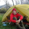
Anyway I've got a couple of days R+R here in Hotham where I'll also do my food drops for the next section to Thredbo.
Cheers
Kevin