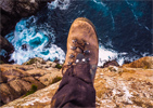
Does anyone know if there are flattish spots suitable for a tent towards the peak?
Thanks
![]() by ScottM » Sun 15 Apr, 2012 8:48 pm
by ScottM » Sun 15 Apr, 2012 8:48 pm

![]() by stepbystep » Mon 16 Apr, 2012 8:54 am
by stepbystep » Mon 16 Apr, 2012 8:54 am
ScottM wrote:I'm hoping to get up to Mt Murchison this coming weekend where there are other patches of Fagus, and I'd prefer to be there overnight for sunset/sunrise photos too.
Does anyone know if there are flattish spots suitable for a tent towards the peak?
Thanks

![]() by ScottM » Mon 16 Apr, 2012 10:07 am
by ScottM » Mon 16 Apr, 2012 10:07 am
![]() by eggs » Mon 16 Apr, 2012 11:15 am
by eggs » Mon 16 Apr, 2012 11:15 am
![]() by ScottM » Tue 17 Apr, 2012 9:26 am
by ScottM » Tue 17 Apr, 2012 9:26 am
![]() by north-north-west » Sun 22 Apr, 2012 1:12 pm
by north-north-west » Sun 22 Apr, 2012 1:12 pm

![]() by biggbird » Wed 25 Apr, 2012 11:29 pm
by biggbird » Wed 25 Apr, 2012 11:29 pm

![]() by cams » Mon 17 Dec, 2018 2:12 pm
by cams » Mon 17 Dec, 2018 2:12 pm
![]() by north-north-west » Mon 17 Dec, 2018 2:22 pm
by north-north-west » Mon 17 Dec, 2018 2:22 pm
![]() by eggs » Mon 17 Dec, 2018 2:24 pm
by eggs » Mon 17 Dec, 2018 2:24 pm
![]() by cams » Mon 17 Dec, 2018 3:03 pm
by cams » Mon 17 Dec, 2018 3:03 pm
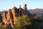
north-north-west wrote:Tyndall Range is only a short drive south of Murchison. Gate is usually open now and it's not a long walk up to the lakes where there is plenty of camping. Lots of car camping options near there too.
eggs wrote:The circuit route over Murchison sometimes have folk camping near Lake Sandra.
Do a search on this site for more details.
![]() by danman » Sun 30 Dec, 2018 2:10 pm
by danman » Sun 30 Dec, 2018 2:10 pm
eggs wrote:The circuit route over Murchison sometimes have folk camping near Lake Sandra.
Do a search on this site for more details.

![]() by tasmaniac » Mon 07 Jan, 2019 9:16 am
by tasmaniac » Mon 07 Jan, 2019 9:16 am

Users browsing this forum: No registered users and 37 guests