Hello all,
I'll be potentially heading into the wilderness yet again this upcoming summer - I just can't help myself!
Plenty of good information is available about the Mt Anne circuit in another thread on this forum, but I'll instead ask the following.
Is the Mt Anne summit walk comparable with any other summits, such as those one can take from the Overland? I would say I'm normally not fantastic with heights, but I had no issues going up Mt Ossa or Barn Bluff (maybe I'm actually fine with some heights...). Is Mt Anne a different kettle of fish? Is one who has done the Overland and its side tracks experienced enough to take the next step of completing Mt Anne without formal or other climbing lessons/experience? I see mixed talk about it on other forums, so it would be great to see all your opinions in one place!
Mt Anne summit
Forum rules
Tasmania specific bushwalking discussion. Please avoid publishing details of access to sensitive areas with no tracks.
Tasmania specific bushwalking discussion. Please avoid publishing details of access to sensitive areas with no tracks.
21 posts
• Page 1 of 1
Mt Anne summit
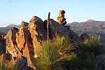
![]() by LoaferBread » Tue 20 Jun, 2017 1:16 am
by LoaferBread » Tue 20 Jun, 2017 1:16 am
-

LoaferBread - Nothofagus gunnii

- Posts: 20
- Joined: Fri 07 Feb, 2014 2:55 am
- Location: Adelaide
- Region: South Australia
- Gender: Male
Re: Mt Anne summit
![]() by Tortoise » Tue 20 Jun, 2017 9:13 am
by Tortoise » Tue 20 Jun, 2017 9:13 am
G'day, Loafer. I can certainly relate to the call of the Tassie bush. Watch out, or you'll end up moving here like I did. 
For me, Anne summit was a HUMUNGOUS step up from Ossa, Barn etc. Chalk and cheese, night and day etc. Not because the rock scrambling was much more difficult. It was about being on the edge of a cliff down which one slip would have me plummeting into oblivion. One spot had me in major panic the first time around - a slot we had to negotiate down from one ledge onto a very sloping rock. Next time, in a very different head space, I had no trouble. (I can give you more details on that.) But some other people found traversing 3 other sloping rocks/wide ledges terrifying. I just got down low on those and found them scary but doable.
You might have come across my 'Tortoise's Epic Adventure' report from the first time I did Anne and the circuit. I haven't yet finished the sequel, 'In which Tortoise Smashes the Anne Circuit', which I did just 12 months later. But I did make a concerted effort for the intervening year to get better with heights. That made a massive difference. More later, but part of my 'training' was getting 2 private rock climbing lessons (given by 2 very generous people!). It radically improved my confidence, and gave me dozens more holds than I had before, by using my weight in the right direction, using the right part of my foot, knowing when to keep my arm straight, getting confident with finger holds instead of having to wrap my hand around a 'jug' etc. I actually enjoyed going up and down Anne!
That suggests to me that you would do well doing some things to improve this before you tackle Anne. Are you planning to go solo? (One thing that makes it much harder is not having someone below you telling you where potential footholds are.) All the best for getting to the top - given the right preparation, go for it!!!!
For me, Anne summit was a HUMUNGOUS step up from Ossa, Barn etc. Chalk and cheese, night and day etc. Not because the rock scrambling was much more difficult. It was about being on the edge of a cliff down which one slip would have me plummeting into oblivion. One spot had me in major panic the first time around - a slot we had to negotiate down from one ledge onto a very sloping rock. Next time, in a very different head space, I had no trouble. (I can give you more details on that.) But some other people found traversing 3 other sloping rocks/wide ledges terrifying. I just got down low on those and found them scary but doable.
You might have come across my 'Tortoise's Epic Adventure' report from the first time I did Anne and the circuit. I haven't yet finished the sequel, 'In which Tortoise Smashes the Anne Circuit', which I did just 12 months later. But I did make a concerted effort for the intervening year to get better with heights. That made a massive difference. More later, but part of my 'training' was getting 2 private rock climbing lessons (given by 2 very generous people!). It radically improved my confidence, and gave me dozens more holds than I had before, by using my weight in the right direction, using the right part of my foot, knowing when to keep my arm straight, getting confident with finger holds instead of having to wrap my hand around a 'jug' etc. I actually enjoyed going up and down Anne!
I would say I'm normally not fantastic with heights
That suggests to me that you would do well doing some things to improve this before you tackle Anne. Are you planning to go solo? (One thing that makes it much harder is not having someone below you telling you where potential footholds are.) All the best for getting to the top - given the right preparation, go for it!!!!
-

Tortoise - Lagarostrobos franklinii

- Posts: 5166
- Joined: Sat 28 Jan, 2012 9:31 pm
- Location: NW Tasmania
- Region: Tasmania
- Gender: Female
Re: Mt Anne summit
![]() by dee_legg » Tue 20 Jun, 2017 9:19 am
by dee_legg » Tue 20 Jun, 2017 9:19 am
I would say that the technical climbing ability required to summit Mt Anne is similar to that required for Barny or maybe Pelion East but the exposure is far greater as mentioned by Tortoise which could mean a lot or very little to you depending on how to feel around heights. I don't personally love standing on the edge of cliffs but I've been up lots of scary mountains (usually aided by the tactic of not standing around long enough to think about it too much) so I think in summary, give it go and listen to what your body and your mind tells you. Mt Anne (as a day walk or as part of a circuit) is one of Tassie's classics and is well worth the effort even if you don't stand on top (as I didn't for the first 4 attempts).
-

dee_legg - Athrotaxis cupressoides

- Posts: 450
- Joined: Mon 01 Oct, 2007 4:12 pm
- Location: Hobart
- Region: Tasmania
- Gender: Female
Re: Mt Anne summit
![]() by eggs » Tue 20 Jun, 2017 9:57 am
by eggs » Tue 20 Jun, 2017 9:57 am
If you follow some of the discussions you may notice that there are 3 possible routes up Anne. The official route is the most exposed and that is the only one I have been on all the way to the top.
We have been up the western gully approach which had virtually no exposure - but due to incoming weather, we did not work out the last stage at about 10m below the summit.
The columns were certainly larger at that stage, but no big cliff faces. There were some cairns leading into this gully and a lot of big boulder hopping in going around the mountain to the gully.
I am also aware of a way up from the North East by traversing on grassy shelves and then climbing a short gully to intersect the main route at about the end of the amazing shelf running along the top of the eastern cliff face.
It would be a short exposed scramble up from there. I don't believe there are any indicators for this route.
-
eggs - Lagarostrobos franklinii
- Posts: 10469
- Joined: Fri 23 May, 2008 2:58 pm
- Location: Para Vista, South Australia
- Region: South Australia
Re: Mt Anne summit
![]() by Geevesy » Tue 20 Jun, 2017 11:38 am
by Geevesy » Tue 20 Jun, 2017 11:38 am
eggs wrote:If you follow some of the discussions you may notice that there are 3 possible routes up Anne. The official route is the most exposed and that is the only one I have been on all the way to the top.
We have been up the western gully approach which had virtually no exposure - but due to incoming weather, we did not work out the last stage at about 10m below the summit.
The columns were certainly larger at that stage, but no big cliff faces. There were some cairns leading into this gully and a lot of big boulder hopping in going around the mountain to the gully.
I am also aware of a way up from the North East by traversing on grassy shelves and then climbing a short gully to intersect the main route at about the end of the amazing shelf running along the top of the eastern cliff face.
It would be a short exposed scramble up from there. I don't believe there are any indicators for this route.
Although I initially followed cairns around the western flank, I lost them about 10m vertically from the summit. Then, frustrated, completely circumnavigated the northern face of the mountain (not as far as it sounds though) to find this aforementioned gully. Whilst it is certainly less exposed, it's not particularly "environmentally friendly" so I won't shed any more light on the route. The "track" up the peak - I've had three goes at it and it's too much for me... possibly because the first time it was icy...
A path! A path!
-

Geevesy - Phyllocladus aspleniifolius

- Posts: 704
- Joined: Tue 19 Apr, 2016 2:42 pm
- Region: Tasmania
- Gender: Male
Re: Mt Anne summit
![]() by Thornbill » Tue 20 Jun, 2017 1:01 pm
by Thornbill » Tue 20 Jun, 2017 1:01 pm
I did the circuit for the first time earlier this year. Didn't make the summit, didn't even attempt it in fact. Because it was wet, we knew that the exposed nature of the route probably wasn't for us, and we are completely non-fussed by not standing on the summit of each mountain we walk to. Do I feel that the walk wasn't as good because we didn't summit? Not at all! The rest of the circuit is fantastic and I highly recommend it, whether you decide to go to the top of Mt Anne or not. Enjoy.
How would a cubist paint a flounder?
-

Thornbill - Athrotaxis cupressoides
- Posts: 230
- Joined: Tue 25 Mar, 2014 2:25 pm
- Location: Hobart
- Region: Tasmania
- Gender: Male
Re: Mt Anne summit
![]() by north-north-west » Tue 20 Jun, 2017 1:19 pm
by north-north-west » Tue 20 Jun, 2017 1:19 pm
Anne's summit must be right up there with Fedders with regard to attempt/fail ratio.
The only difficult bit of the main route is that sloping shelf mentioned further up - not so much getting up it as negotiating the descent to it, especially in wet or icy conditions. The rest is technically easy but has more exposure than Barn or Ossa or any of the more accessible OT summits.
The only difficult bit of the main route is that sloping shelf mentioned further up - not so much getting up it as negotiating the descent to it, especially in wet or icy conditions. The rest is technically easy but has more exposure than Barn or Ossa or any of the more accessible OT summits.
"Mit der Dummheit kämpfen Götter selbst vergebens."
-

north-north-west - Lagarostrobos franklinii
- Posts: 15142
- Joined: Thu 14 May, 2009 7:36 pm
- Location: The Asylum
- ASSOCIATED ORGANISATIONS: Social Misfits Anonymous
- Region: Tasmania
Re: Mt Anne summit
![]() by devoswitch » Tue 20 Jun, 2017 1:40 pm
by devoswitch » Tue 20 Jun, 2017 1:40 pm
My first proper bushwalk once I moved to tassie. Will always be a special place for me! P.s helps if you're tall 
-
devoswitch - Athrotaxis cupressoides
- Posts: 424
- Joined: Mon 30 Dec, 2013 5:36 pm
- Region: Tasmania
- Gender: Male
Re: Mt Anne summit
![]() by Tortoise » Tue 20 Jun, 2017 3:23 pm
by Tortoise » Tue 20 Jun, 2017 3:23 pm
eggs wrote:We have been up the western gully approach which had virtually no exposure - but due to incoming weather, we did not work out the last stage at about 10m below the summit. The columns were certainly larger at that stage, but no big cliff faces. There were some cairns leading into this gully and a lot of big boulder hopping in going around the mountain to the gully.
Geevesy wrote:Although I initially followed cairns around the western flank, I lost them about 10m vertically from the summit.
Yes, the going is fine until those last few vertical metres. We had a VERY good look around for any sign of continuing cairns/markings at that point, and found nothing - so I don't think there are any. We could hear the voices of a couple on the summit, tantalisingly close. If it wasn't for Icefest's confidence, strength and long arms to give me a couple of crucial hoiks, I wouldn't have made it. At the top, we decided to give the normal route a shot, because we didn't think it could be any worse. And as far as the actual scrambling went, we were right.
When I later picked a bone with someone who had told me about the 'easy' way, he conceded that it is actually harder than the usual way. There just isn't as far to fall. Easy enough to break a leg in a 2 or 3 metre fall, in my book, but I agree that route completely avoids the serious exposure.
-
Tortoise - Lagarostrobos franklinii
- Posts: 5166
- Joined: Sat 28 Jan, 2012 9:31 pm
- Location: NW Tasmania
- Region: Tasmania
- Gender: Female
Re: Mt Anne summit
![]() by cams » Tue 20 Jun, 2017 5:18 pm
by cams » Tue 20 Jun, 2017 5:18 pm
Can anyone comment on the potential for building an anchor to belay up a less confident second through the most exposed section of the scramble?
-

cams - Phyllocladus aspleniifolius
- Posts: 725
- Joined: Tue 24 Aug, 2010 1:54 pm
- Region: Tasmania
- Gender: Male
Re: Mt Anne summit
![]() by Tortoise » Tue 20 Jun, 2017 6:52 pm
by Tortoise » Tue 20 Jun, 2017 6:52 pm
This photo that I borrowed from Nick S shows the trickiest bit pretty well:
It's the dropping down onto the rock that the guy with the stripey shirt is standing on that gets a lot of people. Note the cairn next to the guy at the top. On my second, blow-it-out-of-the-water descent, we actually came down the slot to the right of that. Our leader reckoned it's easier, and it may well be.
I know nothing about anchors, but to my novice eye, it looks like there might be more options for them at the top of the right-hand slot than for the cairned slot.
- Anne tricky bit Nick S.jpg (121.06 KiB) Viewed 19705 times
It's the dropping down onto the rock that the guy with the stripey shirt is standing on that gets a lot of people. Note the cairn next to the guy at the top. On my second, blow-it-out-of-the-water descent, we actually came down the slot to the right of that. Our leader reckoned it's easier, and it may well be.
I know nothing about anchors, but to my novice eye, it looks like there might be more options for them at the top of the right-hand slot than for the cairned slot.
Last edited by Tortoise on Thu 22 Jun, 2017 1:18 pm, edited 1 time in total.
-
Tortoise - Lagarostrobos franklinii
- Posts: 5166
- Joined: Sat 28 Jan, 2012 9:31 pm
- Location: NW Tasmania
- Region: Tasmania
- Gender: Female
Re: Mt Anne summit
![]() by JohnR » Tue 20 Jun, 2017 9:43 pm
by JohnR » Tue 20 Jun, 2017 9:43 pm
I have climbed up and down it both on the NW approach and also the main route. I agree the NW approach has generally much harder moves but is no where near as exposed as the main route. Also agree that the cairns appear to run out, but if you keep trying to climb up at every opportunity then that seems to work.
When doing the main route I went straight up (pretty much climbing above or just to the right of the guy in the red shirt). To me that appeared safer as no chance of slipping off that angled shelf that the guy in the stripped shirt is about to climb off. That shelf when wet is a bit off-putting.
As to protection, I did see some slings when climbing straight up near the main route (some looked old and you would not use on their own) and there did appear to be many places to put in your own protection or an anchor.
Cheers,
JohnR
- JohnR
- Atherosperma moschatum

- Posts: 88
- Joined: Tue 26 Nov, 2013 8:07 am
- Region: Victoria
- Gender: Male
Re: Mt Anne summit
![]() by north-north-west » Wed 21 Jun, 2017 10:28 am
by north-north-west » Wed 21 Jun, 2017 10:28 am
The photo makes that rock look even worse than I remember. Maybe it's just the angle.
"Mit der Dummheit kämpfen Götter selbst vergebens."
-
north-north-west - Lagarostrobos franklinii
- Posts: 15142
- Joined: Thu 14 May, 2009 7:36 pm
- Location: The Asylum
- ASSOCIATED ORGANISATIONS: Social Misfits Anonymous
- Region: Tasmania
Re: Mt Anne summit
![]() by Orion » Wed 21 Jun, 2017 11:26 am
by Orion » Wed 21 Jun, 2017 11:26 am
north-north-west wrote:The photo makes that rock look even worse than I remember. Maybe it's just the angle.
That's what I was thinking. I don't even remember that part. There was another place where we had to swing low around a boulder perched near the edge. That sticks in my mind for some reason.
Mt. Anne and that circuit are so nice, mostly anyway. I want to go back and do it all again.
- Orion
- Athrotaxis selaginoides

- Posts: 1963
- Joined: Mon 02 Feb, 2009 12:33 pm
- Region: Other Country
Re: Mt Anne summit
![]() by GPSGuided » Wed 21 Jun, 2017 12:04 pm
by GPSGuided » Wed 21 Jun, 2017 12:04 pm
Tortoise wrote:This photo that I borrowed from Nick S shows the trickiest bit pretty well:
Wow, that's pretty serious exposure and did some of you say you did it with ice covering? New respect for Mt Anne.
Just move it!
-

GPSGuided - Lagarostrobos franklinii
- Posts: 6968
- Joined: Mon 13 May, 2013 2:37 pm
- Location: Sydney
- Region: New South Wales
Re: Mt Anne summit
![]() by bax67 » Fri 23 Jun, 2017 8:10 pm
by bax67 » Fri 23 Jun, 2017 8:10 pm
i've been up a few times, it certainly helps if you're tall for that first tricky bit. my wife came up to the summit as well last time, and as she's short and doesn't like heights, i protected a few sections. you can protect the tricky bits pretty well for the second with a very light rack and a garda hitch. the first bit would have been hard without a skyhook or similar though to build the anchor. coming back down there is the most anxiety inducing part i find. i think the crack just before this one that tortoise mentioned would take better gear, but is harder climbing and always seems to be wetter...
alternatively for coming down just under this boulder there's a fixed rope that (last february was solid) that you can lower off or rap from down to the first ledge. we had a 30m rope, a 20m might make it but i didn't measure. you could climb up this bit but it's a lot harder than the usual route zig-zagging across the ledges.
alternatively for coming down just under this boulder there's a fixed rope that (last february was solid) that you can lower off or rap from down to the first ledge. we had a 30m rope, a 20m might make it but i didn't measure. you could climb up this bit but it's a lot harder than the usual route zig-zagging across the ledges.
- bax67
- Nothofagus gunnii
- Posts: 10
- Joined: Sun 02 Apr, 2017 5:03 pm
- Region: Victoria
Re: Mt Anne summit
![]() by Tortoise » Sat 24 Jun, 2017 9:41 am
by Tortoise » Sat 24 Jun, 2017 9:41 am
Hey there, Bax, and welcome to the forum. It's great to get your input - I'm surprised that with Mt Anne being such an iconic walk that is not exactly easy for lots of people, I've never actually seen details like yours.
I agree, but my mindset has changed. At 5'0", it felt like a big disadvantage I could do nothing about. On another thread, somebody hit the nail on the head (a generalisation, of course, but it makes the point). For challenging bits, guys can get away with reach and brute force, but women often need better technique. On my second descent of Anne, after a year of working on heights and a couple of lessons that gave me better technique, I had no trouble coming down. I found it easier than one of the guys who is well over 6' and is experienced climbing mountains in Tassie. I ended up not taking the advice of the guy below about what footholds to use. Instead, I swung myself out, had a good look, and found holds that were perfect for me.
it certainly helps if you're tall for that first tricky bit
I agree, but my mindset has changed. At 5'0", it felt like a big disadvantage I could do nothing about. On another thread, somebody hit the nail on the head (a generalisation, of course, but it makes the point). For challenging bits, guys can get away with reach and brute force, but women often need better technique. On my second descent of Anne, after a year of working on heights and a couple of lessons that gave me better technique, I had no trouble coming down. I found it easier than one of the guys who is well over 6' and is experienced climbing mountains in Tassie. I ended up not taking the advice of the guy below about what footholds to use. Instead, I swung myself out, had a good look, and found holds that were perfect for me.
-
Tortoise - Lagarostrobos franklinii
- Posts: 5166
- Joined: Sat 28 Jan, 2012 9:31 pm
- Location: NW Tasmania
- Region: Tasmania
- Gender: Female
Re: Mt Anne summit
![]() by LoaferBread » Sun 02 Jul, 2017 8:21 pm
by LoaferBread » Sun 02 Jul, 2017 8:21 pm
Thanks for all of your responses. It's great to hear a bit about the walk before attempting to tackle it. At this stage we'll give it a go and see how it goes!
How hairy would the Anne summit daywalk be in comparison with the rest of the Anne circuit?
Because we're planning Anne summit as a daywalk, we won't have to negotiate the stretch between Anne and Lot with beefy packs (for now ).
I think exposure is my main issue, especially when there's nothing to hold onto. When I can hold onto something, even if I can just feel a bit of a grip on some rock, I feel 1000x better. I will be working on this much more before Anne.
We're planning to tackle the Overland (will be my 3rd time!), including making an ambitious attempt at Pelion West via the "track" just south of Pelion Ck. This Overland stint will be a chance for me to tackle some 4s again, and a 5 (Pelion West) on the peakbaggers list. Anne being a 6 - now that sounds intense! Looking forward to trying it nonetheless
How hairy would the Anne summit daywalk be in comparison with the rest of the Anne circuit?
Because we're planning Anne summit as a daywalk, we won't have to negotiate the stretch between Anne and Lot with beefy packs (for now
I think exposure is my main issue, especially when there's nothing to hold onto. When I can hold onto something, even if I can just feel a bit of a grip on some rock, I feel 1000x better. I will be working on this much more before Anne.
We're planning to tackle the Overland (will be my 3rd time!), including making an ambitious attempt at Pelion West via the "track" just south of Pelion Ck. This Overland stint will be a chance for me to tackle some 4s again, and a 5 (Pelion West) on the peakbaggers list. Anne being a 6 - now that sounds intense! Looking forward to trying it nonetheless
-
LoaferBread - Nothofagus gunnii
- Posts: 20
- Joined: Fri 07 Feb, 2014 2:55 am
- Location: Adelaide
- Region: South Australia
- Gender: Male
Re: Mt Anne summit
![]() by LoaferBread » Thu 08 Feb, 2018 4:15 pm
by LoaferBread » Thu 08 Feb, 2018 4:15 pm
Trip summary: We went up yesterday in beautiful weather! It was around 23 degrees and very sunny. All was good until the final summit climb. We followed the advice from everybody but I think our climbing experience lacked. We got to the base of the summit and found a crack around 4m tall. Other walkers that passed us told us that was the crack to climb, and we could definitely see the path marked by other posters on this forum. But, we didn’t know how on earth to climb that crack! Hence, we decided to call it a day there. The views were fantastic and the walk was one of my favourites in Tas. So, I think it would be good to first learn a bit more about rock-climbing before attempting the summit again. Would anybody advise that this be the way to go? If only I could bring up a lightweight ladder 
-
LoaferBread - Nothofagus gunnii
- Posts: 20
- Joined: Fri 07 Feb, 2014 2:55 am
- Location: Adelaide
- Region: South Australia
- Gender: Male
Re: Mt Anne summit
![]() by ILUVSWTAS » Thu 08 Feb, 2018 5:27 pm
by ILUVSWTAS » Thu 08 Feb, 2018 5:27 pm
I dont remember having to climb up any crack.... last time I was up there ( a few years ago now ) we had carried full packs up from another route and came down to the main track with full packs. The only time I remember having to take the pack off was at the 4m wall mentioned earlier in this thread. We only pack hauled there cause we'd carried the rope the whole way and decided it might be the last opportunity to use it.
Nothing to see here.
-

ILUVSWTAS - Lagarostrobos franklinii
- Posts: 11046
- Joined: Sun 28 Dec, 2008 9:53 am
- Region: Tasmania
- Gender: Male
Re: Mt Anne summit
![]() by L_Cham_67 » Thu 08 Feb, 2018 6:09 pm
by L_Cham_67 » Thu 08 Feb, 2018 6:09 pm
I remember climbing a crack on the way down (which was slightly different to my upwards route), and felt very vulnerable doing it solo
It's a good thing you didn't continue if you weren't confident on the way up; descending is a lot trickier (for me anyway haha!).
It's a good thing you didn't continue if you weren't confident on the way up; descending is a lot trickier (for me anyway haha!).
-
L_Cham_67 - Athrotaxis selaginoides
- Posts: 1045
- Joined: Thu 17 Dec, 2015 6:43 pm
- Region: Tasmania
- Gender: Male
21 posts
• Page 1 of 1
Who is online
Users browsing this forum: No registered users and 55 guests