Falls Creek to Mt Hotham Alpine Crossing
Victoria specific bushwalking discussion. Please avoid publishing details of access to sensitive areas with no tracks.
-

neilmny - Lagarostrobos franklinii

- Posts: 2604
- Joined: Fri 03 Aug, 2012 11:19 am
- Region: Victoria
- Gender: Male
Re: Falls Creek to Mt Hotham Alpine Crossing
![]() by Xplora » Wed 13 Sep, 2017 5:40 pm
by Xplora » Wed 13 Sep, 2017 5:40 pm
neilmny wrote:Xplora wrote:Take a look. https://www.everestsports.com.au/produc ... bh0b7IjHcc
A lot of money. See how they go. I have no objection with this type of operation. A good use of existing accommodation at resorts. Not sure how they are going to manage a 5 star camp at Fed hut but they must have it figured out.
The link takes me to Everest Sports and that is all a dead end.
Thanks Neil. I have repair (replaced) the link and it will take you to a page that works now. This site also has some good gear for sale and on sale. Saw my Alpina Alaska boots on sale nearly $200 off. Similar price to what I payed OS.
- Xplora
- Athrotaxis selaginoides

- Posts: 1578
- Joined: Sat 01 Aug, 2015 7:24 am
- Region: Victoria
- Gender: Male
-
neilmny - Lagarostrobos franklinii
- Posts: 2604
- Joined: Fri 03 Aug, 2012 11:19 am
- Region: Victoria
- Gender: Male
Re: Falls Creek to Mt Hotham Alpine Crossing
![]() by Earwig » Thu 05 Oct, 2017 10:47 am
by Earwig » Thu 05 Oct, 2017 10:47 am
http://parkweb.vic.gov.au/explore/parks/alpine-national-park/plans-and-projects/falls-to-hotham-alpine-crossing-master-plan
Six main topics were identified in the feedback:
•Development of Roofed Accommodation within the National Park (Key issue: Development within Parks)
•Campsite Locations and Quality (Key issue: Non-exclusive setting)
•Track Alignment and Quality (Key issue: Track quality and wilderness experience)
•Visitor Numbers (Key issue: Appropriateness of numbers)
•Project Costs and Benefits (Key issue: Appropriateness of modelling)
•Environmental Impact (Key issue: Development within Parks)
MY HIKING BLOG http://ian-folly.blogspot.com/
-

Earwig - Athrotaxis cupressoides

- Posts: 289
- Joined: Wed 11 Nov, 2009 3:25 pm
- Location: NE Victoria
- Region: Victoria
- Gender: Male
Re: Falls Creek to Mt Hotham Alpine Crossing
![]() by Xplora » Thu 05 Oct, 2017 4:45 pm
by Xplora » Thu 05 Oct, 2017 4:45 pm
Earwig wrote:A summary of the community feedback on the Master plan is now available on PV's website.
http://parkweb.vic.gov.au/explore/parks/alpine-national-park/plans-and-projects/falls-to-hotham-alpine-crossing-master-plan
Six main topics were identified in the feedback:
•Development of Roofed Accommodation within the National Park (Key issue: Development within Parks)
•Campsite Locations and Quality (Key issue: Non-exclusive setting)
•Track Alignment and Quality (Key issue: Track quality and wilderness experience)
•Visitor Numbers (Key issue: Appropriateness of numbers)
•Project Costs and Benefits (Key issue: Appropriateness of modelling)
•Environmental Impact (Key issue: Development within Parks)
Good catch. Time for some reading and absorbing. Not all bad on the first read but some concerns. It still has to pass the pollies.
- Xplora
- Athrotaxis selaginoides
- Posts: 1578
- Joined: Sat 01 Aug, 2015 7:24 am
- Region: Victoria
- Gender: Male
Re: Falls Creek to Mt Hotham Alpine Crossing
![]() by Xplora » Sat 14 Oct, 2017 6:27 am
by Xplora » Sat 14 Oct, 2017 6:27 am
note steepness of ascent.'
The number of responses received was only 229 and they broke the points raised into 7 groups giving the percentage of responses addressing these 7 groups. This may give some indication of the level of concern attached to the group but it does not break it up into a percentage of those objecting or supporting. The summary does note the objections but then puts considerable emphasis on the positive or supportive view which may or may not be in the majority.
A review of current walker numbers and projected has been accepted and the lack of any real economic review noted. It all may hinge on this one thing. Given the government expenditure is not high (according to the MP's spoken to) it may be an easy right off if things do not pan out but they may also see it as another white elephant which the opposition could use come next election. It is pretty clear the Alpine Shire has no interest in the environment unless it is taking money for a permit to cut trees down.
- Xplora
- Athrotaxis selaginoides
- Posts: 1578
- Joined: Sat 01 Aug, 2015 7:24 am
- Region: Victoria
- Gender: Male
Re: Falls Creek to Mt Hotham Alpine Crossing
![]() by Lophophaps » Sun 15 Oct, 2017 6:32 am
by Lophophaps » Sun 15 Oct, 2017 6:32 am
This lack of transparency means that the credibility of the report is greatly diminished.
I very strongly suspect that the lack of a list of people and entities and lack of access to submissions is to avoid the very critical nature of some submissions. My submission was very critical of a number of points, especially the economic modelling.
I have been unable to locate any recent advice from PV that the report was available. Did anyone else not get PV advice about the report? If advice was not sent out as a matter of policy then one conclusion is that PV did not want to have people who made submission aware of the report. This is also ill-advised, and throws doubt on the consultation process. If there was a decision to not advise people and entities about the report, how can we comment on it?
I can only comment on how my submission was treated. Briefly, all my very serious concerns have been watered down or ignored. The suggestions in the report do not address my concerns adequately or at all. The pie charts in the report are not much use; people will comment on that which interests them. I’m not at all persuaded by the form of words on the line “Most people supported (subject).” A popular vote is not an indication of the merit of an argument. Instead, looking at the words and thinking about them will persuade - or not. It is instructive that none of my major points was denied, and as far as I can recall, none of the minor ones.
The report seems designed to have the walk no matter what, and seeks ways to minimise adverse impacts. The FHAC is based on ideology, fundamentally flawed.
There’s still irritating mistakes like “Australian Alps Walking Trail” and too may typos. There’s a premise that platforms are desirable. Adverse impacts have been downplayed – the report says that they can be fixed. A cost-benefit analysis is missing. My submission had several pages of financial analysis showing that the total return is negative. I included a lot of costs missing from the draft plan.
Nothing much has changed in the last 12 months, and the concept is still quite inappropriate for the region and zones. A far greater return on investment can be obtained by upgrading the Dibbins route, overnight at Hotham, and if walkers want to do Feathertop it’s there, go down the Bungalow.
Commercial infrastructure has no place in national parks.
-

Lophophaps - Auctorita modica

- Posts: 3382
- Joined: Wed 09 Nov, 2011 9:45 am
- Region: Victoria
- Gender: Male
Re: Falls Creek to Mt Hotham Alpine Crossing
![]() by peregrinator » Sun 15 Oct, 2017 11:35 am
by peregrinator » Sun 15 Oct, 2017 11:35 am
Lophophaps wrote:. . . Did anyone else not get PV advice about the report? . . .
I wasn't notified.
- peregrinator
- Athrotaxis selaginoides
- Posts: 1781
- Joined: Fri 15 Apr, 2011 2:50 pm
- Region: Victoria
Re: Falls Creek to Mt Hotham Alpine Crossing
![]() by crockle » Mon 23 Oct, 2017 8:26 am
by crockle » Mon 23 Oct, 2017 8:26 am
Is is possible to get a copy of your submission Lophophaps?
On the financial side, it's interesting [in a bad way interesting] if they are relying on flawed or wildly imaginative modelling, and then disregarding any submissions touching on this area
-
crockle - Athrotaxis cupressoides
- Posts: 108
- Joined: Tue 13 Nov, 2007 9:10 pm
- Location: Victorian Lowlands
Re: Falls Creek to Mt Hotham Alpine Crossing
![]() by Xplora » Mon 23 Oct, 2017 3:10 pm
by Xplora » Mon 23 Oct, 2017 3:10 pm
- Xplora
- Athrotaxis selaginoides
- Posts: 1578
- Joined: Sat 01 Aug, 2015 7:24 am
- Region: Victoria
- Gender: Male
Re: Falls Creek to Mt Hotham Alpine Crossing
![]() by Lophophaps » Mon 23 Oct, 2017 3:33 pm
by Lophophaps » Mon 23 Oct, 2017 3:33 pm
6.21 The DMP says that 60,500 walker nights give $14.3 million benefit, so 36,500 walker nights (or 9100 walkers) gives $8.6 million a year. Or the average spend of $137 a day (DMP page 84) can be applied. This gives nine days for the trip (two before and two after) equals (36,500 X 9 X 137)/4 equals $11 million. So using the flawed DMP rate a benefit of $8-11 million may be possible. However, it seems to me very unlikely that the number of walkers will reach 9100. This is more than the OLT, a long-established walk in spectacular scenery. It's hard to envisage more than perhaps 2000 people a year on average doing FHAC in the first 10 years. If so, then the income is around $1.9 million a year or 10 X $1.9 million equals $19 million for 10 years. Using the real start figure of 800 overnights a year gives an average of about half the DMP figure: income $4-6 million.
6.27 Page 94 and 95 have costs, a travesty. The figures are in a small, thin, faded font, in breach, and are actionable. This format in a legal document would be invalid due to lack of clarity. The reason that the figures are faded very much seems to be that the figures are outrageous. Paying $20,000 or $50,000 for a track marker is insane. Paying $574,000 for one camping platform defies belief. Or is it yet more muddy words from McGregor Coxall? To say that a platform costs this much means … words fail me. An idea. Save $574,000 on a platform and let people camp on the grass. The camping grounds cost $250,000, also unnecessary. Just let it be! The structure costs seem to be quite high. The format is opaque. For example, one iconic track marker has a rate per unit of $50,000, construction costs of $50,000 and a total of $82,000. McGregor Coxall's maths seems suss. These costs are unreal, massive expenditure for limited gains. The only things that need to be done are some track maintenance near Westons Hut and other places, and revegetation of the fire and other scars at Federation Hut.Assume that the easier FHAC via Swindlers Spur route attracts 1000 people. This is probably unachievable, but say it is so. Page 84 of the DMP says that visitors spend $137/night. So nine days in the region (two before, the FHAC, two after), by 137 equals $1233 spent by each person. For 1000 people this is $1.2 million. Over 10 years this is $12 million. Total cost for 10 years $59 million, income $12 million. The table on page 92 is laughable.
6.28 So the shortfall is conservatively about $30-40 million over 10 years, or $3-4 million a year. Call it 100 jobs. Jobs are subsidised at about $3-400,000 each a year, expensive and ouchies. Is this the best regional use of state funds? I think not. Where is the business case?
*** ends
In brief, I totally destroyed the DMP economic purported factual basis and reasoning. The recent document says that they will look into this, no hint of criticisms like mine; I'm aware of others. Perhaps we can hope that sanity will prevail. If not and the track is built I'm on record as saying it's a hazard for less experienced walkers. If necessary I will so advise the Coroner. In early 2016 I advised the Coroner about a possible death due to negligence at a hospital. A person died and now I am giving evidence.
-
Lophophaps - Auctorita modica
- Posts: 3382
- Joined: Wed 09 Nov, 2011 9:45 am
- Region: Victoria
- Gender: Male
Re: Falls Creek to Mt Hotham Alpine Crossing
![]() by Lophophaps » Wed 25 Oct, 2017 5:28 pm
by Lophophaps » Wed 25 Oct, 2017 5:28 pm
-
Lophophaps - Auctorita modica
- Posts: 3382
- Joined: Wed 09 Nov, 2011 9:45 am
- Region: Victoria
- Gender: Male
Re: Falls Creek to Mt Hotham Alpine Crossing
![]() by paidal_chalne_vala » Wed 25 Oct, 2017 10:23 pm
by paidal_chalne_vala » Wed 25 Oct, 2017 10:23 pm
- paidal_chalne_vala
- Lagarostrobos franklinii
- Posts: 2468
- Joined: Sun 22 Jan, 2012 10:30 pm
- ASSOCIATED ORGANISATIONS: VNPA.BTAC.Friends of Baw Baw.Mt.Bogong Club.
- Region: Victoria
- Gender: Male
Re: Falls Creek to Mt Hotham Alpine Crossing
![]() by Xplora » Thu 26 Oct, 2017 5:06 am
by Xplora » Thu 26 Oct, 2017 5:06 am
paidal_chalne_vala wrote:I sent in a 7,000 word submission and never heard from PV again.I get the feeling it is all a done deal , like that visitor centre at Seal Rocks was, at Phillip Island. That came unstuck care of mother nature and bad weather if I recall rightly and the place was abandoned.
I actually feel the other way. Maybe they are having trouble putting enough positive spin on it or getting the numbers to go in their favour. I would not expect to hear anything back until the final is out and maybe not then. I did send an email to the PV in charge a short while ago pointing out some error in the summary but have not heard back.That is disappointing.
- Xplora
- Athrotaxis selaginoides
- Posts: 1578
- Joined: Sat 01 Aug, 2015 7:24 am
- Region: Victoria
- Gender: Male
Re: Falls Creek to Mt Hotham Alpine Crossing
![]() by paidal_chalne_vala » Fri 27 Oct, 2017 8:32 am
by paidal_chalne_vala » Fri 27 Oct, 2017 8:32 am
- paidal_chalne_vala
- Lagarostrobos franklinii
- Posts: 2468
- Joined: Sun 22 Jan, 2012 10:30 pm
- ASSOCIATED ORGANISATIONS: VNPA.BTAC.Friends of Baw Baw.Mt.Bogong Club.
- Region: Victoria
- Gender: Male
Re: Falls Creek to Mt Hotham Alpine Crossing
![]() by Lophophaps » Tue 12 Dec, 2017 6:27 am
by Lophophaps » Tue 12 Dec, 2017 6:27 am
"A total of 229 submissions were received during final round of consultation".
Yesterday PV advised that there were over 260 submissions, about 80 of which are confidential. I cannot reconcile 229 and 260.
PV advised that after publication of the approved plans, copies of all non-confidential submissions will be made public, cited in the late 2016 request for submissions said as much. Has anyone seen this?
PV say that they will not make public the non-confidential submissions now, saying it's too hard. Que? If this information will be public in due course, why not now? I'm puzzled as to why PV will not make the non-confidential submissions public now. Again and again the responses do not stand up to scrutiny.
There's a lack of transparency, with a process that is not only flawed but secretive. It looks like the flaws in the PV methodology will not come to light until after a decision is made, and it's hard to reverse such decisions; better to stop them in the first place.
-
Lophophaps - Auctorita modica
- Posts: 3382
- Joined: Wed 09 Nov, 2011 9:45 am
- Region: Victoria
- Gender: Male
Re: Falls Creek to Mt Hotham Alpine Crossing
![]() by paidal_chalne_vala » Tue 12 Dec, 2017 3:58 pm
by paidal_chalne_vala » Tue 12 Dec, 2017 3:58 pm
When I got to that beautiful scenic campsite on the top of the Diamantina spur, high above the world , I had to lie down because I was absolutely ROGERED!.
- paidal_chalne_vala
- Lagarostrobos franklinii
- Posts: 2468
- Joined: Sun 22 Jan, 2012 10:30 pm
- ASSOCIATED ORGANISATIONS: VNPA.BTAC.Friends of Baw Baw.Mt.Bogong Club.
- Region: Victoria
- Gender: Male
Re: Falls Creek to Mt Hotham Alpine Crossing
![]() by Xplora » Wed 13 Dec, 2017 5:01 am
by Xplora » Wed 13 Dec, 2017 5:01 am
- Xplora
- Athrotaxis selaginoides
- Posts: 1578
- Joined: Sat 01 Aug, 2015 7:24 am
- Region: Victoria
- Gender: Male
Re: Falls Creek to Mt Hotham Alpine Crossing
![]() by Lophophaps » Wed 13 Dec, 2017 6:01 am
by Lophophaps » Wed 13 Dec, 2017 6:01 am
Xplora, agree. In any case it's not the number of votes aka submissions that count, it's the merit in the arguments. In the mid-1990s when Mount Stirling was suggested as a place for downhill skiing there were about six options. Submissions rolled in, about 600 of them from memory. Many of these submissions were literally pro forma, just add a name, address and date. Nearly all of these pro formas were for the downhill resort and dated on a Saturday. It was clear that these were done in ski lodges at Mount Buller; some said as much. I was advised that these submissions were considered as being one submission, and lacking in anything of substance. Something like that.
Alternatively, there were rather a lot of detailed long submissions based on science, the environment, economics, and the like opposing a downhill resort. These were given much greater weight. Even then climate change was cited a s good reason to have the track head higher. Stirling is still a XC and bushwalking mountain.
My very strong suspicion is that most submissions do not support the FHAC, and certainly not as stated in the October 2017 Summary report. This report is too vague, devoid of evidence. My January 2017 FHAC submission was probably one of the longest, and utterly destroyed the economic case and the basis for nearly all the figures. I raised many questions that require answers. Providing those answers will be very hard for PV. It's fascinating that having shown that the consultants have minimal skills about the FHAC they were again engaged to produce the October 2017 report. Your taxes at work.
-
Lophophaps - Auctorita modica
- Posts: 3382
- Joined: Wed 09 Nov, 2011 9:45 am
- Region: Victoria
- Gender: Male
Re: Falls Creek to Mt Hotham Alpine Crossing
![]() by paidal_chalne_vala » Wed 13 Dec, 2017 7:31 am
by paidal_chalne_vala » Wed 13 Dec, 2017 7:31 am
- paidal_chalne_vala
- Lagarostrobos franklinii
- Posts: 2468
- Joined: Sun 22 Jan, 2012 10:30 pm
- ASSOCIATED ORGANISATIONS: VNPA.BTAC.Friends of Baw Baw.Mt.Bogong Club.
- Region: Victoria
- Gender: Male
Re: Falls Creek to Mt Hotham Alpine Crossing
![]() by Lophophaps » Wed 13 Dec, 2017 8:41 am
by Lophophaps » Wed 13 Dec, 2017 8:41 am
paidal_chalne_vala wrote:The rest of the re vamped FHAC can't compete with this scenery except for the top of the You Ate my tongue peak.
LOL! It's easier than a Welsh name
Llanfairpwllgwyngyllgogerychwyrndrobwll-llantysiliogogogoch
As the trees dwindle on the ascent of Diamantina Spur the views get better, a very pretty place. Most other Bogong High Plains summits have a resort or road in the frame, undesirable. All we can do now is to keep asking PV for details and to point out that FHAC does not make economic or environmental sense. Those involved need to be held responsible for wasted funds, loss of reputation and possibly death.
-
Lophophaps - Auctorita modica
- Posts: 3382
- Joined: Wed 09 Nov, 2011 9:45 am
- Region: Victoria
- Gender: Male
Re: Falls Creek to Mt Hotham Alpine Crossing
![]() by paidal_chalne_vala » Wed 13 Dec, 2017 3:19 pm
by paidal_chalne_vala » Wed 13 Dec, 2017 3:19 pm
I will definitely camp on the top of it again on the March long weekend. Fed. hut that weekend will be horrendously busy. I just need to buy a second 4 Litre water transport bladder for that dry campsite.
- paidal_chalne_vala
- Lagarostrobos franklinii
- Posts: 2468
- Joined: Sun 22 Jan, 2012 10:30 pm
- ASSOCIATED ORGANISATIONS: VNPA.BTAC.Friends of Baw Baw.Mt.Bogong Club.
- Region: Victoria
- Gender: Male
Re: Falls Creek to Mt Hotham Alpine Crossing
![]() by Crooke » Sun 14 Jan, 2018 7:45 pm
by Crooke » Sun 14 Jan, 2018 7:45 pm
Just returned from doing Falls-Diamantina Spur-Fethertop-Hotham-Falls walk. Diamantina Spur isnt the steepest ive hiked up but it was the hardest. Was a mild day, with no breeze. It was unrelentingly hot in the sun and little difference in the limited shade.(coundnt imagine a 35 degree or hotter day) Good luck to the guides getting their walkers up it.
Thanks again for the info
p.s no campers at fed hut knew anything about this crazy idea
- Crooke
- Nothofagus cunninghamii

- Posts: 1
- Joined: Sun 14 Jan, 2018 6:49 pm
- Region: Victoria
- Gender: Male
Re: Falls Creek to Mt Hotham Alpine Crossing
![]() by Lophophaps » Sun 14 Jan, 2018 10:05 pm
by Lophophaps » Sun 14 Jan, 2018 10:05 pm
One point that I have stressed to PV is that guided walkers or those enticed by spurious marketing will struggle, and, on balance of probability, there will be a fatality. The people that can safely do the walk now do not need marketing as a motivator or a guide, and the rest are walking into danger, or at least having the odds stacked somewhat against them. I stack the odds in my favour as much as possible. Having bad odds often enough leads to a statistical certainty of ending in tears. Marketing that shows blue skies, happy people and easy walking is far from reality at times. Not often, but poor weather or a bushfire in the wrong place and time means that bumblies will be sad.
I've called out PV on this, asked who will be responsible if there's a death. No reply, yet. If the plan proceeds as PV wants then I'll be contacting the State Coroner advising that a death is probable. Then I wait.
-
Lophophaps - Auctorita modica
- Posts: 3382
- Joined: Wed 09 Nov, 2011 9:45 am
- Region: Victoria
- Gender: Male
Re: Falls Creek to Mt Hotham Alpine Crossing
![]() by paidal_chalne_vala » Tue 16 Jan, 2018 8:07 pm
by paidal_chalne_vala » Tue 16 Jan, 2018 8:07 pm
- paidal_chalne_vala
- Lagarostrobos franklinii
- Posts: 2468
- Joined: Sun 22 Jan, 2012 10:30 pm
- ASSOCIATED ORGANISATIONS: VNPA.BTAC.Friends of Baw Baw.Mt.Bogong Club.
- Region: Victoria
- Gender: Male
Re: Falls Creek to Mt Hotham Alpine Crossing
![]() by Earwig » Mon 16 Apr, 2018 1:43 pm
by Earwig » Mon 16 Apr, 2018 1:43 pm
http://parkweb.vic.gov.au/explore/parks/alpine-national-park/plans-and-projects/falls-to-hotham-alpine-crossing-master-plan
MY HIKING BLOG http://ian-folly.blogspot.com/
-
Earwig - Athrotaxis cupressoides
- Posts: 289
- Joined: Wed 11 Nov, 2009 3:25 pm
- Location: NE Victoria
- Region: Victoria
- Gender: Male
Re: Falls Creek to Mt Hotham Alpine Crossing
![]() by neilmny » Mon 16 Apr, 2018 2:42 pm
by neilmny » Mon 16 Apr, 2018 2:42 pm
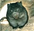
Found this picture of a Common Wombat in the new "master plan" FHAC-Master-Plan-PartA-2018.jpg
-
neilmny - Lagarostrobos franklinii
- Posts: 2604
- Joined: Fri 03 Aug, 2012 11:19 am
- Region: Victoria
- Gender: Male
Re: Falls Creek to Mt Hotham Alpine Crossing
![]() by Lophophaps » Mon 16 Apr, 2018 5:17 pm
by Lophophaps » Mon 16 Apr, 2018 5:17 pm
There's four reports and quite a lot of pages. I've picked up a few blunders. Note the track length to Feathertop and Diamantina Hut placement. it has moved north since the last PV plan.
- Razorback.png (104.17 KiB) Viewed 29207 times
The basic questions we have been asking for ages have not been answered. The FHAC is taming our beloved mountains, and this is ill-advised.
I walked on the high plains over Easter, and extracted the following from Cope Hut log book.
- Cope log book.png (90.02 KiB) Viewed 29207 times
This is for two nights so there are about 70 walker nights a year on the easier current FHAC. The DMP says 17,000 walker nights at present for the much harder and longer insanity.
Not happy at all.
-
Lophophaps - Auctorita modica
- Posts: 3382
- Joined: Wed 09 Nov, 2011 9:45 am
- Region: Victoria
- Gender: Male
Re: Falls Creek to Mt Hotham Alpine Crossing
![]() by paidal_chalne_vala » Tue 17 Apr, 2018 12:45 am
by paidal_chalne_vala » Tue 17 Apr, 2018 12:45 am
Page 40 ,the Diamantina Hut has moved quite a bit along the Razorback towards High Knob.
This whole thing is full of mistakes, ergo written by people who have never been there and I will for one be sure to act up and stage some civil disobedience if they try to build their bleeding Lego Land Club Med on top of the Diamantina Spur.
I won't weep if and when a bushfire wipes out the whole monstrosity.
- paidal_chalne_vala
- Lagarostrobos franklinii
- Posts: 2468
- Joined: Sun 22 Jan, 2012 10:30 pm
- ASSOCIATED ORGANISATIONS: VNPA.BTAC.Friends of Baw Baw.Mt.Bogong Club.
- Region: Victoria
- Gender: Male
Re: Falls Creek to Mt Hotham Alpine Crossing
![]() by Lophophaps » Tue 17 Apr, 2018 9:23 am
by Lophophaps » Tue 17 Apr, 2018 9:23 am
Final management plan comments
I've briefly looked at the latest plans and continue to be unimpressed. It's the same bland ideas, with all of the downside glossed over. It works like this. A government agency commissions a report. The contractor knows what is required, and that the report should reflect this. If it does not, then there will be no more jobs from that agency. It's subtle but pervading.
This is why the old way of public service advice worked very well. If the Minister had a bad idea than he was so advised, with no threat to public servant's job. The new way is that one agrees with the boss or you may be sacked, or miss out on promotions. The new way is barmy.
Here's a few points from the reports.
As before the layouts are not very good, quite faded. As mentioned above, Diamantina Hut has moved north. There's a handful of typos, but far less than before. It seems that my comments about spelling, punctuation and grammar were noted.
Part A page 1 says "In order to maximise the experiences for a diverse array of walkers, including individual adventure seekers, small and self-guided groups, larger educational and school groups and guided tours, a suite of improvements and additional infrastructure will be developed to the highest standards of sustainable planning, design and management. These upgrades will consist of a higher track quality to enable improved engagement with the surrounds, rest stops to fully appreciate the breathtaking beauty of the High Country, interpretation to gain understanding and insight into the landscapes narratives, and a choice of well-designed, low-impact accommodation options that cater to individual levels of comfort along the walk."
This is nearly all BS. These groups manage at present. There is no need for all this expense!
Part A page 5 says "It is estimated that there will be an uplift in visitor spending, both regionally and by means of travel, to the potential total spend of $23.4 million per annum by 2027 when the trail is fully operational."
I cannot see this happening. It's too much.
Part A page 18 discusses the environmental risk assessment "Biosis identified that, at a top level, there were no significant adverse environmental impacts of the track, and that priority risks could be adequately managed by following normal planning procedures and detailed on-ground assessments prior to construction."
Interesting. What about the 5-10,000 bushwalkers on the FHAC? The OLT has pollution problems due to not enough toilets, and is starting to fix this with a toilet at Pelion Gap. The April 2018 plan seems not to mention toilets between nodes.
Part A page 44, they still suggest a jaunt from a Tawonga camp to Jaithmathang to watch the sunset. The writer is insane! It's a tricky descent from the summit, moreso at night. Just after this is a plan for a new track, bypassing pole 333 to go to Westons. madness! There's already a track, Tawonga, pole 333, Westons.
Part A page 48 says "The most physically challenging of all segments provides walkers with a grade 4 track to conquer. Diamantina Spur heaves up from the valley floor, rising 450 m in roughly 1.5 km". No mention of the rest of the climb, and I abhor the word "conquer".
My January 2017 submission about the Draft Management Plan said:
"3.11 There's contradictions. Page 32 in fine print says "Diamantina River Camp-Mt Feathertop 8.5km (sic) - 760m (sic) climb - 7 hours Grade 4". Page 48 implies that the climb is 450 metres. The climb from the valley to Mt Feathertop is about 900 metres."
That is, they took no notice of my advice. The April 2018 plan is still misleading. No surprise.
Part A page 48 says "Walkers can stop on the spur to spend the night in an area protected by snow gums. An add-on is the climb to Mt Feathertop for sunset or sunrise."
Part A page 49 says "Following a sunrise climb to Mt Feathertop, the final day of the trail takes walkers along the Razorback".
They still have these crazy ideas about sunrises and sunsets. It's too far, too dangerous. I raised both of these in my submission, again ignored.
Part B page 56 details tracks. It's scary in places.
Part B page 57 says "Utilise existing trails where possible. Utilise existing infrastructure as much as possible, minimising the need for additional construction."
So why duplicate the track from Tawonga Huts to pole 333? Why add the huts and platforms? Why over-engineer the tracks? Why add seats?
"Ensure the trail is always clearly visible to the walker and use existing fallen tree branches and/or loose stones to clearly mark the direction and edge of the trail (without impeding drainage)."
Gosh! The tracks I have been on generally are defined by people, boots on the ground. There is no need to have branches and rocks at the edges.
Part B page 62 "Elevated camping platforms can improve the camping experience, especially during bad weather, and better protect the surrounding environments. Each Hiker Camp is proposed to offer 12 elevated 3-person platforms, each able to secure one tent or swag."
What a total waste of resources! Grass works fine, and can have more people camped. How many swags have you seen on bushwalks? I've never seen one. Mentioning swags suggests that the writer has no idea about bushwalking, none at all. The possibility arises that swag is a typo and should be SWAG - Stupid Wild-Arsed Guess.
Part B page 64 "Elevated camp platforms. 4 x 4 metres. Hardwood timber decking. 12 x platforms accommodating 2–3 people per platform. Platforms to be located individually and some groups of 3 or 4 to accommodate larger group settings and families."
This will destroy the environment. The platforms have a huge footprint, and will significantly reduce the number of available tent sites. The platforms have a huge amount of dead space.
"2 x drop toilet cubicles over a sealed vault system."
The numbers envisaged require two sets of two toilets, one set in use, one set not, waiting to be emptied. This is the setup at many popular remote campsites.
Part B, page 64 details lodges - there is no other word - with "1 x communal hut. Full weather protection. Tables and chairs for dining. Kitchen for fully catered services. Water provision by roof water harvesting (non-potable water quality). Solar power (for charging of low-voltage devices such as cameras and phones). Outdoor decking for social engagement and relaxation. Integrated lockers and drying room/ area."
This is not what our wild and beautiful places are about. The proposal reeks of privatisation of the mountains at our expense. Ghastly. Note that before (from memory) the huts were temporary. Now they are fixed. How long before they are used in winter? What about the conservation zone on Diamantina Spur?
Part B page 78 "The Falls to Hotham Alpine Crossing should meet or exceed the pre-walking standards of other iconic walks."
Not good. Part of the charm of the place is the variety of tracks, obstacles, and challenges. The FHAC proposes to homogenise that, making it one size fits all. This is bollocks.
Part C page 86 says "Recent research undertaken and brought forward in 'Victoria's Nature-Based Tourism Strategy' 2008–2012, shows shifts in consumer preferences from traditional independent multi-day bushwalking trips to a greater demand for soft adventure, comfort and security offered by commercial operators."
This needs to be verified. I suspect it's mainly BS.
Part C page 87 says of the Overland Track "Bookable tent platforms at most overnight nodes. Toilet facilities. Non-bookable basic hut facilities [i.e. no mattress or cooking facilities). $150 per person total".
Can OLT platforms be booked? The OLT costs $200 plus a park fee, $30 minimum.
Part C page 88 "Limited surveys have indicated that current users are of a diverse mix of day walkers, with overnight users tending to seek an adventurous, self-sufficient experience. The nature of the solely tent-based accommodation dictates the current profile of users, with overnight users consisting predominantly of 'adventure seekers' and outdoor educational groups such as scouts and school groups.
"Adventure seekers
"The ‘adventure seekers’ are a market which has been described as valuing the ‘wild’ experience and being self-sufficient. This group consists mainly of experienced to very experienced walkers who are fully independent in terms of drop-off and pick-up and for all equipment. They value solitude and wish to pit themselves against nature while being fully immersed in it, and wish to ‘tread lightly’. This user profile is dictated by the relatively high level of difficulty of trail segments, together with the nature of the solely tent-based accommodation."
I've taken beginners to the Bogong High Plains, summer and winter.
Part C page 90 "According to the visitation numbers outlined in these reports it can be assumed that groups that will take up the opportunity for facilitated walking will be drawn from the following areas:
– Bushwalkers in the High Country
– 7,000 pa international visitors.
– 193,000 pa domestic overnight visitors.
– 93,000 pa day-trippers.
– Total 293,000 bushwalkers."
Right, 293,000 bushwalkers. The BS level is rising.
Part C page 91 says that there are three scenarios for the number of walkers low 5175, medium 7777 and high 10,699. I love the way that they have such precise figures. The OLT has 7-9000 walkers a year. This is a long-established internationally recognised walk, brilliant scenery. How can an upstart like FHAC compete? I simply cannot see even the low figure being met.
Part C page 91 "One approach to estimating the number of walkers who may take up the opportunity for facilitated walks on the proposed trail is to estimate the market share of the number of current bushwalkers in the High Country. As outlined above the estimate is 293,000 per annum. This is increased by the official visitation forecasts to estimate that the number of bushwalkers will increase to 427,000 per annum by 2027."
BS's getting higher. I will attempt to dig out, perhaps with the help of 427,000 bushwalkers.
Part C page 93 "All of the trails mentioned above are one-way only. The Falls to Hotham Alpine Crossing will be marketed and managed as a one-way walking experience, although some walkers will inevitably enter the trails from other origins such as Harrietville and Dinner Plain, as well as from the Mt Loch trail head. With a potential diversity of origins, walkers will meet on the trail network over an extended period in the middle of the day."
Nobody, repeat nobody tells me where and how and in what direction I walk. On a recent trip to the region, of the 11 nights I varied campsites for six nights. Too far, too windy, saw an easier way. The route was varied as well.
Part C page 96 "A significant opportunity for the private sector is to tap into the delivery of infrastructure associated with the trailhead locations. These are the Lakeside trailhead at Falls Creek and the Mt Loch trailhead in Mt Hotham. These trailheads would include not only components of the trail infrastructure, such as information boards and maps, trailhead sculpture for photo opportunities and some seating for preparation works, and could also be enriched by the following:
– Cafe/ Restaurant to celebrate 'last and first meals of quality'".
Good grief, they want to put a cafe at Heathy and Loch! If they rely on walkers they will go broke. Even on a main road there will probably be limited custom - drivers will not want to stop that close to Falls and Hotham Heights.
Part C page 103 has a total cost of $34,090,506. I love the fact that they have the cost to the nearest dollar. Page 92 of the DMP had capital costs of $22.4 million. Given that the cost has jumped over 50%, might not a figure to the nearest dollar be a tad silly?
There seems to be no mention of bushwalkers displaced by the new infrastructure, or how our experiences are compromised bt the FHAC. Finally, there is an Australian track standard. In Victoria we walk in tracks, not trails.
If this monstrosity proceeds, let it be. Let it fail, wait for the rescues and deaths, then see who takes responsibility for the chaos. If FHAC is approved I will advise the State Coroner of my misgivings. If there's a death then it wil be on record that it was preventable.
-
Lophophaps - Auctorita modica
- Posts: 3382
- Joined: Wed 09 Nov, 2011 9:45 am
- Region: Victoria
- Gender: Male
Who is online
Users browsing this forum: No registered users and 11 guests