Kanangra - Brumby Ridge - Kowmung

NSW & ACT specific bushwalking discussion.
Forum rules
NSW & ACT specific bushwalking discussion. Please avoid publishing details of access to sensitive areas with no tracks.

Kanangra - Brumby Ridge - Kowmung

Postby Flipper Hands » Wed 13 Sep, 2017 8:47 am

Looking to do a straight forward over night walk this weekend. This route looks to fit the bill, About 11 km in and out.

I've been very ill lately but am all good now, and my fitness is down hence the short days.

    I've done Cloudmaker before, this looks easier, am I right?
    I'll be map and GPS equipped and have read all the simple to find notes, any special tips other than those?
    How much offtrack walking is needed these days?
    Is there water anywhere other than the Kowmung? Do I need to carry water all the way in? I may walk in on Friday night and find a spot to sling a hammock to make a quick start on Saturday, anywhere I can top up in the morning except at the trail head?
    I'm assuming there are plenty of options for hammocks.

Thanks in advance all.
Flipper Hands
Atherosperma moschatum
 
Posts: 84
Joined: Sun 06 Dec, 2015 9:32 pm
Region: New South Wales
Gender: Male

Re: Kanangra - Brumby Ridge - Kowmung

Postby puredingo » Wed 13 Sep, 2017 10:42 am

Mate, if you have done cloudmaker before than you will most likely do this walk on your head...it's pretty basic.

From memory it's tracked the whole way the part I had a little confusion over was where the track splits off over Maxwell top from the cloudmaker route but that is only due to the nature of the flat rock without scrub, once you see the lead it's obvious.

You will more than likely strike water at the coal seam cave. A plastic drum sits under a small run off from the cave roof and although tannin(sp?) coloured with the odd mozzie swimming and breeding on the surface it's very tastey, drinkable water. other than that and maybe some pools up on the walls (which I highly doubt after this dry weather) I can't recall water till the Kowmung.

Friday night you can walk in a short way on a good path (possible at night) and camp in the dance floor cave. that will give you good start in the morning and probably have you on the river earlier than expected. If this happens why not walk part way up stream through the day, camp, then the next morning leave for the tops via Bull Head ridge?...Make a nice little circuit out of it.
puredingo
Athrotaxis selaginoides
 
Posts: 1267
Joined: Mon 13 Feb, 2012 6:54 am
Region: New South Wales

Re: Kanangra - Brumby Ridge - Kowmung

Postby Flipper Hands » Wed 13 Sep, 2017 11:58 am

puredingo wrote:Mate, if you have done cloudmaker before than you will most likely do this walk on your head...it's pretty basic.


Thanks PD,

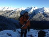
That is what I was hoping to hear. I did Cloudmaker last year solo, 1st time, too heavy (snow about) with a poor map, and a phone for GPS. I had a bad 1st day, trouble finding the pass, multiple false trails, resulting in some hard bush bashing. As a result I made extremely poor time, so am understandably wary of the area.

On the way out on that trip I rolled my ankle very badly just before Crafts Wall. Took a fall down the hill, and two more on the way back to Kanangra (~4hours from Crafts Wall) . I seriously considered the SOS button on the SPOT3. Took me up until Jan this year to start walking again. As a result I wear trail runners, and walk with poles now.

I'm less fit, but far better prepared today though :) If its as easy as you say I'll do Kanagra > Brumby > Kowmung in <4 hours.

I like the idea of a circuit, I will plan as such.

So the plan sounds like it should be;
    Walk in with water to Dance Floor Cave and camp Friday night,
    Coal Seam Cave to top up water,
    Walk to base of Bullshead via Brumby - maybe camp somewhere nice along the river,
    Walk out via Bullshead

How hard is Coal Seam Cave to find?
Which is the easier climb out in your opinion Brumby or Bullshead?

I'll be sure to post a track report on return, info is not great on this area.

Thanks again.
Flipper Hands
Atherosperma moschatum
 
Posts: 84
Joined: Sun 06 Dec, 2015 9:32 pm
Region: New South Wales
Gender: Male

Re: Kanangra - Brumby Ridge - Kowmung

Postby puredingo » Wed 13 Sep, 2017 12:36 pm

Coal seam cave is basically part of the track, it looms on your left as you drop down through a short rock line meeting the Gingra track. You literally pass within meters of the container...pretty much unmissable.

Personally I found Bullshead a more gradual but longer, more interesting ridge. Brumby steeper, shorter and not offering many views, Roots (the next ridge down stream) somewhere in the middle of the other two.

DISCLAIMER: I'm going off memory here from quite awhile ago, I'm sure there are more qualified Kanangra officiard's on here who can add more current information.
puredingo
Athrotaxis selaginoides
 
Posts: 1267
Joined: Mon 13 Feb, 2012 6:54 am
Region: New South Wales

Re: Kanangra - Brumby Ridge - Kowmung

Postby tom_brennan » Wed 13 Sep, 2017 1:04 pm

Not sure what your camping options are if you go upstream from Brumby (Orange Bluff) towards Bullhead.

If you head downstream, you can camp at Ferny Flat or Rainbow Bluff, and exit via Roots or Hughes Ridge. Bottom of Roots is nice.
http://bushwalkingnsw.com/walk.php?nid=997

There is a track down Brumby, but it's vague in some places. Keep an eye on the map and compass. Near the bottom the track may branch and spread out, since Orange Bluff is a big area. I would say it's less well tracked than Cloudmaker, but that's just me.

If you don't find Coal Seam Cave, you're in the wrong place :)
Bushwalking NSW - http://bushwalkingnsw.com
User avatar
tom_brennan
Athrotaxis selaginoides
 
Posts: 1353
Joined: Wed 29 Sep, 2010 9:21 am
Location: Sydney
Region: New South Wales
Gender: Male

Re: Kanangra - Brumby Ridge - Kowmung

Postby Flipper Hands » Wed 13 Sep, 2017 1:36 pm

tom_brennan wrote:Not sure what your camping options are if you go upstream from Brumby (Orange Bluff) towards Bullhead.


I'm hammocking - so long as I find a couple trees and a bit of a clearing I'll be right.
Flipper Hands
Atherosperma moschatum
 
Posts: 84
Joined: Sun 06 Dec, 2015 9:32 pm
Region: New South Wales
Gender: Male

Re: Kanangra - Brumby Ridge - Kowmung

Postby Flipper Hands » Wed 13 Sep, 2017 1:38 pm

tom_brennan wrote:There is a track down Brumby, but it's vague in some places. Keep an eye on the map and compass. Near the bottom the track may branch and spread out, since Orange Bluff is a big area. I would say it's less well tracked than Cloudmaker, but that's just me.


Thanks, I'll keep my eye on the map a bit more than usual then.
Flipper Hands
Atherosperma moschatum
 
Posts: 84
Joined: Sun 06 Dec, 2015 9:32 pm
Region: New South Wales
Gender: Male

Re: Kanangra - Brumby Ridge - Kowmung

Postby puredingo » Thu 14 Sep, 2017 7:57 am

Up stream from brumby there is a great little spot for camping. This is on the opposite bank (left) about 15 minutes up. Nice sandy shore and a flat, even grass bank. Also if you manage to haul it all the way up to BullHead if you cross the creek just past the track (Amaroo or something) then you'll find another good spot. Small spots but with a hammock you'll have plenty of room.
puredingo
Athrotaxis selaginoides
 
Posts: 1267
Joined: Mon 13 Feb, 2012 6:54 am
Region: New South Wales

Re: Kanangra - Brumby Ridge - Kowmung

Postby roysta » Thu 14 Sep, 2017 8:30 am

As mentioned by others it's pretty straightforward getting to the River via Brumby Ridge. With the lack of rain the water in the barrel at Coal Seam Cave will be ordinary. There's no other water from there to the river. Just carry a couple of litres for your daily needs. Orange Bluff is a fantastic, expansive area to camp. You could chill out there for days. If you feel you need to exit elsewhere, downstream to Rainbow Bluffs and an exit via Roots Ridge is simple.
Going upstream involves going through Bulga Denis canyon and you'll be in the river in places. The exit would be via Cambage Spire and Bullhead Mountain, much rockier than the other ridges. Have fun.


Sent from my iPhone using Tapatalk
User avatar
roysta
Phyllocladus aspleniifolius
 
Posts: 674
Joined: Mon 22 Dec, 2008 8:14 am
Location: New South Wales
Region: New South Wales
Gender: Male

Re: Kanangra - Brumby Ridge - Kowmung

Postby hanna » Thu 28 Sep, 2017 9:49 am

Hi,my husband and I are taking two 13 year old boys camping and we were originally thinking of going to Orange Bluff campsite (down Brumby ridge, from Kanangra Walls) - but now, we are not sure if Rooty Ridge would be better (easier to find and navigate on). Any suggestions? Thanks
hanna
Nothofagus cunninghamii
 
Posts: 7
Joined: Tue 26 Sep, 2017 10:38 pm
ASSOCIATED ORGANISATIONS: none
Region: New South Wales
Gender: Female

Re: Kanangra - Brumby Ridge - Kowmung

Postby ribuck » Thu 28 Sep, 2017 5:01 pm

Hanna, Brumby ridge is straightforward once you're on it. You just have to get it correct at the top, where there is a spot or two with more complex contours (i.e. the line of the ridge is not always jump-out-into-your-face-obvious). With a GPS it's trivial. With paper maps it's straightforward, provided you are paying close attention at the top. If you're aiming for Orange Bluff, then Brumby ridge is a good choice.
User avatar
ribuck
Athrotaxis selaginoides
 
Posts: 1887
Joined: Wed 15 May, 2013 3:47 am
Region: Other Country
Gender: Male

Re: Kanangra - Brumby Ridge - Kowmung

Postby hanna » Thu 28 Sep, 2017 6:14 pm

Thanks for your quick reply. Only problem is, that I couldn't find a GPX download for that walk (down Brumby to Orange Bluff campsite), but have been able to download the Rooty Ridge track (which is also outlined on the paper map). So I'm inclined to go down the Rooty Ridge. Some people have said that the Rooty Ridge track is also hard to find, as it is overgrown with saplings (which by now would be quite a forest). People mentioned that it is a 50m bush bash to find the footpad down Rooty. Is that true? I've also found information that there is a tree marking at the start of Rooty ridge, but that it's hard to find as well. Are there any other signs to look out for? Is Rooty ridge easier to find/ navigate on, or Brumby? Basically, I think that will help me decide which track to choose.
hanna
Nothofagus cunninghamii
 
Posts: 7
Joined: Tue 26 Sep, 2017 10:38 pm
ASSOCIATED ORGANISATIONS: none
Region: New South Wales
Gender: Female

Re: Kanangra - Brumby Ridge - Kowmung

Postby Flipper Hands » Thu 28 Sep, 2017 6:37 pm

Hi Hanna,
Here is the GPX track I used.

You will have no problem getting down with this. The track is indistinct at times, but there are no significant hurdles to cross.

https://www.beyondtracks.com/walks/kanangra-boyd-national-park/brumby-ridge/

Have a look in the trip reports section for more info on the walk I did 2 weeks back.
Flipper Hands
Atherosperma moschatum
 
Posts: 84
Joined: Sun 06 Dec, 2015 9:32 pm
Region: New South Wales
Gender: Male

Re: Kanangra - Brumby Ridge - Kowmung

Postby rcaffin » Sat 30 Sep, 2017 7:44 pm

Only problem is, that I couldn't find a GPX download for that walk (down Brumby to Orange Bluff campsite)
You know, once upon a time, bushwalkers relied on a map and a compass. And got up and down these spurs with no trouble at all.

Cheers
Roger
User avatar
rcaffin
Athrotaxis selaginoides
 
Posts: 1225
Joined: Thu 17 Jul, 2008 3:46 pm

Re: Kanangra - Brumby Ridge - Kowmung

Postby johnk1 » Mon 02 Oct, 2017 7:52 am

Well said Roger - and still do.
johnk1
Athrotaxis cupressoides
 
Posts: 104
Joined: Sat 30 May, 2015 9:11 am
Region: New South Wales
Gender: Male

Re: Kanangra - Brumby Ridge - Kowmung

Postby hanna » Mon 02 Oct, 2017 4:47 pm

Thanks for all your help. It was very useful to have all that information. The track / footpad was fairly clear and the ridge tops are not dense with vegetation, so no bush bashing was required. Gingra track up to first top mountain is very straight forward. The turn off down Brumby ridge is faint, but there's a campfire site just about 20m from the junction, so you know you're on the right track when you pass that. We mostly used the map and compass, but there were a couple of tricky points where double checking our GPS location on the GPX file track was well worth it. Sure, we would've eventually found out we went the wrong way, but with two 13 year old boys and one who had never hiked before, it was great that we didn't have to put them through that ordeal. Getting down and back up Brumby ridge was hard enough! It sure is steep going down off Brumby Mt. Having walking sticks helps. We thought we were nearly at the river after the second drop and wanted to start veering off to the east which would've been a mistake. Actually, there are 4 "steps" (steep downhill followed by a short plateau) as we went down from Brumby Mt to the river and for most of the way, a steep drop off was to our right. The campsite was as amazing as everyone said.The wombats made a home down there! The bluff changed colour as the sun went down. I couldn't believe that there was a frying pan and a metal mesh for cooking down there! We filled up water, 2Lt per person, before climbing back up the next day. It was hard carrying that much water on that steep ridge, but well worth it. The container of water at Coal seam cave is a little less than half full and I didn't want to rely on that. Going back up Brumby ridge was easier (on the knees) than going down. We had only one tricky point on our return trip, after Brumby Mountain, the ridge flattens out and the track disappears. We nearly ended up descending into a gully to the NW of the track, as the actual ridge veered off to the right (Nth). Again, eventually you would realise it was wrong to continue going NW, as it descended into a steep gully. But the GPS saved us those few extra hundred or so metres - well worth it!
hanna
Nothofagus cunninghamii
 
Posts: 7
Joined: Tue 26 Sep, 2017 10:38 pm
ASSOCIATED ORGANISATIONS: none
Region: New South Wales
Gender: Female

Re: Kanangra - Brumby Ridge - Kowmung

Postby ribuck » Mon 02 Oct, 2017 6:50 pm

rcaffin wrote:You know, once upon a time, bushwalkers relied on a map and a compass. And got up and down these spurs with no trouble at all.

You know, once upon a time, aborigines relied on nothing but their knowledge of the land. And got up and down these spurs with no trouble at all. But I won't criticize anyone who uses a compass. Technology is there to improve our lives.

And Hanna, thanks for your update. It's always great to hear how things turned out.
User avatar
ribuck
Athrotaxis selaginoides
 
Posts: 1887
Joined: Wed 15 May, 2013 3:47 am
Region: Other Country
Gender: Male

Re: Kanangra - Brumby Ridge - Kowmung

Postby puredingo » Mon 02 Oct, 2017 9:14 pm

Well do you know that, many moons ago, before Aboriginal people there were animals who relied on nothing but an inborn instict. But they got up and down these Spurs with no trouble at all.
puredingo
Athrotaxis selaginoides
 
Posts: 1267
Joined: Mon 13 Feb, 2012 6:54 am
Region: New South Wales


Return to New South Wales & ACT

Who is online

Users browsing this forum: No registered users and 1 guest