Hi All
Thanks for all your info, post event.
I just spent hours looking for the eastern lead, admittedly underprepared with no GPS, a 1 to 250K map and a sense of adventure.
Easily found the Knights road entrance, despite huge logging operations in the whole area.
They're really going for it while they still can, what a shame.
I, for one, don't believe the bridge was washed away. It looks very much like a bucket scraped off the top and piled it back, then placed rocks in front of it...
Now why would Forestry do that?
Anyway, could I please have a GPS route screenshot or similar? And perhaps the grid ref for the eastern start. The Able guide wasn't useful, and I tried over and over again in the area over the bridge and up (and left and right) just after the little motocross park.
This area had also been VERY recently heavily logged.
Grateful for any tips (other than use a 1 to 25k!) as I now have a bee in the able bonnet.
At the minimum, I'll cross that bridge on the KLR650.
Mount Maurice
Forum rules
Tasmania specific bushwalking discussion. Please avoid publishing details of access to sensitive areas with no tracks.
Tasmania specific bushwalking discussion. Please avoid publishing details of access to sensitive areas with no tracks.
43 posts
• Page 2 of 2 • 1, 2
Re: Mount Maurice
![]() by Niftynomad » Wed 20 Sep, 2017 10:27 pm
by Niftynomad » Wed 20 Sep, 2017 10:27 pm
- Niftynomad
- Athrotaxis cupressoides

- Posts: 304
- Joined: Tue 09 Sep, 2008 9:59 pm
- Location: SW W.A.
- Region: Tasmania
- Gender: Male
Re: Mount Maurice
![]() by L_Cham_67 » Tue 20 Feb, 2018 11:35 pm
by L_Cham_67 » Tue 20 Feb, 2018 11:35 pm
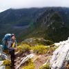
I did Mt Maurice yesterday via the western, Knights road route. 5.8km of road walking was not that great  but the forest, granite outcrops, and surprisingly good views from the summit made it worth it!
Yeah that bridge is still impassable...a high clearance car might manage it... maybe. Then it's a matter of whether the dilapidated bridge could hold the weight of it! Abels description was pretty good, we did overshoot the turnoff by a couple of hundred metres, but my car odometer could be wrong (or my maths is!)
Yeah that bridge is still impassable...a high clearance car might manage it... maybe. Then it's a matter of whether the dilapidated bridge could hold the weight of it! Abels description was pretty good, we did overshoot the turnoff by a couple of hundred metres, but my car odometer could be wrong (or my maths is!)
-

L_Cham_67 - Athrotaxis selaginoides

- Posts: 1045
- Joined: Thu 17 Dec, 2015 6:43 pm
- Region: Tasmania
- Gender: Male
Re: Mount Maurice
![]() by Azza » Wed 21 Feb, 2018 7:57 am
by Azza » Wed 21 Feb, 2018 7:57 am
Niftynomad wrote:Hi All
Anyway, could I please have a GPS route screenshot or similar? And perhaps the grid ref for the eastern start. The Able guide wasn't useful, and I tried over and over again in the area over the bridge and up (and left and right) just after the little motocross park.
This area had also been VERY recently heavily logged.
Grateful for any tips (other than use a 1 to 25k!) as I now have a bee in the able bonnet.
At the minimum, I'll cross that bridge on the KLR650.
Have you had a look on the list?
Both the eastern and western approaches are shown and are also available on the Tracks, Ferry Routes layer.
You can export the data in a variety of formats such as SHP, which you can then convert using online tools to a GPX file.
I've just attached the Mt Maurice track pulled from the list as a GPX file.
use at your own risk, its just what data is publicly available.
I've done it from the east many years ago before the bridge was an issue.
 Tracks_FerryRoutes.gpx
- (50.57 KiB) Downloaded 702 times
-

Azza - Phyllocladus aspleniifolius

- Posts: 980
- Joined: Thu 06 Mar, 2008 11:26 am
Re: Mount Maurice
![]() by L_Cham_67 » Wed 21 Feb, 2018 9:33 am
by L_Cham_67 » Wed 21 Feb, 2018 9:33 am
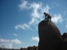
A couple of pics of the bridge
- Attachments
-
-
-
L_Cham_67 - Athrotaxis selaginoides
- Posts: 1045
- Joined: Thu 17 Dec, 2015 6:43 pm
- Region: Tasmania
- Gender: Male
Re: Mount Maurice
![]() by Azza » Wed 21 Feb, 2018 10:12 am
by Azza » Wed 21 Feb, 2018 10:12 am
Azza wrote:I've done it from the east many years ago before the bridge was an issue.
Whoops.. I meant the west...
-
Azza - Phyllocladus aspleniifolius
- Posts: 980
- Joined: Thu 06 Mar, 2008 11:26 am
Re: Mount Maurice
![]() by Last » Fri 23 Feb, 2018 10:34 pm
by Last » Fri 23 Feb, 2018 10:34 pm
We went up Mt Maurice in early Feb. It is possible to drive over the bridge in a 4wd. They are possibly my tyre tracks visible in L_Cham's pics above. With a little work a SUV should be able to make it. This saves a 6.5 walk up the road. The road is also rapidly deteriorating. We drove up in a car 4 years ago and the road was much better. It's a matter of time before either the road or bridge are impassable.
noen ganger er det godt å være alene i villmarken
- Last
- Lagarostrobos franklinii

- Posts: 2166
- Joined: Thu 23 Jun, 2016 3:43 pm
- Region: Tasmania
Re: Mount Maurice
![]() by LeftRightShoot » Sat 20 Oct, 2018 8:00 pm
by LeftRightShoot » Sat 20 Oct, 2018 8:00 pm
Hey all, Thanks for this info. I might bike up from the bridge.
- LeftRightShoot
- Athrotaxis cupressoides
- Posts: 154
- Joined: Sat 29 May, 2010 5:49 pm
- Region: Tasmania
- Gender: Male
Re: Mount Maurice
![]() by weetbix456 » Sun 04 Aug, 2019 12:42 pm
by weetbix456 » Sun 04 Aug, 2019 12:42 pm
Bridge over St Pat’s was ok in my old RAV4. Although it is a tad spooky! Currently a decent sized tree over the road about 2.5k from bridge adding about a 30 min walk to the trail head. Lovely spot!
-
weetbix456 - Athrotaxis selaginoides
- Posts: 1057
- Joined: Mon 04 May, 2009 6:01 pm
- Location: Launceston
- ASSOCIATED ORGANISATIONS: TWGA, TCIA, CragCare
- Region: Tasmania
- Gender: Male
Re: Mount Maurice
![]() by bogholesbuckethats » Wed 23 Oct, 2019 2:09 pm
by bogholesbuckethats » Wed 23 Oct, 2019 2:09 pm
Has anyone been up the eastern access track (off Maurice Road) lately? If so was it overgrown and difficult to follow?
Cheers
Cheers
That looks like a pad.
-

bogholesbuckethats - Phyllocladus aspleniifolius
- Posts: 583
- Joined: Mon 02 Oct, 2017 12:06 pm
- Location: Hobart
- Region: Tasmania
- Gender: Male
Re: Mount Maurice
![]() by headwerkn » Sun 15 Dec, 2019 2:23 pm
by headwerkn » Sun 15 Dec, 2019 2:23 pm
Went up the western (Knights Rd) access yesterday with a mate. Appears the ailing bridge over the St Pats River has seen some love in recent months, with the gaps in the logs filled in a bit with stone and gravel... no issue getting over in the Pajero, honestly anything with more clearance than a Lambo would be fine My partner went up there a few months earlier when the bridge was in worse wear and just made it over with her Mazda CX5.
Track itself is still in reasonable nick, other than a few trees over the pad in spots. Plenty of markers and tape still.
Track itself is still in reasonable nick, other than a few trees over the pad in spots. Plenty of markers and tape still.
-

headwerkn - Phyllocladus aspleniifolius
- Posts: 630
- Joined: Sat 09 Nov, 2013 3:50 pm
- Region: Tasmania
- Gender: Male
Re: Mount Maurice
![]() by bluewombat » Thu 26 Nov, 2020 6:51 am
by bluewombat » Thu 26 Nov, 2020 6:51 am
I was here yesterday, the bridge is in much the same condition, passable in my AWD. I have been looking forwards to walking up Mt Maurice for a while, and the walk itself is lovely. Unfortunately much of pleasure was taken out of it as there was evidence of motorbikes and/or fat tyre mountain bikes having been ridden up the track virtually to the summit relatively recently. 
Not surprisingly there is some damage to the track in several places, moss stripped off rocky areas, muddy sections dug out etc. Very sad.
BW
Not surprisingly there is some damage to the track in several places, moss stripped off rocky areas, muddy sections dug out etc. Very sad.
BW
Even a long life is short
HPB
HPB
-

bluewombat - Athrotaxis cupressoides
- Posts: 327
- Joined: Sun 10 Feb, 2008 3:55 pm
- Region: Tasmania
Re: Mount Maurice
![]() by currawong » Sat 10 Apr, 2021 7:42 am
by currawong » Sat 10 Apr, 2021 7:42 am
I went up Mt Maurice from the East approach on 7 April 21. The track was well marked but a bit scrubby. We drove to the start via the Maurice Rd from Ringarooma, this track is only suitable for full high clearance 4WDs. It gets easier the further you head west after the trailhead, so regular cars would get pretty close to the start if they come in from the west.
I walked a little way along the west track down from the summit and this is clearly the preferred route.
I walked a little way along the west track down from the summit and this is clearly the preferred route.
- currawong
- Nothofagus cunninghamii

- Posts: 6
- Joined: Tue 08 Jan, 2013 9:26 am
- Region: Tasmania
- Gender: Male
Re: Mount Maurice
![]() by Mowser » Sun 06 Jun, 2021 2:32 pm
by Mowser » Sun 06 Jun, 2021 2:32 pm
4th June 21 - We went up Maurice from Maurice Road. Drove in via Targa, Diddleum and Maurice Road. Road in great condition until about 1.5km before track starts. At that point it got very rocky and rutted out so we just walked the road for that part. If you can get past that short rocky seciton (which will be doable in a 4WD), then the road's in pretty good nick right through to the track. Great walk and beautiful clear winters day up there.
-
Mowser - Atherosperma moschatum

- Posts: 68
- Joined: Tue 15 May, 2007 9:38 pm
- Location: Launceston
- Region: Tasmania
43 posts
• Page 2 of 2 • 1, 2
Who is online
Users browsing this forum: No registered users and 34 guests