Morning.
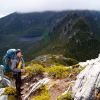
Looking for a little info. Heading into Ragoona on the long weekend with a plan to camp on the shores of Mrytle, weather pending.
Done a little research about Jacksons Creek Track and it would seem to me that its dropped off all maps. Ive tried contacting parks... no luck but will keep trying...I seem to recall its use was being discouraged...
Question is, has anyone used it lately, love to know if its still marked and usable/not overgrown... or if we are not to use it...
Look forward to your feedback...
Haydyn
Jacksons Creek Track
Forum rules
Tasmania specific bushwalking discussion. Please avoid publishing details of access to sensitive areas with no tracks.
Tasmania specific bushwalking discussion. Please avoid publishing details of access to sensitive areas with no tracks.
11 posts
• Page 1 of 1
Jacksons Creek Track
![]() by Haydynb » Tue 30 Oct, 2018 9:27 am
by Haydynb » Tue 30 Oct, 2018 9:27 am
- Haydynb
- Atherosperma moschatum

- Posts: 93
- Joined: Wed 17 Nov, 2010 12:09 pm
- Region: Tasmania
- Gender: Male
Re: Jacksons Creek Track
![]() by north-north-west » Tue 30 Oct, 2018 10:17 am
by north-north-west » Tue 30 Oct, 2018 10:17 am
*Rogoona
The logbook is still in place at the spot where the Jacksons and Moses Creeks tracks diverge, and there's a warning that Jacksons is unmarked, unmaintained, rarely used and poorly defined, although the "unmarked" bit depends on whether anyone has taken some tape through recently. If you have a GPS with the OSM maps on it, the line on that for Jacksons is pretty accurate. Otherwise, just cross your fingers and hope for the best.
It would be easier to follow uphill, so maybe go in that way.
"Mit der Dummheit kämpfen Götter selbst vergebens."
-

north-north-west - Lagarostrobos franklinii

- Posts: 15114
- Joined: Thu 14 May, 2009 7:36 pm
- Location: The Asylum
- ASSOCIATED ORGANISATIONS: Social Misfits Anonymous
- Region: Tasmania
Re: Jacksons Creek Track
![]() by Son of a Beach » Tue 30 Oct, 2018 10:25 am
by Son of a Beach » Tue 30 Oct, 2018 10:25 am
It's been closed for many years now, but can still be easily followed for most (but not all!) of its length.
However, its gets difficult to follow for the last few km, so I would not advise using the track if you are not confident with off-track navigation.
One of the best descriptions of the track can be found in this topic: viewtopic.php?f=3&t=158 (including a good description of how to find the start of the track where it branches off the Moses Creek Track).
- Son of a Beach
- Lagarostrobos franklinii
- Posts: 7023
- Joined: Thu 01 Mar, 2007 7:55 am
- ASSOCIATED ORGANISATIONS: Bit Map (NIXANZ)
- Region: Tasmania
- Gender: Male
Re: Jacksons Creek Track
![]() by Haydynb » Wed 31 Oct, 2018 4:43 pm
by Haydynb » Wed 31 Oct, 2018 4:43 pm
Hey guys.. Thx for your feedback and responses.
I had a call from the Deloraine PWS office today after Id left a message Monday.
Tony from PWS indicated that the Jackson Creek track was usable and had infact had work recently done on it over the past 12 months.
So we are gunna give it a crack on Sunday... let you all know how it goes.
HB
I had a call from the Deloraine PWS office today after Id left a message Monday.
Tony from PWS indicated that the Jackson Creek track was usable and had infact had work recently done on it over the past 12 months.
So we are gunna give it a crack on Sunday... let you all know how it goes.
HB
- Haydynb
- Atherosperma moschatum
- Posts: 93
- Joined: Wed 17 Nov, 2010 12:09 pm
- Region: Tasmania
- Gender: Male
Re: Jacksons Creek Track
![]() by Haydynb » Mon 05 Nov, 2018 7:59 pm
by Haydynb » Mon 05 Nov, 2018 7:59 pm
Hey guys.. just an update on the JC track. Walked in and out over the past two days. Track is right at the rego booth..and clearly visible but not sign posted. Tis a note on the front of the log in book that say JC left..MC right. Some excellent steps in place as part of the first climb..towards the back end of it and is pretty easy to follow to Mrytle ..little tricky towards the back end though if ya miss a tag.Like any track I guess. Track is in good Nick...easy for experienced walkers... I had GPS with marked track..as did others in our group... I'm not sure its any easier than Myrtle Creek Track.. but it is shorter. I used Locus map.. and Android app with the Tas map.. really good!
- Haydynb
- Atherosperma moschatum
- Posts: 93
- Joined: Wed 17 Nov, 2010 12:09 pm
- Region: Tasmania
- Gender: Male
Re: Jacksons Creek Track
![]() by north-north-west » Tue 06 Nov, 2018 8:35 am
by north-north-west » Tue 06 Nov, 2018 8:35 am
Great. I might go in that way next time.
"Mit der Dummheit kämpfen Götter selbst vergebens."
-
north-north-west - Lagarostrobos franklinii
- Posts: 15114
- Joined: Thu 14 May, 2009 7:36 pm
- Location: The Asylum
- ASSOCIATED ORGANISATIONS: Social Misfits Anonymous
- Region: Tasmania
Re: Jacksons Creek Track
![]() by Haydynb » Tue 06 Nov, 2018 10:54 am
by Haydynb » Tue 06 Nov, 2018 10:54 am
I suspect it's slightly quicker...bit Blizzard Plain is quite pretty...
- Haydynb
- Atherosperma moschatum
- Posts: 93
- Joined: Wed 17 Nov, 2010 12:09 pm
- Region: Tasmania
- Gender: Male
Re: Jacksons Creek Track
![]() by north-north-west » Tue 06 Nov, 2018 11:15 am
by north-north-west » Tue 06 Nov, 2018 11:15 am
Haydynb wrote:I suspect it's slightly quicker...bit Blizzard Plain is quite pretty...
Makes for a good loop. circuits are always better.
"Mit der Dummheit kämpfen Götter selbst vergebens."
-
north-north-west - Lagarostrobos franklinii
- Posts: 15114
- Joined: Thu 14 May, 2009 7:36 pm
- Location: The Asylum
- ASSOCIATED ORGANISATIONS: Social Misfits Anonymous
- Region: Tasmania
- Haydynb
- Atherosperma moschatum
- Posts: 93
- Joined: Wed 17 Nov, 2010 12:09 pm
- Region: Tasmania
- Gender: Male
Re: Jacksons Creek Track
![]() by Mowser » Fri 09 Nov, 2018 4:58 pm
by Mowser » Fri 09 Nov, 2018 4:58 pm
I solo walked in on the Jacksons Creek Track one evening last February to meet some mates at Lake Myrtle. Track was very easy to follow and took a bit under 2 hours to the lake. Nice walk and good way to get in to Myrtle.
-
Mowser - Atherosperma moschatum
- Posts: 68
- Joined: Tue 15 May, 2007 9:38 pm
- Location: Launceston
- Region: Tasmania
Jacksons Creek Track Update
![]() by Peregrine » Sat 01 Feb, 2020 7:30 am
by Peregrine » Sat 01 Feb, 2020 7:30 am
Walked in and out of this track in the last few days to access Lake Myrtle and the Rogoona summit circuit. The track is in quite good condition, a few tree falls but clearly marked and easy to follow. The two steep sections till the plateau is reached are mostly through burnt forest. On the plateau Rogoona comes into view and it is a straightforward walk to Lake Mrytle crossing the creek just before the campsite. Allow over 2 hours in and just under 2 hours out. The turnoff is still clear but unmarked at the registration booth 1km in the Moses Creek Track just after the suspension bridge.
- Peregrine
- Nothofagus cunninghamii

- Posts: 1
- Joined: Tue 02 Apr, 2019 1:45 pm
- Region: Tasmania
- Gender: Male
11 posts
• Page 1 of 1
Who is online
Users browsing this forum: No registered users and 2 guests