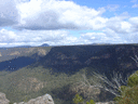
The ones in red are based on Sloss, the ones in black/blue are off OpenStreetMap. Sloss has the Chasm Lookout a ridge (or two) away from where people have put it on OSM. Obviously none of these are official names, but I assume that clubs (Southern Highlands Bushwalkers?) that walk in the area would have the most knowledge of the generally accepted names. Anyone know anything?
[You might need to click on the map - it's a bit fuzzy at the re-scaled resolution.]