Page 1 of 1

Mt Murchison

PostPosted: Fri 06 Feb, 2009 10:47 pm
by eggs
It was time to get back to Tassie again. So we had almost a month on the island from Christmas day.
Had to stack in a lot, but for now I thought I would share a short day trip up Mt Murchison.

1072LowerLake.jpg
The lower lake


1082GettingThere.jpg
Track up - the plants were lush


1086TopAppears.jpg
the top is ahead

Re: Mt Murchison

PostPosted: Fri 06 Feb, 2009 10:53 pm
by eggs
1089LakeBelowQueens.jpg
Hanging Lake below Queen's Head


1097SteepSlab.jpg
Final part is a steep rock slope


1107ViewNorth.jpg
View to the North over Tullah and Mt Farrell

Re: Mt Murchison

PostPosted: Fri 06 Feb, 2009 11:04 pm
by eggs
1109Frenchman.jpg
Remnant New Year's snow on a distant Frenchman's Cap


1110BasinZoom.jpg
2 lakes in the main basin


1120MurchoRidgeWest.jpg
Ridge line heading west

Re: Mt Murchison

PostPosted: Fri 06 Feb, 2009 11:18 pm
by eggs
1121FrozenWalker.jpg
Met another hiker who was a bit chilly


1133Rolleston.jpg
Looking past Hydro Lake Plimsol to glacial Lake Rolleston and the Tyndall range


1138EldonBluffBoys.jpg
There were great views across to all the peaks in Cradle Mt National Park, and this is over the Whitecliff Hills to Eldon Bluff as we are descending

Re: Mt Murchison

PostPosted: Sat 07 Feb, 2009 8:15 am
by Son of a Beach
Thanks eggs... fantastic pictures of an often overlooked mountain. I'll have to add that to my own mental to-do list.

Re: Mt Murchison

PostPosted: Sat 07 Feb, 2009 11:15 am
by walkinTas
Heh Eggs, those pictures just moved Mt Murchison a long way up the to-do list. I was looking on the maps and GE a couple of weeks ago wondering what might be a good approach. Did you go up the track off the Anthony Road?

Re: Mt Murchison

PostPosted: Sat 07 Feb, 2009 12:05 pm
by eggs
Yes, the new track up from the Anthony Road is very good and does not take very long.
This is a very quiet track so far - so there is little wear and tear. Some forest with roots to be careful on, followed by good rock with a few smaller cliffy bits, but nothing extreme.

Prior to the new road going in, people used to hike a long way to get up. I believe they would go from Rosebury along the power lines and then along the full length of the ridgeline.
We were a bit rushed getting up and down, as we had spent the morning exploring the cliffs and coastline north of Trial Harbour.
I would love to have worked back along the western ridge line to get better views of the 4 lakes that step down the "basin" gully and also to get far enough over to see the 2 other lakes at the western end of the mountain.
And the lighting would have been better in the morning rather than mid afternoon.

Another day perhaps...
But a top climb.

Brian

Re: Mt Murchison

PostPosted: Sun 08 Feb, 2009 12:04 am
by GerryDuke
Thanks also Brian.

I drove past the start of the track Christmas Day and had the thought also - I must do that one day. Also moved up the priority list!!

Gerry

Re: Mt Murchison

PostPosted: Sun 08 Feb, 2009 8:57 pm
by Nick S
Yeah I've been meaning to get up there sometime. Such great views for a day walk as well! Thats Tassie for ya.

Re: Mt Murchison

PostPosted: Mon 09 Feb, 2009 9:30 pm
by wello
Eggs,

Great shots. Thanks for showing me what it looks like up there. I climbed Murchison on November and beyond that ridge above the lower lake, all I saw was the inside of a cloud and a fair bit of driving snow.

You've certainly had some good luck with west coast weather (and you certainly take full advantage with fantastic camera work). I headed to the Tyndall Range after viewing your photos on this site in December. A beautiful place, but I ended up walking out inside the clouds again!

Wello

Re: Mt Murchison

PostPosted: Mon 09 Feb, 2009 11:01 pm
by eggs
wello,

Thanks for your kind words, and commiserations on your weather.
I presume, like me, you have to carefully plan holiday trips to Tassie well in advance.

I guess that kind of misty wet weather is pretty typical of the west coast. So yes - I was pretty happy with the weather we had.
My general method is to plan a trip which is full on - and then when we actually get there and are coming to grip with the weather reports, we end up cutting out/rearranging about half of it.
As a result, during our 3.5 weeks over in Tas, we did an awful lot of driving.
Noting the weather report we went straight to the Western Arthurs (see Dec photo comp) and after a few good days we ended up coming out through raging wind and rain.
So knowing it was going to bad for a while, we then escaped to the east coast and climbed Mt Amos.
Later, we slotted Mt Murchison in because there was a good weather report. So we drove over from Hobart the day before, explored Trial Harbour and Murcho and the 3rd day we drove back to Hobart so one of the party [who had been injured in Hobart :roll: ] could fly home.
Then the very next day was my worst choice, badly misreading the weather report - as we went up Schnell's Ridge in cloudy conditions and when up there, it turned into a really strong wind with driving rain and we ended up having trouble finding our way down in very poor visibility.
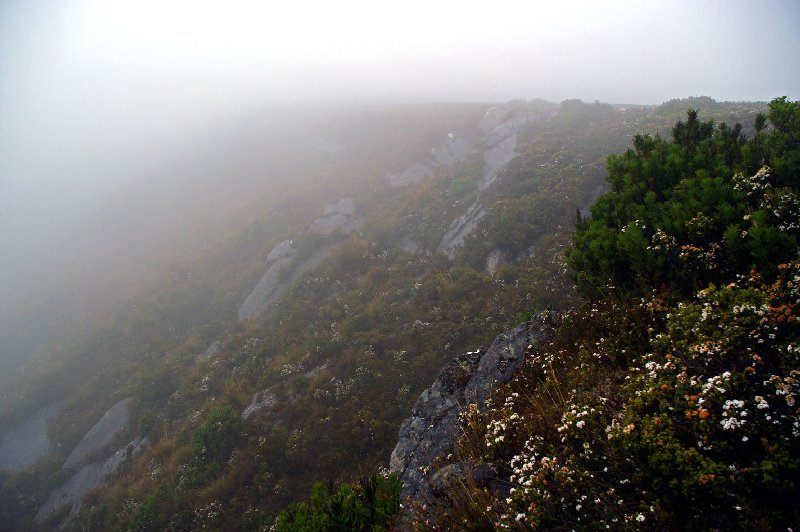
1173MoreMistAheadSm.jpg
Halfway up Schnells and heading into worse


But I consider that was very poor planning and execution on my part.
As for the West Coast - I am very fond of it, having spent 2 months working over there during uni vacation 29 years ago.
For all the West Coast places I walked to back then [Mts Owen, Dundas, Zeehan, Geikie and below Agnew], this was my first successful attempt at Mt Murchison - so it has been a long time coming.

Brian

Re: Mt Murchison

PostPosted: Tue 10 Feb, 2009 7:29 am
by Mickeymoo
Great shots eggs, looks like you got some great weather and some great photos of a stunning area.

Re: Mt Murchison

PostPosted: Wed 11 Feb, 2009 10:17 am
by kanangra
I love the shot looking towards Frenchmans. Great work.

Re: Mt Murchison

PostPosted: Sun 15 Feb, 2009 11:51 am
by Steve
Nice shots eggs! LoL at the hiker you met. :lol:

Last time I went up it was overcast which ruined the view of the distant mountain (could still see a bit though), the walk was still great.. wasn't expecting those cliffs haha. :wink:

Re: Mt Murchison

PostPosted: Sat 21 Feb, 2009 11:51 pm
by Speculator
Heya thanks for these photos!

This one has been a walk the BWT strollers have talked about doing for a while now but not made it to yet. By the looks of it we should probably get cracking. The views look fantastic!

L8r.

Re: Mt Murchison

PostPosted: Sun 22 Feb, 2009 8:59 pm
by cvn76hk
These are truly and absolutely stunning shots, thank you for taking my breath away :D

I wish I can visit Tassie one day, maybe just for the sake of such beautiful scenery (and hopefully the weather cooperates)

Re: Mt Murchison

PostPosted: Wed 01 Apr, 2009 2:59 pm
by waratah
Oh My!! My most favourite mountain has just taken on a new light! Thank you so much. :wink:

Re: Mt Murchison

PostPosted: Wed 01 Apr, 2009 9:32 pm
by eggs
I put one of the following photos in the monthly comp, but I will add it here for completeness + 2 more showing some more top views towards the Overland Track area.

1099BasinPanLesser.jpg
Panorama over the lakes basin

1126HangingLakeLess.jpg
View over the east side hanging lake

1108ToptoOT&EldonsLess.jpg
Remnant snow with view to Ossa, Ducaine & Eldons with Hydro Lake Murchison below


Good luck for those trying to ascend this weekend - though I suspect the weather will not be this good.

eggs