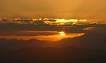
We started at McFarlane Saddle and set off south along McFarlane Track to the head of the Moroka River, dropping packs for a side trip to Mt Wellington – all well-defined tracks. Back to the packs and lunch then headed (briefly off-track) to Spion Kopje. An intermittent track, it’s pretty easy to follow the ridge line and great views are afforded if the weather is co-operative.
- from Mt Wellington, looking to Spion Kopje - Jan 2014
After descending from Spion Kopje and meeting the McFarlane Tk we turned east and walked 600m (past Riggalls old hut site and the turnoff back to McFarlane Saddle) to a new campsite with pit toilet and water tank – many open and sheltered campsites widely dispersed (and a better alternative to Millers Hut, IMO).
The next day was a little challenging.
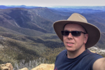
- looking into the Avon Wilderness from Gable End - Jan 2014
Starting with an easy stroll to Millers Hut (plenty of water flowing in Nigothoruk Creek – surprising, considering how dry it’s been) and then a climb to the Gable End turnoff, this was all on 4WD track. Again we dropped packs and followed a vehicle track to the trig point on the cliffline overlooking the Avon Wilderness – more inspiring views.
Back to the packs and then out to the Sentinels, overlooking Lake Tali Karng, for lunch – feeling like we were on top of the world.
Where’s the challenging bit, I hear you ask.
- 1st Glimpse - Lake Tali Karng from The Sentinels - Jan 2014
We headed over the top and down the NW spur directly to the lake. Initially we dropped down a gully heading N – very steep with many rock scrambles and dead branches to negotiate. One section required an awkward sidle on a narrow sloping ledge around a rock and a crevice– potentially dangerous and needs great care. Many of the party elected to pass their pack across the gap.
Finally below the bluffs, we could contour around (through fallen trees and very thick regrowth of Daviesia – this whole area was severely burned in the 2007 fire season) to regain the ridgeline.
We had thought there might be a track on the spur but it’s long gone – we instead faced the 600m descent on highly heat-fractured rock, through thick 2+m high regrowth all the way to the bottom.
The pace had been much slower that anticipated and it was a very thirsty group that arrived at Tali Karng’s (nominal) outlet – just short of a 12 hour day ! Lake level is currently low enough to walk along the bank to Snowden Falls but no-one was keen – after a swim and a meal, bed was all we wanted.
Day 3 was a very straight-forward tramp up Gillio’s Track (yes it’s steep-ish at the bottom but well-defined and zig-zagged to ease the gradient) then along McFarlane’s Tk and back to the cars.