The most common way to get to jagungal seems to be via Guthega Power Station, Schlink Pass, and from there diverse routes to the Hilton, Valentines, Gungartan, Mawsons and points north. I'm looking for other ways. One that is now firmly closed for skiing is Bradneys Gap, Everards Flat, Pretty Plain and Grey Mare. The narrow fire track is now scrubbed.
Two ways may be viable. From Kiandra follow the AAWT to Mackays or Cesjacks. A variation is to start at Mount Selwyn, perhaps with a ski lift to the top. This would be two slightly long days to Mackays or Cesjacks. The scrub down to Happys Hut may be problematic.
Another option is on the track that leads to near Cesjacks. This has far less skiing but needs a 4WD; there are river crossings. The gate is at about 1700 metres and it's quite possible that wheeled progress would halt at about 1600 metres. This is 3-4 kilometres from Cesjacks, an hour or two of skiing.
Comments about the above and any other ways are sought.
Jagungal access in winter
Forum rules
NSW & ACT specific bushwalking discussion. Please avoid publishing details of access to sensitive areas with no tracks.
NSW & ACT specific bushwalking discussion. Please avoid publishing details of access to sensitive areas with no tracks.
36 posts
• Page 1 of 2 • 1, 2
Jagungal access in winter
![]() by Lophophaps » Mon 14 Aug, 2017 1:45 pm
by Lophophaps » Mon 14 Aug, 2017 1:45 pm
-

Lophophaps - Auctorita modica

- Posts: 3383
- Joined: Wed 09 Nov, 2011 9:45 am
- Region: Victoria
- Gender: Male
Re: Jagungal access in winter
![]() by peregrinator » Mon 14 Aug, 2017 2:53 pm
by peregrinator » Mon 14 Aug, 2017 2:53 pm
The only access route I have experienced is your second one. I've commented on that previously here. In 2016 and 2017, I decided it was not safe to drive my 2WD further than the western-most bit of Nimmo Road, where it begins to descend to Gungarlin River. That's about four hours walk to Cesjacks Hut. Note both my trips were in summer so those creek crossings you're referring to were not a consideration. I just felt that rough bit of track down to the Gungarlin (and more pertinently, back up again) was probably going to be too difficult with low clearance.
- peregrinator
- Athrotaxis selaginoides

- Posts: 1784
- Joined: Fri 15 Apr, 2011 2:50 pm
- Region: Victoria
Re: Jagungal access in winter
![]() by kanangra » Mon 14 Aug, 2017 5:07 pm
by kanangra » Mon 14 Aug, 2017 5:07 pm
You've also got access from the north via Round Mt. Personally I think Nimmo and Snowy Plain leaves all the other access routes in the shade. It's a gentle 40 mins walk into Cessjacks! Can't beat it.
K.
K.
- kanangra
- Athrotaxis selaginoides
- Posts: 1340
- Joined: Sun 25 May, 2008 3:52 pm
Re: Jagungal access in winter
![]() by north-north-west » Mon 14 Aug, 2017 6:42 pm
by north-north-west » Mon 14 Aug, 2017 6:42 pm
kanangra wrote:You've also got access from the north via Round Mt.
That can be dodgy in winter. The usual road is closed, so you have to take the longer and less direct option, and even that can sometimes be blocked by heavy snow.
"Mit der Dummheit kämpfen Götter selbst vergebens."
-

north-north-west - Lagarostrobos franklinii

- Posts: 15175
- Joined: Thu 14 May, 2009 7:36 pm
- Location: The Asylum
- ASSOCIATED ORGANISATIONS: Social Misfits Anonymous
- Region: Tasmania
Re: Jagungal access in winter
![]() by Lophophaps » Mon 14 Aug, 2017 9:51 pm
by Lophophaps » Mon 14 Aug, 2017 9:51 pm
Thanks for the advice. Cesjacks via Nimmo seems best, 4WD vehicle or not. Four hours to Cesjacks Hut is about the same as Guthega PS to Whites River or the Hilton. NNW, my map shows only one way to get to Round Mounatin by car - the Carramurra Road from the west or east. The gate on the west (Khancoban) side is locked (may be opened for some operators) and I suspect that there's a gate near Cabramurra or Tumut Pondage. This is perhaps 10 kilometres of road bashing, not pleasant. And once at Round Mountain it's another day to SMC and then Jagungal. You mention a "longer and less direct option". Can you please advise about this?
-
Lophophaps - Auctorita modica
- Posts: 3383
- Joined: Wed 09 Nov, 2011 9:45 am
- Region: Victoria
- Gender: Male
Re: Jagungal access in winter
![]() by climberman » Tue 15 Aug, 2017 7:29 am
by climberman » Tue 15 Aug, 2017 7:29 am
You can also go in from Eucumbene Cove via Happy Jacks Road.
There is a small carpark near the NPWS gate, which is around 3 or 4 km from the last house in the Cove.
Around 20 k's from the carpark to the big J as the crow flies.
There is a small carpark near the NPWS gate, which is around 3 or 4 km from the last house in the Cove.
Around 20 k's from the carpark to the big J as the crow flies.
- climberman
- Phyllocladus aspleniifolius

- Posts: 656
- Joined: Tue 09 Dec, 2008 7:32 pm
Re: Jagungal access in winter
![]() by north-north-west » Tue 15 Aug, 2017 8:47 am
by north-north-west » Tue 15 Aug, 2017 8:47 am
I've been in via Elliot Way in early spring when the Khancoban Road was still closed. Very icy and awkward, and probably not a reliable access route.
"Mit der Dummheit kämpfen Götter selbst vergebens."
-
north-north-west - Lagarostrobos franklinii
- Posts: 15175
- Joined: Thu 14 May, 2009 7:36 pm
- Location: The Asylum
- ASSOCIATED ORGANISATIONS: Social Misfits Anonymous
- Region: Tasmania
Re: Jagungal access in winter
![]() by RVG » Tue 15 Aug, 2017 11:26 am
by RVG » Tue 15 Aug, 2017 11:26 am
Winter access via the Nimmo Rd and Cesjacks is quite feasible. There are private lodges near Cesjacks and the owners go in there as a matter of course during winter, but there a few things to bear in mind.
A 4WD is needed, but a soft roader will get you well past the Gungarlin River, from which there is a long plain all the way through to the last rise up to the National Park boundary and Cesjacks. That rise is fairly steady and, as indicated in another post, snow may be a factor in the last few kilometres.
One point to bear in mind is that Nimmo Hill is a good indicator of snow levels. If it is clear, you should have little trouble in getting close to the NPWS boundary. If it is snowy there then it is unlikely that you will get right to the boundary.
Both the Gungarlin River and Bulls Peaks Creek need to be crossed, although there is a vehicle bridge which bypasses the ford at the Gungarlin. There are also footbridges which give walking/skiing access across the Bulls Peaks Creek and beyond.
Winter crossings of these rivers are not usually a problem. (It is the Spring melt which is the main cause of increased river heights.)
Please also stick to the formed road as the going beside it can be soft and the locals will be annoyed if the road is damaged in any way.
Do not be put off by the misleading road signs which imply that you are on Private Property or that the road is closed ahead. By sticking to the road you are perfectly entitled to get all the way through to the National Park boundary.
- RVG
- Atherosperma moschatum

- Posts: 81
- Joined: Sat 02 May, 2015 2:18 pm
- Region: New South Wales
Re: Jagungal access in winter
![]() by Lophophaps » Tue 15 Aug, 2017 12:48 pm
by Lophophaps » Tue 15 Aug, 2017 12:48 pm
RVG, thanks, most useful. Do you have any idea who put up the private and closed road signs, and why? Many years ago there was a lovely lodge near Cesjacks, Nordheim, just outside the KNP border. Are the private lodges near here?
-
Lophophaps - Auctorita modica
- Posts: 3383
- Joined: Wed 09 Nov, 2011 9:45 am
- Region: Victoria
- Gender: Male
Re: Jagungal access in winter
![]() by RVG » Tue 15 Aug, 2017 3:24 pm
by RVG » Tue 15 Aug, 2017 3:24 pm
All of the lodges within the National Park were removed during the 1980s or thereabouts, including Nordheim.
The private lodges in the area are near Cesjacks, and are on the eastern side of the Divide, between it and Bulls Peaks Creek. They are all accessed via the Nimmo Rd/Snowy Plains FT.
The signs are a mixture of private and public signage. Once one crosses the Gungarlin R, the route becomes the Snowy Plains Fire Trail and there is an official sign saying something like that. The other signs say things like "Private Property Ahead" and "No Through Rd", all of which is true but do not let it deter you. A recent sign at the entrance to the last property before Cesjacks is more strident, saying something like "Private Property. Do Not Enter."
But, and this has been thrashed out over the years, the road is a legal access all the way through to the National Park boundary and it remains a legal access even where the physical road strays a little from the Road Reserve.
From time to time owners of the last property put a chain across the road at a point up the last hill, so as to stop vehicle traffic chopping up the road during the snow season. That point is about 2km from the boundary. It seems to me that during the winter that is a reasonable thing for them to do.
- RVG
- Atherosperma moschatum
- Posts: 81
- Joined: Sat 02 May, 2015 2:18 pm
- Region: New South Wales
Re: Jagungal access in winter
![]() by rcaffin » Tue 15 Aug, 2017 8:56 pm
by rcaffin » Tue 15 Aug, 2017 8:56 pm
Beware the Spring thaw. Really beware. The rivers can rise, both fast and high.
And do NOT drive off the formed road. You will get bogged, and you will annoy the property owners. Yes, it IS PP.
Cheers
Roger
And do NOT drive off the formed road. You will get bogged, and you will annoy the property owners. Yes, it IS PP.
Cheers
Roger
-

rcaffin - Athrotaxis selaginoides
- Posts: 1238
- Joined: Thu 17 Jul, 2008 3:46 pm
Re: Jagungal access in winter
![]() by climberman » Tue 15 Aug, 2017 9:17 pm
by climberman » Tue 15 Aug, 2017 9:17 pm
As ever RVG you are clear and concise 
All I would add is that coming back up the Nimmo Hill can be 'interesting' (slippery and difficult, or worse) after rain. It can be difficult in a 2WD, and you can bugger the road.
All I would add is that coming back up the Nimmo Hill can be 'interesting' (slippery and difficult, or worse) after rain. It can be difficult in a 2WD, and you can bugger the road.
- climberman
- Phyllocladus aspleniifolius
- Posts: 656
- Joined: Tue 09 Dec, 2008 7:32 pm
Re: Jagungal access in winter
![]() by peregrinator » Sun 14 Apr, 2019 6:18 pm
by peregrinator » Sun 14 Apr, 2019 6:18 pm
peregrinator wrote:The only access route I have experienced is your second one. I've commented on that previously here. In 2016 and 2017, I decided it was not safe to drive my 2WD further than the western-most bit of Nimmo Road, where it begins to descend to Gungarlin River. That's about four hours walk from Cesjacks Hut. Note both my trips were in summer so those creek crossings you're referring to were not a consideration. I just felt that rough bit of track down to the Gungarlin (and more pertinently, back up again) was probably going to be too difficult with low clearance.
Updating my earlier note after walking here last month.
The road down to Gungarlin River looked like it might have been improved and be fine for 2WD at the time. Cannot verify that though, first because I'd already decided to walk down and up (doesn't add greatly to the total duration). Second because, as others have commented, the road's condition does vary at various times. As a possible example of how that may occur, I saw a mob of about twenty maniacal motorbike riders go past at the top of the road when I'd returned. Then heard aggressive revving as they presumably had "fun" on the hill. Thanks for the erosion, you morons, to say nothing of the noise.
- peregrinator
- Athrotaxis selaginoides
- Posts: 1784
- Joined: Fri 15 Apr, 2011 2:50 pm
- Region: Victoria
Re: Jagungal access in winter
![]() by clonanster » Sun 14 Apr, 2019 7:37 pm
by clonanster » Sun 14 Apr, 2019 7:37 pm
peregrinator wrote:The only access route I have experienced is your second one. I've commented on that previously here. In 2016 and 2017, I decided it was not safe to drive my 2WD further than the western-most bit of Nimmo Road, where it begins to descend to Gungarlin River. That's about four hours walk to Cesjacks Hut. Note both my trips were in summer so those creek crossings you're referring to were not a consideration. I just felt that rough bit of track down to the Gungarlin (and more pertinently, back up again) was probably going to be too difficult with low clearance.
Did you park at the river and walk the fire trail? Easy walking?
- clonanster
- Nothofagus gunnii

- Posts: 20
- Joined: Mon 14 Nov, 2011 9:56 am
- Region: Tasmania
- Gender: Female
Re: Jagungal access in winter
![]() by davidp » Mon 07 Oct, 2019 8:52 pm
by davidp » Mon 07 Oct, 2019 8:52 pm
Some people do get a long way in a basic 4WD but be careful. Strongly suggest you stick to the road or you will get bogged - especially on the minor creek crossings. The two big creek crossings should also be carefully checked before crossing them. Also take extra food and clothes to leave in the car in case you get stuck for 24 hrs on the way out. A spade and some hesssin bags are good in case you get bogged. I have used them twice to unbog my car in winter and I have a Toyota Landcruiser. Another walk in option is via Nimmo Hill and Davies Hut and Kidmans Hut. This year I skied from Nimmo Plain to Wheelers Hut and Patons Hut - effectively an East - West crossing. Only person I saw in 5 days was a shooter in a helicopter controlling feral deer. I made very sure i did not look like a deer!
- davidp
- Atherosperma moschatum
- Posts: 88
- Joined: Sun 13 Feb, 2011 5:22 pm
- Region: Australian Capital Territory
- Gender: Male
Re: Jagungal access in winter
![]() by rcaffin » Fri 11 Oct, 2019 7:52 pm
by rcaffin » Fri 11 Oct, 2019 7:52 pm
Strongly suggest you stick to the road or you will get bogged - especially on the minor creek crossings.
Oh yeah, for really sure!
Stay on the road at all times, even more so around the creeks. Get off them and you will be in deep ... mud.
Please note: I carry two sets of chains in winter, and the LC has a large Warn winch plus anchors.
Yes, walking the FT is easy. Done that a few times.
Cheers
Roger
Oh yeah, for really sure!
Stay on the road at all times, even more so around the creeks. Get off them and you will be in deep ... mud.
Please note: I carry two sets of chains in winter, and the LC has a large Warn winch plus anchors.
Yes, walking the FT is easy. Done that a few times.
Cheers
Roger
-
rcaffin - Athrotaxis selaginoides
- Posts: 1238
- Joined: Thu 17 Jul, 2008 3:46 pm
Re: Jagungal access in winter
![]() by peregrinator » Sat 12 Oct, 2019 10:24 am
by peregrinator » Sat 12 Oct, 2019 10:24 am
clonanster wrote:peregrinator wrote:The only access route I have experienced is your second one. I've commented on that previously here. In 2016 and 2017, I decided it was not safe to drive my 2WD further than the western-most bit of Nimmo Road, where it begins to descend to Gungarlin River. That's about four hours walk to Cesjacks Hut. Note both my trips were in summer so those creek crossings you're referring to were not a consideration. I just felt that rough bit of track down to the Gungarlin (and more pertinently, back up again) was probably going to be too difficult with low clearance.
Did you park at the river and walk the fire trail? Easy walking?
My apologies, clonanster. I forgot to respond until now. Roger and David have provided the necessary information.
But to address your questions: (1) I parked about 1 km above the river and walked down (don't have 4WD); and (2) yes, the walking is easy as there are quaint footbridges at the creeks. Without them you might get a little muddy, but not bogged! That's due to the terrain (and the elevation), it being a fairly broad plain, bordered by low hills.
Almost forgot to mention, though I did mention it in an earlier post, the best source of information that I know is Exploring the Jangungal Wilderness, by Robert Green.
- peregrinator
- Athrotaxis selaginoides
- Posts: 1784
- Joined: Fri 15 Apr, 2011 2:50 pm
- Region: Victoria
Re: Jagungal access in winter
![]() by paidal_chalne_vala » Wed 30 Oct, 2019 12:49 pm
by paidal_chalne_vala » Wed 30 Oct, 2019 12:49 pm
The advice I have received from Ski forum users is that parking at the Top of Nimmo Hill and proceeding all the way to Cesjack's hut on foot from there is the best way to go .You will avoid any dramas getting your vehicle in or out of the area. I will try this in green season one year before trying it with skis and boots strapped to the pack in white season for BC XC skiing .
- paidal_chalne_vala
- Lagarostrobos franklinii
- Posts: 2479
- Joined: Sun 22 Jan, 2012 10:30 pm
- ASSOCIATED ORGANISATIONS: VNPA.BTAC.Friends of Baw Baw.Mt.Bogong Club.
- Region: Victoria
- Gender: Male
Re: Jagungal access in winter
![]() by rcaffin » Wed 30 Oct, 2019 2:08 pm
by rcaffin » Wed 30 Oct, 2019 2:08 pm
The advice I have received from Ski forum users is that parking at the Top of Nimmo Hill and proceeding all the way to Cesjack's hut on foot from there is the best way to go
If you have only a 2WD vehicle, this is so. This was driving away from the Cesjacks gate in May one year. Short wheel-base LandCruiser WITH chains - I always carry them.
- 1722.jpg (121.29 KiB) Viewed 28500 times
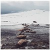
This was crossing Bulls Peak Creek a few hours later.
- 1733.jpg (112.29 KiB) Viewed 28500 times
It can happen, any time.
before trying it with skis and boots strapped to the pack in white season for BC XC skiing .
Hey - if it is a good season, you will (might?) be able to ski a lot of the way! Yes, we have.
Cheers
Roger
-
rcaffin - Athrotaxis selaginoides
- Posts: 1238
- Joined: Thu 17 Jul, 2008 3:46 pm
Re: Jagungal access in winter
![]() by paidal_chalne_vala » Wed 30 Oct, 2019 8:40 pm
by paidal_chalne_vala » Wed 30 Oct, 2019 8:40 pm
That looks skiable. The water crossing looks character building :-0 .
- paidal_chalne_vala
- Lagarostrobos franklinii
- Posts: 2479
- Joined: Sun 22 Jan, 2012 10:30 pm
- ASSOCIATED ORGANISATIONS: VNPA.BTAC.Friends of Baw Baw.Mt.Bogong Club.
- Region: Victoria
- Gender: Male
Re: Jagungal access in winter
![]() by rcaffin » Thu 31 Oct, 2019 6:31 am
by rcaffin » Thu 31 Oct, 2019 6:31 am
Yeah, but that was MAY! This was a bushwalking trip! But that is KNP. We had to walk out to the car:
Good trip though.
Cheers
Roger
- 1721.jpg (59.39 KiB) Viewed 28407 times
Good trip though.
Cheers
Roger
-
rcaffin - Athrotaxis selaginoides
- Posts: 1238
- Joined: Thu 17 Jul, 2008 3:46 pm
Re: Jagungal access in winter
![]() by Carcass » Tue 08 Dec, 2020 2:19 pm
by Carcass » Tue 08 Dec, 2020 2:19 pm
Hi Brains Trust,
Has anyone driven out along the Snowy Plains Fire Trail this year? I am taking a group hiking over New Year and looking at different access points. The original plan was to start from Guthega Power Station and head up the pipeline trail to Disappointment Spur & then up and over to Tin Hut for the first night before continung on to Cesjacks, Mt Jagungal, Valentines, Whites RIver & back to the cars at the Power Station. As we are coming from Sydney and do not want to leave at 2am, we planned to drive down & camp the first night at Island Bend but it is fully booked for the date we need and I am therefore seeking alternative access points.
Starting at the north end near Cesjacks seems the most viable option but my mate only has a Koleos AWD (I have a lifted Prado so no real issue for me), and I am not sure whether he will make the descent/ascent of Nimmo Rd hill, judging by the previous comments.
The other alternative I am looking at is heading into the park from Gungarlin River campground, walking down the trail to the junction of Gungarlin River & Burrungubugge River & then up the hill to Mt Porcupine and on over to Tin Hut. The main consideration for this route is how dense the forest growth is heading up onto Porcupine Ridge and if there is a reasonably clear access route up anywhere between the river junctions & Constance Hut site. Any commentary on this would also be appreciated.
Thanks heaps
Stuart
- Carcass
- Nothofagus cunninghamii

- Posts: 8
- Joined: Mon 27 Nov, 2017 6:12 pm
- Region: New South Wales
- Gender: Male
Re: Jagungal access in winter
![]() by rcaffin » Tue 08 Dec, 2020 3:51 pm
by rcaffin » Tue 08 Dec, 2020 3:51 pm
my mate only has a Koleos AWD (I have a lifted Prado so no real issue for me)
The main Q here is whether you have chains for the cars. If there has been rain then Nimmo Hill may be tricky: it can be slippery at the bottom. 'They' do work on it sometimes.
A possibility here is to park the Koleos at the top of the Nimmo Hill descent and all travel in the Prado for the last bit, with chains in the boot. You may be able to hire chains in Cooma. You may sometimes find other cars parked at the top.
Another possibility here is to start walking AT Nimmo Hill and to follow the 'road' to Cesjacks. We have done that once. It's a few hours. As long as the sun is not too bright ... Alpine scenery.
Burrungubuggee to Tin Hut works, IF (and only IF) you go the right way. The west bank of some of the B has some truly spectacular scrub all the way down. In a pig headed moment we came down that way once, and regretted it. Totally sub-alpine stuff and worse. Yeah, I stuffed the navigation. My wife thought so at the top.
Cheers
Roger
-
rcaffin - Athrotaxis selaginoides
- Posts: 1238
- Joined: Thu 17 Jul, 2008 3:46 pm
Re: Jagungal access in winter
![]() by Carcass » Tue 08 Dec, 2020 4:13 pm
by Carcass » Tue 08 Dec, 2020 4:13 pm
rcaffin wrote:
Burrungubuggee to Tin Hut works, IF (and only IF) you go the right way.
Cheers
Roger
I guess that's the core issue, I don't suppose you have any thoughts on where to start so as not to go the wrong way
- Carcass
- Nothofagus cunninghamii
- Posts: 8
- Joined: Mon 27 Nov, 2017 6:12 pm
- Region: New South Wales
- Gender: Male
Re: Jagungal access in winter
![]() by rcaffin » Tue 08 Dec, 2020 4:23 pm
by rcaffin » Tue 08 Dec, 2020 4:23 pm
Well, I know where not to go ...
I am going to pass on this one. The route is a bit complex, this is a public forum, and I don't know what fire damage has been done.
Walking the road up the Gungarlin valley is fool-proof. Just a thought: stay on the road and don't try for short-cuts up the sides of ridges. Most of them don't work real well. The two river crossings (Barleymans and Bulls Peak) do have foot bridges if you look around. I don't know who looks after them, but they have been there for some time.
Cheers
Roger
I am going to pass on this one. The route is a bit complex, this is a public forum, and I don't know what fire damage has been done.
Walking the road up the Gungarlin valley is fool-proof. Just a thought: stay on the road and don't try for short-cuts up the sides of ridges. Most of them don't work real well.
Cheers
Roger
-
rcaffin - Athrotaxis selaginoides
- Posts: 1238
- Joined: Thu 17 Jul, 2008 3:46 pm
Re: Jagungal access in winter
![]() by paidal_chalne_vala » Tue 08 Dec, 2020 6:01 pm
by paidal_chalne_vala » Tue 08 Dec, 2020 6:01 pm
I am considering scouting out the Nimmo Hill to Cesjack's hut route this Easter 2021 . I will leave my soft roader AWD RAV 4 at the top of Nimmo hill and go on foot until I reach the hut.
- paidal_chalne_vala
- Lagarostrobos franklinii
- Posts: 2479
- Joined: Sun 22 Jan, 2012 10:30 pm
- ASSOCIATED ORGANISATIONS: VNPA.BTAC.Friends of Baw Baw.Mt.Bogong Club.
- Region: Victoria
- Gender: Male
Re: Jagungal access in winter
![]() by Zapruda » Wed 09 Dec, 2020 8:18 am
by Zapruda » Wed 09 Dec, 2020 8:18 am
Carcass wrote:Hi Brains Trust,
Has anyone driven out along the Snowy Plains Fire Trail this year? I am taking a group hiking over New Year and looking at different access points. The original plan was to start from Guthega Power Station and head up the pipeline trail to Disappointment Spur & then up and over to Tin Hut for the first night before continung on to Cesjacks, Mt Jagungal, Valentines, Whites RIver & back to the cars at the Power Station. As we are coming from Sydney and do not want to leave at 2am, we planned to drive down & camp the first night at Island Bend but it is fully booked for the date we need and I am therefore seeking alternative access points.
Starting at the north end near Cesjacks seems the most viable option but my mate only has a Koleos AWD (I have a lifted Prado so no real issue for me), and I am not sure whether he will make the descent/ascent of Nimmo Rd hill, judging by the previous comments.
The other alternative I am looking at is heading into the park from Gungarlin River campground, walking down the trail to the junction of Gungarlin River & Burrungubugge River & then up the hill to Mt Porcupine and on over to Tin Hut. The main consideration for this route is how dense the forest growth is heading up onto Porcupine Ridge and if there is a reasonably clear access route up anywhere between the river junctions & Constance Hut site. Any commentary on this would also be appreciated.
Thanks heaps
Stuart
I drove down the Snowy Plains FT a few weeks ago after all the rain in my Forester. the bottom of Nimmo hill was fine. I parked at Barleymans Creek as it was up and walked from there. The road is in good condition
You could also park at the Gungarlin River camp and head for Kidmans hut and make your way up from there. It would be far more enjoyable than Mt Porcupine. That country is rough and slow. The road off Nimmo hill to the Gungarlin Camp is always more manageable for lower clearance cars than SP FT.
-
Zapruda - Athrotaxis selaginoides
- Posts: 1690
- Joined: Thu 07 Apr, 2016 10:46 am
- Region: Australian Capital Territory
- Gender: Male
Re: Jagungal access in winter
![]() by Zapruda » Wed 09 Dec, 2020 8:38 am
by Zapruda » Wed 09 Dec, 2020 8:38 am
paidal_chalne_vala wrote:I am considering scouting out the Nimmo Hill to Cesjack's hut route this Easter 2021 . I will leave my soft roader AWD RAV 4 at the top of Nimmo hill and go on foot until I reach the hut.
Whats the aim of the trip? I ask this because I think there are far more enjoyable ways to get to Cesjacks than trudging along the Snowy Plains FT from Nimmo. The beauty of the Snowy Plains FT is that it gets you right up close to Cesjacks with your vehicle.
The off track walking in Jagungal is the best in the whole park. I would suggest you build a route around that rather than fire trail walking the whole time.
-
Zapruda - Athrotaxis selaginoides
- Posts: 1690
- Joined: Thu 07 Apr, 2016 10:46 am
- Region: Australian Capital Territory
- Gender: Male
Re: Jagungal access in winter
![]() by Carcass » Wed 09 Dec, 2020 9:25 am
by Carcass » Wed 09 Dec, 2020 9:25 am
Thanks Zapruda,
That is the exact intel I was after re Snowy Plains FT.
Re: Island Bend - I am not so sure about rangers checking. Normally I would agree but all 70 sites have been booked for the date I need & I feel that in these current time rangers will be checking over the peak periods. In any case I am taking a group of 8 and would need a largish space.
Re the scrub up from Burrungubuggee. I spoke to a park ranger from KNP & the fires from January didn't make it that far, so there is no change to the scrub up that hill.
Thanks all for your help. I have a good idea where to head now
- Carcass
- Nothofagus cunninghamii
- Posts: 8
- Joined: Mon 27 Nov, 2017 6:12 pm
- Region: New South Wales
- Gender: Male
Re: Jagungal access in winter
![]() by rcaffin » Wed 09 Dec, 2020 9:39 am
by rcaffin » Wed 09 Dec, 2020 9:39 am
so there is no change to the scrub up that hill.
It has just got thicker.
When we came down the side we were fighting not just the sub-alpine scrub but also the fallen timber from the 2003 fires. I had to 'bulldoze' so my wife could follow.
Cheers
Roger
It has just got thicker.
When we came down the side we were fighting not just the sub-alpine scrub but also the fallen timber from the 2003 fires. I had to 'bulldoze' so my wife could follow.
Cheers
Roger
-
rcaffin - Athrotaxis selaginoides
- Posts: 1238
- Joined: Thu 17 Jul, 2008 3:46 pm
36 posts
• Page 1 of 2 • 1, 2
Return to New South Wales & ACT
Who is online
Users browsing this forum: No registered users and 11 guests