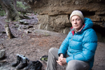
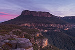
Walkers: Frank Neri, Josh Neri, Rob WIldman
This was meant to be a pleasant stroll up the Yadboro River to view Dendrobium Speciosum (Rock Orchid) in flower. While I have walked extensively in the Yadboro area, I had never walked upstream along the river and basing the planning of the walk from Ron Doughton's day walk in the same area, I thought we would be in the area while the rock lilies would be in great profusion. Of course, Ron's "trip downriver can be a casual affair", turned out to be a little different to expectations. We parked the car and sauntered across the river and then started to head to our left thinking this was going to be a breeze of a walk. After about 15 minutes, I discovered we had been following Oaky Creek and not Yadboro River. The confusion was caused by the fact that both streams, almost equal in flow, joined at the crossing and it was actually very easy to pick the wrong one. To justify my false directions, there was a lot of flood drift on the correct route and it was only when we returned down the right track did we scramble through this and returned to the original crossing.
Ten minutes after the embarrassing back track, we stumbled on what was obviously an old 4WD track running along the river flats which are quite lovely in this section. We followed this, given there weren't many other places where you could walk, along some lovely river flats and soon came to the first of the river crossings. This is where things got really confusing. The topo map shows the old Wog Wog trail running along the river but definitely not crossing where we were. No matter, we decided to follow this anyway and so came to a second and then a third crossing, just adding to the confusion as to where we were.
Crossing the river for the last time, the 4WD track then started heading up the nearby ridge so we finally departed company and headed back to the river. If there was ever a Wog Wog trail here, it is extremely hard to find any evidence of it now. Crossing from bank to bank when the river allowed, we marveled at the beauty of the pools and the interrupting shallows even though the river was at its lowest level possible. The vegetation in this stretch was so full of creepers and restricting branches and we wondered why until we came to the appropriately named Viney Creek, which starts its way down the mountain from the top of Mt Cole. Just before the junction with Belowra Creek there are a series of lovely pools, and enclosing cliffs, which happen to have the much sought after dendrobiums, albeit not in flower.
It was only one o'clock but we were supposed to be here by 11. This was the point where we had organised to down packs and head off up Belowra Creek exploring the tight canyons as it winds up towards Wirritin ridge. But we just weren't in any mood - the sun was out, the sparkling river pools beckoned and we just decided that this was it for the day. Yes I know, what kind of explorers were we? There was hardly any room for putting down a tent so we scrambled around in the bush for a while and came up with our 'Belowra Heights' spot just out of sight of the river. The rest of the day and night was left to solving the world's problems.
The return down river the next morning was uneventful except for us trying to piece together where the old trail may have gone. Who knows but we realised that this spot could become a base for a series of day pack walks up into Belowra Creek and Yadboro River. The area is interesting and the river vistas of long pools and riverbank walking is quite pleasant, if you don't mind a few vines along the way.
Timings: the downward trip was recorded at 5.21kms and took 2.25 hours.
Yadboro River to Belowra Creek - short walk
Forum rules
Posting large/multiple images in this forum is OK. Please start topic titles with the name of the location or track.
For topics focussed on photos rather than the trip, please consider posting in the 'Gallery' forum instead.
This forum is for posting information about trips you have done, not for requesting information about a track or area.
8 posts
• Page 1 of 1
-

rwildman - Nothofagus gunnii

- Posts: 44
- Joined: Fri 06 Jul, 2012 10:39 pm
- Location: Summer Hill NSW
- Region: New South Wales
- Gender: Male
Re: Yadboro River to Belowra Creek - short walk
Nice report mate. Yep, I’ve walked the length of the Wog Wog walking track and I can tell you in no uncertain terms...it ain’t there. Unfortunately I came in off the escarpment from the other end so had to find out the hard way.
- puredingo
- Athrotaxis selaginoides

- Posts: 1296
- Joined: Mon 13 Feb, 2012 6:54 am
- Region: New South Wales
Re: Yadboro River to Belowra Creek - short walk
Great report! Thanks for sharing.
-

Huntsman247 - Phyllocladus aspleniifolius

- Posts: 593
- Joined: Wed 22 Mar, 2017 10:07 pm
- Region: New South Wales
- Gender: Male
Re: Yadboro River to Belowra Creek - short walk
Great report.
We walked this section of the Yadboro about a year ago from long gully until the end of the 4WD track as you described and it was a great walk. I wanted to continue but as you described we couldn't find any trace of the track beyond that point and my shoes had decided to self destruct, so i wasn't up to off track walking through that typical difficult river edge. Very interested to hear from others that there is no track!
We walked this section of the Yadboro about a year ago from long gully until the end of the 4WD track as you described and it was a great walk. I wanted to continue but as you described we couldn't find any trace of the track beyond that point and my shoes had decided to self destruct, so i wasn't up to off track walking through that typical difficult river edge. Very interested to hear from others that there is no track!
- FionaShedden
- Atherosperma moschatum

- Posts: 56
- Joined: Wed 20 Sep, 2017 9:55 pm
- Region: New South Wales
- Gender: Female
Re: Yadboro River to Belowra Creek - short walk
There is no “river edge” walking further up...it’s all straight down the guts of the river, which in summer a great option.
- puredingo
- Athrotaxis selaginoides

- Posts: 1296
- Joined: Mon 13 Feb, 2012 6:54 am
- Region: New South Wales
Re: Yadboro River to Belowra Creek - short walk
Where we camped at the junction of the two water courses, we found two pink ribbons in the bush about 10-20 metres north of the stream both sort of showing a route away from the water. However, I think it's safe to assume though that the old trail is now well and truly gone. Thanks puredingo for your comments.
-

rwildman - Nothofagus gunnii

- Posts: 44
- Joined: Fri 06 Jul, 2012 10:39 pm
- Location: Summer Hill NSW
- Region: New South Wales
- Gender: Male
Re: Yadboro River to Belowra Creek - short walk
The first Wog Wog track was an Aboriginal route. Then it became a cattlemans stock route. Later, I'm guessing in the 1950's-1960's, the firetrail preceded logtruck road construction which took timber in the 1960's from the ridges between Yadboro Flat and the ridge system coming off Mt Owen.
- yogibarnes
- Nothofagus gunnii

- Posts: 32
- Joined: Sun 17 Jun, 2012 11:06 am
- ASSOCIATED ORGANISATIONS: Batemans Bay Bushwalkers
- Region: New South Wales
- Gender: Male
Re: Yadboro River to Belowra Creek - short walk
Thanks yogibarnes,
Your comments match what I thought was the case. The area looks like it was heavily logged for quite some time. I was planning to walk someday from the first river crossing up the ridge to the cliffline below Mt Owen and see if it was possible to get up to the caves on Mt Cole but lack of enthusiasm from others (and probably myself) never saw this eventuate and I suspect the old log track marked on the topo maps is now well and truly overgrown.
Your comments match what I thought was the case. The area looks like it was heavily logged for quite some time. I was planning to walk someday from the first river crossing up the ridge to the cliffline below Mt Owen and see if it was possible to get up to the caves on Mt Cole but lack of enthusiasm from others (and probably myself) never saw this eventuate and I suspect the old log track marked on the topo maps is now well and truly overgrown.
-

rwildman - Nothofagus gunnii

- Posts: 44
- Joined: Fri 06 Jul, 2012 10:39 pm
- Location: Summer Hill NSW
- Region: New South Wales
- Gender: Male
8 posts
• Page 1 of 1
Return to NSW & ACT Trip Reports & Track Notes
Who is online
Users browsing this forum: No registered users and 3 guests
