Hi there
I’m in Sydney and currently planning a little trip to the High Plains area of Kosciusko with one walking companion, aiming to depart soon after the locked gates there are unlocked (in the October long weekend). One walk we’re hoping to do is a little return overnighter, camping near Oldfield’s hut (coming in from the west from the locked gate on Gurrangorambla Creek), then walking from there to Murray’s Gap and Bimberi Peak.
Does anyone know if Bimberi Peak itself got burned in the recent fires?
One reason I’m asking is the concern that the bushfires might have made the existing footpad difficult to find. (We will be bringing paper topo maps, compass, GPS, smartphone with GPS aps etc. Hoping not to have to bushbash though.)
Additionally, before that walk, we’re also planning to car camp in the vicinity of Blue Waterholes.
Another question: does anyone know if the NSWNP&WS did successfully eradicate brumbies in the Blue Waterholes area during the recent closure of the camping ground?
Thanks.
Murray’s Gap to Bimberi Peak, also Blue Waterholes brumbies
Forum rules
NSW & ACT specific bushwalking discussion. Please avoid publishing details of access to sensitive areas with no tracks.
NSW & ACT specific bushwalking discussion. Please avoid publishing details of access to sensitive areas with no tracks.
16 posts
• Page 1 of 1
Murray’s Gap to Bimberi Peak, also Blue Waterholes brumbies
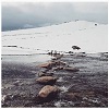
![]() by Snooze » Sat 18 Jul, 2020 3:25 pm
by Snooze » Sat 18 Jul, 2020 3:25 pm
- Snooze
- Atherosperma moschatum

- Posts: 53
- Joined: Tue 05 Jun, 2018 3:20 pm
- Region: New South Wales
Re: Murray’s Gap to Bimberi Peak, also Blue Waterholes brumb
![]() by Walk_fat boy_walk » Mon 20 Jul, 2020 7:04 pm
by Walk_fat boy_walk » Mon 20 Jul, 2020 7:04 pm
I don't have an answer to either question, but if Bimberi's been burnt you shouldn't need a track anyway... just take a bearing to the top from Murray's Gap? Either way should be ok.
- Walk_fat boy_walk
- Lagarostrobos franklinii

- Posts: 2091
- Joined: Sat 21 Nov, 2009 6:59 am
- Gender: Male
Re: Murray’s Gap to Bimberi Peak, also Blue Waterholes brumb
![]() by Snooze » Mon 20 Jul, 2020 8:23 pm
by Snooze » Mon 20 Jul, 2020 8:23 pm
Thanks for answering. That's a good point.
Also, after posting here, I downloaded the Rendezvous Creek map from maps.six.nsw.gov.au to that Avenza ap. Also noticed from recorded tracks published by others online that the track seems to exactly follow the NSW-ACT border, so yeah we should be okay.
Also, after posting here, I downloaded the Rendezvous Creek map from maps.six.nsw.gov.au to that Avenza ap. Also noticed from recorded tracks published by others online that the track seems to exactly follow the NSW-ACT border, so yeah we should be okay.
- Snooze
- Atherosperma moschatum
- Posts: 53
- Joined: Tue 05 Jun, 2018 3:20 pm
- Region: New South Wales
Re: Murray’s Gap to Bimberi Peak, also Blue Waterholes brumb
![]() by Mark F » Mon 20 Jul, 2020 8:52 pm
by Mark F » Mon 20 Jul, 2020 8:52 pm
The border follows the ridge line.
NPWS closed the Blue Waterholes campground for the cull. If the npws web site shows it as open, possibly only when the gate opens on Long Plain Rd, then it will be fine.
If it is burnt (please report back) you could do a loop over Bimberi from Murray Gap to Leura Gap and back down Leura Gap f/t.
NPWS closed the Blue Waterholes campground for the cull. If the npws web site shows it as open, possibly only when the gate opens on Long Plain Rd, then it will be fine.
If it is burnt (please report back) you could do a loop over Bimberi from Murray Gap to Leura Gap and back down Leura Gap f/t.
"Perfection is attained not when there is nothing more to add, but when there is nothing more to remove".
-

Mark F - Lagarostrobos franklinii
- Posts: 2332
- Joined: Mon 19 Sep, 2011 8:14 pm
- Region: Australian Capital Territory
- Gender: Male
Re: Murray’s Gap to Bimberi Peak, also Blue Waterholes brumb
![]() by Zapruda » Tue 21 Jul, 2020 7:27 am
by Zapruda » Tue 21 Jul, 2020 7:27 am
Mark F wrote:
If it is burnt (please report back) you could do a loop over Bimberi from Murray Gap to Leura Gap and back down Leura Gap f/t.
I can confirm that Murrays Gap, Mt Bimberi, Rolling Ground Gap and Leura Gap were lightly burned in the recent fires.
-
Zapruda - Athrotaxis selaginoides

- Posts: 1690
- Joined: Thu 07 Apr, 2016 10:46 am
- Region: Australian Capital Territory
- Gender: Male
Re: Murray’s Gap to Bimberi Peak, also Blue Waterholes brumb
![]() by Zapruda » Tue 21 Jul, 2020 7:36 am
by Zapruda » Tue 21 Jul, 2020 7:36 am
Snooze wrote:Hi there
I’m in Sydney and currently planning a little trip to the High Plains area of Kosciusko with one walking companion, aiming to depart soon after the locked gates there are unlocked (in the October long weekend). One walk we’re hoping to do is a little return overnighter, camping near Oldfield’s hut (coming in from the west from the locked gate on Gurrangorambla Creek), then walking from there to Murray’s Gap and Bimberi Peak.
Does anyone know if Bimberi Peak itself got burned in the recent fires?
One reason I’m asking is the concern that the bushfires might have made the existing footpad difficult to find. (We will be bringing paper topo maps, compass, GPS, smartphone with GPS aps etc. Hoping not to have to bushbash though.)
Additionally, before that walk, we’re also planning to car camp in the vicinity of Blue Waterholes.
Another question: does anyone know if the NSWNP&WS did successfully eradicate brumbies in the Blue Waterholes area during the recent closure of the camping ground?
Thanks.
Yes Bimberi was lightly burned and the the foot pad is now hard to follow except for the occasional pad and cairn. Luckily it follows the border so just head straight up. The vegetation is now open enough to easily do so. The "bush bashing" will be light.
If you are camping at Blue Waterholes I wouldn't bother driving all the way around to park at the Gurrangorambla. Just leave the car at the campground and walk to Oldfields from there. It is super easy. Make sure to spend some time wandering around Cooleman plain and definitely explore Nichols and Clarkes Gorge. Cooleman falls are lovely too.
Eradicate the brumbys? There are 1000s up there. Its going to take many, many years to even put a dent in the population without proper eradication methods. You cant walk 100 meters in the northern end of the park without seeing signs of those feral things. Its not uncommon to see mobs up to 30+ horses, The destruction is terrible. If you are going up there to see them you wont be disappointed. Despite the pro brumby rhetoric they are in plague proportions up there. You will soon see how far from majestic and special they actually are.
NPWS are going ahead with the trapping and removal of the feral horses after a failed court case by pro brumby advocates last week. Cooleman Plain is one of the areas they are focusing on.
-
Zapruda - Athrotaxis selaginoides
- Posts: 1690
- Joined: Thu 07 Apr, 2016 10:46 am
- Region: Australian Capital Territory
- Gender: Male
Re: Murray’s Gap to Bimberi Peak, also Blue Waterholes brumb
![]() by johnrs » Tue 21 Jul, 2020 10:17 am
by johnrs » Tue 21 Jul, 2020 10:17 am
Heh Snooze
Could you post some brumby damage photos if you get the chance?
Thanks
John
Could you post some brumby damage photos if you get the chance?
Thanks
John
- johnrs
- Phyllocladus aspleniifolius

- Posts: 621
- Joined: Mon 09 Aug, 2010 6:09 pm
- Region: New South Wales
Re: Murray’s Gap to Bimberi Peak, also Blue Waterholes brumb
![]() by Snooze » Tue 21 Jul, 2020 5:15 pm
by Snooze » Tue 21 Jul, 2020 5:15 pm
Thanks everybody for answering. Sad to hear it confirmed with those words “lightly burned”. Ah well.
With a little bit of googling I found this last night. https://www.environment.nsw.gov.au/topi ... be-removed
According to this report, 99 brumbies were removed from the Blue Waterholes area in a completed horse control program (between October and November 2019).
Yeah fingers crossed there's no second spike then in NSW (closing the campgrounds again) and we go, I'll report back with photos.
- Snooze
- Atherosperma moschatum
- Posts: 53
- Joined: Tue 05 Jun, 2018 3:20 pm
- Region: New South Wales
Re: Murray’s Gap to Bimberi Peak, also Blue Waterholes brumb
![]() by robc » Wed 22 Jul, 2020 4:33 pm
by robc » Wed 22 Jul, 2020 4:33 pm
I was at Blue Waterholes the last weekend before they lock the gates for winter. Just as many brumbies as ever.
- robc
- Nothofagus cunninghamii

- Posts: 6
- Joined: Sun 24 Jul, 2016 6:45 pm
- Region: Australian Capital Territory
- Gender: Male
Re: Murray’s Gap to Bimberi Peak, also Blue Waterholes brumb
![]() by Snooze » Wed 22 Jul, 2020 9:05 pm
by Snooze » Wed 22 Jul, 2020 9:05 pm
Good to know. Thanks.
- Snooze
- Atherosperma moschatum
- Posts: 53
- Joined: Tue 05 Jun, 2018 3:20 pm
- Region: New South Wales
Re: Murray’s Gap to Bimberi Peak, also Blue Waterholes brumb
![]() by blagle » Tue 25 Aug, 2020 10:23 pm
by blagle » Tue 25 Aug, 2020 10:23 pm
Interestingly the Act Parks Service have Mt Bimberi listed as closed due to fire damage. I was camping near Oldfields Hut a couple of weeks ago and would note that NSW Parks and Wildlife had erected a sign near the hut noting the area was closed. It did not include any detail of what specific area was actually closed but it was reasonably obvious that it was the area NE of the Hut toward Murrays Gap/Mt Bimberi. I came in through private property from the east which was hammered in parts. It was obvious that Mt Bimberi got burnt reasonably badly, I wouldn't describe it as "lightly" as some others have but appreciate it is subjective. Hope you get to enjoy the area, great place to visit.
- blagle
- Nothofagus cunninghamii
- Posts: 4
- Joined: Mon 10 Aug, 2020 12:54 pm
- Region: Australian Capital Territory
- Gender: Male
Re: Murray’s Gap to Bimberi Peak, also Blue Waterholes brumb
![]() by Snooze » Tue 25 Aug, 2020 10:44 pm
by Snooze » Tue 25 Aug, 2020 10:44 pm
Thanks blagle! That's disappointing but good to know. The situation was quite unclear since technically Bimberi Peak lies half in Kosciuszko, which is open, and half in Namadgi, which is closed, but from what you write I assume that walk is off the table for now.
- Snooze
- Atherosperma moschatum
- Posts: 53
- Joined: Tue 05 Jun, 2018 3:20 pm
- Region: New South Wales
Re: Murray’s Gap to Bimberi Peak, also Blue Waterholes brumb
![]() by Gunner55 » Mon 16 Nov, 2020 4:47 pm
by Gunner55 » Mon 16 Nov, 2020 4:47 pm
Hi there thanks for your info on Bimberi Peak. Based on your advice I checked in with the Tumut office of National Parks. The responsible ranger for this part of Kosi said it's AOK to take the AAWT to Murray Gap and climb Bimberi (though having just checked the ACT side of the walk up looks to be closed for quite some time). In fact, if I end up doing this scoped walk around xmas, the ranger has asked for feedback on what it's like. The warnings were watch out for branches falling off burned trees and avoid any soaks where the walker could damage the recovering environment. My plan is do do a bit of a loop from Cooinbil Hut that involves 2 nights at Oldfields, up and back Bimberi and some Goodradigbee exploring.
- Gunner55
- Nothofagus gunnii

- Posts: 19
- Joined: Sat 09 Sep, 2017 9:26 pm
- Region: New South Wales
Re: Murray’s Gap to Bimberi Peak, also Blue Waterholes brumb
![]() by Zapruda » Mon 16 Nov, 2020 4:56 pm
by Zapruda » Mon 16 Nov, 2020 4:56 pm
Gunner55 wrote:Hi there thanks for your info on Bimberi Peak. Based on your advice I checked in with the Tumut office of National Parks. The responsible ranger for this part of Kosi said it's AOK to take the AAWT to Murray Gap and climb Bimberi (though having just checked the ACT side of the walk up looks to be closed for quite some time). In fact, if I end up doing this scoped walk around xmas, the ranger has asked for feedback on what it's like. The warnings were watch out for branches falling off burned trees and avoid any soaks where the walker could damage the recovering environment. My plan is do do a bit of a loop from Cooinbil Hut that involves 2 nights at Oldfields, up and back Bimberi and some Goodradigbee exploring.
That sounds like a great plan. There is a wonderful bridle trail from Cooinbil to the Harris hut site on Cooleman Plain. Using it cuts that boring road walk in half.
The Good is fun to explore between the confluence of Cave Creek and Leura Gap Trail. The fire has made exploration easier.
I was just in the area this weekend. No matter how many times I visit, and I visit a lot, I am still in awe of that part of the park. Beautiful and underrated!
-
Zapruda - Athrotaxis selaginoides
- Posts: 1690
- Joined: Thu 07 Apr, 2016 10:46 am
- Region: Australian Capital Territory
- Gender: Male
Re: Murray’s Gap to Bimberi Peak, also Blue Waterholes brumb
![]() by Gunner55 » Wed 18 Nov, 2020 7:13 am
by Gunner55 » Wed 18 Nov, 2020 7:13 am
Thanks Zapruda I was hoping to find a way between Harris and Cooinbil - do you have any tips, especially starting from the Harris/east end, of where to pick up the trail, as I know first hand how thick the scrub can be on the range between the two? I'm guessing the Cooinbil end of the trail is down near the creek near Cooinbil Hut itself...
- Gunner55
- Nothofagus gunnii
- Posts: 19
- Joined: Sat 09 Sep, 2017 9:26 pm
- Region: New South Wales
Re: Murray’s Gap to Bimberi Peak, also Blue Waterholes brumb
![]() by Zapruda » Wed 18 Nov, 2020 8:10 am
by Zapruda » Wed 18 Nov, 2020 8:10 am
Gunner55 wrote:Thanks Zapruda I was hoping to find a way between Harris and Cooinbil - do you have any tips, especially starting from the Harris/east end, of where to pick up the trail, as I know first hand how thick the scrub can be on the range between the two? I'm guessing the Cooinbil end of the trail is down near the creek near Cooinbil Hut itself...
I’ll shoot you a pm with a map and gpx file.
-
Zapruda - Athrotaxis selaginoides
- Posts: 1690
- Joined: Thu 07 Apr, 2016 10:46 am
- Region: Australian Capital Territory
- Gender: Male
16 posts
• Page 1 of 1
Return to New South Wales & ACT
Who is online
Users browsing this forum: No registered users and 19 guests