Thinking about doing a trip down the cox from around where the six foot track comes in.. but also might start further down stream..
Finishing at yellow pup and then looping back
What's the general guidance on access through some of the farmland between six foot track and iron pot ridge..
Specifically..
- walking down the cox itself...
- walking on farm access roads between those two points.
Am I likely to have some bloke coming at me with a pitch fork?
cox river access.
Forum rules
NSW & ACT specific bushwalking discussion. Please avoid publishing details of access to sensitive areas with no tracks.
NSW & ACT specific bushwalking discussion. Please avoid publishing details of access to sensitive areas with no tracks.
17 posts
• Page 1 of 1
cox river access.
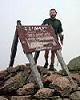
![]() by wildwanderer » Sat 13 Mar, 2021 4:13 pm
by wildwanderer » Sat 13 Mar, 2021 4:13 pm
-

wildwanderer - Athrotaxis selaginoides

- Posts: 1640
- Joined: Tue 02 May, 2017 8:42 am
- Location: Out of lockdown \o/
- Region: New South Wales
- Gender: Male
Re: cox river access.
![]() by kelvinn » Sat 13 Mar, 2021 7:08 pm
by kelvinn » Sat 13 Mar, 2021 7:08 pm
I did Six Foot to Cox to Breakfast Creek to Dunphrys and Narrow Neck about a year ago, and didn’t know enough then to check the water gauges first.
When I went the river was way too high to cross, and the water was all the way up to the rocks or vegetation, which meant I was up in the thick bushes, or rock climbing.
I was doing almost 6km/hr on Six Foot, and sometimes only 2km/hr bushwhacking.
No mobile reception, as you probably know.
I only saw one couple out there. Not certain on the access roads. A lot of stuff was washed away or overgrown.
Plan well and have fun!
- kelvinn
- Nothofagus gunnii

- Posts: 29
- Joined: Thu 15 Aug, 2019 8:10 pm
- Region: New South Wales
Re: cox river access.
![]() by jonnosan » Sat 13 Mar, 2021 8:36 pm
by jonnosan » Sat 13 Mar, 2021 8:36 pm
you are allowed to walk along the river as long as you dont camp on the private land and leave all gates as you find them.
A lot of the private roads in that area are going to take you past people's houses.
A lot of the private roads in that area are going to take you past people's houses.
-

jonnosan - Phyllocladus aspleniifolius

- Posts: 896
- Joined: Fri 27 Jan, 2012 4:06 pm
- Region: New South Wales
- Gender: Male
Re: cox river access.
![]() by wildwanderer » Sun 14 Mar, 2021 9:12 am
by wildwanderer » Sun 14 Mar, 2021 9:12 am
Thanks guys,
Appreciate the advice.
Jonosan, have you seen anywhere online where it says walking down the Cox is permitted? It would be handy to have that screenshotted on my phone in case anyone questions.
Do you know if the farm roads are considered public access? Or are they private land no public access roads?
Cause as you mentioned they basically go by the homesteads so if they are private it might led to a robust chat I'd rather avoid.
-
wildwanderer - Athrotaxis selaginoides
- Posts: 1640
- Joined: Tue 02 May, 2017 8:42 am
- Location: Out of lockdown \o/
- Region: New South Wales
- Gender: Male
Re: cox river access.
![]() by Xplora » Sun 14 Mar, 2021 11:35 am
by Xplora » Sun 14 Mar, 2021 11:35 am
If you stay on the northern side of the river from Cox's river reserve then you will pass fenced private property and from memory one house close to the river. I walked down from Breakfast creek once and came across the owners. At first it was a bit of a 'what do you think you are doing' but turned out we had friends in common and all was good. As long as you are on the Crown land frontage you have every right to continue walking. There is no real need to go on any road. These people know all too well the lawful right of way so just wave and be polite. I would not think anyone out there would get nasty and would fall foul of the law if they were. High water has stopped me once from Yellow Pup to Breakfast creek and another time it was a deep wade. Lots of crossings. Not sure what you are intending with a loop back. You can loop it back to Breakfast Creek from Yellow Pup then up Ironmunger and over to Tin Pot to be back on the Cox's. It has been some years since I have been there so my memory may be faded.
- Xplora
- Athrotaxis selaginoides
- Posts: 1578
- Joined: Sat 01 Aug, 2015 7:24 am
- Region: Victoria
- Gender: Male
Re: cox river access.
![]() by jonnosan » Sun 14 Mar, 2021 1:43 pm
by jonnosan » Sun 14 Mar, 2021 1:43 pm
Hi Wildwander - if you go to https://maps.six.nsw.gov.au/, search for 'COXS RIVER CAMPING AREA" then click on 'Map Contents' near top right, and turn on the 'Lot Boundaries' layer you will be able to see the property boundaries. This shows that the Cox's river and the banks are outside anyone's property. you can also see where there are public road easements - anything else is private.
-
jonnosan - Phyllocladus aspleniifolius
- Posts: 896
- Joined: Fri 27 Jan, 2012 4:06 pm
- Region: New South Wales
- Gender: Male
Re: cox river access.
![]() by wildwanderer » Sun 14 Mar, 2021 6:00 pm
by wildwanderer » Sun 14 Mar, 2021 6:00 pm
jonnosan wrote:Hi Wildwander - if you go to https://maps.six.nsw.gov.au/, search for 'COXS RIVER CAMPING AREA" then click on 'Map Contents' near top right, and turn on the 'Lot Boundaries' layer you will be able to see the property boundaries. This shows that the Cox's river and the banks are outside anyone's property. you can also see where there are public road easements - anything else is private.
Thanks jonnosan very helpful.
Those property boundaries and easements are very interesting indeed!
-
wildwanderer - Athrotaxis selaginoides
- Posts: 1640
- Joined: Tue 02 May, 2017 8:42 am
- Location: Out of lockdown \o/
- Region: New South Wales
- Gender: Male
Re: cox river access.
![]() by wildwanderer » Sun 14 Mar, 2021 6:14 pm
by wildwanderer » Sun 14 Mar, 2021 6:14 pm
Xplora wrote:If you stay on the northern side of the river from Cox's river reserve then you will pass fenced private property and from memory one house close to the river. I walked down from Breakfast creek once and came across the owners. At first it was a bit of a 'what do you think you are doing' but turned out we had friends in common and all was good. As long as you are on the Crown land frontage you have every right to continue walking. There is no real need to go on any road. These people know all too well the lawful right of way so just wave and be polite. I would not think anyone out there would get nasty and would fall foul of the law if they were. High water has stopped me once from Yellow Pup to Breakfast creek and another time it was a deep wade. Lots of crossings. Not sure what you are intending with a loop back. You can loop it back to Breakfast Creek from Yellow Pup then up Ironmunger and over to Tin Pot to be back on the Cox's. It has been some years since I have been there so my memory may be faded.
Thanks Xplora. Still considering options at this stage and time available.. and yes river levels will be very relevant.
So far my wish plan is Six ft to Cox. Walk down the Cox R. to yellow pup, up yellow pup ridge and then connecting (maybe via blackhorse/carlons) on to the mitchells FT (or whats left of it) and then up to Katoomba via devils hole.
Most likely i wont have the time to be so ambitious and will need to do a shorter version but will see once I start planning.
-
wildwanderer - Athrotaxis selaginoides
- Posts: 1640
- Joined: Tue 02 May, 2017 8:42 am
- Location: Out of lockdown \o/
- Region: New South Wales
- Gender: Male
Re: cox river access.
![]() by DaveNoble » Sun 14 Mar, 2021 10:21 pm
by DaveNoble » Sun 14 Mar, 2021 10:21 pm
You may find that due to bushfires and then a lot of subsequent rain that the banks are heavily vegetated - and too hard to walk through. This vegetation is likely to remain till winter. You can walk on the river cobbles - but only if the river is low. The Coxs River is a river that is often easier to walk if you cross to avoid bluffs. Crossing are normally very easy on the shoals at the start of rapids - but only if the water level is low. And it is easier if you keep your shoes on. There are tracks along several ridges like Blue Dog and Yellow Pup - but any of the other spurs can be used as exit points - they are fairy open (or they were before the fires).
Dave
Dave
- DaveNoble
- Athrotaxis selaginoides
- Posts: 1031
- Joined: Sun 03 Feb, 2008 3:56 pm
Re: cox river access.
![]() by wildwanderer » Mon 15 Mar, 2021 7:09 am
by wildwanderer » Mon 15 Mar, 2021 7:09 am
Thanks Dave,
Yes the thickness of the regrowth is a concern. Do you know how long once the first frosts come it takes for this fire/rain caused vegetation to die off? Are we talking a few weeks after the frosts or is it likely to be a long term thing that dies off bit by bit each winter?
Yes the thickness of the regrowth is a concern. Do you know how long once the first frosts come it takes for this fire/rain caused vegetation to die off? Are we talking a few weeks after the frosts or is it likely to be a long term thing that dies off bit by bit each winter?
-
wildwanderer - Athrotaxis selaginoides
- Posts: 1640
- Joined: Tue 02 May, 2017 8:42 am
- Location: Out of lockdown \o/
- Region: New South Wales
- Gender: Male
Re: cox river access.
![]() by Xplora » Mon 15 Mar, 2021 7:22 am
by Xplora » Mon 15 Mar, 2021 7:22 am
I remember doing it once in late May and was surprised to come across another person who seemed to be struggling to find his way through the weeds. His fleece jacket was covered in Farmer's friends and he looked like a porcupine. I think he misplaced the footpad. The crossings will become obvious and Dave's clue about avoiding bluffs is a key. If you are time poor then you could start at Carlon's and head to the Cox's via Tin Pot or Ironmunger if you want a quicker trip in but be careful to take the right spur down on the top of the ridgeline. You can loop pretty easy back to Carlon's from Yellowpup.
- Xplora
- Athrotaxis selaginoides
- Posts: 1578
- Joined: Sat 01 Aug, 2015 7:24 am
- Region: Victoria
- Gender: Male
Re: cox river access.
![]() by Turfa » Mon 15 Mar, 2021 10:57 am
by Turfa » Mon 15 Mar, 2021 10:57 am
I walked the Coxs from Quartpot ridge down to Breakfast Ck in November and the going was clear and easy until the Jenolan R junction, but downstream from here I was surprised at how thick the vegetation was. The track was hidden under chest high weeds/growth for much of the distance. I had expected a lot of growth after all the rain, but surprised it did not show more signs of previous walkers. Was glad it is not much of a distance. We had a group of 5 and couldn't help but leave a fairly clear path though the growth.
-
Turfa - Athrotaxis cupressoides

- Posts: 328
- Joined: Mon 18 Jan, 2010 2:06 pm
- Region: Australia
Re: cox river access.
![]() by irrgent » Wed 17 Mar, 2021 9:01 pm
by irrgent » Wed 17 Mar, 2021 9:01 pm
Around Breakfast Creek/Ironmonger Hill the vegetation is somewhat thick but there is a decent foot pad going through it. Not sure how long it lasts though as I just stayed at the campsite near Breakfast Creek. I also visited further upstream on another trip recently, descending one of the spurs off Tinpot Mountain. Up there the vegetation is much less dense and not difficult to walk through at al but is private property so no camping. There is actually a sign at the bottom of the spur I descended informing walkers that it is private property with no camping and to walk further downstream into the national park to camp.
- irrgent
- Nothofagus gunnii
- Posts: 14
- Joined: Thu 13 Aug, 2020 10:22 pm
- Region: New South Wales
- Gender: Male
Re: cox river access.
![]() by wildwanderer » Thu 18 Mar, 2021 9:04 am
by wildwanderer » Thu 18 Mar, 2021 9:04 am
Thanks All,
It sounds like it will be a bit of a mixed bag, some dense areas of weeds and other areas a bit more clear.
I was last in the area about 18 months ago and the Cox from Breakfast creek to Merrigal creek was fairly open and grassy in parts. Sounds like those grassy areas are weed-fests now. Which is a shame but thats nature..
-
wildwanderer - Athrotaxis selaginoides
- Posts: 1640
- Joined: Tue 02 May, 2017 8:42 am
- Location: Out of lockdown \o/
- Region: New South Wales
- Gender: Male
Re: cox river access.
![]() by Xplora » Sat 20 Mar, 2021 12:19 pm
by Xplora » Sat 20 Mar, 2021 12:19 pm
With the dam about to spill I think this trip may be postponed. Waters will back up quite a way when the dam is full and that will affect crossings.
- Xplora
- Athrotaxis selaginoides
- Posts: 1578
- Joined: Sat 01 Aug, 2015 7:24 am
- Region: Victoria
- Gender: Male
Re: cox river access.
![]() by DaveNoble » Sat 20 Mar, 2021 9:56 pm
by DaveNoble » Sat 20 Mar, 2021 9:56 pm
Xplora wrote:With the dam about to spill I think this trip may be postponed. Waters will back up quite a way when the dam is full and that will affect crossings.
Its not the water backing up that will make crossings difficult. The full height of the water level is below the level of the Kowmung River at the junction. Its the extra volume of water flowing in the Coxs River that makes crossings harder.
Dave
- DaveNoble
- Athrotaxis selaginoides
- Posts: 1031
- Joined: Sun 03 Feb, 2008 3:56 pm
Re: cox river access.
![]() by wildwanderer » Sun 21 Mar, 2021 7:14 am
by wildwanderer » Sun 21 Mar, 2021 7:14 am
Xplora wrote:With the dam about to spill I think this trip may be postponed.
Yes, Definitely wasn't going to attempt in this weather. Far to dangerous.
It seems some were still keen on doing a trip though..
https://www.smh.com.au/national/nsw/two ... 57ckt.html
Earlier on Saturday afternoon police and emergency services rescued two bushwalkers who were returning from a camping trip while walking the Six-Foot Track at Katoomba in the Blue Mountains.
Seems they got trapped between two water courses in Nellie's Glen.
If they had camping equipment Im curious why they didn't just wait it out though.. Maybe no where to set up a shelter..
-
wildwanderer - Athrotaxis selaginoides
- Posts: 1640
- Joined: Tue 02 May, 2017 8:42 am
- Location: Out of lockdown \o/
- Region: New South Wales
- Gender: Male
17 posts
• Page 1 of 1
Return to New South Wales & ACT
Who is online
Users browsing this forum: No registered users and 14 guests