Hi all
I am interested in finding out if there is any standing water on the ridge between Juke's and Pyramid, on the maps it looks like there is a marshy area and possibly a tarn close to Pyramid but otherwise pretty barren. Dropping into Upper Juke's lake looks like a bit of a mission. I would appreciate your advice
cheers
BW
Jukes/Pyramid
Forum rules
Tasmania specific bushwalking discussion. Please avoid publishing details of access to sensitive areas with no tracks.
Tasmania specific bushwalking discussion. Please avoid publishing details of access to sensitive areas with no tracks.
5 posts
• Page 1 of 1
Re: Jukes/Pyramid
![]() by ILUVSWTAS » Tue 22 Dec, 2020 7:19 am
by ILUVSWTAS » Tue 22 Dec, 2020 7:19 am
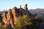
Good stream near pyramid.
Nothing to see here.
-

ILUVSWTAS - Lagarostrobos franklinii

- Posts: 11046
- Joined: Sun 28 Dec, 2008 9:53 am
- Region: Tasmania
- Gender: Male
Re: Jukes/Pyramid
![]() by eggs » Mon 16 Jan, 2023 11:45 am
by eggs » Mon 16 Jan, 2023 11:45 am
Can I hijack this thread.
My question is if anyone has accessed the Pyramid from the south over South Jukes Peak via the old 4WD roads up near Intercolonial Spur?
I was turned back on the Mt Jukes track by some friends who are getting a little more fussy with age, and I would like to get them up there so was wondering if that southerly ridgeline could be less challenging?
-
eggs - Lagarostrobos franklinii
- Posts: 10529
- Joined: Fri 23 May, 2008 2:58 pm
- Location: Para Vista, South Australia
- Region: South Australia
Re: Jukes/Pyramid
![]() by north-north-west » Mon 16 Jan, 2023 4:31 pm
by north-north-west » Mon 16 Jan, 2023 4:31 pm
I haven't done it, but it's still listed as part of a circuit route (including car shuffle) for Jukes. Between the Sth Jukes summit and the top of the vehicle track is supposed to be pretty thick scrub, but.
"Mit der Dummheit kämpfen Götter selbst vergebens."
-

north-north-west - Lagarostrobos franklinii
- Posts: 15175
- Joined: Thu 14 May, 2009 7:36 pm
- Location: The Asylum
- ASSOCIATED ORGANISATIONS: Social Misfits Anonymous
- Region: Tasmania
Re: Jukes/Pyramid
![]() by bluewombat » Thu 16 Mar, 2023 11:01 am
by bluewombat » Thu 16 Mar, 2023 11:01 am
Just a quick note regarding the lower part of the Jukes walk. The most recent edition of the Abels suggests walking up from the Mt Owen lookout and then before the road cut starts again, heading up to the right. I found a couple of cairns where the book mentions but if you walk a little further up until you reach the only power pole on the right side of the road (400 mtrs from the car park). Here there is a bit of pink table, climb up at that point. You are now on an old vehicle track, head parallel to the road towards the high point of the road, once you are close to the high point (another 100 mtrs) look right. There is a bright quartzite cairn and beyond that another cairn leading to a cutline through the teatree (mentioned elsewhere on the forum). You can follow that cutline and then more pink tape and a bit of a pad through much of the lower scrub (it does weave around a fair bit). In due course this leads to a point where following the cairned track is more obvious. For me this seems to have avoided the common problems trying to follow the track over the lower portion of the walk. BTW I would recommend keeping an eye on your GPS on the way down particularly in the 750-1000 mtr band, there are a few cairns visible on the way down which are not on the main track. These made for a couple of 'interesting' detours on my part.
I did not actually head out to Pyramid but there is an obvious watercourse probably half way between Jukes and Pyramid which I could see water in (mid March)
BW
I did not actually head out to Pyramid but there is an obvious watercourse probably half way between Jukes and Pyramid which I could see water in (mid March)
BW
Even a long life is short
HPB
HPB
-

bluewombat - Athrotaxis cupressoides

- Posts: 328
- Joined: Sun 10 Feb, 2008 3:55 pm
- Region: Tasmania
5 posts
• Page 1 of 1
Who is online
Users browsing this forum: No registered users and 26 guests