| Start | At the intersection of Gibberagong Track & Grosvenor Street (-33.6960922,151.126699) |
| Mode | Bus Car (There is free parking available.) |
| Directions | From Junction Road, Wahroonga.
|
| Finish | From the Ku-Ring-Gai Chase Road (-33.6596461,151.1591056) |
| Mode (end) | Car Shuttle Car (A park entry fee is required for driving into the park.) |
| Turn map | Directions & comments |
|---|---|
 |
|
 |
|
 |
|
 |
|
 |
|
 |
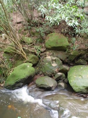
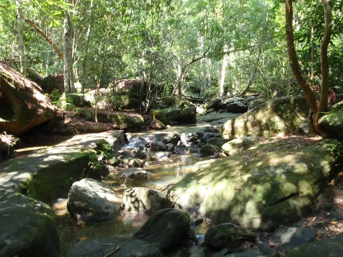
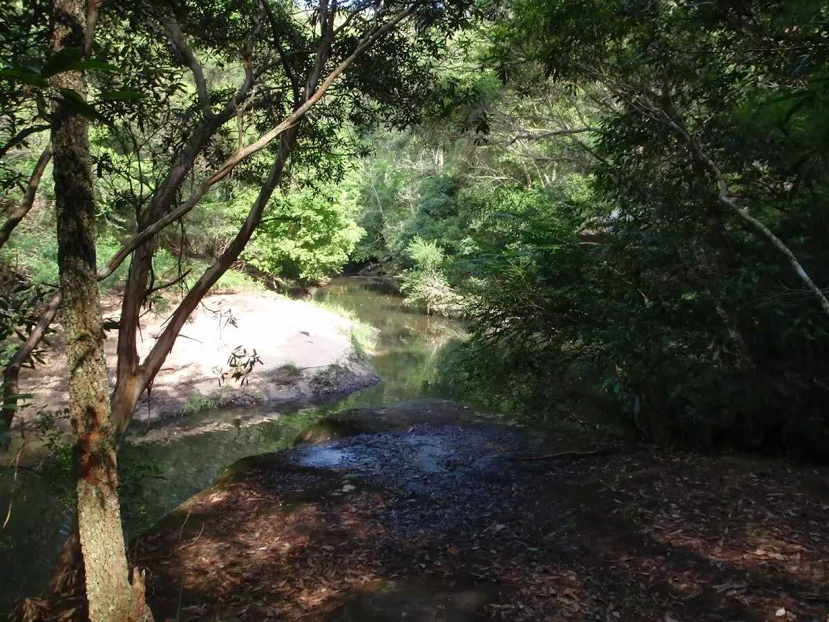 Gibberagong waterhole is an informal name for a wide section of Cockle Creek that run for over 150m north of the confluence with Lovers Jump creek. This secluded and shady spot is a great place to sit and enjoy the waterholes, cascading water and the view to the sandy banks on the other side. If you sit quietly enough you may see lyrebirds scratching through the bush by the creek.
|
 |
|
 |
|
 |
The starting point of an optional sidetrip. An optional side trip to Bobbin Head Rainforest. To start this optional side trip turn right here. On returning from this side trip turn right when you get back to this intersection. Details below.
After another 1.1 km (at the intersection of Gibberagong Track & Rainforest Track) continue straight, to head along Gibberagong Track.
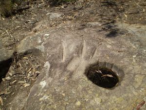
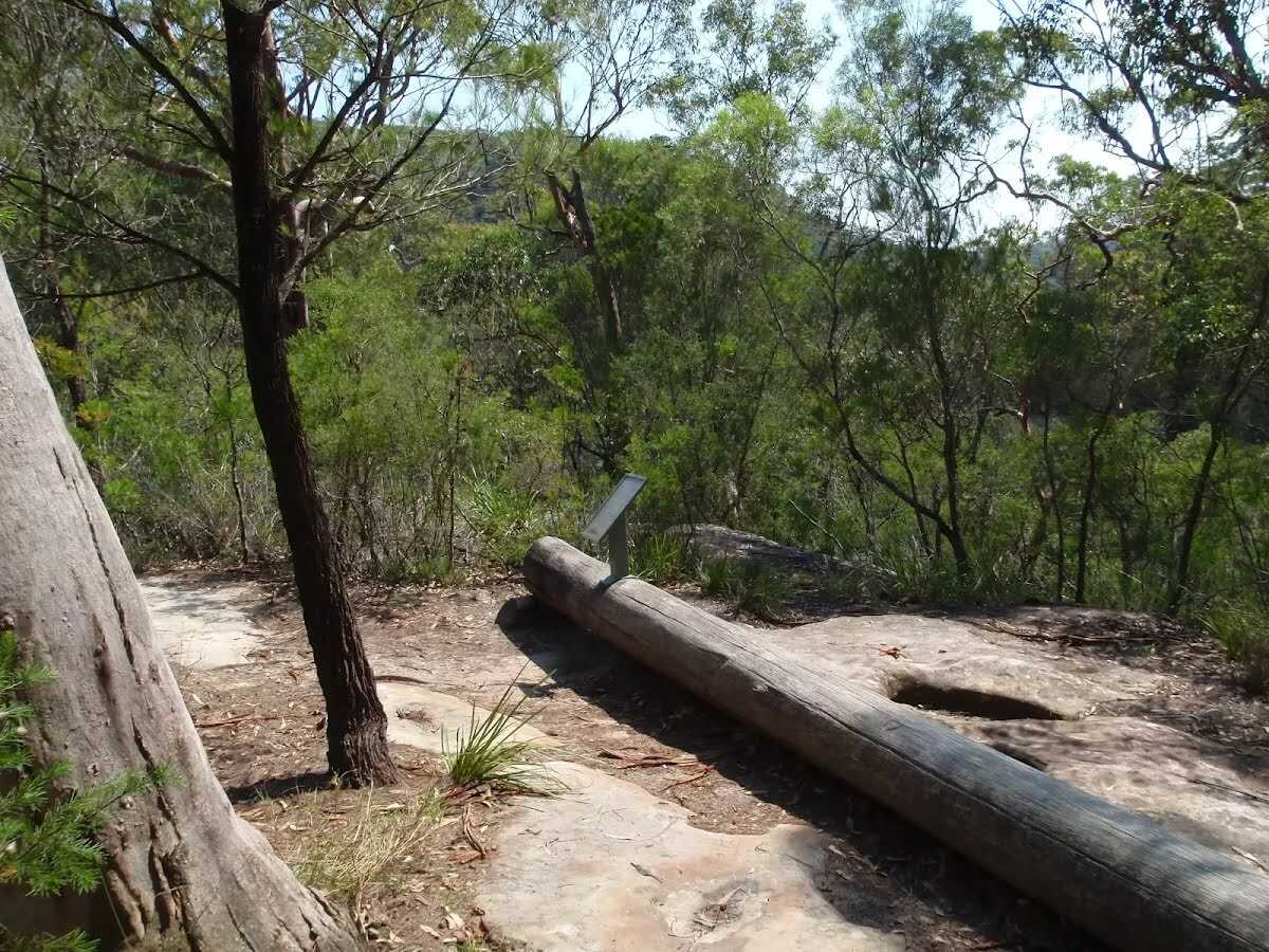 This protected site clearly shows 23 oval-shaped grooves that were worn by Indigenous Australian people, making axe heads from hard rock. Using a blank axe head, the Aboriginal people would use this rock platform, with water from the nearby creek, to sharpen the stone into a useful tool. The rubbing ground the axe head to a sharp edge and left behind these tell-tale signs.
|
 |
|
 |
After another 120 m (from the Gibberagong Track) continue straight, to head along Gibberagong Track.
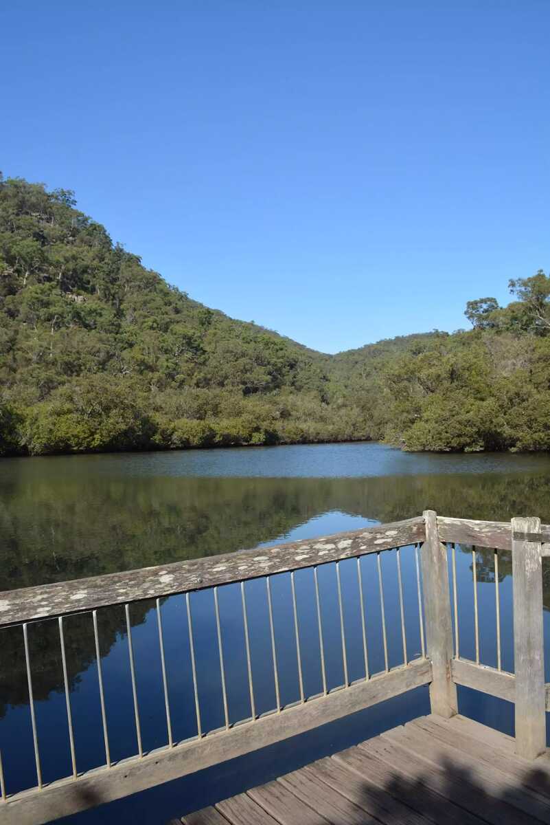 Part way along the timber Bobbin Head boardwalk is a partially fenced timber viewing platform. There is a beautiful view over Cockle Creek and a 'Teeming with life' information sign to enjoy. The platform area is 7.3m deep and 3.9m wide.
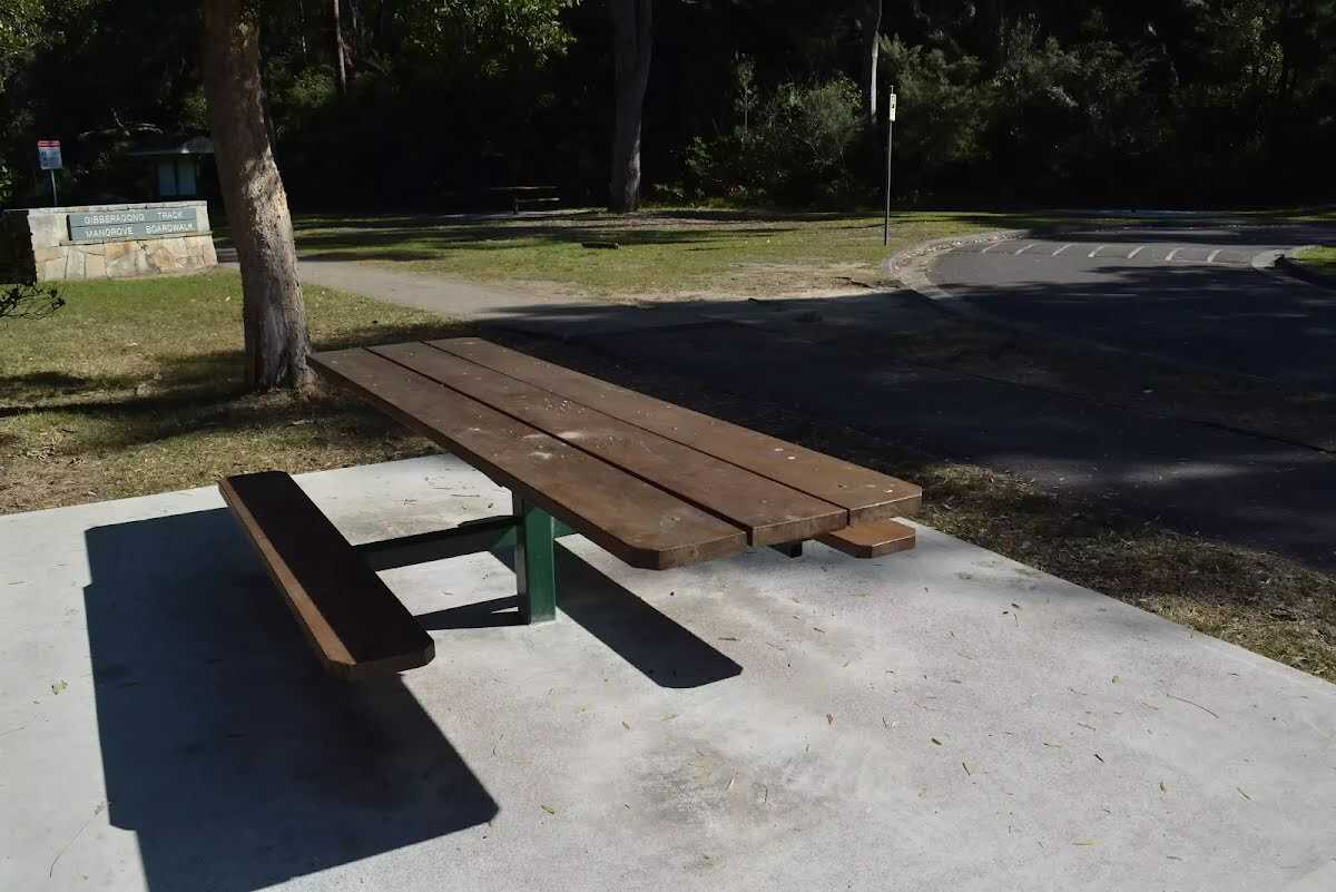
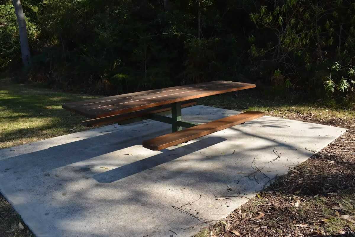
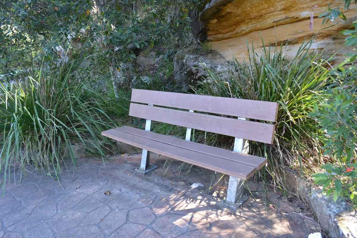 A timber slat bench seat, 43cm high, 30cm deep and 1.6m wide with a 41cm high backrest. The seat is on concrete beside the track.
|
 |
|
 |
|
 |
|
 |
|
 |
|
 |
|
 |
After another 90 m (from the Ku-Ring-Gai Chase Road) turn left, to head along Ku-Ring-Gai Chase Road (a road).
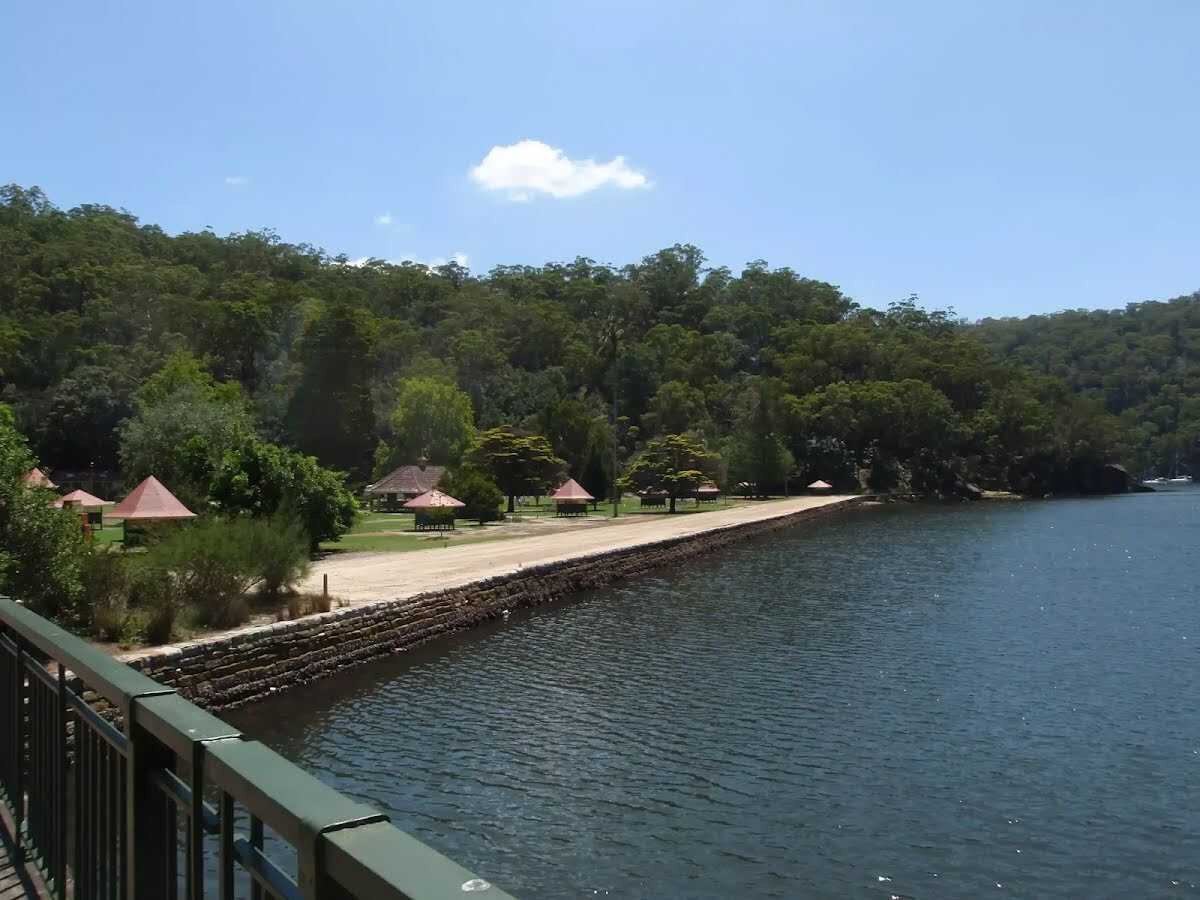 Bobbin Head is a historic recreation area which is still popular today, suiting the needs of many people. At the center of the Bobbin Head area is the old 'Bobbin Inn', built in the 1930s - it is now the park information center and cafe. The area is popular with picnickers, boaters, walkers, canoeists, family groups and people who like to fish. Bobbin Head is roughly divided into three sections (north, south and east).
Southern Bobbin Head is a popular picnic area for families and large groups. The area is surrounded by a car park and dotted with picnic tables, electric BBQs, shelters and a large playground. There are toilets nearby, and 'The Station' is a sheltered accessible area with BBQ and tables that can be booked NPWS.
The northern Bobbin Head (Orchard Park) area is a more formal picnic area. There is a large picnic shelter, surrounded by 14 smaller octagonal shelters, each of these divided into 4 walled-off compartments, ideal for small groups.
The eastern side of Bobbin Head is dominated by the Empire Marina and a public wharf. The marina is home to a nice restaurant and public toilets.
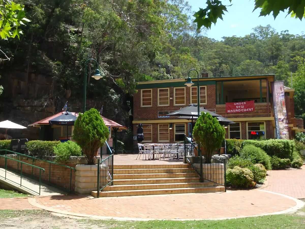 At the centre of Bobbin Head picnic area, in the old 'Bobbin Inn' building, is a cafe offering inside and outdoor dining, and a range of foods and drinks. Food includes fish and chips, wraps, focaccia, sandwiches and snack foods. Tea, coffee and cold drinks are also on offer. Opening hours are 9 - 4pm Mon to Fri (closed Tuesdays) & 9 - 5pm weekends. For more information, phone the cafe on 9457 7170.
The NPWS Bobbin Head Information Centre is open 7 days a week (closed Christmas Day) 10 - 4pm (closed 12 - 12:30pm lunch).
Ramp access available on the southwestern corner of the building. Ramp access to the information centre through the cafe.
|
 |

|
|
Class 4/6 Hard track |
|---|---|
| Length | 6.4 km |
| Time | 2 h 15 min to 2 h 30 min |
| Quality of track | Formed track, with some branches and other obstacles (3/6) |
| Gradient | Very steep (4/6) |
| Signage | Directional signs along the way (3/6) |
| Infrastructure | Limited facilities, not all cliffs are fenced (3/6) |
| Experience Required | Some bushwalking experience recommended (3/6) |
| Weather | Storms may impact on navigation and safety (3/6) |
| Item | From Start | Name & link to notes |
|---|---|---|
Seat
| 5.8 km | [seat] |
Seat
| 5.9 km | Seat |
Seat
| 6.1 km | [seat] |
Toilet
| 6.1 km | [toilet] |
Shelter
| 6.2 km | [shelter] |
Toilet
| 6.3 km | [toilet] |