| Start | (-33.1102789,151.6463063) |
| Mode | Bus Car (There is free parking available.) |
| Directions | From Pacific Highway, A43
|
| Turn map | Directions & comments |
|---|---|
 |
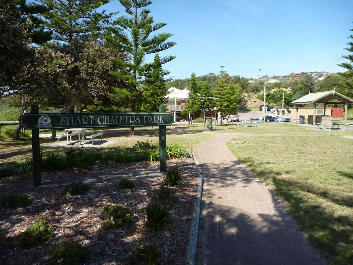 Named after a cancer victim, Stuart Chalmers Park is a well established park close to Caves Beach. Stuart Chalmers Park has toilets, car parking, water, sheltered electric barbeques and picnic tables. The park has easy access to Caves Beach, the cafe Acquablu and the Caves Beach SLSC.
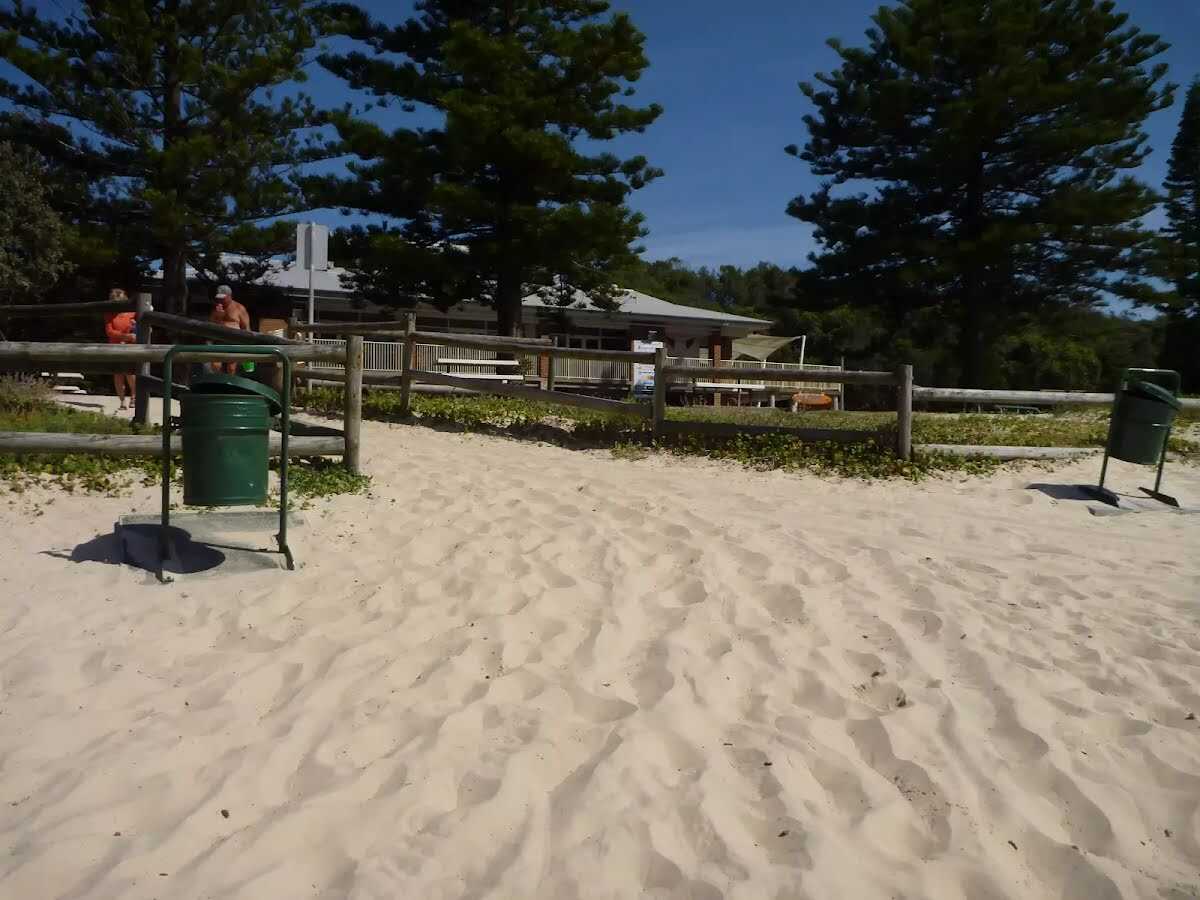 The Swansea-Caves Beach Surf Life Saving Club, south of Newcastle, was founded in 1929. The SLSC looks after Caves Beach, which runs from this southern end of the beach, for 300m to the northern Swansea (Hams) Beach. A road runs the length of the beach, with car parking along much of it. Though Caves Beach faces the south-east, it is afforded a moderate degree of wave protection by reefs in the centre and north and Spoon Rocks to the south-east.
|
 |
|
 |
 The Cave Beach Lookout, on the southern headland of Caves Beach, is easily accessible via wheelchair from the car park nearby. The lookout offers excellent views over the caves of Caves Beach and also to the north and south. There are is a large stone viewing platform on which to sit and enjoy the views.
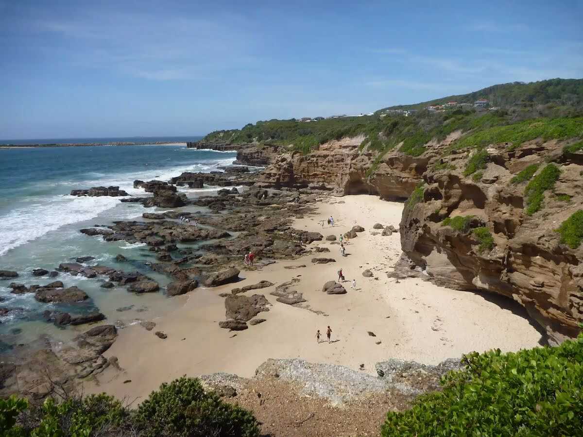
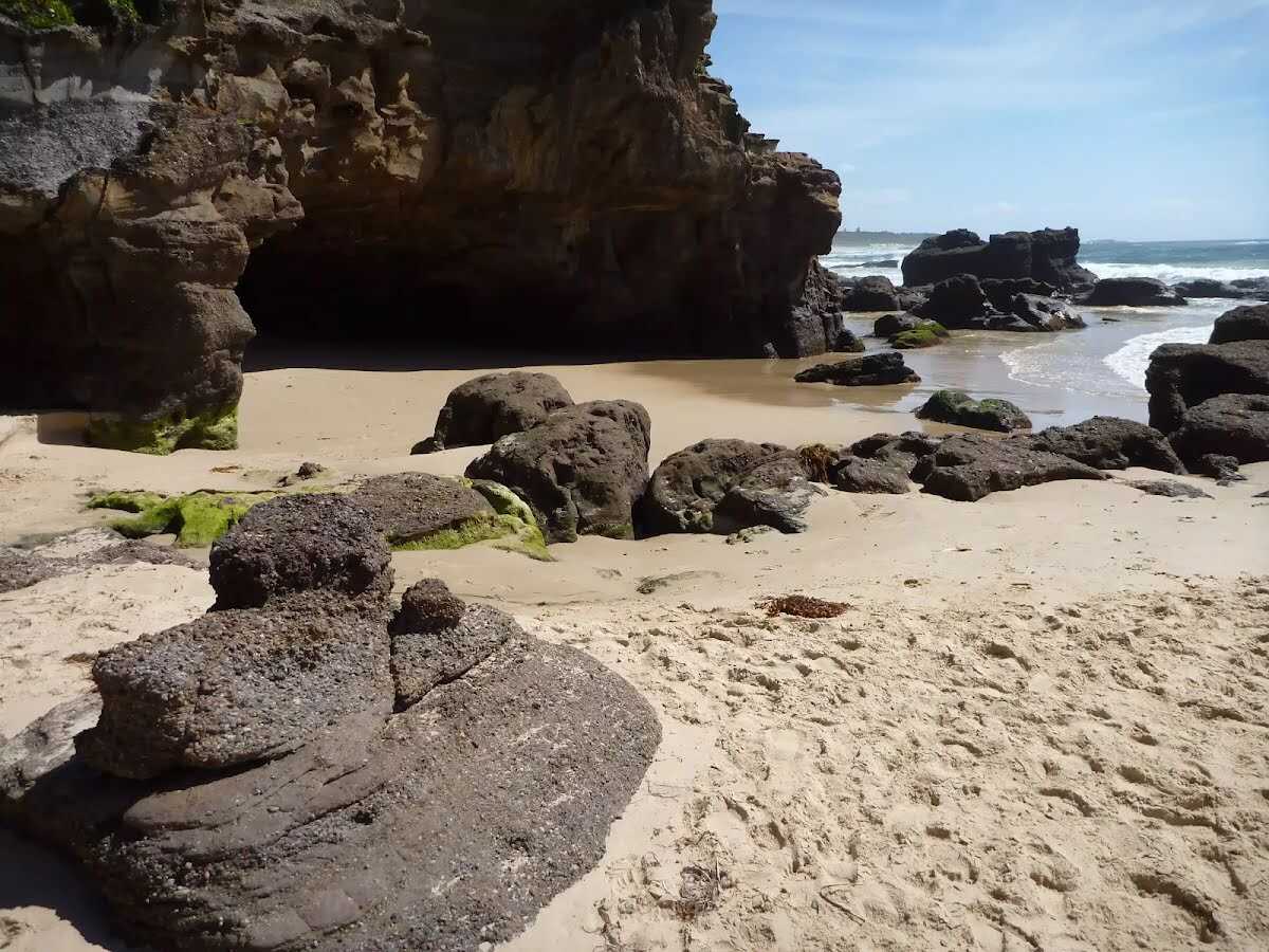 Caves Beach derives its name from the sea caves in the headland at it's southern end. The caves are only accessible at low tide. It is best to ask at the Caves Beach SLSC for local advice before attempting to visit the caves. The caves are roughly broken into two halves, with somewhat easier access to the first section of caves, while access to the second section (further to the south) is certainly restricted to low tide and light conditions. Allow time to return before the tide changes. These caves are pleasantly cool on a hot day and offer plenty of exploring potential.
 Wallarah Penisula, also referred to as the Swansea Pennisula, is surrounded by water and includes the Wallarah National Park. The Wallarah Pennisula stretches from Lake Macquarie in the west to the ocean in the east, from Swansea and Caves Beach in the north to Catherine Hill Bay and Lake Munmorah in the south. Within the Wallarah National Park, there are plenty of things to do, including walking, fishing, swimming and surfing. The coastal views are spectacular, and this is also a good whale watching spot. The Wallarah National Park co-operates with its park neighbours, including Stockland Wallarah Peninsula Pty Ltd, on a wide range of issues relating to the management of the Wallarah Peninsula through a joint management agreement.
|
 |
|
 |
|
 |
|
 |
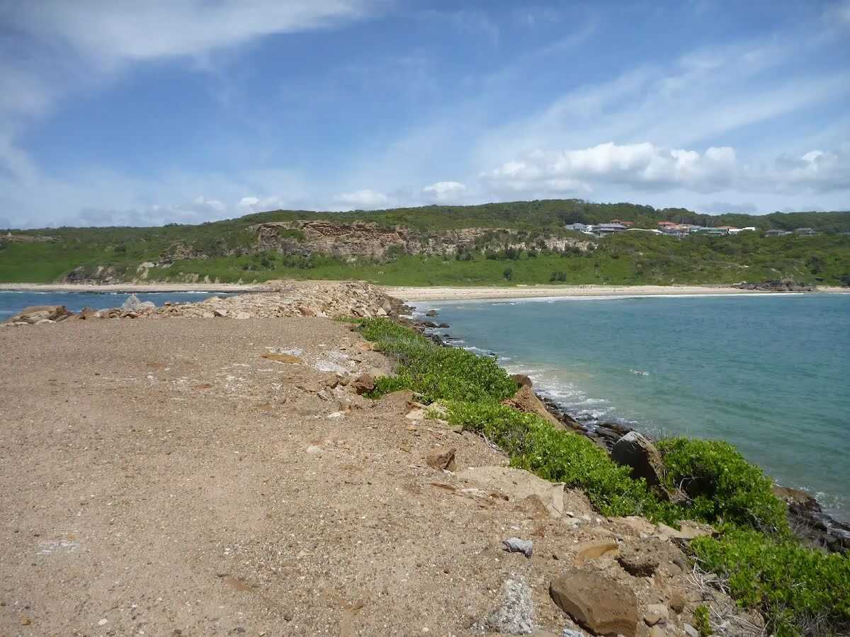
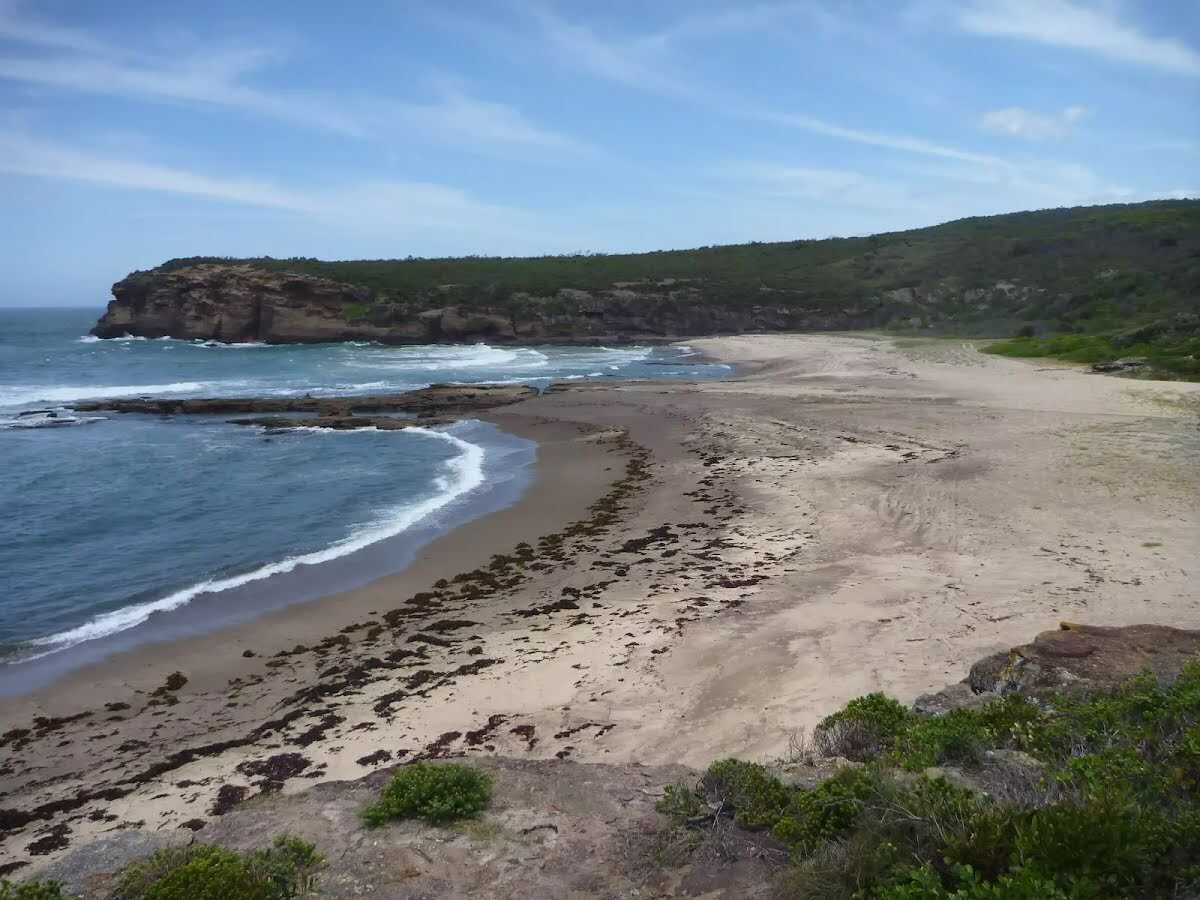
 Spoon Rocks Beach, south of Caves Beach is a sheltered sandy beach. Spoon Rocks breakwater forms the southern end of the beach and has allowed sedimentation of sand to occur and created this attractive beach. The beach is 300m long, faces north-east and is good for swimming. The Spoon Rocks Beach is worth the walk in to it.
|
 |
The starting point of an optional sidetrip. An optional side trip to End of Spoon Rocks Spit. To start this optional side trip turn left here. On returning from this side trip turn left when you get back to this intersection. Details below.
|
 |
|
 |
|
 |
|
 |
|
 |
 Pinney's Lookout overlooks the northern side of Pinney's Beach on the Wallarah Peninsula. From this timber platform, the whole of Pinney's Beach can be seen, including Pinney's Headland to the south. Some of the timber on this lookout was missing when visited, so take care.
 Pinney's Beach is a good beach for fishing, surfing and swimming. This beach is accessible on foot, via the coastal walk. This beach is not patrolled and rock platforms can be dangerous, even when the seas appear calm. Personal fishing is permitted off all the coast in Wallarah National Park, although a licence is needed. A midden (dated to about 1200 years old), with about 20 stone artefacts, was discovered here in the 1960s, but unfortunately 4WD vehicles have caused erosion to this site.
|
 |
|
 |
|
 |
|
 |
|
 |
|
 |
|
 |
There are magnificent vistas from Pinney's Headland Lookout, particularly to the north. The headland is accessed on foot via the Wallarah Peninsula coastal walk, and the headland itself has a loop walking trail on it. At the southernmost point of this walking loop, there are unfenced rock platforms forming the ocean shoreline - take care.
|
 |

|
|
Class 4/6 Hard track |
|---|---|
| Length | 8.4 km |
| Time | 2 h 30 min to 3 h |
| Quality of track | Formed track, with some branches and other obstacles (3/6) |
| Gradient | Very steep (4/6) |
| Signage | Minimal directional signs (4/6) |
| Infrastructure | Limited facilities (such as cliffs not fenced, significant creeks not bridged) (4/6) |
| Experience Required | Some bushwalking experience recommended (3/6) |
| Weather | Weather generally has little impact on safety (1/6) |