| Start | (-33.4317118,151.2766347) |
| Mode | Car (A park entry fee is required for driving into the park.) |
| Directions | From Pacific Motorway, M1
|
| Turn map | Directions & comments |
|---|---|
 |
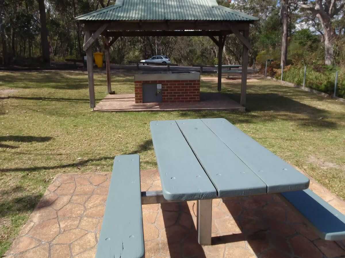 Girrakool picnic area is a wonderful family destination, just 5 minutes' drive from Kariong. The picnic area provides all the necessary facilities for a full day's activities, including barbecues, tables, shelters, water and toilets. National Park fees apply. The main picnic area is on the eastern side of the car park, and smaller, older picnic area is at the north-eastern corner of the car park. The southern Girrakool picnic area is located near the toilets. The picnic area is dedicated to John 'Jack' Higgs, the first superintendent of Brisbane Water National Park, and Mrs Vera Murdoch, who provided the funds. 'Girrakool' is an Aboriginal word meaning 'place of still waters'.
|
 |
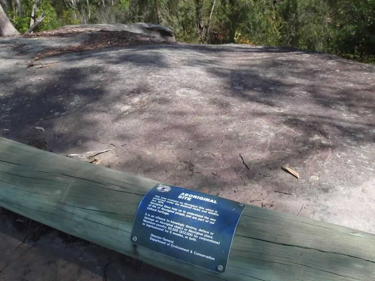 This rock platform has a log and 'Aboriginal Site' sign. Make an effort to not walk on the the engravings as this will only fade the engraving further. The engraving on this rock have faded but with a bit of effort you can make out a man and kangaroo.
|
 |
|
 |
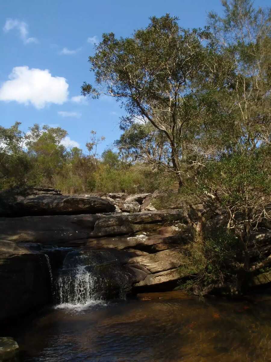
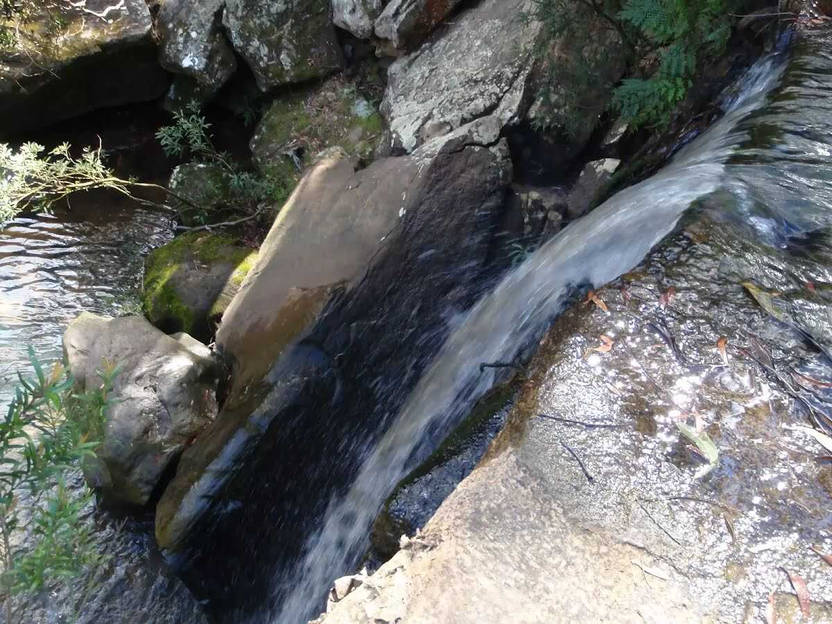
The starting point of an optional sidetrip. An optional side trip to Piles Creek Cascades. To start this optional side trip turn left here. On returning from this side trip continue straight when you get back to this intersection. Details below. 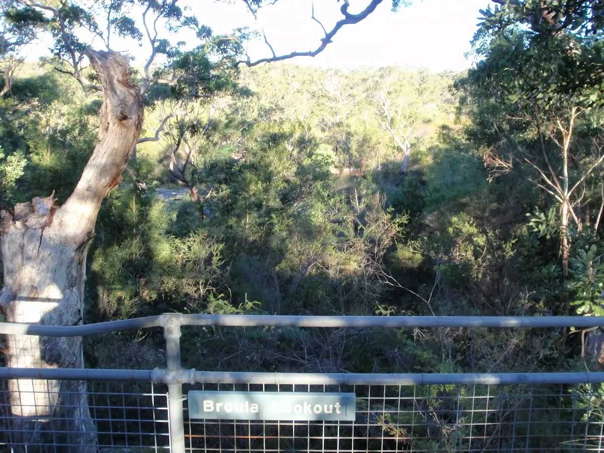 Broula Lookout is fenced and a fairly short walk down from the Girrakool picnic area. Over time, the trees in the area have grown, filtering what would otherwise be a great vantage point for the Piles Creek waterfall. Broula is an Aboriginal word referring to a place of trickling water.
|
 |
|
 |
The starting point of an optional sidetrip. An optional side trip to Piles Creek Waterfall. To start this optional side trip turn left here. On returning from this side trip turn left when you get back to this intersection. Details below.
After another 40 m (at the intersection of Girrakool Loop Track & Piles Creek Loop) continue straight, to head along Girrakool Loop Track.
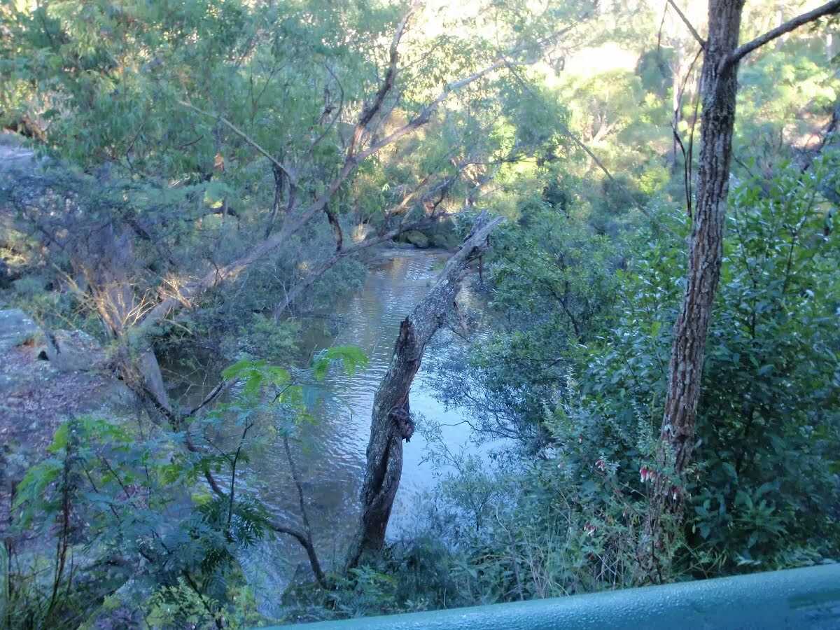 Illoura Lookout, Brisbane Water National Park, can be found a short walk south-west of the Girrakool picnic area, following the Great North Walk sign. This lookout provides a filtered view up and down the Leask and Piles Creek junction. There is a view of a waterfall from Piles Creek. Illoura is an Aboriginal word referring to a pleasant or peaceful place.
|
 |
|
 |
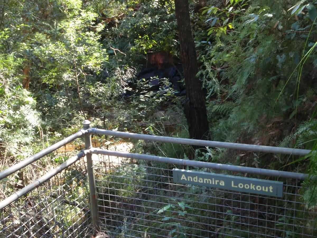 The fenced Andamira Lookout is on a platform, overlooking Leaskes Creek waterfall on the Girrakool Loop walk. The waterfall is in a sandstone and ferny amphitheatre with a sandy base. Prior to reaching the waterfall, this creek has just passed under the F3 freeway, which can be heard a short distance away. Trees have grown up over the years and the view of the water if filtered through the leaves.
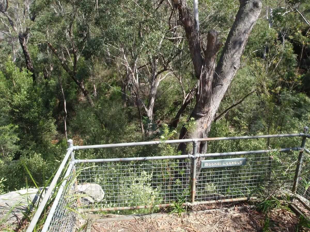 Boondi Lookout is a fenced and signposted lookout on the Girrakool Loop track, in Brisbane Water National Park. The view is mostly of the trees in the valley, with some glimpses of Leaskes Creek to the right. 'Boondi' is a word used by the Darkinjung people meaning 'Club-headed weapon'.
|
 |
|
 |

|
|
Class 3/6 Moderate track |
|---|---|
| Length | 1.4 km |
| Time | 30 min to 45 min |
| Quality of track | Formed track, with some branches and other obstacles (3/6) |
| Gradient | Short steep hills (3/6) |
| Signage | Directional signs along the way (3/6) |
| Infrastructure | Generally useful facilities (such as fenced cliffs and seats) (1/6) |
| Experience Required | No experience required (1/6) |
| Weather | Weather generally has little impact on safety (1/6) |
| Item | From Start | Name & link to notes |
|---|---|---|
Toilet
| -25 m | [toilet] |