| Start | (-33.4319388,151.2765593) |
| Mode | Car (A park entry fee is required for driving into the park.) |
| Directions | From Woy Woy Road
|
| Finish | (-33.5504179,151.2744485) |
| Mode (end) | Car Shuttle Bus Car (There is free parking available.) Ferry Special (There is no regular ferry service between Patonga and Brooklyn any more. You can easily grab a water taxi (about $80+). If you are part of a large group they can also organise a larger boat carrying 35 passengers (about $16 pp). Phone 0410 554 777 to book. Enjoy the boat ride.) |
| Turn map | Directions & comments |
|---|---|
 |
 Girrakool picnic area is a wonderful family destination, just 5 minutes' drive from Kariong. The picnic area provides all the necessary facilities for a full day's activities, including barbecues, tables, shelters, water and toilets. National Park fees apply. The main picnic area is on the eastern side of the car park, and smaller, older picnic area is at the north-eastern corner of the car park. The southern Girrakool picnic area is located near the toilets. The picnic area is dedicated to John 'Jack' Higgs, the first superintendent of Brisbane Water National Park, and Mrs Vera Murdoch, who provided the funds. 'Girrakool' is an Aboriginal word meaning 'place of still waters'.
|
 |
|
 |
|
 |
After another 40 m (at the intersection of Girrakool Loop Track & Piles Creek Loop) turn left, to head along Piles Creek Loop.
 Illoura Lookout, Brisbane Water National Park, can be found a short walk south-west of the Girrakool picnic area, following the Great North Walk sign. This lookout provides a filtered view up and down the Leask and Piles Creek junction. There is a view of a waterfall from Piles Creek. Illoura is an Aboriginal word referring to a pleasant or peaceful place.
|
 |
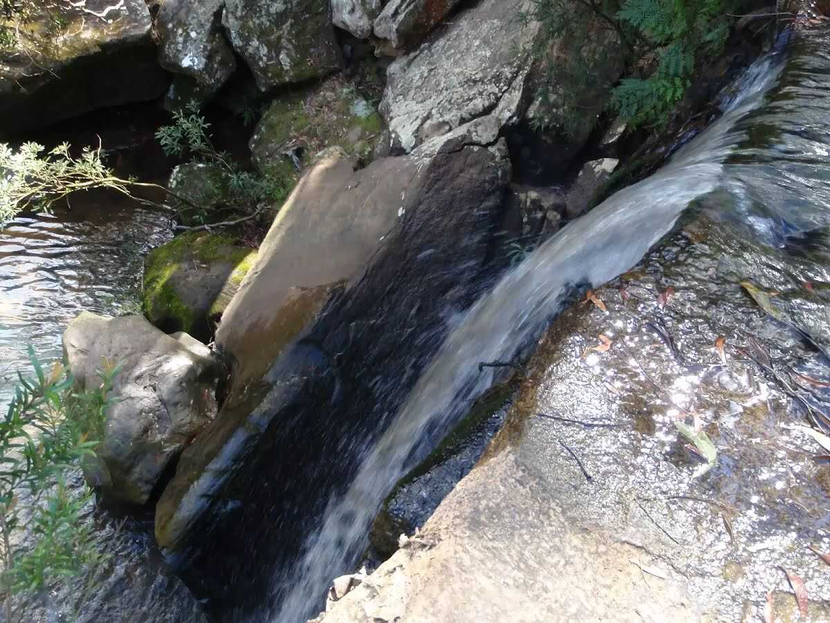 The large waterfall on Piles Creek is south of Girrakool Picnic Area in Brisbane Water National Park. At the Piles Creek Loop track crossing at the top of the falls, there is a large rock platform. The cliff edge is unfenced and would be dangerous to approach for the view. The water falls down the large drop, into a big pool below. The 'Bundilla Lookout' on the other side of the valley provides the only square view onto the falls, but even this only witnesses the top half.
|
 |
|
 |
The starting point of an optional sidetrip. An optional side trip to Piles Ck Lookout. To start this optional side trip turn right here. On returning from this side trip turn left when you get back to this intersection. Details below. 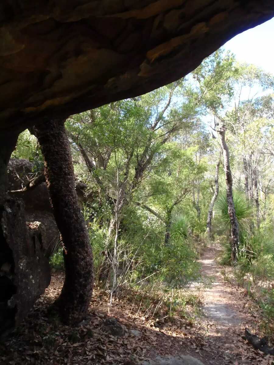 Monolith Cave is an informally named cave and interesting rock formation high on the ridge east of Piles Creek and North of Rat Gully in the Brisbane Water National Park. The cave is a fairly large sandstone overhang on the edge of the track. The cave provides shelter for walkers and is a great spot to rest and enjoy the area. This rock and the more Monolithic rock about 60m to the south are interesting to explore, and provide great views of the surrounding area. Take great care if exploring the rocks.
|
 |
|
 |
|
 |
|
 |
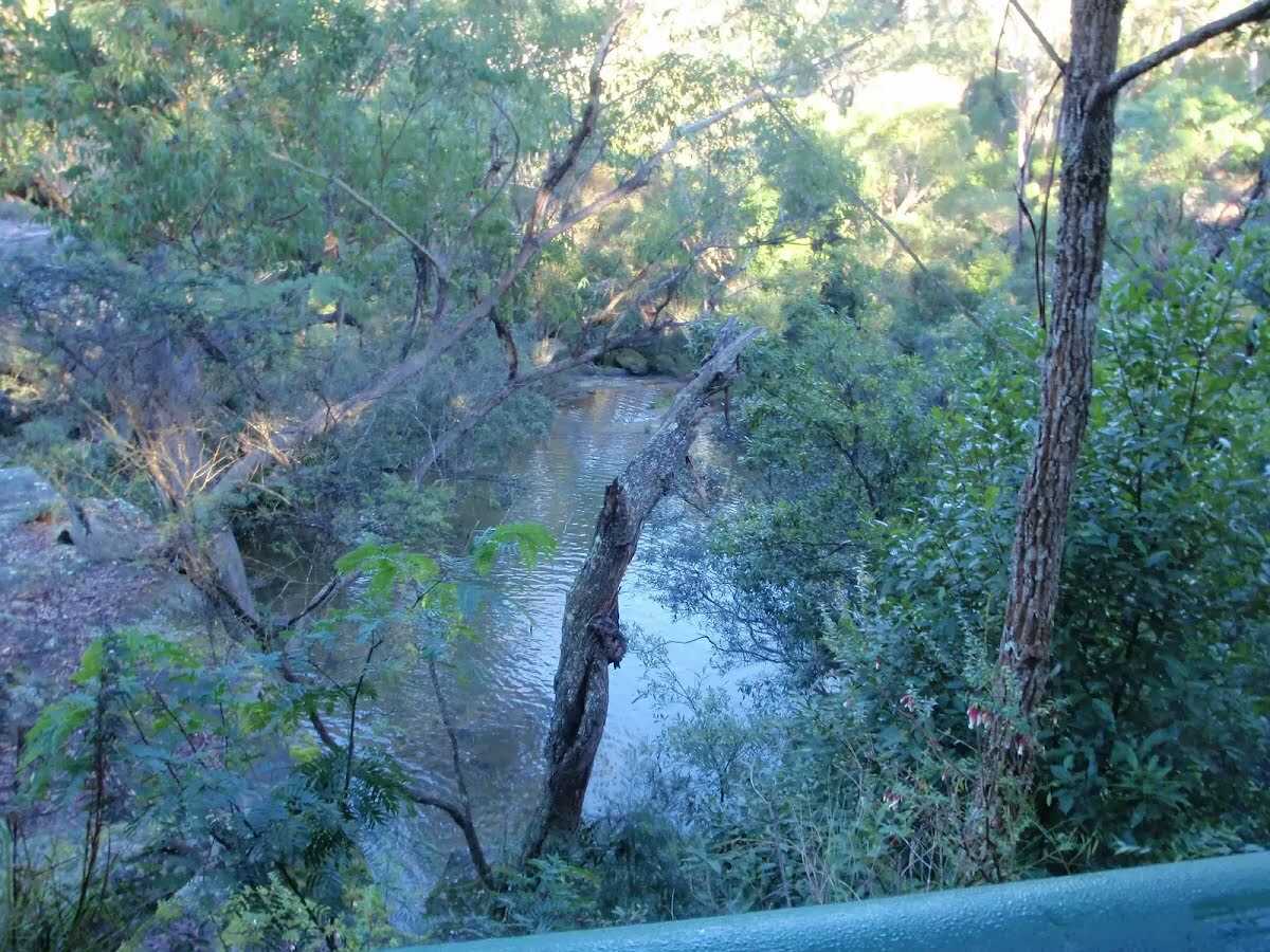
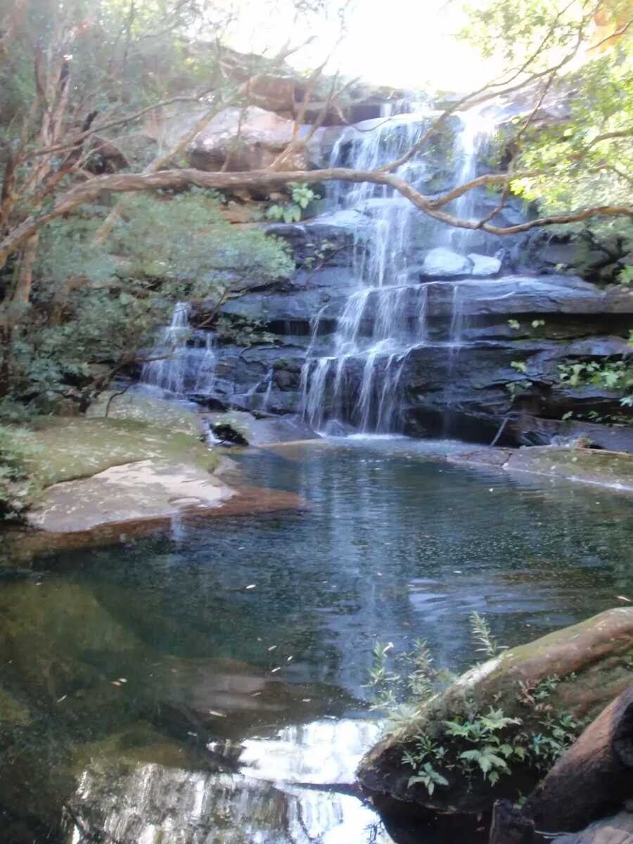 This tranquil spot of the Great North Walk is home to some lovely falls and a water hole. The eastern side of the creek has a tall sandstone cave and wall. After rain these falls can become very spectacular, other times is a cool place to rest. A great spot to stop for a snack.
|
 |
|
 |
|
 |
|
 |
|
 |
The starting point of an optional sidetrip. An optional side trip to Mt Wondabyne Peak. To start this optional side trip turn left here. On returning from this side trip turn left when you get back to this intersection. Details below. 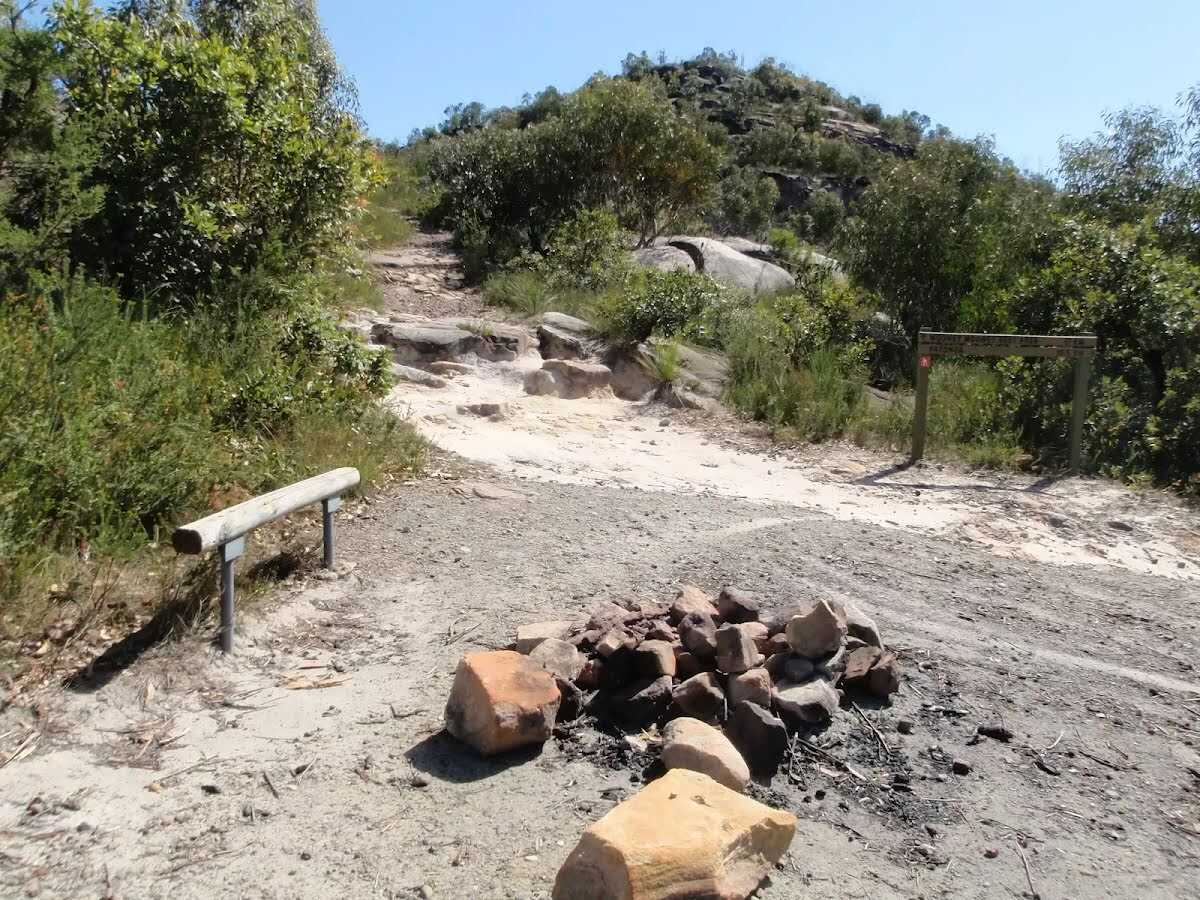 This basic campsite is found at the end of a management trail, near the base of Mt Wondabyne. The campsite is at the bottom of a small (east facing) rock wall and has trees surrounding much of the area, providing some shelter. There is an established fire circle and a basic seat. There is no water or other facilities. (There is also small cave suitable for sleeping a few people about half way up Mount Wondabyne).
|
 |
|
 |
|
 |
|
 |
|
 |
|
 |
|
 |
|
 |
|
 |
|
 |
|
 |
|
 |
|
 |
After another 940 m (at the intersection of Warrah Escape Trail & Warrah Trig Road) continue straight, to head along Warrah Trig Road.
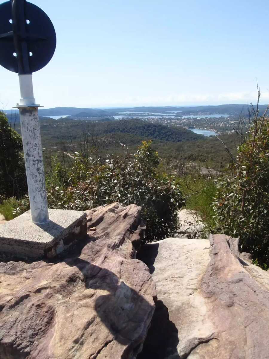
 Warrah Trig Station is part of a national geodetic survey established during the 1970's. The 'Triangulation station' (aka trigonometrical or trig station) is a distinct marker once clear of trees, and would have been visible for many kilometers in the area. There are many such trig stations around Australia, which were used to help in surveying. Each station has a know position and altitude, which allows surveyors to use triangulation and determine another point's location. With advances in technology, these trig stations have been abandoned and superseded. The trig station is now surrounded by trees, with some filtered views along the Hawkesbury River. The area is rich with wildflowers in spring.
|
 |
The starting point of an optional sidetrip. An optional side trip to Warrah Lookout. To start this optional side trip continue straight here. On returning from this side trip veer left when you get back to this intersection. Details below.
|
 |
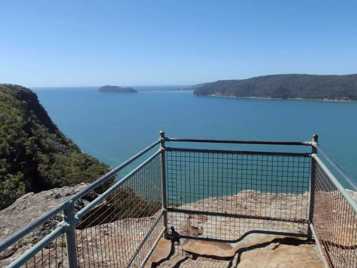
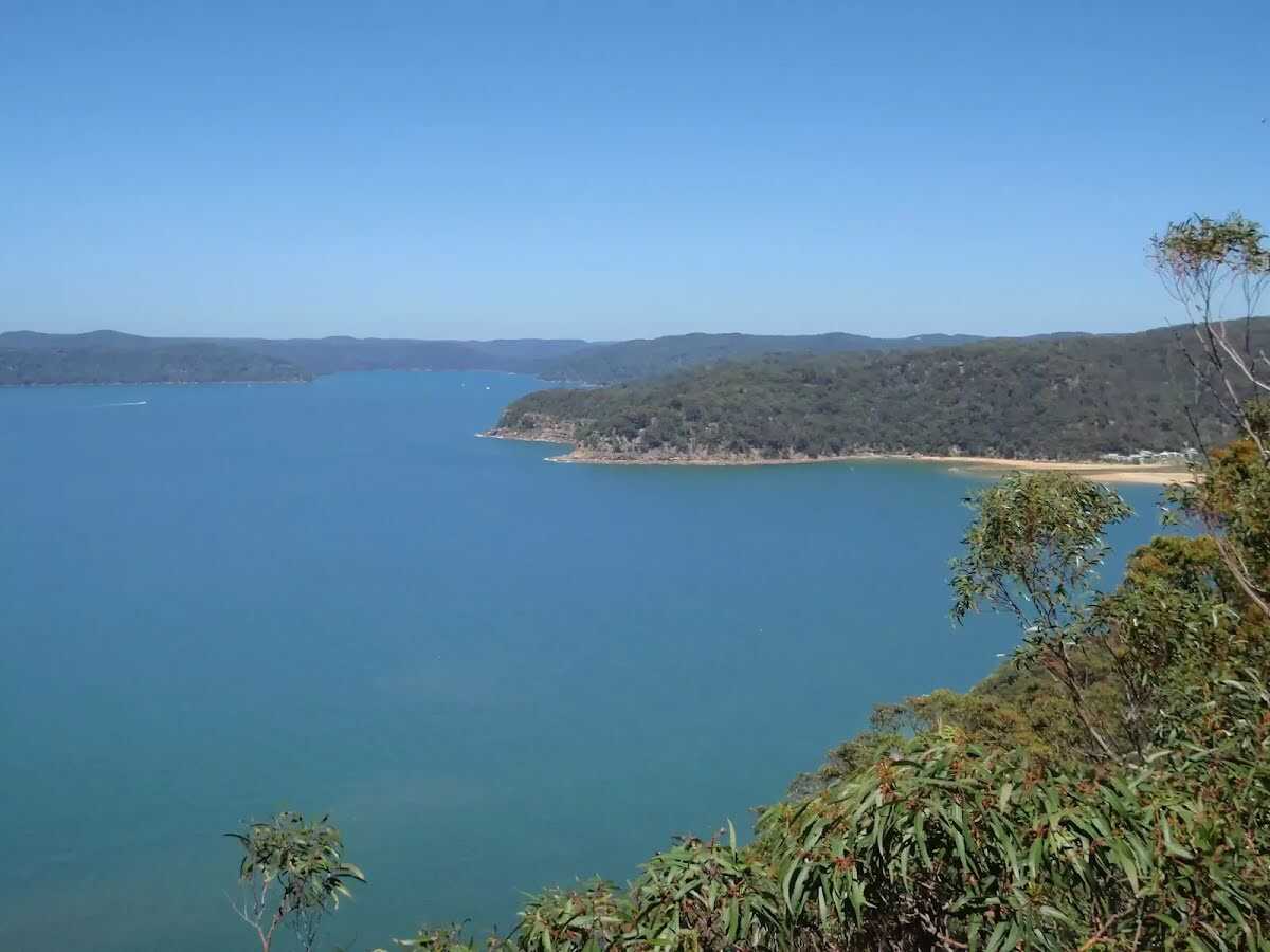 Broken Bay View is an informal, unnamed and unfenced vantage point at the top of the cliffs, east of Patonga. The large rock platform has a number of large Sydney Red Gums, providing some shade. There are great views across the Hawkesbury River, along Cowan Creek and to West Head. The views to the left extend past Lion Island to Barrenjoey Head and out to the Pacific Ocean.
|
 |
|
 |
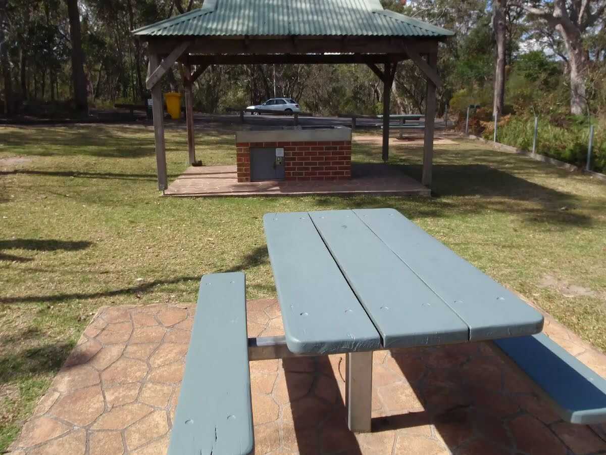
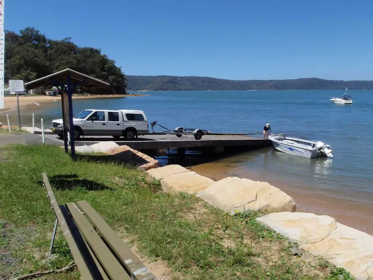 Warrah Reserve boat ramp provides a large car park and access to both the boat ramp and Patonga Beach. There are garbage bins, a picnic table and information board. The boat ramp offers good views along the beach to 'Dark Corner', found at the eastern end of Patonga Beach.
|
 |
|
 |
|
 |
|
 |
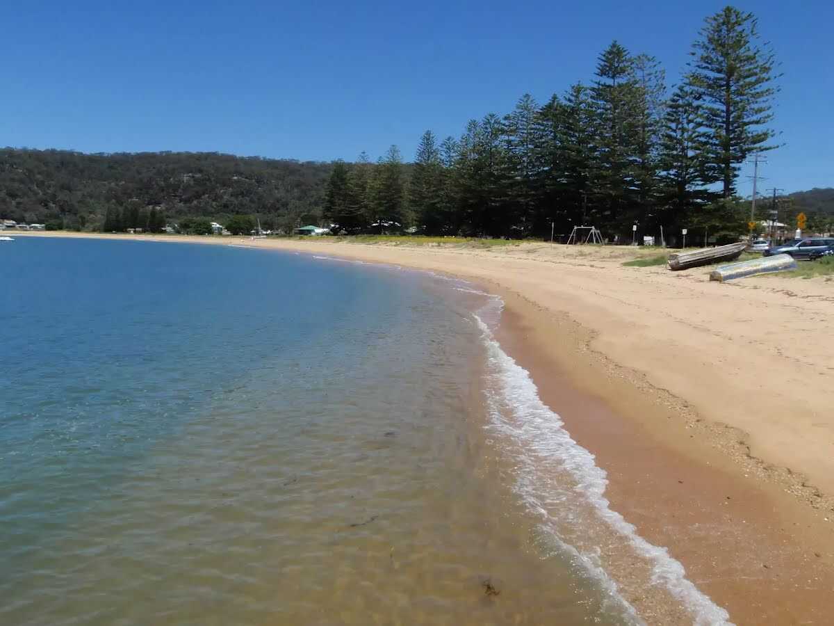 Patonga Village is a lovely small township on the Hawkesbury River. Just near the ferry wharf are a few helpful facilities:
The Eve Williams Memorial Oval, where you will find a large pavilion, drinking water and public toilets.
A fish and chips shop (and general store) is open reasonable hours, where you can buy lunch, a coffee and basic supplies (fishing needs, milk, canned food).
Patonga Beach Hotel is available for a cold drink at the bar or a meal on the deck, or even overnight accommodation (from $242 a couple) ph: 02 4379 1111.
|
 |
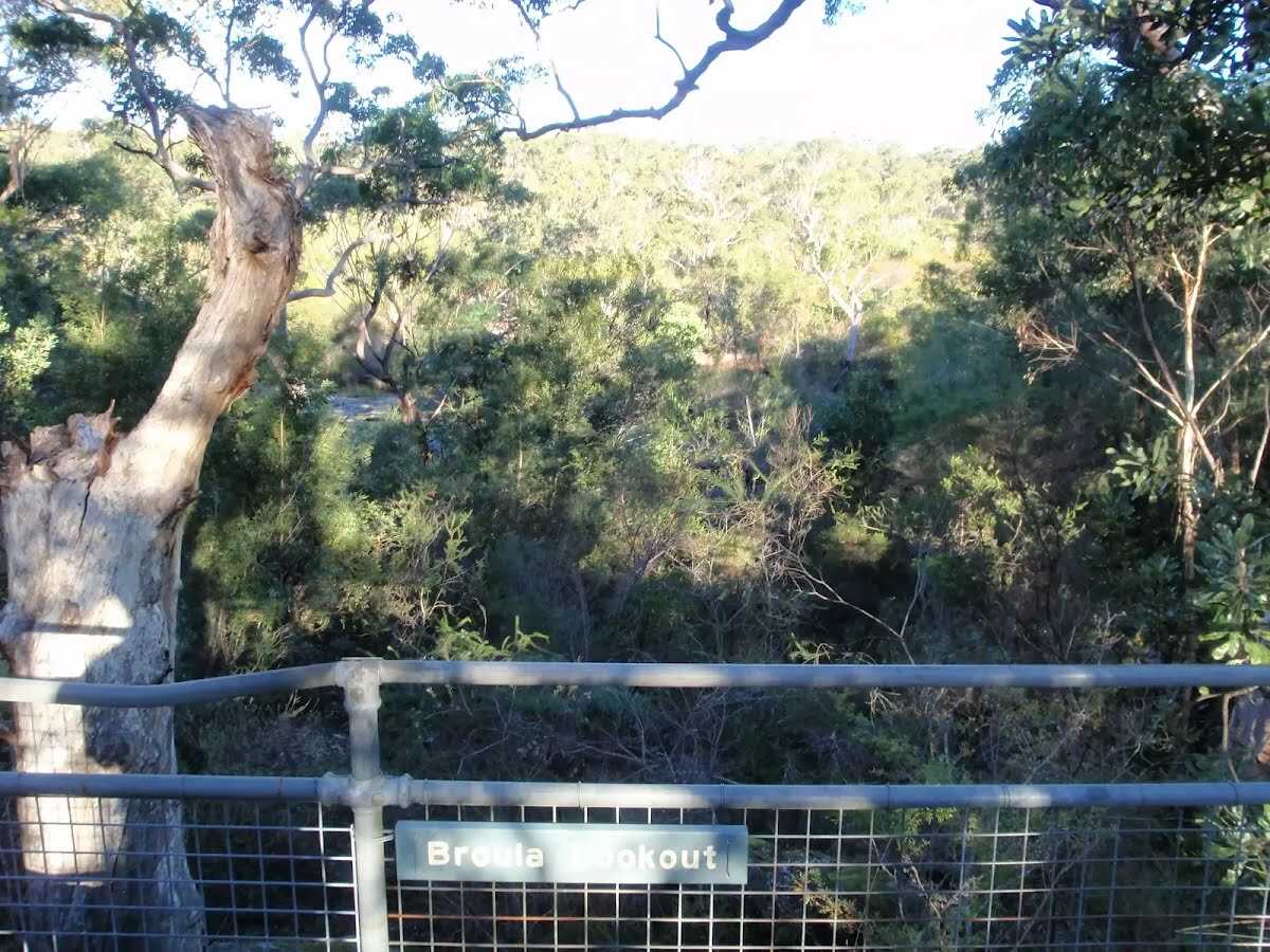 Broula Lookout is fenced and a fairly short walk down from the Girrakool picnic area. Over time, the trees in the area have grown, filtering what would otherwise be a great vantage point for the Piles Creek waterfall. Broula is an Aboriginal word referring to a place of trickling water.
|
 |
|
 |

|
|
Class 4/6 Hard track |
|---|---|
| Length | 24.4 km |
| Time | 10 h to 2 days |
| Quality of track | Rough track, where fallen trees and other obstacles are likely (4/6) |
| Gradient | Very steep (4/6) |
| Signage | Minimal directional signs (4/6) |
| Infrastructure | Limited facilities (such as cliffs not fenced, significant creeks not bridged) (4/6) |
| Experience Required | Some bushwalking experience recommended (3/6) |
| Weather | Storms may impact on navigation and safety (3/6) |
| Item | From Start | Name & link to notes |
|---|---|---|
Toilet
| 50 m | [toilet] |
Campsite
| 13.4 km | Mt Wondabyne Campsite |
Toilet
| 24.3 km | [toilet] |
Shelter
| 24.5 km | [shelter] |