| Start | (-33.1041609,151.230605) |
| Mode | Car |
| Directions | From , Somersby. |
| Finish | (-32.9952377,151.3003893) |
| Mode (end) | Car Shuttle Car |
| Turn map | Directions & comments |
|---|---|
 |
|
 |
|
 |
|
 |
|
 |
|
 |
|
 |
|
 |
|
 |
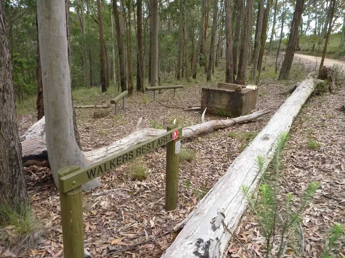
 This relatively small campsite is a flat open clearing a stones throw away from the dirt road with a small fire pit and enough room to comfortably pitch three tents. There is no water available at this campsite so you will need to make sure you have enough to last until you get to the next water source.
|
 |
|
 |
|
 |
|
 |
The starting point of an optional sidetrip. Side trip to Mt Warrawolong. At 642m above sea level, it is the highest point of the Great North Walk. To start this optional side trip turn left here. On returning from this side trip turn around when you get back to this intersection. Details below.
|
 |
|
 |
|
 |
|
 |
|
 |
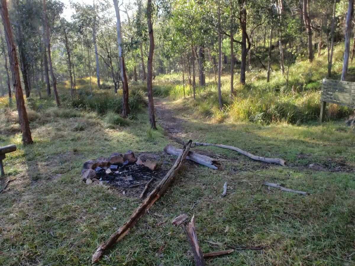
 This neat little signposted campsite consists of a brick fireplace with a couple of basic wooden seats and some room for a few tents. There is no water available at this campsite.
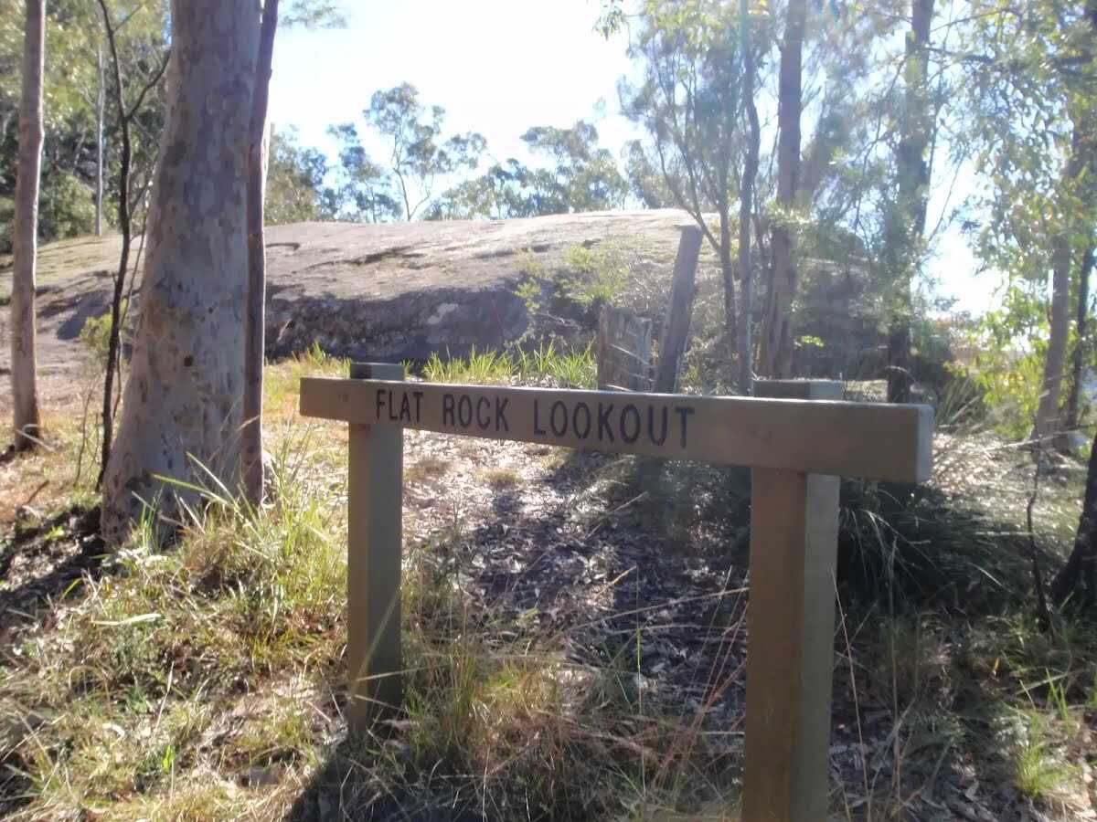 Flat Rock Lookout is a natural rock platform that offers magnificent views across the Congewai Valley to the east and north. There are, however, no fences or safety railings at the lookout, so walkers will need to exercise extra caution.
|
 |
|
 |
|
 |
|
 |
|
 |
|
 |
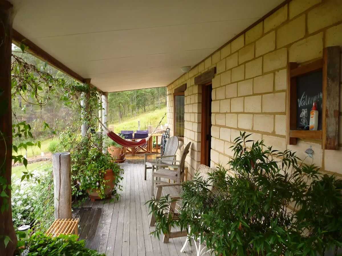
The starting point of an optional sidetrip. Side trip to Lonely Goat Olives - a tranquil country cottage in Congewai Valley, about 900m from the GNW. The cottage has two separate bedrooms, both with en-suites. The bedrooms open on to a veranda with views over the gorgeous valley and the Tuscan style olive groves. The cottage has an outdoor BBQ kitchen and both rooms have a satellite TV, Wi-Fi Internet access, bar fridge, toaster and kettle. Rooms are from $202 a night including breakfast, meal packs are also available. A two night min. stay is normal, but chat with Keith about mid-week and other options. Your friendly host is also happy to pick you up or drop you off at Watagan Creek Rd for about $75. Ph 02 4998 1693 To start this optional side trip turn left here. On returning from this side trip turn sharp right when you get back to this intersection. Details below.
|
 |
|
 |
| Turn map | Directions & comments |
|---|---|
 |
|
 |
|
 |

|
|
Class 3/6 Moderate track |
|---|---|
| Length | 29.5 km |
| Time | 9 h 30 min to 2 days |
| Quality of track | Formed track, with some branches and other obstacles (3/6) |
| Gradient | Short steep hills (3/6) |
| Signage | Directional signs along the way (3/6) |
| Infrastructure | Limited facilities, not all cliffs are fenced (3/6) |
| Experience Required | Some bushwalking experience recommended (3/6) |
| Weather | Storms may impact on navigation and safety (3/6) |
| Item | From Start | Name & link to notes |
|---|---|---|
Toilet
| 25 m | [toilet] |
Entity|rest area
| 2.6 km | Wollombi Brook Pool |
Campsite
| 7.9 km | Mt Warrawolong Campsite |
Campsite
| 12.3 km | Watagan Creek Campsite |
Camp site
| 12.4 km | Mt Warrawolong Campsite |
Seat
| 15.9 km | [seat] |
Campsite
| 16 km | Great North Walk Campsite |
Accommodation
| 23.4 km + 950 m | Lonely Goat Olives |