

The MacDonnell Ranges are a long chain of mountains stretching about 150 kilometres west of Alice Springs, desert country where water can be scarce. The winter months have very mild to freezing temperatures enabling multi-day walking. My walk was in September, and a run of warm weather made it a challenge. Despite its harshness, the majestic rock faces and various colours combine with magical waterholes to make it a place worth the effort to explore and that live long in the memory. The long-distance Larapinta Trail runs along this range.
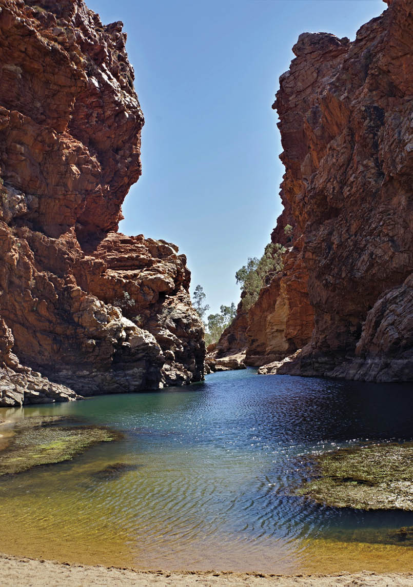
Ellery Big HoleAll photos by Brian Eglinton

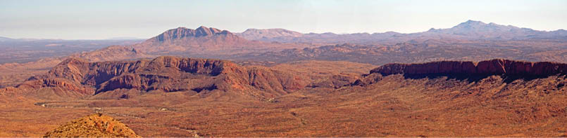
Western Macs
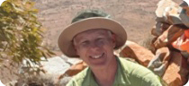
Brian Eglinton

20 | BWA December 2020


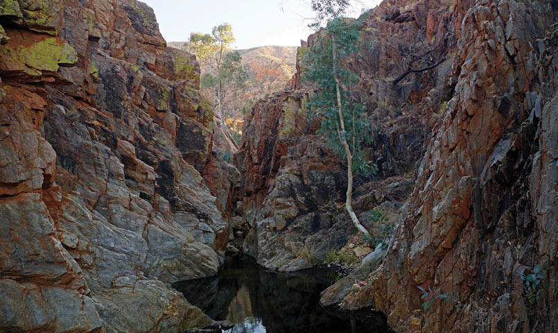
Ormiston from Giles
Changing plansAs with most of my trips, it was a case of reworking the plans on the run.
Ribuck has spent a lot of time in the area and it was under his excellent guidance that I was able to get to the top of Mount Giles.
That was day two of a nine day plan, but with 30 degree plus temperatures during the day, the drain due to lots of sweat and muscle fatigue led me to parting ways after day three.
So when this report is finished, it will be of two divergent tales. My tale is of a five day trip with a rest day, followed by a three day trip.
Starting outWe met up the day I flew in, and checking the time I suggested a quick run up the local exercise route at Mount Gillen, a short distance out of Alice Springs.
Next day was a drive out to Ormiston Gorge to start the walk. This first five day walk involved passing through a lot of burnt out country, and the start of the popular Pound
walk was very black. We took a very direct route to the base of Mount Giles, which meant some scrub bashing up a winding valley and then climbing to a high ridge. This then drops through an easy wide open valley which had also been burnt recently.
There were more places holding water when I went through late August in 2013. I was feeling the conditions and needed to have rests, so we settled with camping near the first waterhole off the Giles massif. Despite incredibly dry conditions, this consisted of a number of pools leading back to a waterfall pool and then more in the gully above that. I cramped that night as the body relaxed, but that had happened on a few of my more recent trips after a hard first day. So I was hoping to bounce back on day two.
The plan was to go over the top of Giles with full packs to camp at a canyon some distance east along the northern edge of the range. The day was warming quickly and I could feel the strain of the climb and decided it would be best to rethink the plan. It was decided to drop packs but finish the climb of Giles and then return and continue to Giles Yard Springs.
BWA December 2020 | 21
Oasis
So with light day packs we continued up the relentless very rocky climb to the top and enjoyed the vast vista on offer. The top of Giles has little level ground, but people have made small clearings at various levels to allow overnight bivouacs. And all the approaches to it are steep. We took lunch at a lovely waterhole in the gully adjacent the climbing ridge.
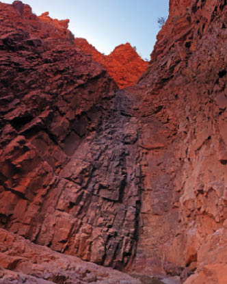
We then made off in the heat aiming for Giles Yard Springs. It was getting quite late and I was really struggling, so when we arrived at Oasis waterhole we had to camp. It had a delightful pool but not much clear ground for camping. Upstream was a constricted gorge that hid a large basin with several creeks leading up the sides of the range. We did not try a wade to see beyond.
That night I had severe cramping in both quads of the upper legs. This was a new spot for me and a bit disturbing. I had been taking magnesium, staminade drinks and straight salt, but still suffered on these first two days.
Ribuck was happy to go with a rest day - which for him was providential - as he accomplished his great goal of getting
into the upper Canyon of Defiance on this day as a solo walk over the top of the range and then dropping down. In retrospect he thought that this task was probably best done from exactly where we camped.
I slept till 11 am (it was getting very hot in the tent) and then took a day walk to Giles Yard Springs and explored. The high route along the southern edge of the Giles massif was burnt and is quite bare, crossing a lot of saddles before working along some valleys.
But Giles Yard Springs was exceptional with lots of pools connected by flowing water.
Camping is not allowed in the main spring area, but the flowing water and pools extended past the fence and the burnt out sign that marks the boundary. This is where people camp.
Heading upstream to the main spring, despite the fires that went through the gully becomes lusher and after a series of rocky pools ends in a large pool below a waterfall. The afternoon light was on the fascinating upper reaches above Oasis on my return Ribuck returned late afternoon. It was a very peasant spot apart from some windy gusts and given the area had been burnt out, a lot of fine black soot got into my tent and gear.
“... he accomplished his great goal of getting into the upper Canyon of Defiance ...
22 | BWA December 2020
Decision to return and restNext day I decided I was not confident I would not cause more trouble if I went to a point three days from the car, so with Mount Giles under the belt, we decided to part company. Ribuck went on to explore his canyon in more detail and I retreated for a day's break.
We planned to meet again at Bowmans Gap - Ribuck would be traversing the Redwall ridge over two days. I retraced my GPS back along the face of Giles.
Given a relaxed schedule, I decided to explore two of the streams coming off Giles. In each case, they begin with a small gorge which opened out into some valleys behind before heading steeply up the slopes. The first one led to a series of four dry waterfalls which I climbed.
The second led to a dry waterfall which became impassable with a large boulder to skirt before ending under a large chockstone bridge. This stream also had some flowing water in it - as well as a deep worn rock basin with water in it at the entrance gorge. I then proceeded more directly to the day one Giles campsite, passing the climbing ridge on the way.
My plan was to take an hour's rest at the waterholes here and stock up with water before using the last light of the day to head out into Ormiston Creek East branch to camp.
I was pleased to meet NNW here. She had been exploring extensively and was planning on using the waterhole gully to climb Giles probably the next day.
I said my farewells and headed off towards the Pound. Next day was another warm one and I made my way along Ormiston Creek to Ormiston Gorge. Early on I picked a straighter path a little higher on the northern bank through a flat section of spinifex. Dropping back down into the creek I found Ribuck's "where is this" waterhole - now very dry and sandy.
Ormiston Creek has a lot of ups and downs as it alternates between sand (which is like walking in molasses) and very rocky outcrops. I found two spots with water prior to reaching the junction of the East and West branches as they combine to flow through Ormiston Gorge.
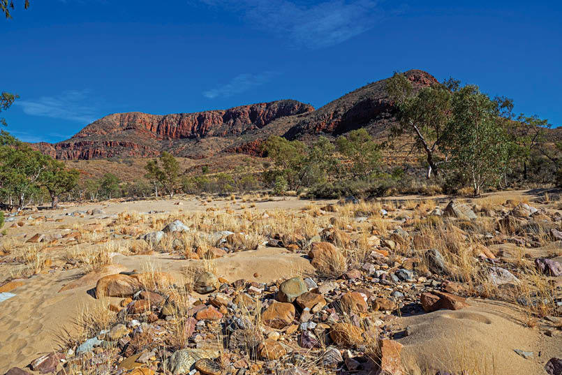
Ormiston Hill
“I was pleased to meet NNW here.
BWA December 2020 | 23
I cut through some spinifex just before the junction of the two arms, dropped into the creek for a while and then climbed out before intercepting the official Pound Track. I then began to meet day walkers in the area. The pools in Ormiston were dry or very low. The walk out had been in good time, but the heat had still taken a toll and I was happy to take things a bit slower and relax. It is possible to get a shower at Ormiston and I made use of that. I drove the 130 kilometres back to Alice and booked two nights.
Next day was my rest day - but after a slow morning I did a tourist run dropping in on Simpsons Gap and Glen Helen Gorge. It was fascinating to see a swarm of Zebra Finches at Simpsons Gap; I saw another lot drinking at Ellery the next day. I saw a number of different birds while in the area. The Northern Territory has more diversity of birds than any other state except South Australia.
I had not decided exactly what to do the next day, but started with more tourist activities - Ellery Big Hole and Serpentine Gorge, which demonstrates a tremendous amount of folding in the strata. Here as in many places such folding indicates a plastic condition in the rock which results in no cracking. This would be consistent with the whole stack of layers being contorted while they have still not solidified into hard rock.
The view from the upper lookout is into a valley with three major ridges. Access is currently restricted into the inner gorge, but the second ridge is highly constricted. Along with places like Redbank Gorge, these water gaps (where the stream runs through a mountain range rather than flowing around it) look very young. A slow carving out over millions of years would not leave such steep vertical walls.
The second tripI was feeling pretty good by the time I got back to Ormiston (I did the 130 kilometres drive six times over the 11 days) and decided to go for Bowmans Gap in the late afternoon. I had already greatly reduced my pack weight based on lessons from the first hike and knowing from Ribuck that Bowmans Gap had good water.
There had been a change in weather and the maximum for the day was forecast as 24 °C - much cooler. Once again I chose to go through Ormiston Gorge but starting with a high route past the Ghost Gun lookout which drops down mid gorge. After stumbling and almost breaking the camera (again?), I took off my graduated prescription dark glasses. I rarely used them on this walk, but this stumble emphasised how they distort the view of my feet.
The official pamphlet shows an unmarked track over the hilly shoulders rather than following the creek. This route was initially quite good, though it is full of spinifex, but it does come to a very rocky and steep section which slowed me down. Having spotted a lone walker, I dropped down to ensure they were okay. It was a lady who was local and very well prepared, carrying nine litres of water. We passed two waterholes on the way there, but it was certainly much drier than my trip at a similar time of year in 2013.
There are two waterholes in Bowmans Gap itself; the first is very large but not flowing.
We parted here as I wanted to go on to the second waterhole at the other end of the Gap.
This one appears to be a spring out the cliff face and while shallower is extensive and flowing in parts. It was my camping spot for the next two nights.
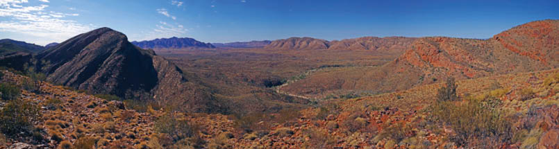
Pound Panorama
“ It was fascinating to see a swarm of Zebra Finches at Simpsons Gap
24 | BWA December 2020


The next day I wanted to get the early sun on Mount Sonder. Assuming the northern slopes would get me a view, I was early climbing. It was a big mistake to have left the gaiters off.
These slopes are covered in spinifex, so it was a careful climb. I also discovered that west of Bowmans Gap is a quite high area, meaning I had to go a fair way up to see Mount Sonder.
Having gone that far I decided to carefully press on to the very top, and from there I decided to push all the way along the ridge to the top of the big waterfall about 1.5 kilometres distant.
This is a complex and difficult place to get views. I tried a few exposed spots from the very top before getting into the gully itself. Climbing down this, I was reluctant to go the very lip of the fall, as the rock was polished and very steep. Taking a line across the slope
to a higher point on the edge, it was clear an unobstructed view was not available.
On the return leg, I managed to very carefully work to a spot more directly above it - and with camera suspended over the void got a shot with most of the waterfall in it.
It is a four drop waterfall - the first drop lining up with the valley into a good pool, then it turns 90 degrees to go over a small drop to a small rock pool before going over a larger drop to a bigger pool. It then angles around to again follow the valley line over a rocky drop that can be climbed from the bottom.
I retraced my steps on the return journey, with most things now in good light. Breakfast was still waiting. The views back along Waterfall Valley were great.
Sonder Zeil Panorama
Bowmans Waterhole
“Assuming the northern slopes would get me a view, I was early climbing.
BWA December 2020 | 25

After brekky, I decided to check out a waterhole I had seen from up top. Apparently named Whistling Kite Waterhole, it is a bit over a kilometre upstream from Bowmans Gap. Ribuck wandered into camp around lunchtime. We used the afternoon to explore up Waterfall Valley from the bottom. It was my second time up this valley, and it is a scary place. After working up a broad creek valley, it rapidly narrows and forms a very sharp V. A large cliff towers over the left-hand side, while a very steep and broken rock shelf slopes in on the right.
The slope angle can vary, but looking up at various places there are line after line of thick rock slabs just perched waiting to break off and slide down to crush anything in its way as it hits the cliff on the left. If this had been eroded slowly over time, there should have been a substantial pile of debris lining the bottom in various states of wear.
There is clearly some debris in the slot, but some sections have none at all, and where it does lie, it is very thin. The valley looks like it was eroded very cleanly so that almost all of the rock removed was swept a long way away leaving quite a pristine rock surface. And the time since then has seen only a small amount of debris building up by normal erosion rates.
Early in this section, you need to get past a number of rock pools. Last time I had to work up the sloping rock shelves to get around, but this time the levels were low enough to get past all but the last one. We gave up the attempt to climb through it. But the slope we then climbed was steep indeed. And coming back down it was a careful exercise as well.
I had previously stopped just above this last pool, but this time we followed an easy line of cracks in the sloping rock and got the waterfall proper. The first face of the four drops can be climbed a couple of ways and leads to some large rock slabs and some gravel with a plunge pool. You cannot see the top two drops from here, but it is hard to get photos to give a true impression of the place.
Curiously, using my phone to take a vertical shot was about the best I could do.
I took to the slopes on the way back to see if I could get a vantage point in the late afternoon.
Next day was an easy walk out, this time sticking to the creek bed up to meeting the Pound Track.
After we had cleaned up at Ormiston Gorge, we had a relaxed drive back to Alice. We also dropped in on Standley Chasm on the way for an ice cream and to check out the Chasm in comparison with what Ribuck had seen in the Canyon of Defiance.
But this is the end of my part of the tale. A tough, but rewarding expedition.


Brian is from Adelaide and like to get out regularly throughout the year for some multiday hiking. The cool winter weather generally sees him heading north to the Flinders Ranges and Central Australia.

The second face of the waterfall
26 | BWA December 2020