

Have you ever dreamed of climbing a continent's highest peak? For many, I am sure this question immediately evokes images of the Himalayas and the stunning Mount Everest. Whilst there would be few capable of tackling such heights, it's out of reach for the rest of us.
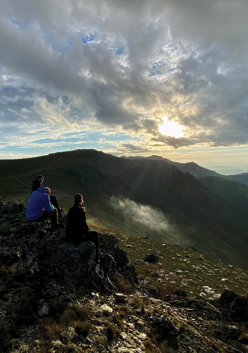
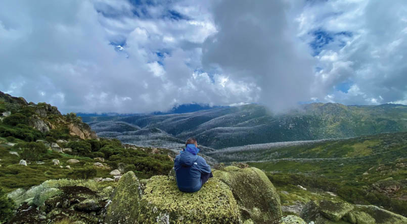
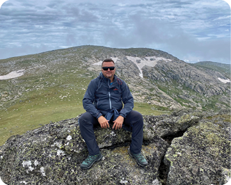
Sunset from KosciuszkoAll photos by Norbert Benko

15 Highest Peaks in Australia in Four Days
Norbert Benko

10 | BWA April 2022
Australia's highest peak, Mount Kosciuszko, is only a quarter the height of the famous mountain. Summiting it is just a gentle few kilometres walk on tracks, then you're there on top of Australia at 2228 metres. Situated in the beautiful Kosciuszko National Park (KNP), the mountain is surrounded by beautiful lakes and streams.
We might not have the highest mountains in the world, but we certainly have the oldest. Our peaks have withstood the force of time, battered by millions of years with high winds and extreme weather to achieve their current beauty. The Australian Alps Great Dividing Range and KNP are unique. There is no other mountain range in the world where you can summit all 15 highest peaks within one pack carry hiking expedition.
I named it "15 Highest Peaks in Australia in 4 Days Expedition", and planning began. Mapping out a suitable trail proved challenging. Not only to ensure that all 15 peaks could be reached within four days, but also that the trail could be tackled with 20+ kilogram packs without ropes or climbing equipment. There is no better way to plan this than on a detailed topographic map where we could clearly see ridges and any cliffs. I will get into the details of the chosen trail later, but the walk was to start and finish at Charlotte Pass, near the ski resort.
Being a summer expedition, we set the date to start on 26 January, Australia Day. As I've mentioned "we" several times, it's only fitting to introduce the members now. We are a team of seven passionate hikers with experience from many corners of the world. Two members with experience in hiking in the Himalayas, including summiting 6000+ metre peaks, an experienced hiker from Quebec, Canada, two members originally from Iran and Scotland, our Captain and oldest member who has hiked almost every continent in the world, and of course me. Having such experience was comforting, and I knew that we could rely on each other no matter the circumstances.
Departure approached; anxiety levels grew, but the excitement of what we were about to embark on was insane. Backpacks were checked and rechecked to ensure we had everything to survive the four days, exposed to the elements at altitudes of 2000 metres. Weather forecast watching became a daily habit, and it wasn't looking great. The forecast for three out of the four days was thunderstorms, following a heatwave that preceded the entire week before our journey.
Then came D-day. We said our goodbyes to our families and loved ones and began the 500 kilometre drive from Melbourne to Jindabyne, a small town near the Snowy Mountains. It is one of the highest settlements of its size in Australia. It overlooks the beautiful Lake Jindabyne and serves as a gateway to Kosciuszko National Park.
After driving through Gippsland it was slow going through the Snowy River National Park on the gravel and unpaved roads, but that allowed us time to admire the scenery of the stunning Snowy River. Should you wish to extend your stay there are many camping sites on the way. For us though, it was a straight drive through to Jindabyne.
At Jindabyne we stopped overnight, and the next day drove to Charlotte Pass 43 kilometres away to begin the expedition. This was the last night of sleeping in dry, soft beds with the luxuries of kitchen and bathroom facilities. I don't know when I fell asleep or how many times I woke up that night, but one thing but one thing I recall quite clearly was waking up at 5:30 am. The first thing I did was to unpack the entire backpack and rechecked it for maybe the 100th time. This was day 1 when we left civilisation and headed into the mountains.
We drove the short distance to Charlotte Pass, arriving at around 8:30 am. The sky was a little cloudy but there was no sign of rain or other extreme weather.
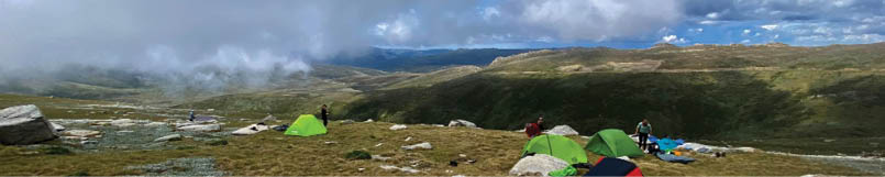
Camp below Rawson Pass
BWA April 2022 | 11

The south side of Twynam
Day 1: Charlotte Pass, Twynam, 18 kmThe first part of the day's itinerary was relatively easy, with a gradual ascent. We followed the well-travelled Main Range Track for about five kilometres and arrived at Blue Lake at the foot of Mount Twynam. After a short break to fuel up and take some photos, we followed the track for another kilometre or so, before joining the ridge that would eventually take us to the first three peaks of our expedition, which we would summit today. At this point, our experience showed. It was decided that we would leave our packs at the junction with the ridge and tackle the peaks with day packs only, then return to the intersection.
The following 12 kilometres were relatively easy-going with only day packs on. One thing to note is that there is water everywhere, with many streams from the melting snow. Yes, you heard me right. There is snow still up there in January. Therefore, you don't need to carry much water with you, maybe 1.5-2 litres in your pack is sufficient at any one time with constant refills. Some streams are clean, and the water doesn't need to be treated most of the time.
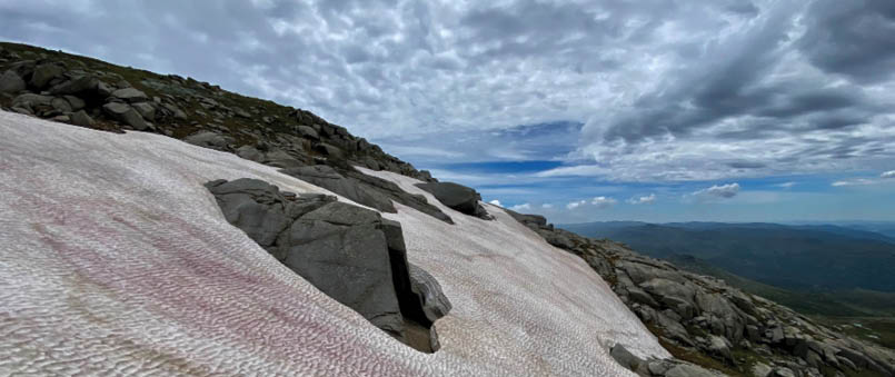
After about two hours from the junction, we reached the summit of Mount Twynam, 2195 metres. The views are stunning up there, and on the southern sides, the slopes were covered in snow. After a short break, we descended into a valley and climbed the next peak, Little Twynam, 2132 metres. The snow-
covered views from here are just exhilarating, and we knew we had to explore them before continuing onto the third peak of the day.
I could not believe my eyes. The icy snow was a metre or two deep, and all this was in the middle of the Australian summer. Just stunning. The melting snow created several small waterfalls and streams of fresh water. A short snow fight followed, and then we were off again through grassy and rocky terrain. At about 2 pm we reached the last summit of the day, the Tenison Woodsknoll, 2134 metres. The views of the Snowy Mountains from here are spectacular and need to be put on canvas for all to see.
As we slowly descended the ridge back to the junction, the sun and the gentle wind started to take a toll on some members. We returned to the junction at 5 pm and decided to set up camp nearby, as the next section of our journey was another peak, and we all needed a rest.
We found a flat plain on the southern side of the hill, just south of the Twynam turnoff, which proved to be the best decision made on this expedition. With camp set up we made some warm lunch/dinner; and some of us ascended a nearby hill to watch the sunset. It was partly cloudy, but the sun's rays created beautiful colours on the mountains - a relaxing time contemplating the day's 18 kilometre journey. As the sun set, the clouds started to come in, so we decided to call it a day and returned to our tents. The wind also started to pick up, but nothing could prepare us for what was to come in the morning.
“The icy snow was a metre or two deep, and all this was in the middle of the Australian summer.
12 | BWA April 2022
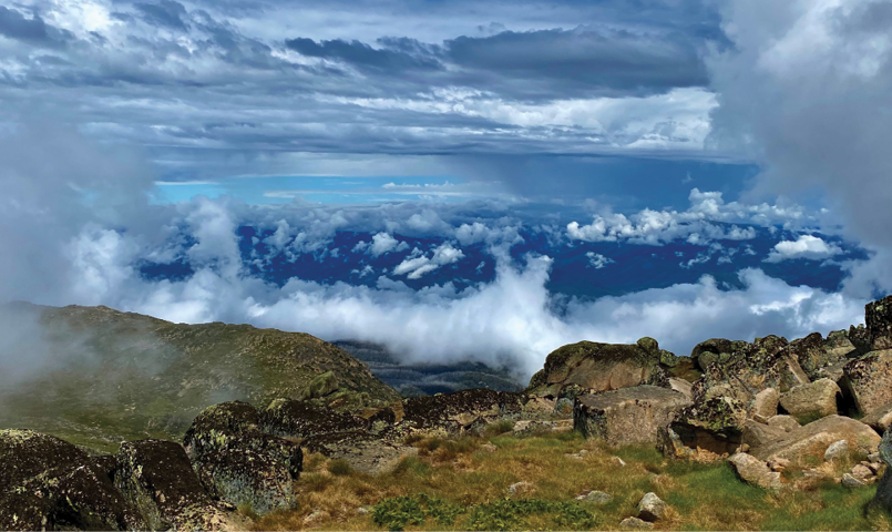

Looking north from Kosciuszko
Day 2: Carruthers, Northcote, Kosciuszko, 17 kmI woke up around 6 am to the relentless sound of the wind. It was insane. I looked outside and could not see past 15-20 metres. We were covered in white clouds with such wind gusts that we could not hear each other talking. To make things even worse, one of our team members had set up his tent some 100 or so meters from the rest of the group to be closer to a stream. This proved to be a huge mistake. He lost his orientation and could not find us for two hours and vice versa. Frustration grew as we should have been on our way, and instead, we were searching for one of our own. The number one rule to remember in any expedition is to stick together, and I am sure none of us will ever forget it. It was 10 am by the time we were all together again, and to add to the wind, the rain arrived. This was on a day we had planned to summit seven peaks.
We began by following the Main Ridge Track, with summits of the Carruthers Peak (2145 metres) and Mount Northcote (2129 metres) in zero visibility, slashed by the relentless wind and rain. Due to the weather, seven kilometres into the day we decided to walk all the way to below Mount Kosciuszko in the hope we could track back the next day and complete the other five peaks.
By around 2 pm we arrived under Mount Kosciuszko, and the weather had completely cleared, with the sun out again.
We set up camp in the valley north of Rawson Pass and decided to summit both Kosciuszko (2228 metres) and the nearby peak Etheridge Ridge (2188 metres) with just day packs. This gave us the opportunity to tackle the five peaks we missed out on the day before, as well as the remaining three, on the final day. The weather was kind to us the whole afternoon, so summiting was quite easy. We also managed to visit Lake Cootapatamba, beautiful.
Returning to our camp at about 6 pm, someone suggested that it would be nice to summit Kosciuszko for the sunset, so five of us went up again. The sun hid behind the clouds, but we were still given some gorgeous views of the Alps. Arriving back at camp at around 9 pm it was high time to sleep. The 17 kilometre day had it all, and we were grateful to be safe and progressing our quest to climb all 15 peaks, with eight completed in two days. Not bad, considering the extreme changes in weather. A thunderstorm came with the night, but we were all safe in our tents and exhausted from the day, so most of us slept through it well.
BWA April 2022 | 13

Day 3: Du Faur, Abbott Peak, Townsend, 14 kmThe morning of day three started with cloudy skies but no rain and good visibility. Unfortunately, two of our team members decided to head back to Charlotte Pass and not complete the expedition. Without going into the reasons for their departure, it was a sad moment. We bonded so well over the first two days, and they will be greatly missed.
After saying our goodbyes, we decided to keep our camp as is and head out to the five peaks with day packs only. We set off at about 8 am, reaching the summit of Mount Du Faur (2159 metres) by 11 am. After this we went to Abbott Peak (2155 metres) and then on toward the second highest mountain in Australia, Mount Townsend (2209 metres). This mountain was considered the highest mountain in Australia for years. It was called Mount Kosciuszko until it was discovered it was smaller, and the names were simply switched. We reached the summit at around 1 pm and had a short break to replenish energy and of course, take photographs. The weather was holding up for us with only some low cloud cover around, and the morale in the group was upbeat. We then continued along the ridge summiting Alice Rawson Peak (2170 metres) and then finally Muellers Peak (2129 metres), which overlooks Lake Albina.
By now, the bad weather was coming in fast, and we hurried back to our camp, arriving at around 5 pm. We were so lucky.
After this 14 kilometre day, within 30 minutes, the mountains were covered in grey clouds with zero visibility. The icy wind and rain started to beat on us. This was the coldest night by far. Everything was damp, and the only warmth available was in our sleeping bags. I don't remember if anyone set foot outside of our tents, except for a toilet break, of course.
An early night meant early morning; that was the plan. All agreed that we would abort the mission and return to Charlotte Pass the next morning if the weather did not improve.
Day 4: Rams Heads, Charlotte Pass, 23 kmThe weather gods were on our side as the morning greeted us with sunny breaks and partly cloudy skies.
We quickly had our breakfast, packed up the camp, and headed towards the three Rams Heads to complete our goal. After a four kilometre hike we arrived at a junction under North Rams Head (2178 metres). It was around 9 am with no sign of rain. We headed to the summit with day packs on our backs, reaching it around 10:30 am. We reached the summit of Rams Head (2193 metres) through the ridge an hour or so later. One more to go.
Serenity of the mountains, just below Rams Head summit
14 | BWA April 2022
By now, everyone was on autopilot and still enthusiastic, with one last summit remaining. The route to the South Rams Head (2191 metres), took us through some valleys with plenty of water. The sun was shining, and it was pretty humid, so the water was refreshing. Here is where we saw our only snake, a red-belly black enjoying the sun on a rock. At about 1 pm we finally made it, the last and 15th peak of our expedition. High fives and hugs were all around as our exhausted bodies realised what they had achieved. After a well-earned break, it was time to head back to our packs and then walk out of the mountains to Charlotte Pass.
Exhaustion causes bad decisions, and it was no different with us. Tracking off the summit we decided to take a shortcut, thinking it would be easier than climbing over a smaller peak. What a wrong choice! It did take us around the peak, however, to get back we had to go over additional two smaller peaks.
By the time we reached the junction and our packs, it was 3 pm. The skies had turned completely dark, and peals of thunder could be heard in the distance. In front of us was another eight kilometres, four of which were through some level plains full of little streams and creeks.
As soon as we lifted our packs onto our backs, literally all hell broke loose. Heavy rain and lightning were all around us. The ground underneath turned to running creeks within minutes, and for the next three hours we put our heads down and walked among hundreds of lightning bolts that were hitting the ground around us. I am not exaggerating at all. Over 100 bolts hit the very plains we were walking on. All I could see from underneath my hood were flashes of light followed by its immediate rumble. This was the scariest thing I have ever lived through.
Ankle deep water and lightning just don't go well together. I don't think any lightning hit closer than a couple hundred metres from us, but the sound was deafening. I think all of us just accepted the fact that if it hits, it hits, and just kept walking through the water. With all the downpour, my pack felt heavier than when we started, but fear eliminated tiredness, and we kept on.
And as with previous days, about a kilometre away from Charlotte Pass, the weather cleared and the sun came out.
SummaryWe survived and climbed the 15 highest peaks in Australia in four days. There was certainly joy among us, but exhaustion could be seen on all of our faces at Charlotte Pass.
We not only battled through kilometres of ascents and descents to reach each peak, but the weather threw a few curve balls to make it more interesting. Adventure it was. All 72 kilometres. Great memories and great friendships formed on this expedition. A love of nature and exploration brought us together and bonded us forever. If you respect the mountains, they will reward you with unforgettable views and memories.
Norbert is a hiker, photographer and an adventure seeker. He was born in eastern Europe, and has backpacked and travelled to many parts of our beautiful world, finally settling in Melbourne in 2013. He founded Norby’s Adventures, an online portal, portraying the beauty of our nature and inspiring readers to venture outdoors through his lens. Each post is a photographic journey and focuses on a hiking trail or a stretch of our beautiful coastline. In nature, we find peace. In hiking we find the challenge. Challenge yourself to reap the reward.


BWA April 2022 | 15