Text and photos Brian English
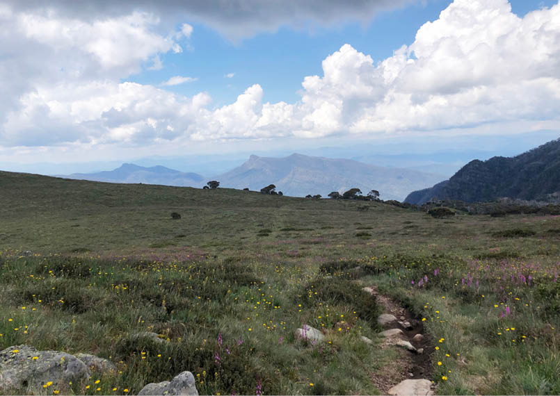
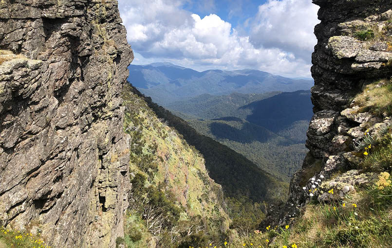
Razor-Viking in the distance, day 1
After having a taste of the Mount Howitt area, I had a chance to go up again. I wanted to go via Gippsland and the Howitt Road, but wasn't sure of the road condition, and with heavy rain forecast, I decided to enter via Upper Howqua again. It turned out the rain didn't happen, and several people I spoke with had driven their 2WD cars in that way, avoiding potholes, but passable.
Howitt Circuit


4 | Bushwalk October 2022
Day 1: Upper Howqua to Mac Springs, 12 km
At the 31 kilometre marker on the Stirling Circuit Road, a tree was across the road. I don't carry a chainsaw, so I turned back, thinking I'd head the other way around the circuit. A few minutes later I saw vehicles approaching, flagged them down and let them know the track was blocked. They had a chainsaw, so I followed them back and they cleared the road. Thanks guys! They were going down to pick up some people who'd walked a section of the AAWT.
I was starting later than I'd like in the first place, then the road clearing delayed things more. I walked up Howitt Spur, taking about the same time as two weeks earlier, but didn't feel as fatigued when I got to Mac Springs.
I was sweating buckets all the way up, but otherwise it was good. I saw three Alpine copperheads; one made me jump as I thought I'd stepped on it, and another was right near my foot looking like it wasn't impressed with me.
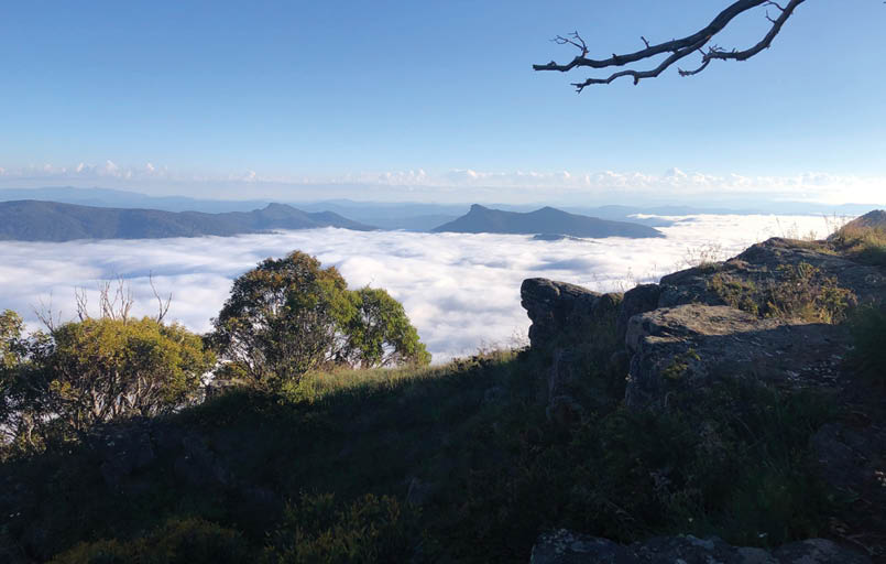
I was thinking of going somewhere else before evening but it was getting late (late start and delay) by the time I got to Mac Springs. A few drops of rain started, with a forecast of 4 mm of rain and a possible thunderstorm, so I decided to camp. When I was getting water, for a moment I thought there must have been a bushfire, as a white cloud billowed up over the saddle between Mac Springs and Mount Howitt. I worked out it was a rising cloud, or fog that soon enveloped the whole area and stayed until early morning, when it receded into the Wonnangatta Valley.
Day 2: Mac Springs, Magdala, Helicopter Spur, Upper Howqua, 15 km
I left Mac Springs at about 7 am, with the fog cleared and no clouds above. When the Terrible Hollow became visible, The Razor and Viking had a sea of white clouds heading off in the distance.

Clearing the tree on the Stirling Circuit Road, day 1
"
They had a chainsaw, so I followed them back and they cleared the road.


5

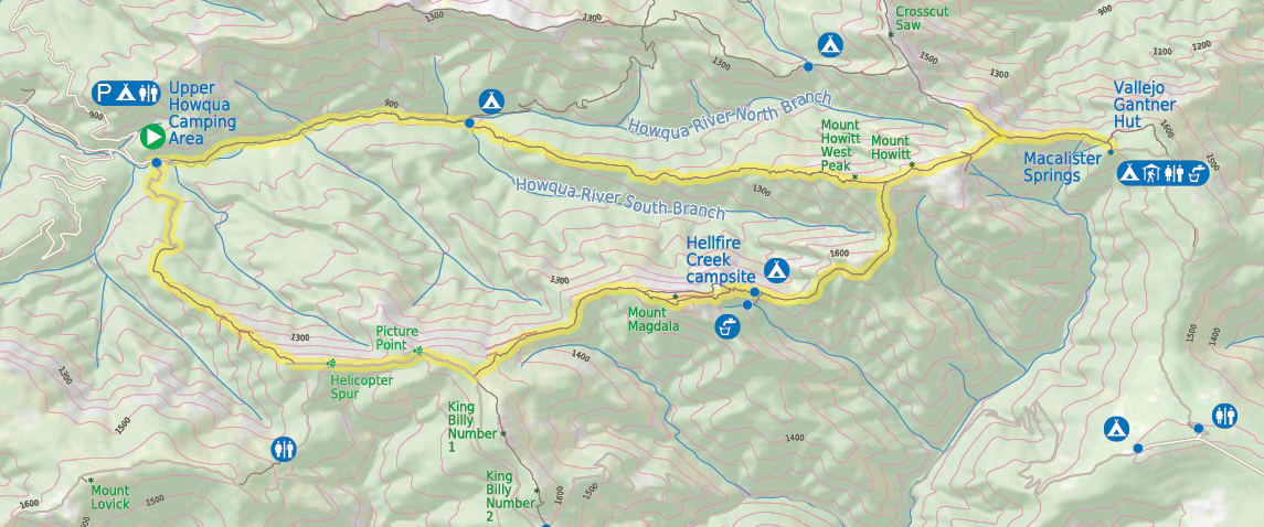
Bushwalk.com notes and maps on webpage, GPX and PDF
This map is © Bushwalk.com and is created using data © OpenStreetMap contributors
Mount Howitt Circuit
Road, four-wheel drive track, walking track (treed)
Main track, side trip, alternate route
Cliff, major contour line, minor contour line (100 metre interval)
Lake, river, waterfall or creek


0 km 0.5 1 2 3 km

Start of the walk
Hut
Campsite
Toilet
Parking


6 | Bushwalk October 2022
A sea of cloud over the Wonnangatta, with Razor-Viking just above the clouds, day 2
I dropped the pack at the Crosscut junction and walked towards Speculation a bit, didn't go far, but the views were great, with the Howqua Valley clear of cloud. I wanted to push on to Mount Magdala, and then see how far I would get before deciding how to get back down that day or stay another night. There's a nice campsite between Big Hill and Mount Magdala, and I think a red marker on a tree indicated where to head for Hellfire Creek, but I didn't check it out. I felt good so far, and it wasn't until ascending Magdala that I started to feel it a bit. The break for a view
at Hells Window was much appreciated, as well as the chilled breeze. The hardest thing is when you're below the treeline is that there's barely a breath of wind and with the sun at its peak, I really felt hot and was sweating heaps again.
After Magdala, I slipped on loose stones a bit on the way down and fell once, nothing terrible, just annoying. I spoke with two young blokes who were doing a seven day trip from Upper Howqua to The Viking via Dry Creek anticlockwise (I think). They'd ascended Helicopter Spur the day before, realised they'd left something, so they went back down leaving packs behind, got what they were missing, and went back up. Hard work.
The day was warming up (or felt like it) and the climb/walk up to Bluff Track was slow and hot, and I was feeling it. By this stage I'd decided I was going to get down the Helicopter Spur or die trying. PCV had suggested walking along

"
... the views were great, with the Howqua Valley clear of cloud.


7
the Bluff Track to Bluff Hut, staying the night, then heading down Bluff link as a way to get down. However, I was starting to run low on water and wasn't sure where to find it near King Billy 1 and was starting to suffer from the walking/sweating/blisters/chafing. It felt like heading back to the car the shorter route would do. The Bluff road was hot and boring in that section anyway.
I found some water near the campsite at the top of Helicopter Spur, a big puddle about 5 cm deep, so I filtered a bit. The March flies were becoming a pain, and drawing blood a lot. I sprayed 40% Deet on my clothes and arms. That only seemed to inflame them, as they kept trying to distract me and drawing blood down the spur.
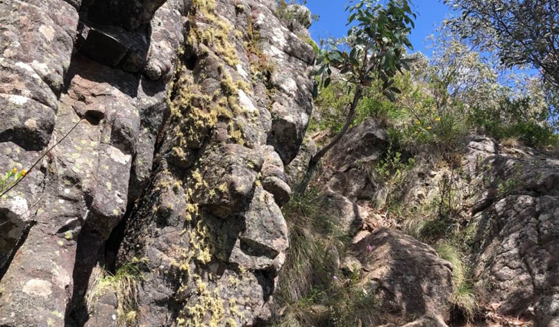
I started heading down Helicopter Spur, but wasn't sure of the route at first, as people seemed to have walked out various ways leaving trails (or animals?). NNW's GPS track
came in handy here! Once the spur starts, it's easy to follow, and soon enough was at the top of the third (highest) band of rocks. I went down the rocks with my pack on, a little bit sitting on my bum, and lowering down until legs touched something firm, a little bit facing rocks gripping plants/rocks. It felt like I could slip and in hindsight taking off the pack and lowering would have made it easier.
Shortly after I was at the second rock band. I found the dreaded chute, lowered the pack and looked at the options. The place I got stuck on last time didn't look enticing. The V-shape seemed good. I noticed the slab in the middle which forms part of the V-shape had notch or step like features and would probably be the easiest way to ascend or descend facing the rocks. I decided to go down into the V, and twisted under the gum tree while facing forward, and using hands and feet lowered myself down. It was very simple; gravity helps a bit I guess.
Mount Buller and Mount Stirling through Hells Window, day 2
8 | Bushwalk October 2022
I continued, but was really feeling the exhaustion/dehydration and found on the last step I felt unsteady on my feet with the pack. I took off the pack and tethering it with the cord I'd brought, pushed it down a bit in front of me and slid after it, or walked down a bit and dragged it down to where I was to get down the steep part of the first band. This was ugly, slow, but effective. Anyway, I've completed Helicopter Spur (if going down counts)!
My phone died at about this point, so no more pictures. After that, it was just a slow slog back to the campsite. It took a long time to
get down the spur and a bit of suffering was involved, but the height/exposure thing never bothered me. Weird. Maybe too tired to care?
About 13 hours from when I left Mac Springs I got to the Upper Howqua with lots of photo breaks, but not too many pack-off stops. Only snacking along the way. I'm just slow.
I decided to drive home. I got massive cramps in the hands just after I hit the Circuit Road, so much so that I had to pull over for 10 minutes to keep stretching my hands out as they cramped into deformed fists … fun! I'd been drinking sports drinks and water with hydrolyte throughout the day and had more in the car which I hopped into at the end of the walk. They seemed to kick in, as after that, only a few small cramps in the legs and arms on the way home. I nearly hit a Lyrebird who thought it was Road Runner just before Howqua Gap. I got home in one piece, so all good.
Looking back up third band, day 2
"
... I've completed Helicopter Spur (if going down counts)
9